Knucklas Road, Knighton
- Land size
- 1 acres
- Bedrooms
- 4
- Bathrooms
- 1
Key Features
- Detached bungalow
- Non traditional build
- Just over 1 acres of grounds (approx.)
- Four bedrooms, three reception rooms
- Elevated position just out of town
- Excellent opportunity for development
- Motivated sellers
Description
A non-traditionally constructed bungalow situated in a slightly elevated position just outside Knighton. The property extends to just over one acre and includes four bedrooms and three reception rooms, offering well-proportioned accommodation throughout. The plot provides ample space for further development or improvement, subject to the necessary consents, making it a practical opportunity for buyers seeking a property with potential in a semi-rural setting.
Introduction - The Willows is a non-traditionally constructed bungalow set in a slightly elevated position just outside Knighton, with grounds extending to just over an acre. The sellers are motivated, and the accommodation currently comprises an entrance hall, kitchen, dining room, storage cupboard, bathroom, living room, office and four bedrooms. The property offers practical space throughout and presents clear scope for development or improvement, subject to the necessary consents.
Property Description - Steps lead up to the front door and into the hallway. The property benefits from double-glazed windows throughout. From the hall, a door to the left opens into the kitchen, which then leads through to the dining room where there is a storage cupboard and sliding French doors giving access to the outside space. Off the hall is the bathroom, fitted with a three-piece white suite. To the right of the hall is a large, double-aspect living room with views over the Teme Valley and a central fireplace. From here, four doors lead to the bedrooms, which run along the back of the property. At the far end, a further door opens into an office with windows to the front and side, along with a door returning to the front of the property.
Gardens - The property is approached via a footpath that leads directly to the front of the bungalow. The grounds extend to approximately one acre, made up grass areas, orchard and woodland to the rear and sides. The setting offers privacy and a natural backdrop, with clear potential for buyers to create landscaped areas, seating spaces or further defined garden zones to make full use of the plot. The current owners park in the layby opposite the bungalow.
Agents Notes - Construction - Prospective purchasers are advised the property is of non-standard construction and therefore advised if they need to purchase with a mortgage they should seek advise from a financial advisor prior to viewing to confirm eligibility.
Agents Notes - Title - The property benefits from 3 titles:
WA639632 - house & garden
WA260766 - area containing the septic tank
WA663922 - Field to rear
There is a small area of land that has been missed off the field title and is subject to a possessory title. This area of land has been part of the property for over 35 years & registered as possessory title for over 13 years and can now be claimed as title absolute. Where title to an estate in land is a possessory one, you can apply to upgrade the title to an absolute freehold title once the possessory title has been registered for 12 years. For further information, please contact us.
Agents Notes - Public Footpath - The map shown on these details identifies that an unmade public footpath leads off Glyndwr Way & crosses the south western boundary of the field and follows a route around mostly the edge of the field exiting on to the B4355. The vendor has stated that due to the condition of the footpath it is rarely if ever used.
Location - The property is located on the fringes of Knighton (Tref y Clawdd) which is located in Mid Wales and is a market town within the historic county boundary of Radnorshire, lying on the river Teme, with a railway station on the Heart of Wales line. The Offas Dyke footpath is a 177 mile National Trail footpath that closely follows the England/Wales border. It opened in 1971 from Prestatyn to Chepstow with Knighton sitting at the half way point. At the Knighton visitors centre by the river, you can stand with one foot in each country. Knighton also has a primary school, supermarket, leisure centre, and many other smaller independent shops. The larger market town of Ludlow, 16 miles away, has a wider variety of facilities and hosts the famous Ludlow Food Festival. The larger spa town of Llandrindod Wells, 18 miles away, offers a further wider range of facilities.
Services - The property has oil fired heating, mains water, drainage and electricity.
Anti-Money Laundering Regulations - In accordance with The Money Laundering Regulations 2007, Cobb Amos are required to carry out customer due diligence checks by identifying the customer and verifying the customer’s identity on the basis of documents, data or information obtained from a reliable and independent source. At the point of your offer being verbally accepted, you agree to paying a non-refundable fee of £24 Inc. VAT per purchaser, in order for us to carry out our due diligence.
Map Location
Property details
- Tenure
- Freehold
- Council Tax Band
- B
- Date Posted
- 2026-08-05
Market Value Analysis
Compared with 1,208 Homes with Land listings in Wales (1+ acres).
Energy Performance Certificate
Energy Efficiency Rating
Based on UK Energy Performance Certificate standards (EU Directive 2002/91/EC)
Running costs are one side. Planning activity, flood history and ground risks for this location are in the full report.
Utilities & Restrictions
Utilities
- Electricity
- Ask Agent
- Water
- Ask Agent
- Heating
- Ask Agent
- Broadband
- Ask Agent
- Sewerage
- Ask Agent
Rights & Restrictions
- Public Rights of Way
- Ask Agent
- Private Rights of Way
- Ask Agent
- Listed Property
- Ask Agent
- Restrictions
- Ask Agent
Listed status, conservation areas and planning constraints for this location are in the full report.
Property Features
- Accessibility
- Ask Agent
- Parking
- Ask Agent
- Garden
- Garden
Beyond the particulars: planning activity, flood history, heritage and ground risks, checked for this exact spot.
Connectivity
Broadband
Fastest speed available at this postcode
80 Mbps
Superfast · available to 94% of premises
Suitable for
- HD streaming
- Video calls
- Web & social
Mobile signal
Outdoor predictions; indoor signal depends on building materials.
Ofcom Connected Nations postcode-level predictions. Speeds and signal are modelled, not measured, and vary between addresses and providers.
Signal is the easy part. Planning activity, flood history and protected designations here are in the full report.
Nearest Schools
Primary
- Knighton Church In Wales Primary School0.9 miles
- Pupils
- 168
- Type
- Nursery, Infants & Juniors
- Language
- English medium school / provision
- Presteigne C.P. School5.6 miles
- Pupils
- 173
- Type
- Nursery, Infants & Juniors
- Language
- English medium school / provision
- Radnor Valley C.P. School8.4 miles
- Pupils
- 48
- Type
- Nursery, Infants & Juniors
- Language
- English medium school / provision
- Llanbister C.P. School11 miles
- Pupils
- 58
- Type
- Nursery, Infants & Juniors
- Language
- English medium school / provision
- Gladestry C.I.W. School11 miles
- Pupils
- 34
- Type
- Nursery, Infants & Juniors
- Language
- English medium school / provision
Secondary
- Newtown High School16 miles
- Pupils
- 896
- Type
- Secondary (ages 11-19)
- Language
- English medium school / provision
- Ysgol Calon Cymru20 miles
- Pupils
- 948
- Type
- Secondary (ages 11-19)
- Language
- Dual language school / provision (Welsh and English) (including transitional)
- Llanidloes High School22 miles
- Pupils
- 703
- Type
- Secondary (ages 11-19)
- Language
- Dual language school / provision (Welsh and English) (including transitional)
- Welshpool High School22 miles
- Pupils
- 816
- Type
- Secondary (ages 11-19)
- Language
- English medium school / provision
- Gwernyfed High School23 miles
- Pupils
- 505
- Type
- Secondary (ages 11-19)
- Language
- English medium school / provision
Distances are straight-line from the advertised location. Source: the national school registers (DfE, Welsh Government, Scottish Government) and Ofsted.
Schools are just the start: sold prices nearby, planning activity and any flood history are in the full report.
Amenities
Supermarket
GP surgery
Pharmacy
Green space
Walking trail
Straight-line distances from the advertised location. Sources: NHS records, Geolytix supermarket locations, OS Open Greenspace and the national trails registers.
The area stacks up? Now check the location itself: planning nearby, protected designations and past flooding.
Getting Around
Nearest station
Nearest bus stop
Typical drive times
Straight-line distances from the advertised location; drive times are typical free-flow times over OpenStreetMap road data, so allow more at peak. Public transport locations from DfT NaPTAN.
Easy to reach matters. So do planning activity, flood history and ground risks: all in the full report.
Flood Risk
From Natural Resources Wales flood map open data, checked around the advertised map pin and allowing for the listed acreage where known. This summary comes from LandSale, the advertising platform, not from the listing agent, and is not part of the agent's particulars. Risk can vary across a single holding, so verify anything critical through your own searches before committing.
Rivers and the sea
Surface water
The detail behind these bandings
The full report pinpoints where this location sits on the flood maps, and runs the deeper checks that usually only surface after an offer.
- Exact flood zones & annual chances (included in the full report)
- Any recorded past flooding (included in the full report)
- Planning activity nearby (included in the full report)
- Heritage & conservation (included in the full report)
- Protected nature designations (included in the full report)
- Ground risks (included in the full report)
- Sold prices nearby (included in the full report)
£14.99 · one-off purchase
By LandSale, the platform. Not provided by the listing agent. Ready in about a minute.
Important notice: Information, maps and tags on this page are drawn from the advertising agent's marketing materials or generated automatically. LandSale has not verified them. Relying on these details is at your own risk, always carry out independent checks before committing to a purchase.
LandSale full disclaimer
Marketing information only - not formal particulars. The details on this website are provided for general guidance and do not constitute an offer or contract. Neither LandSale nor the advertising estate/land agent accepts responsibility for any inaccuracy.
1. Source of information
- Listing content: Core description, asking price, tenure, measurements, photographs and planning history originate from the marketing materials of the advertising estate or land agent. LandSale does not author this content and cannot guarantee its accuracy.
- Automated tags & categorisation: Property type, land-use class, acreage bands and similar labels may be applied by machine-learning models. They are intended as a helpful guide only and may not reflect the property's legal status or permitted use.
- Third-party & enriched data layers: Maps, boundary outlines, planning designations, soil reports, broadband coverage and other environmental or location-based insights are licensed from external suppliers. Such data are supplied “as is", may be incomplete or out of date and are subject to change without notice.
2. Verification required
Prospective purchasers must verify critical matters, including but not limited to planning permission, title boundaries, public rights of way, environmental constraints, acreage, services, access and VAT status, through their own inspections, specialist surveys, legal advisers and the selling agent before relying on the information or entering into any contract.
3. No warranty or liability
LandSale gives no warranty, express or implied, as to the accuracy, completeness or fitness for any particular purpose of the information displayed. LandSale shall not be liable for any loss, damage, cost or expense arising directly or indirectly from any use of or reliance on such information, save where liability may not be excluded by law.
4. Updates & feedback
If you believe any detail on this listing is inaccurate, please let us know. We will investigate and, where appropriate, update the listing or notify the agent.
© LandSale | Version 1.3 - August 2026
Listing agent
Cobb Amos, Knighton
22 Broad Street, Knighton, LD7 1BL
Similar properties for sale
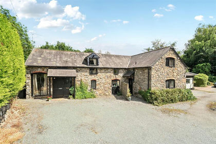
- Price
- Offers in Region of£225,000
The Granary, Pultheley Farm, Hyssington, SY15, More, Shropshire SY15 England
Added on 14/07/2026Barn Conversion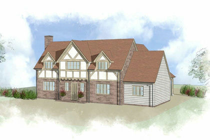
- Price
- Guide Price£235,000
- Size
- 0.39 acres
Plot For Sale, Dilwyn, Hereford, HR4, Dilwyn, Herefordshire, County of HR4 England
Added on 28/01/2026Self Build Plot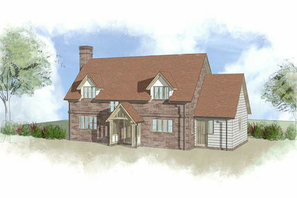
- Price
- Guide Price£230,000
- Size
- 0.41 acres
Great House Orchard, Dilwyn, Hereford, HR4, Dilwyn, Herefordshire, County of HR4 England
Added on 29/01/2026Self Build Plot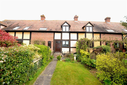 Added on 12/04/2026Cottage
- Price
- Offers in Region of£225,000
- Size
- 0.35 acres
Steventon New Road, Ludlow, SY8, Ludlow, Shropshire SY8 England
Added on 29/01/2026Building Plot
- Price
- Offers in Region of£185,000
Gardeners Cottage, Milford, Newton, Powys, Newtown and Llanllwchaiarn, Powys SY16 Wales
Added on 08/08/2026Barn Conversion Added on 14/07/2026Building Plot
 Added on 03/04/2026Building Plot
- Price
- Offers in Region of£225,000
- Size
- 0.54 acres
Land Opposite Old Barn Close Llandinam, Powys, SY17, Llandinam, Powys SY17 Wales
Added on 13/02/2026Development Land
- Price
- Guide Price£275,000
- Size
- 9.29 acres
Oakley Park, Llanidloes, Powys, SY18, Llanidloes Without, Powys SY18 Wales
Added on 03/07/2026House with Land