Bickington, Newton Abbot, TQ12
- Land size
- 4.1 acres
Key Features
- Approximately 4.10 acres (1.65 hectares) in all
- Benefitting from three stables & tack room (extending to 44 sqm)
- Permanent pasture land
- Good road access with 2 gateways
- Mains water supply
- Rural location with safe hacking
- Offering potential for other uses (subject to planning)
- For sale by Formal Tender with a closing date of Tuesday 15th September 2026 at 12 noon
- Sale by Formal Tender
Description
DIRECTIONS
From the A38 northbound towards Exeter, take the exit signposted Newton Abbot, Bickington, Widecombe and Sigford. Follow the A383 for about 1 mile, then turn right signposted Gale and Burne. Continue for roughly 0.4 miles and turn left onto Gale Road. The land entrance is on the left after approximately 0.2 miles.
What3Words Location to Gateway 1 – aquatics.booms.triangle
What3Words Location to Gateway 2 - quilt.driveway.lobbed
SITUATION
The land is situated on the periphery of the village of Bickington, outside of an area designated as National Landscape (formerly known as Area of Outstanding Natural Beauty) in the Teignbridge area of South Devon.
The nearby market town of Ashburton is approximately 3.5 miles to the south west. The A38 dual carriageway expressway, connecting to the M5 motorway and national road network, is approximately 1 mile distant.
DESCRIPTION
The Land & Stables at Longstone Bridge comprises of approximately 4.10 acres (1.65 hectares) of permanent pasture land with a stable block, the full extent being outlined in red on the site plan.
Bound by mature Devon hedgerows, and bordered by agricultural land on the north, east and west boundaries and the council maintained highway to the south.
The land benefits from a stable block comprising three stables and a tack room, extending to approximately 473 square feet (44 square metres) in total, with a concrete apron yard, albeit the stables are in an unused condition. The stable block is of concrete block work wall construction, beneath corrugated roof sheets with concrete flooring throughout.
The existing layout offers flexibility and could easily be adapted to suit a purchaser's individual requirements.
The land is predominantly of a moderate south facing gradient and is well suited to equestrian use. However, it may also appeal to purchasers seeking land for grazing, amenity, recreational or other alternative uses, subject to any necessary consents.
SERVICES
The property benefits from a mains water supply to a tap.
ACCESS
The land can be accessed via two separate vehicular width gateways, both of which are situated on the southern boundary of the land, directly off the council-maintained highway (Gale Road).
TENURE
The land is being offered on a freehold basis with vacant possession being available on legal completion.
PUBLIC RIGHTS OF WAY
There are no public rights of way as far as known.
SPORTING AND MINERAL RIGHTS
The sporting and mineral rights are included in the sale, as far as are known.
ENVIRONMENTAL STEWARDSHIP
The land is not subject to any Environmental or Countryside Stewardship agreements.
WAYLEAVES AND EASEMENTS
The land is sold subject to any Wayleave and Easements agreements.
METHOD OF SALE
Land & Stables at Longstone Bridge is offered for sale by Formal Tender (unless sold prior).
The deadline date for the submission of tenders is Tuesday 15th September 2026 at 12 noon and all tenders must be submitted to Luscombe Maye Offices of 62 Fore Street, Kingsbridge or 6 Fore Street, South Brent in a sealed envelope clearly marked ‘Land & Stables at Longstone Bridge’.
Buyers who wish to submit a tender will be required to complete and sign the tender form and provide any supporting documentation as detailed within the Legal Pack available from the solicitor acting for the seller (see Legal Pack below).
Any tender by the deadline date received will be subject to contract. Prospective purchasers should be aware that upon acceptance of their tender offer, a 10% deposit of the agreed sale price will be payable to the agent acting for the seller (or via their own solicitor), within 24 hours of written acceptance of their offer; failure to do so may result in the tender being rejected.
Should a tender be acceptable to the seller and the 10% deposit received within the time frame outlined above, this will then constitute an exchange of contracts and be treated as a binding contract and legal completion and payment of the balance of the purchase price will follow approximately 28 days later or by the time frame set out in the legal pack. If the deposit is failed to be presented by the successful tender, then the Formal Tender Conditions will not be met and this will result in the tender being rejected.
Moreover, the successful purchaser will be liable to pay the sum of £2,000 plus VAT as an administration fee in addition to their tender price on completion.
Please note, the seller does not undertake to accept the highest or any of the offers and the seller reserves the right to withdraw, alter or amend the way in which the land is offered for sale.
LEGAL PACK
A copy of the legal pack may be requested from the Sole Selling Agents, or the Seller's Solicitors, Howard & Over Solicitors, Plym House, 3 Longbridge Road, Plymouth, PL6 8LT. Attention: Mr Jacob Cunningham, Tel: 01752 556606 or e-mail [email protected]
GUIDE PRICE
£80,000
LOCAL AUTHORITY
Teignbridge District Council, Ford House, Brunel Road, Newton Abbot, TQ12 4XX Tel: 01626 361 101
HEALTH & SAFETY
Any prospective purchasers of whom would like to view the land do so at their own risk. The vendors nor their selling agent accept any responsibility in any incident or accident that may happen.
VIEWING
Strictly by appointment with the Sole Agents, Luscombe Maye of 6 Fore Street, South Brent. Telephone 01364 646177 for details.
Map Location
Property details
- Tenure
- Freehold
- Council Tax Band
- Ask Agent
- Date Posted
- 2026-07-30
- Local Authority
- South Hams District Council
Market Value Analysis
Compared with 75 Equestrian listings in South West England (1+ acres).
Property Brochure
Seen the details? The full report adds the independent checks: planning activity, flood history, heritage and ground.
Utilities & Restrictions
Utilities
- Electricity
- Ask Agent
- Water
- Ask Agent
- Heating
- Ask Agent
- Broadband
- Ask Agent
- Sewerage
- Ask Agent
Rights & Restrictions
- Public Rights of Way
- Ask Agent
- Private Rights of Way
- Ask Agent
- Listed Property
- Ask Agent
- Restrictions
- Ask Agent
Listed status, conservation areas and planning constraints for this location are in the full report.
Property Features
- Accessibility
- Ask Agent
- Parking
- Ask Agent
- Garden
- Ask Agent
Beyond the particulars: planning activity, flood history, heritage and ground risks, checked for this exact spot.
Connectivity
Broadband
Fastest speed available at this postcode
15 Mbps
Standard (10-30 Mbps)
Suitable for
- Web & social
- Music streaming
- Standard video calls
Mobile signal
Outdoor predictions; indoor signal depends on building materials.
Ofcom Connected Nations postcode-level predictions. Speeds and signal are modelled, not measured, and vary between addresses and providers.
Signal is the easy part. Planning activity, flood history and protected designations here are in the full report.
Nearest Schools
Primary
- Blackpool Church of England Primary School1.9 milesOfsted: Good
- Ages
- 4 to 11
- Pupils
- 244
- Type
- Academy converter
- Faith
- Church of England
- Denbury Primary School2.2 milesOfsted: Good
- Ages
- 2 to 11
- Pupils
- 111
- Type
- Community school
- Ashburton Primary School2.6 milesOfsted: Good
- Ages
- 4 to 11
- Pupils
- 161
- Type
- Academy converter
- Bradley Barton Primary School and Nursery Unit3 milesNo Ofsted rating
- Ages
- 3 to 11
- Pupils
- 467
- Type
- Community school
- Ilsington Church of England Primary School3.1 milesNo Ofsted rating
- Ages
- 2 to 11
- Pupils
- 95
- Type
- Academy converter
- Faith
- Church of England
Secondary
- South Dartmoor Community College2.1 milesOfsted: Good *
- Ages
- 11 to 18
- Pupils
- 801
- Type
- Academy converter
- Coombeshead Academy3.5 milesOfsted: Good
- Ages
- 11 to 18
- Pupils
- 870
- Type
- Academy converter
- Newton Abbot College3.7 milesOfsted: Good *
- Ages
- 11 to 18
- Pupils
- 1,108
- Type
- Academy converter
- South Devon UTC4.1 milesOfsted report card · Feb 2026
- Ages
- 14 to 19
- Pupils
- 184
- Type
- University technical college
- Teign School4.5 milesOfsted: Good
- Ages
- 11 to 18
- Pupils
- 1,111
- Type
- Academy converter
* Latest graded judgement covers quality of education only; no overall grade was issued under the 2024-25 inspection framework.
Distances are straight-line from the advertised location. Source: the national school registers (DfE, Welsh Government, Scottish Government) and Ofsted.
Schools are just the start: sold prices nearby, planning activity and any flood history are in the full report.
Amenities
Supermarket
GP surgery
Pharmacy
Hospital
Straight-line distances from the advertised location. Sources: NHS records, Geolytix supermarket locations, OS Open Greenspace and the national trails registers.
The area stacks up? Now check the location itself: planning nearby, protected designations and past flooding.
Getting Around
Nearest station
Nearest bus stop
Typical drive times
Straight-line distances from the advertised location; drive times are typical free-flow times over OpenStreetMap road data, so allow more at peak. Public transport locations from DfT NaPTAN.
Easy to reach matters. So do planning activity, flood history and ground risks: all in the full report.
Flood Risk
From Environment Agency flood map open data, checked around the advertised map pin and allowing for the listed acreage where known. This summary comes from LandSale, the advertising platform, not from the listing agent, and is not part of the agent's particulars. Risk can vary across a single holding, so verify anything critical through your own searches before committing.
Rivers and the sea
Surface water
The detail behind these bandings
The full report pinpoints where this location sits on the flood maps, and runs the deeper checks that usually only surface after an offer.
- Exact flood zones & annual chances (included in the full report)
- Any recorded past flooding (included in the full report)
- Planning activity nearby (included in the full report)
- Heritage & conservation (included in the full report)
- Protected nature designations (included in the full report)
- Ground risks (included in the full report)
- Sold prices nearby (included in the full report)
£14.99 · one-off purchase
By LandSale, the platform. Not provided by the listing agent. Ready in about a minute.
Important notice: Information, maps and tags on this page are drawn from the advertising agent's marketing materials or generated automatically. LandSale has not verified them. Relying on these details is at your own risk, always carry out independent checks before committing to a purchase.
LandSale full disclaimer
Marketing information only - not formal particulars. The details on this website are provided for general guidance and do not constitute an offer or contract. Neither LandSale nor the advertising estate/land agent accepts responsibility for any inaccuracy.
1. Source of information
- Listing content: Core description, asking price, tenure, measurements, photographs and planning history originate from the marketing materials of the advertising estate or land agent. LandSale does not author this content and cannot guarantee its accuracy.
- Automated tags & categorisation: Property type, land-use class, acreage bands and similar labels may be applied by machine-learning models. They are intended as a helpful guide only and may not reflect the property's legal status or permitted use.
- Third-party & enriched data layers: Maps, boundary outlines, planning designations, soil reports, broadband coverage and other environmental or location-based insights are licensed from external suppliers. Such data are supplied “as is", may be incomplete or out of date and are subject to change without notice.
2. Verification required
Prospective purchasers must verify critical matters, including but not limited to planning permission, title boundaries, public rights of way, environmental constraints, acreage, services, access and VAT status, through their own inspections, specialist surveys, legal advisers and the selling agent before relying on the information or entering into any contract.
3. No warranty or liability
LandSale gives no warranty, express or implied, as to the accuracy, completeness or fitness for any particular purpose of the information displayed. LandSale shall not be liable for any loss, damage, cost or expense arising directly or indirectly from any use of or reliance on such information, save where liability may not be excluded by law.
4. Updates & feedback
If you believe any detail on this listing is inaccurate, please let us know. We will investigate and, where appropriate, update the listing or notify the agent.
© LandSale | Version 1.3 - August 2026
Listing agent
Luscombe Maye Farms & Land, Kingsbridge
62 Fore Street Kingsbridge TQ7 1PP
Call agent
01548800183Contact Luscombe Maye Farms & Land, Kingsbridge
62 Fore Street Kingsbridge TQ7 1PP
Call agent
01548800183Similar properties for sale
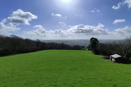
- Price
- Guide Price£85,000
- Size
- 4.25 acres
Added on 28/08/2026Amenity Land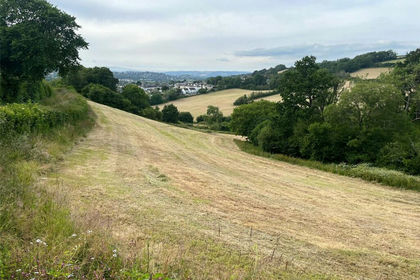
- Price
- Guide Price£75,000
- Size
- 5.32 acres
Kingskerswell, Newton Abbot, Devon, TQ12, Kingskerswell, Devon TQ12 England
Added on 08/08/2026Agricultural Land
- Price
- Guide Price£100,000
- Size
- 380.54 acres
LOT 2 - Didworthy, Dartmoor, South Brent, TQ10, South Brent, Devon TQ10 England
Added on 23/06/2026Grazing Land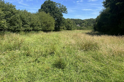
- Price
- Offers in Excess of£40,000
- Size
- 2.13 acres
Added on 07/09/2026Cheap Land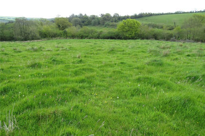
- Price
- Guide Price£50,000
- Size
- 5.38 acres
Added on 21/05/2026Grazing Land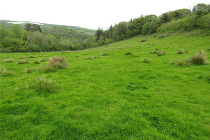
- Price
- Guide Price£60,000
- Size
- 7.6 acres
Added on 21/05/2026Pasture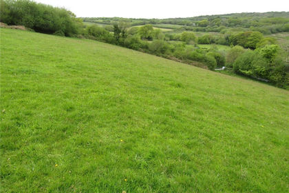
- Price
- Guide Price£50,000
- Size
- 6.64 acres
Added on 20/05/2026Pasture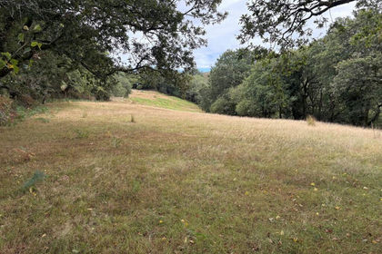
- Price
- Guide Price£65,000
- Size
- 2.18 acres
Added on 09/09/2026Equestrian property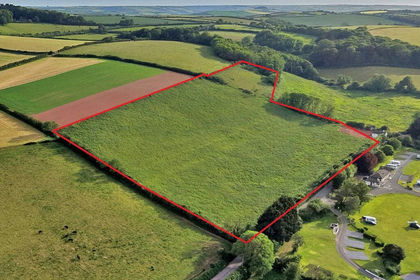
- Price
- Guide Price£85,000
- Size
- 11.03 acres
Land at Turnpike, Stokenham, Kingsbridge, Stokenham, Devon TQ7 England
Added on 26/08/2026Agricultural Land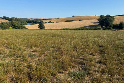
- Price
- Guide Price£50,000
- Size
- 3.28 acres
Added on 24/08/2026Vacant Land