Bwlch-Y-Sarnau, Llandrindod Wells, Powys, LD6
- Land size
- 3.76 acres
- Bedrooms
- 3
- Bathrooms
- 1
Key Features
- 3 Bed stone Farmhouse
- Equestrian property
- Lounge
- Sitting Room / Kitchen / Dining Room
- Conservatory / Boot Room
- Bathroom
- Gardens & Patio
- Outbuildings & Former Cowshed
- Detached Stone Stores
- 4 Stables & All Weather Exercise Yard
Description
A tastefully modernised and extended, Georgian 3-bed stone Farmhouse with a 27’ Kitchen / Living Room and Conservatory, together with 3.76-acres of grounds, useful stone outbuildings, Car Port, stable block, menage and two paddocks, set in a small hamlet in the peaceful Cambrian Mountains surrounded by beautiful countryside.
An attractive detached house built around 1839 from stone walls with rendered and coloured elevations, under a slate roof, together with a large matching extension. It has a oil-fired central heating, PVC double-glazing and briefly provides: - Ground Floor - Conservatory, Entrance Hall, Cloakroom, Sitting Room and 27’ Kitchen / Living Room; First Floor - Corridor Landing, three double Bedrooms and a Bathroom. In addition there is an undulating mature private garden with large paved patio areas, Polytunnel, an adjoining former Cowshed, a Detached Stone Stores with former Granary over, 3-bay Car Port, ample parking, 4 Stables with Feed Store / Tack Room and all-weather exercise yard, and two fertile paddocks. Extending in total to 3.76 acres, or thereabouts. Council Tax - Band E EPC - E ( tbc )
( O S Grid Ref: SO 029 746 Explorer 214 ) Bryneithin is set beside a minor Council road in beautiful upland location (at an altitude of 380m (1,250 ft), the house has a Southerly aspect at the rear and there are beautiful views over rolling farmland. Bwlch-y-Sarnau is a small hamlet with a Baptist Chapel and former Primary School that is used as a Community Centre and DIY Tea Room on Glyndwr’s Way, a National long-distance footpath, and is surrounded by the vast Coed Sarnau Forest. The historic villages of Abbey Cwmhir and Pantydwr are both 3 miles, the latter having a traditional old pub. The small market town of Rhayader is 8 miles has a range of independent shops, butchers, Primary School, Doctors, Leisure Centre, numerous pubs, and is the gateway to the Elan Valley Dam Complex (12 miles). There is a Primary School and Railway Station at Crossgates (8 miles) and the County Town of Llandrindod Wells is 12 miles, and has a range of shops (Tesco Superstore, Aldi Supermarket), Secondary School, Hospital, Railway Station (Shrewsbury to Swansea Line), Leisure Centre, Golf Club, indoor an International standard outdoor bowls, active U3A, Theatre, etc. The pretty market town of Llanidloes is about 8 miles and Newtown, the largest town in Powys is within a ½-hour drive and the University Town and Coastal Resort of Aberystwyth is about an hour’s drive. This area is renowned for its outstanding natural beauty and tranquillity, and is ideal for someone who enjoys walking, horse riding and mountain biking.
GROUND FLOOR
ENTRANCE HALL
Having a PVC double-glazed door, laminate flooring, radiator and doors to the Lounge, Living Room, Conservatory and
Cloakroom
Having a toilet, hand basin and radiator.
LOUNGE
Having a small wood burning stove, alcove shelving, television point and windows to front and rear.
CONSERVATORY / BOOT ROOM
A PVC double-glazed model with a Polycarbonate roof, tiled floor and door to the rear patio.
SITTING ROOM / KITCHEN / DINING ROOM
The first section of this room is a cosy seating area with a low ceiling, multi-fuel stove, flagstone flooring and the new section has a vaulted ceiling, vertical radiator, three windows to front, one to side, two Velux roof lights, French doors to the rear garden and open staircase to first floor. The kitchen area has a range of grey coloured cabinets incorporating eight base cupboards, six wall cupboards, wine rack, Belfast sink, worktops, De Longhi dual-fuel range cooker (5-burner hob and 2 large ovens), matching chimney cooker hood, integrated dishwasher and space for a fridge-freezer.
FIRST FLOOR
SMALL GALLERIED LANDING - Overlooking the Kitchen with a door to
CORRIDOR LANDING
On two levels with a window to South..
BEDROOM 1
Having a radiator, window to front (North) and a 8' 6" wide (3.60m) built-in wardrobe.
BATHROOM
Having a modern white suite incorporating a toilet, a wash basin set in a vanity unit and a panelled bath with a thermostatic shower and glazed screen over, together with tiled surrounds, radiator with towel rail, laminate flooring, extractor fan and window to North.
BEDROOM 2
Having a radiator and window to North.
BEDROOM 3
Having a radiator, television point, book shelves and window to North.
GARDENS
The house is approached through a recessed galvanised gate between the house and the former Granary. This leads to the parking area, car port and stable and a short flight of steps leads down to a large paved patio, on two levels, that is South-facing, has excellent shelter from mixed shrubs and it gives access to the Conservatory. Beyond this there is a large undulating lawn, PVC Oil-tank and a Polytunnel.
OUTBUILDINGS
FORMER COWSHED
Adjoining the house and approximately 28' x 16' (overall)
DETACHED STONE STORES
Having a door to the front, lighting and power points and an external stone flight of steps and door at the rear gives access to FORMER GRANERY - A useful stores with lined walls, window, light and power points.
CAR PORT
An open-fronted 3-bay steel portal frame with European profile steel cladding
STABLES
Four Lambourne style timber loose boxes and a tack room / feed store, with a central concrete hard standing and opening onto a level all-weather exercise yard with post and rail fencing and gate to the field.
THE LAND
The land is all sloping permanent pasture, with shelter from hedges and mature trees, currently divided into two enclosures with galvanised stockproof fences and a Westerly aspect. Bryneithin extends to a total of around 3.76 acres, or thereabouts.
TENURE
This property is Freehold
SERVICES
Mains electric, water and telephone. Septic Tank drainage. Oil central heating with PVC tank. Note - The owner uses Starlink Satellite broadband. Note - The Agents have not tested the installations.
FIXTURES & FITTINGS
Mentioned in this brochure are included in the price. Certain other items may be available subject to separate negotiation.
LOCAL AUTHORITY
Powys County Council, County Hall, Llandrindod Wells, LD1 5LG. Tel:
COUNCIL TAX
Band E ( £2,826.73 for 2026 / 2027 )
Map Location
Property details
- Tenure
- Freehold
- Council Tax Band
- E
- Date Posted
- 2026-07-25
Market Value Analysis
Compared with 1,207 Homes with Land listings in Wales (1+ acres).
Utilities & Restrictions
Utilities
- Electricity
- Ask Agent
- Water
- Ask Agent
- Heating
- Ask Agent
- Broadband
- Ask Agent
- Sewerage
- Ask Agent
Rights & Restrictions
- Public Rights of Way
- Ask Agent
- Private Rights of Way
- Ask Agent
- Listed Property
- Ask Agent
- Restrictions
- Ask Agent
Listed status, conservation areas and planning constraints for this location are in the full report.
Property Features
- Accessibility
- Ask Agent
- Parking
- Parking Available
- Garden
- Garden
Beyond the particulars: planning activity, flood history, heritage and ground risks, checked for this exact spot.
Connectivity
Broadband
Fastest speed available at this postcode
8 Mbps
Under 10 Mbps here
Suitable for
- Basic browsing & email
Mobile signal
Outdoor predictions; indoor signal depends on building materials.
Ofcom Connected Nations postcode-level predictions. Speeds and signal are modelled, not measured, and vary between addresses and providers.
Signal is the easy part. Planning activity, flood history and protected designations here are in the full report.
Nearest Schools
Primary
- Llanbister C.P. School5 miles
- Pupils
- 58
- Type
- Nursery, Infants & Juniors
- Language
- English medium school / provision
- Rhayader C.I.W. School5.2 miles
- Pupils
- 221
- Type
- Nursery, Infants & Juniors
- Language
- Dual language school / provision (Welsh and English) (including transitional)
- Crossgates C.P. School7.1 miles
- Pupils
- 145
- Type
- Nursery, Infants & Juniors
- Language
- English medium school / provision
- Llanidloes C.P. School7.5 miles
- Pupils
- 267
- Type
- Nursery, Infants & Juniors
- Language
- English medium school / provision
- Ysgol Trefonnen Church In Wales Community Primary8.2 miles
- Pupils
- 203
- Type
- Nursery, Infants & Juniors
- Language
- Dual language school / provision (Welsh and English) (including transitional)
Secondary
- Llanidloes High School7.5 miles
- Pupils
- 703
- Type
- Secondary (ages 11-19)
- Language
- Dual language school / provision (Welsh and English) (including transitional)
- Newtown High School11 miles
- Pupils
- 896
- Type
- Secondary (ages 11-19)
- Language
- English medium school / provision
- Ysgol Calon Cymru15 miles
- Pupils
- 948
- Type
- Secondary (ages 11-19)
- Language
- Dual language school / provision (Welsh and English) (including transitional)
- Ysgol Bro Caereinion21 miles
- Pupils
- 494
- Type
- Middle (ages 4-19)
- Language
- Welsh medium school / provision (including transitional)
- Ysgol Henry Richard24 miles
- Pupils
- 387
- Type
- Middle (ages 3-16)
- Language
- Welsh medium school / provision (including transitional)
Distances are straight-line from the advertised location. Source: the national school registers (DfE, Welsh Government, Scottish Government) and Ofsted.
Schools are just the start: sold prices nearby, planning activity and any flood history are in the full report.
Amenities
Supermarket
GP surgery
Pharmacy
Walking trail
Straight-line distances from the advertised location. Sources: NHS records, Geolytix supermarket locations, OS Open Greenspace and the national trails registers.
The area stacks up? Now check the location itself: planning nearby, protected designations and past flooding.
Getting Around
Nearest station
Nearest bus stop
Typical drive times
Straight-line distances from the advertised location; drive times are typical free-flow times over OpenStreetMap road data, so allow more at peak. Public transport locations from DfT NaPTAN.
Easy to reach matters. So do planning activity, flood history and ground risks: all in the full report.
Flood Risk
From Natural Resources Wales flood map open data, checked around the advertised map pin and allowing for the listed acreage where known. This summary comes from LandSale, the advertising platform, not from the listing agent, and is not part of the agent's particulars. Risk can vary across a single holding, so verify anything critical through your own searches before committing.
Rivers and the sea
Surface water
These bandings are the summary. Where this location sits on the flood maps, plus planning activity, heritage and ground risks, is in the full report.
Important notice: Information, maps and tags on this page are drawn from the advertising agent's marketing materials or generated automatically. LandSale has not verified them. Relying on these details is at your own risk, always carry out independent checks before committing to a purchase.
LandSale full disclaimer
Marketing information only - not formal particulars. The details on this website are provided for general guidance and do not constitute an offer or contract. Neither LandSale nor the advertising estate/land agent accepts responsibility for any inaccuracy.
1. Source of information
- Listing content: Core description, asking price, tenure, measurements, photographs and planning history originate from the marketing materials of the advertising estate or land agent. LandSale does not author this content and cannot guarantee its accuracy.
- Automated tags & categorisation: Property type, land-use class, acreage bands and similar labels may be applied by machine-learning models. They are intended as a helpful guide only and may not reflect the property's legal status or permitted use.
- Third-party & enriched data layers: Maps, boundary outlines, planning designations, soil reports, broadband coverage and other environmental or location-based insights are licensed from external suppliers. Such data are supplied “as is", may be incomplete or out of date and are subject to change without notice.
2. Verification required
Prospective purchasers must verify critical matters, including but not limited to planning permission, title boundaries, public rights of way, environmental constraints, acreage, services, access and VAT status, through their own inspections, specialist surveys, legal advisers and the selling agent before relying on the information or entering into any contract.
3. No warranty or liability
LandSale gives no warranty, express or implied, as to the accuracy, completeness or fitness for any particular purpose of the information displayed. LandSale shall not be liable for any loss, damage, cost or expense arising directly or indirectly from any use of or reliance on such information, save where liability may not be excluded by law.
4. Updates & feedback
If you believe any detail on this listing is inaccurate, please let us know. We will investigate and, where appropriate, update the listing or notify the agent.
© LandSale | Version 1.3 - August 2026
Listing agent
Morgan & Co, Llandrindod Wells
Winchester House Temple Street, Llandrindod Wells, LD1 5DL
View agent profileSimilar properties for sale
- Price
- Offers in Region of£395,000
- Size
- 2 acres
Added on 29/01/2026Smallholding
- Price
- Guide Price£550,000
- Size
- 1.29 acres
Tylwch, Llanidloes, Powys, SY18, Llandinam, Powys SY18 Wales
Added on 03/07/2026Cottage
- Price
- Guide Price£549,995
- Size
- 7.11 acres
Llidiartywaun, Llanidloes, Powys, SY18, Llandinam, Powys SY18 Wales
Added on 22/05/2026House with Land
- Price
- Guide Price£440,000
- Size
- 2 acres
Added on 29/01/2026House with Land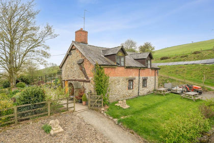
- Price
- Guide Price£575,000
- Size
- 6.5 acres
Added on 23/05/2026House with Land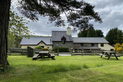
- Price
- Offers Over£500,000
- Size
- 1 acres
Llanwrthwl, Llandrindod Wells, Powys, Nantmel, Powys LD1 Wales
Added on 12/08/2026Holiday Let Property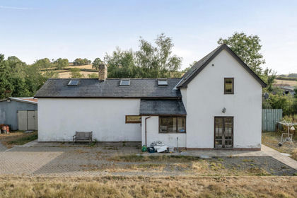
- Price
- Guide Price£495,000
- Size
- 4.36 acres
Added on 08/09/2026House with Land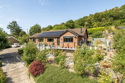
- Price
- Guide Price£425,000
- Size
- 1 acres
Trefeglwys Road, Llanidloes, Powys, SY18, Llanidloes, Powys SY18 Wales
Added on 10/08/2026House with Land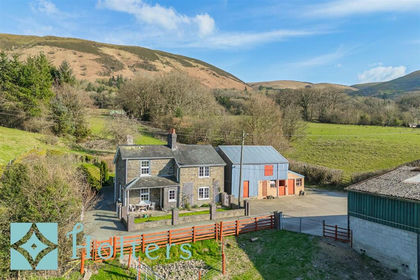
- Price
- Offers in Region of£575,000
- Size
- 10 acres
Added on 28/08/2026House with Land
- Price
- Guide Price£520,000
- Size
- 1.69 acres
Van Road, Llanidloes, Powys, SY18, Llanidloes, Powys SY18 Wales
Added on 29/01/2026House with Land