High Tide, Yaverland, Sandown
- Bedrooms
- 3
Key Features
- Self Build - an exciting opportunity to create a bespoke coastal home in a truly memorable setting
- Outstanding elevated views across Yaverland Bay and the surrounding coastline
- Situated on the former Sandown Manor Hotel site, soon to be demolished
- Contemporary reverse-level concept designed to maximise the outlook towards the sea
- Illustrative plans incorporating three bedrooms, a first-floor lounge and a substantial balcony
- Flexible ground-floor accommodation, principal bedroom with an ensuite
- Private garden and patio areas with provision for off-road parking within the current scheme – carport or garage potential subject to permissions
- Striking architectural styling featuring extensive glazing, clean lines and coastal-inspired materials
Description
A rare opportunity to create an exceptional new home in one of the Island’s most desirable coastal settings. Occupying an elevated position on the former site of the Sandown Manor Hotel, High Tide will enjoy outstanding sea views across Yaverland Bay and offers self-builders the chance to deliver a striking, individually designed home beside the coast.
* Images of the property are for illustration purposes and are artificially generated.
** Image of the view is the actual view from where this property will stand.
*** Floor area is calculated on architectural plans and not internal measurements.
A wonderful alternative to a conventional new build, allowing the purchaser to create a home tailored to their own taste and lifestyle
The current plans illustrate an impressive and highly flexible contemporary residence arranged over two floors. The ground floor is designed around a generous open-plan kitchen and dining space, creating a sociable heart to the home with ample room for everyday living and entertaining. This level also includes a separate utility room, shower room and central hall, together with both a study and a snug. While these rooms would work exceptionally well as a home office, playroom, television room or quiet retreat, either could equally be used as an additional bedroom, allowing the layout to adapt to a purchaser’s individual needs.
The first floor provides the principal sleeping accommodation, with three bedrooms shown on the plans. The main bedroom benefits from its own en-suite shower room, while bedrooms two and three are served by a separate family bathroom. Also positioned on this level is a further lounge, deliberately placed to make the most of the elevated outlook and providing direct access onto the balcony. This would create a superb space from which to enjoy the sea views across Yaverland Bay; however, the room could also readily be used as a fourth bedroom if preferred. Taken as a whole, the proposed layout offers considerable versatility, with the potential to provide three, four or even five bedrooms depending on how the study, snug and first-floor lounge are utilised.
The proposed external appearance combines white render, warm cedar-style cladding, grey detailing and generous areas of glazing, creating a distinctive home that feels entirely appropriate for its coastal surroundings.
The wider site design provides private outside space, patio areas and parking, with the architectural imagery demonstrating how the property could sit comfortably within this exclusive collection of individually designed homes. The plans and computer-generated images are illustrative, and prospective purchasers should review the full planning documentation and satisfy themselves regarding the approved design, conditions, services and construction requirements before proceeding.
Approximate plot size 300 square metres.
Location - Yaverland is renowned for its beautiful beach, expansive coastline and access to some of the Island’s most impressive coastal scenery. The sandy shores of Yaverland and Sandown Bay are within easy reach, while the nearby coastal paths and countryside around Culver Down provide excellent opportunities for walking, cycling and enjoying the outdoors. Sandown offers a broad range of everyday shops, schools, leisure facilities and transport connections, making this an appealing location for both permanent residence and relaxed coastal living.
Opportunities to build an individual new home with views of this calibre are increasingly difficult to find. High Tide presents a compelling prospect for experienced self-builders, developers or purchasers with the vision to create an exceptional home beside the sea. Early contact is strongly encouraged to discuss the plot, available plans and the next steps in bringing this exciting project to life.
Important Notice – Property Particulars - These particulars are intended to give a fair and overall indication of the property and do not constitute any part of an offer or contract. They are provided in good faith and are believed to be correct; however, Elliott Lincoln gives no representation or warranty (whether express or implied) as to the accuracy, completeness or reliability of the information contained within these particulars. All statements, descriptions, photographs, measurements, floor plans and any other information are for guidance only and must not be relied upon as statements of fact.
Any prospective purchaser must satisfy themselves by inspection and/or by making independent enquiries as to the correctness of all information, including (without limitation) the condition of the property, boundaries, title, tenure, planning permissions, building regulations, consents, rights of way, restrictive covenants, access, services, service charges/ground rent (if applicable), and the location and proximity of any facilities or features of specific importance to them. Distances, areas and measurements are approximate and are not guaranteed.
Fixtures, fittings, contents and furnishings are not included in the sale unless specifically stated. Any reference to appliances, services, utilities, heating systems or installations is given in good faith but these have not been tested by Elliott Lincoln, and no warranty is given as to their working order, efficiency or safety. Purchasers are strongly advised to commission appropriate surveys/inspections and to obtain verification from their solicitor and/or other professional advisers prior to exchange of contracts.
Elliott Lincoln is the trading name of Adele Smith Ltd, and its Associates, agents and representatives are not authorised to make or give any representations or warranties in relation to the property.
Map Location
Property details
- Tenure
- Freehold
- Council Tax Band
- TBC
- Date Posted
- 2026-07-21
Price history
| Date | Change | Price |
|---|---|---|
| 4 Sep 2026 | Reduced 14.3% (−£50,000) | £300,000 |
| Until 4 Sep 2026 | Asking price | £350,000 |
Utilities & Restrictions
Utilities
- Electricity
- Ask Agent
- Water
- Ask Agent
- Heating
- Ask Agent
- Broadband
- Ask Agent
- Sewerage
- Ask Agent
Rights & Restrictions
- Public Rights of Way
- Ask Agent
- Private Rights of Way
- Ask Agent
- Listed Property
- Ask Agent
- Restrictions
- Yes
Listed status, conservation areas and planning constraints for this location are in the full report.
Property Features
- Accessibility
- Ask Agent
- Parking
- Driveway
- Garden
- Garden
Beyond the particulars: planning activity, flood history, heritage and ground risks, checked for this exact spot.
Connectivity
Broadband
Fastest speed available at this postcode
900 Mbps
Gigabit full fibre
Suitable for
- 4K streaming on every screen
- Full-time home working
- Online gaming & big downloads
Mobile signal
Predicted 4G and 5G signal; indoor signal depends on building materials.
Ofcom Connected Nations postcode-level predictions. Speeds and signal are modelled, not measured, and vary between addresses and providers.
Signal is the easy part. Planning activity, flood history and protected designations here are in the full report.
Nearest Schools
Primary
- Brading Church of England Controlled Primary School1.2 milesNo Ofsted rating
- Ages
- 2 to 11
- Pupils
- 96
- Type
- Voluntary controlled school
- Faith
- Church of England
- The Bay Church of England School1.2 milesOfsted: Good
- Ages
- 4 to 16
- Pupils
- 1,232
- Type
- Voluntary controlled school
- Faith
- Church of England
- Broadlea Primary School2.2 milesOfsted: Good
- Ages
- 4 to 11
- Pupils
- 242
- Type
- Community school
- Gatten and Lake Primary School2.5 milesOfsted: Good
- Ages
- 5 to 11
- Pupils
- 195
- Type
- Community school
- St Helens Primary School2.6 milesOfsted: Good
- Ages
- 5 to 11
- Pupils
- 96
- Type
- Community school
Secondary
- The Bay Church of England School1.2 milesOfsted: Good
- Ages
- 4 to 16
- Pupils
- 1,232
- Type
- Voluntary controlled school
- Faith
- Church of England
- Lift Ryde4.4 milesOfsted: Good
- Ages
- 11 to 18
- Pupils
- 1,461
- Type
- Academy sponsor led
- The Island Free School5.8 milesNo Ofsted rating
- Ages
- 11 to 16
- Pupils
- 613
- Type
- Free schools
- Medina College7.3 milesOfsted: Requires improvement
- Ages
- 11 to 19
- Pupils
- 1,094
- Type
- Academy converter
- Christ The King College8 milesOfsted: Requires improvement
- Ages
- 11 to 18
- Pupils
- 1,131
- Type
- Voluntary aided school
- Faith
- Church of England/Roman Catholic
Distances are straight-line from the advertised location. Source: the national school registers (DfE, Welsh Government, Scottish Government) and Ofsted.
Schools are just the start: sold prices nearby, planning activity and any flood history are in the full report.
Amenities
Supermarket
GP surgery
Pharmacy
Hospital
Green space
Straight-line distances from the advertised location. Sources: NHS records, Geolytix supermarket locations, OS Open Greenspace and the national trails registers.
The area stacks up? Now check the location itself: planning nearby, protected designations and past flooding.
Getting Around
Nearest station
Nearest bus stop
Typical drive times
Straight-line distances from the advertised location; drive times are typical free-flow times over OpenStreetMap road data, so allow more at peak. Public transport locations from DfT NaPTAN.
Easy to reach matters. So do planning activity, flood history and ground risks: all in the full report.
Flood Risk
Environment Agency open data, checked around the advertised map pin for the listed acreage. Long-term risk counts flood defences; the planning map's flood zones do not. Provided by LandSale, not the listing agent, and not part of the agent's particulars. Risk varies across a holding, so verify before committing.
Rivers and the sea
Planning map: Flood Zone 1.
Surface water
These bandings are the summary. Where this location sits on the flood maps, plus planning activity, heritage and ground risks, is in the full report.
Important notice: Information, maps and tags on this page are drawn from the advertising agent's marketing materials or generated automatically. LandSale has not verified them. Relying on these details is at your own risk, always carry out independent checks before committing to a purchase.
LandSale full disclaimer
Marketing information only - not formal particulars. The details on this website are provided for general guidance and do not constitute an offer or contract. Neither LandSale nor the advertising estate/land agent accepts responsibility for any inaccuracy.
1. Source of information
- Listing content: Core description, asking price, tenure, measurements, photographs and planning history originate from the marketing materials of the advertising estate or land agent. LandSale does not author this content and cannot guarantee its accuracy.
- Automated tags & categorisation: Property type, land-use class, acreage bands and similar labels may be applied by machine-learning models. They are intended as a helpful guide only and may not reflect the property's legal status or permitted use.
- Third-party & enriched data layers: Maps, boundary outlines, planning designations, soil reports, broadband coverage and other environmental or location-based insights are licensed from external suppliers. Such data are supplied “as is", may be incomplete or out of date and are subject to change without notice.
2. Verification required
Prospective purchasers must verify critical matters, including but not limited to planning permission, title boundaries, public rights of way, environmental constraints, acreage, services, access and VAT status, through their own inspections, specialist surveys, legal advisers and the selling agent before relying on the information or entering into any contract.
3. No warranty or liability
LandSale gives no warranty, express or implied, as to the accuracy, completeness or fitness for any particular purpose of the information displayed. LandSale shall not be liable for any loss, damage, cost or expense arising directly or indirectly from any use of or reliance on such information, save where liability may not be excluded by law.
4. Updates & feedback
If you believe any detail on this listing is inaccurate, please let us know. We will investigate and, where appropriate, update the listing or notify the agent.
© LandSale | Version 1.3 - August 2026
Similar properties for sale
- Price
- Offers in Region of£250,000
Added on 11/07/2026Building Plot
- Price
- Guide Price£245,000
Mays Lane, Stubbington, PO14, Gosport, Hampshire PO14 England
Added on 29/01/2026Building Plot
- Price
- Guide Price£225,000
Bracklesham Lane, Bracklesham Bay, East Wittering, West Sussex PO20 England
Added on 01/04/2026Building Plot
- Price
- Guide Price£245,000
Bell Lane, Birdham, West Sussex, PO20, Birdham, West Sussex PO20 England
Added on 19/05/2026Building Plot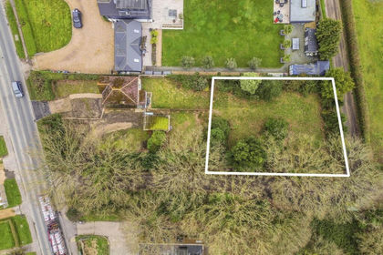
- Price
- Guide Price£295,000
Bell Lane, Birdham, West Sussex, PO20, Birdham, West Sussex PO20 England
Added on 19/05/2026Building Plot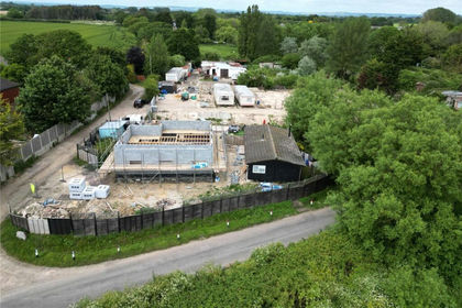
- Price
- Guide Price£230,000
- Size
- 0.12 acres
The Piggery Yard, Green Lane, Ham Road, Sidlesham, PO20, Sidlesham, West Sussex PO20 England
Added on 29/01/2026Building Plot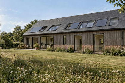
- Price
- Guide Price£250,000
- Size
- 0.44 acres
Chalk Lane, Sidlesham, PO20, Sidlesham, West Sussex PO20 England
Added on 03/10/2026Building Plot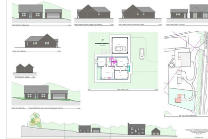
- Price
- Guide Price£350,000
- Size
- 0.85 acres
Reading Room Lane, Curdridge, Curdridge, Hampshire SO32 England
Added on 28/04/2026Building Plot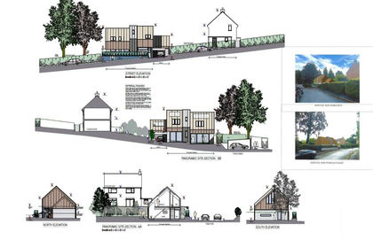
- Price
- Guide Price£265,000
Building Plot, West Meon, Petersfield, West Meon, Hampshire GU32 England
Added on 04/08/2026Self Build Plot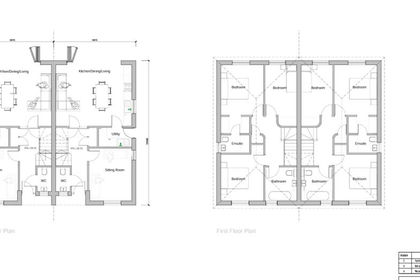 Added on 08/10/2026Building Plot