Low West End, Lunds
- Land size
- 0.33 acres
- Bedrooms
- 1
- Bathrooms
- 1
Key Features
- Detached Barn In Rural Location
- Previous Planning Permission For Two Dwellings
- Set In Approx. 0.33 Acres
- Large Parking Area To The Front
- Garden & Woodland To Rear
- Bore Hole Water, Mains Electric & B4RN On Site
- Great Self Build Opportunity In Yorkshire Dales Subject To Planning Permissions
Description
Offers Over £100,000
Low West End Farm House sits in a spectacular, rural location in Lunds, surrounded by open farmland and long distant views to Wild Boar Fell.
Lunds is a scattered hamlet and is situated about half a mile from the Moorcock Inn on the edge of the B6259, around 6 miles & 10 miles from the market towns of Hawes and Kirkby Stephen respectively. It is in a very rural yet accessible location, with lovely walks and views in all directions. West End is a hamlet of 5 dwellings down a well maintained track about 0.5 mile from the B6259.
This property is currently a two storey stone barn, it is split in to sections with a barn, cow byre (with original stalls), two stables and a store. The property is in need of full renovation.
This property previously had planning permission for conversion into two local occupancy or holiday let properties. This permission has now lapsed, plans are available to view. The plans show two properties, the North part of the property being a 3 bed home and the South part of the property being a two-bed house.
Current plans could be resubmitted to the Yorkshire Dales National Park or they could be changed to create a new, flexible layout to create one, large family home for local occupancy or holiday let.
Outside, to the front the plans show off road parking areas. At the rear is a stone flagged patio area. There is a woodland area with stream to the rear. Low West End is a great self build project in a rural location with spectacular views.
The Barn
This detached barn is currently in a poor state of repair. It is currently a two storey agricultural barn. The barn has two stables, a cow byre and a barn.
The Land
The total site expands to approx. 0.33 acres. There is a sizeable parcel of land to the front, great for off road parking. At the rear is an enclosed area, earmarked to be a patio garden. Beyond is a small woodland area with stream running through.
Planning Permission
Planning permission was granted in 2020 (planning ref: R/48/13F) Plans were submitted for two properties, both with three bedrooms. This planning permission has now lapsed. Planning permission would need to be re submitted by the new owners. Plans can be altered to suit.
Services
Mains electric, communal bore hole water supply and B4RN, high speed broadband are on site. Private drainage system to be installed.
Agents Notes
A second, neighbouring plot (Robinsons Field House) with preserved planning permission for an agricultural dwelling is also available for sale.
Map Location
Property details
- Tenure
- Freehold
- Council Tax Band
- Ask Agent
- Date Posted
- 2026-07-21
Utilities & Restrictions
Utilities
- Electricity
- Ask Agent
- Water
- Ask Agent
- Heating
- Ask Agent
- Broadband
- Ask Agent
- Sewerage
- Ask Agent
Rights & Restrictions
- Public Rights of Way
- Ask Agent
- Private Rights of Way
- Ask Agent
- Listed Property
- Ask Agent
- Restrictions
- Ask Agent
Property Features
- Accessibility
- Ask Agent
- Parking
- Parking Available
- Garden
- Garden
Important notice: Information, maps and tags on this page are supplied by the advertising agent or generated automatically. LandSale has not verified them. Relying on these details is at your own risk, always carry out independent checks before committing to a purchase.
LandSale full disclaimer
Marketing information only - not formal particulars. The details on this website are provided for general guidance and do not constitute an offer or contract. Neither LandSale nor the advertising estate/land agent accepts responsibility for any inaccuracy.
1. Source of information
- Agent-supplied content: Core description, asking price, tenure, measurements, photographs and planning history are uploaded by the appointed agent, who remains solely responsible for their accuracy.
- Automated tags & categorisation: Property type, land-use class, acreage bands and similar labels may be applied by machine-learning models. They are intended as a helpful guide only and may not reflect the property's legal status or permitted use.
- Third-party & enriched data layers: Maps, boundary outlines, planning designations, soil reports, broadband coverage and other environmental or location-based insights are licensed from external suppliers. Such data are supplied “as is", may be incomplete or out of date and are subject to change without notice.
2. Verification required
Prospective purchasers must verify critical matters, including but not limited to planning permission, title boundaries, public rights of way, environmental constraints, acreage, services, access and VAT status, through their own inspections, specialist surveys, legal advisers and the selling agent before relying on the information or entering into any contract.
3. No warranty or liability
LandSale gives no warranty, express or implied, as to the accuracy, completeness or fitness for any particular purpose of the information displayed. LandSale shall not be liable for any loss, damage, cost or expense arising directly or indirectly from any use of or reliance on such information, save where liability may not be excluded by law.
4. Updates & feedback
If you believe any detail on this listing is inaccurate, please let us know. We will investigate and, where appropriate, update the listing or notify the agent.
© LandSale | Version 1.2 - January 2026
Listing agent
J.R Hopper & Co, Leyburn
Central Chambers Market Place, Leyburn, DL8 5BD
Similar properties for sale
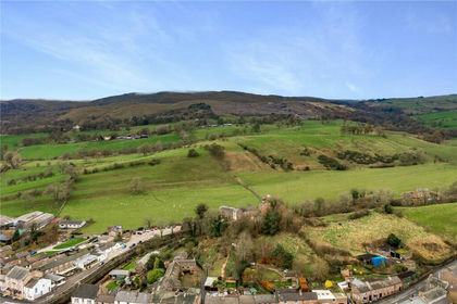
- Price
- £90,000
- Size
- 0.26 acres
Land Off Black Bull Lane, Brough, Cumbria, Brough, Westmorland and Furness CA17 4DN England
Added on 29/01/2026Development Land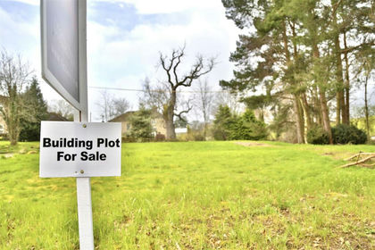
- Price
- Guide Price£125,000
Eggleston Lane, Romaldkirk, Barnard Castle, Romaldkirk, County Durham DL12 9EB England
Added on 29/01/2026Vacant Land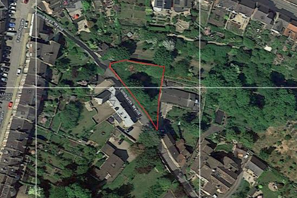
- Price
- Offers Over£120,000
- Size
- 0.16 acres
Added on 29/01/2026Building Plot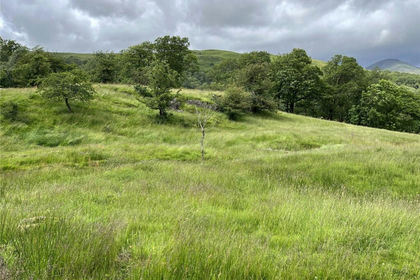
- Price
- £110,000
- Size
- 11.69 acres
Land At Torver - Lot 1, Torver, Cumbria, Torver, Westmorland and Furness LA21 8BT England
Added on 25/06/2026Agricultural Land Added on 29/01/2026Building Plot
- Price
- Guide Price£125,000
Plot 3 - Oakwood Court, Crook, DL15, Bishop Auckland, County Durham DL15 8QF England
Added on 29/01/2026Self Build Plot
- Price
- Guide Price£100,000
- Size
- 0.08 acres
Added on 29/01/2026Development Land
- Price
- Guide Price£95,000
Added on 16/07/2026Redevelopment Land
- Price
- Guide Price£117,000
- Size
- 1.4 acres
Coal Pit Lane, Colne, BB8, Colne, Lancashire BB8 8NR England
Added on 20/02/2026Undeveloped Land
- Price
- Guide Price£117,000
- Size
- 1.4 acres
Coal Pit Lane, Colne, Lancashire, BB8 8NR, Colne, Lancashire BB8 8NR England
Added on 21/02/2026Undeveloped Land