Bradworthy, Holsworthy
- Land size
- 4.35 acres
Key Features
- 4.35 acres (1.76 hectares)
- Pasture land and conifer woodland
- Diverse habitat and amenity appeal
- Edge of village location
- Additional adjoining land available by separate negotiation
- Sale by Public Auction on Wednesday 26th August 2026 at 2pm
- For more information, download the legal pack from our website
Description
Attractive block of pasture land and conifer woodland totalling 4.35 acres (1.75 hectares) on the edge of the village with wonderful amenity and environmental potential.
For sale by livestream Public Auction at 2:00pm on Wednesday 26th August 2026 at Digby Hall, Hound Street, Sherborne with bidding in the room, online and by telephone.
The Land - The land comprises of pasture and woodland split into two separate parcels extending to 4.35 acres (1.76 hectares) in total. The pasture land is level to gently sloping bounded by mature hedgerows and livestock fencing suited to grazing or cutting. The land is freely draining slightly acid loamy soils rated Grade 3 in the Agricultural Land Classification. The land benefits from a right of way access directly from the public highway, shown in brown hatch on the plan.
The southern parcel extends to approximately 1.31 acres (0.53 hectares) of level pastureland with some established saplings. The northern parcel comprises 3.04 acres (1.23 hectares) of gently sloping pasture and coniferous woodland which presents an opportunity for habitat diversity and has great amenity use or for commercial forestry.
Situation - The land is situated in a peaceful rural location on the edge of the attractive village of Bradworthy, which has the largest village square in England as well as a range of shops, a village pub and a primary school.
Located between the A39 and A386, it is approximately 8.1 miles north of the market town of Holsworthy and approximately 12 miles east of the seaside town of Bude, providing the opportunity for a rural, yet accessible location.
Rights Of Way - There are no public rights of way crossing the land.
Designations - The land is located in the North Devon Biosphere Reserve
Services - There are no mains services connected to the land.
A water main crosses the lower field.
Sporting, Timber And Mineral Rights - All sporting, timber and mineral rights are understood to be owned, and are included in the sale insofar as they are owned by the vendor.
Tenure And Possession - Freehold with vacant possession upon completion
Solicitors - Peter Peter & Wright, Holsworthy
Mark Bailey - ,
Local Authority - Torridge District Council
What3words - Land: ///material.copiers.implanted
Access: ///finalists.hurray.stretch
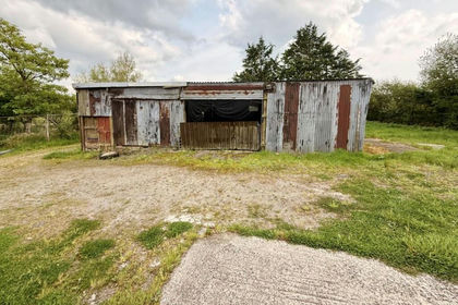
Agents Notes - The vendor owns adjoining land which may be available to a successful purchaser by separate negotiation. Shepherds huts located on the land are not included in the sale but can be available by separate negotiation.
Viewings - During daylight hours, with a set of particulars to hand after informing the agents at the Tiverton Office.
Map Location
Property details
- Tenure
- Freehold
- Council Tax Band
- Ask Agent
- Date Posted
- 2026-07-09
Market Value Analysis
Compared with 97 Bare & Undeveloped Land listings in South West England (1+ acres).
Utilities & Restrictions
Utilities
- Electricity
- Ask Agent
- Water
- Ask Agent
- Heating
- Ask Agent
- Broadband
- Ask Agent
- Sewerage
- Ask Agent
Rights & Restrictions
- Public Rights of Way
- Ask Agent
- Private Rights of Way
- Ask Agent
- Listed Property
- Ask Agent
- Restrictions
- Ask Agent
Property Features
- Accessibility
- Ask Agent
- Parking
- Ask Agent
- Garden
- Ask Agent
Important notice: Information, maps and tags on this page are supplied by the advertising agent or generated automatically. LandSale has not verified them. Relying on these details is at your own risk, always carry out independent checks before committing to a purchase.
LandSale full disclaimer
Marketing information only - not formal particulars. The details on this website are provided for general guidance and do not constitute an offer or contract. Neither LandSale nor the advertising estate/land agent accepts responsibility for any inaccuracy.
1. Source of information
- Agent-supplied content: Core description, asking price, tenure, measurements, photographs and planning history are uploaded by the appointed agent, who remains solely responsible for their accuracy.
- Automated tags & categorisation: Property type, land-use class, acreage bands and similar labels may be applied by machine-learning models. They are intended as a helpful guide only and may not reflect the property's legal status or permitted use.
- Third-party & enriched data layers: Maps, boundary outlines, planning designations, soil reports, broadband coverage and other environmental or location-based insights are licensed from external suppliers. Such data are supplied “as is", may be incomplete or out of date and are subject to change without notice.
2. Verification required
Prospective purchasers must verify critical matters, including but not limited to planning permission, title boundaries, public rights of way, environmental constraints, acreage, services, access and VAT status, through their own inspections, specialist surveys, legal advisers and the selling agent before relying on the information or entering into any contract.
3. No warranty or liability
LandSale gives no warranty, express or implied, as to the accuracy, completeness or fitness for any particular purpose of the information displayed. LandSale shall not be liable for any loss, damage, cost or expense arising directly or indirectly from any use of or reliance on such information, save where liability may not be excluded by law.
4. Updates & feedback
If you believe any detail on this listing is inaccurate, please let us know. We will investigate and, where appropriate, update the listing or notify the agent.
© LandSale | Version 1.2 - January 2026
Listing agent
Symonds & Sampson, Axminster
Trinity Square, Axminster, EX13 5AW
Similar properties for sale
- Price
- Guide Price£50,000
- Size
- 2 acres
Added on 12/06/2026Development Land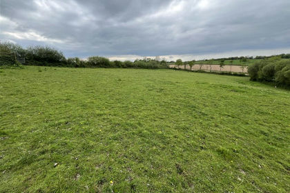
- Price
- £60,000
- Size
- 2.39 acres
Highampton, Beaworthy, Devon, Black Torrington, Devon EX21 5JL England
Added on 19/05/2026Grazing Land
- Price
- Guide Price£30,000
- Size
- 3.09 acres
Trebursye, Launceston, PL15, St. Thomas the Apostle Rural, Cornwall PL15 7ET England
Added on 16/06/2026Vacant Land
- Price
- Guide Price£45,000
- Size
- 4.55 acres
Added on 07/07/2026Pasture