Hafod Y Dail, Clynderwen, SA66
- Land size
- 6 acres
- Bedrooms
- 4
- Bathrooms
- 2
Key Features
- Character smallholding: 1 acre garden and field; ~5 acres ancient woodland
- Peaceful, secluded, sheltered, private, rural location with land
- Annexe - multi-use room - office, spare room
- South-facing, light, cosy and characterful
- Wildlife haven
- Barn. Development potential.
- Renovated throughout using eco-friendly, non-toxic materials
- Solid-fuel rayburn for hotwater and central heating - back-boiler heats radiators throughout the house
Description
A beautiful, 4 bed cottage with ~6 acres. Set in an idyllic, private, secluded, rural location with abundant wildlife. A sheltered, south-facing position, surrounded by meadows and ancient broadleaf woodland. It feels far removed from the noise and hustle of modern life, however Narberth and Haverfordwest towns are 15 mins away; and there are beeches within 30 mins.
The living area of the house faces south over the garden and field, so it is easy to keep an eye on livestock and children and to enjoy wildlife observations.
The outbuilding/barn (~30' x 16') requires improvement and has development potential. It stands on the footprint of the original farmhouse before the existing house was began in mid 1800s.
The field can be used for any combination of free-range poultry, sheep, goats, vegetable growing and wildflower meadow. The garden includes mature fruit and nut trees and soft fruit bushes and mature flower/herb/fruit beds. The current owners sell surplus eggs and vegetables by the road and in a shop in Narberth.
~5 acres (exact acreage unknown) mixed ancient broadleaf woodland to the west of the house: Wildlife, fuel supply and potential space for cabin / ancillary accommodation.
Over the past few years, the property has undergone extensive repairs, renovations and improvements, in a traditional country style, using eco/ natural materials and retaining original character features.
Some of the works include:
Solid-oak and terracotta tile flooring downstairs and natural sisal carpeting upstairs;
Solid-oak and granite-top kitchen with Belfast sink;
Traditional bathroom suit and utility room with traditional WC and basin;
Internal wall removal with exposed character timber joist to make the kitchen and living areas open-plan;
Bespoke solid-wood 'cottage doors' with cast iron fixings throughout the house interior;
New back-boiler for rayburn and lining of chimneys;
Installation of new multi-fuel stove in sitting room;
Replacement of hot-water cylinder and various plumbing improvements;
Installation of new sewerage treatment plant and pipes;
Various repairs to roofs and chimneys;
Drainage improvement works behind house; new Velux double-glazing;
Timber-clad extension/annexe room;
Timber cladding of barn;
Construction of a large reinforced glass greenhouse (14'7" x 8'4");
Major clearance works on the land and subsequent creation of garden and fenced vegetable growing area.
Coppicing, tree and hedgerow management.
EPC grade is poor due to the solid-fuel heating system and some single-glazed windows remain in the living room. There are several grant schemes available for changing the heating system at this property, including solar power and/or ground-source heat pump. Current owners have chosen not to change the system because they prefer being on solid fuel and enjoy the practicalities and comfort of having a Rayburn, particularly since there is the option of being self-sufficient in wood fuel from the woodlands.
Further woodland and meadow land (currently rewildling) may be available by separate negotiation.
The vendors kindly request that viewings are only offered to proceedable buyers.
**ENQUIRIES**
For all enquiries, viewing requests or to create your own listing please visit the Emoov website. If calling, please quote reference: S3092
Living Room
Door and 2 windows to front patio; door to side veranda; newly installed multi-fuel stove, quarry tiled hearth; former Inglenook fireplace with exposed beam over, beamed ceiling; radiator; bespoke wooden shelving for storage; side door to covered veranda; solid oak flooring.
WC, cloak room / utility room
Window to side; plumbing for washing machine; traditional WC and wash hand basin; radiator; vintage coat hooks; genuine terracotta tiled flooring.
Bedroom 1
Large window to rear; radiator; wall-to wall (entire western wall of room) bespoke solid wood shelving for storage; solid oak flooring.
Kitchen/Diner
Solid fuel Rayburn serving hot water and central heating; solid oak fitted cupboards and drawers with granite work surfaces and ceramic Belfast sink; LPG cooker; door to stair; window to front, rear and side; stable door to side.
Annexe Multi-use room
Timber clad exterior. Solid oak flooring. A pleasant multi-use annexe room, currently used as an office.
Potential B&B.
A doorway could be made between this room and the living room; Double Belfast sink with solid wood cupboards and shelves; telephone and internet sockets; French window doors.
Bedroom 2
Window to west side and velux roof-light to north; radiator; natural sisal carpet.
Main Bedroom - Bedroom 3
Window to east side and velux roof-light to north; airing cupboard housing hot water cylinder; fitted wardrobe; radiator; Osmo oiled solid oak flooring.
Bedroom 4
A lovely child’s bedroom. Exposed A frames; windows to south and east; velux roof-light to north; radiator; natural sisal carpet.
Bathroom
Traditional ceramic WC and basin; enamelled steel double-ended bath with mixer tap and shower; windows to south and west; radiator; exposed A frames; lacquered solid oak flooring.
Externally
Verandas (sitting, boots, logs, drying laundry etc).
Field (chickens/goats/sheep/hay).
Lawns, mature flower/herb beds.
Fruit and nut trees.
Fenced vegetable patch.
New large reinforced glass-paned greenhouse, 14.7"' x 8'4".
~5 acres ancient woodland.
Agricultural Building / Barn
The large agricultural building is of block and timber construction with corrugated iron roof. The front part is divided into two for storage and the rear part provides shelter for livestock/further storage). The whole building requires improvement. Development potential.
Map Location
Property details
- Tenure
- Freehold
- Council Tax Band
- Ask Agent
- Date Posted
- 2026-07-04
Market Value Analysis
Compared with 274 Farms & Smallholdings listings in Wales (5+ acres).
Utilities & Restrictions
Utilities
- Electricity
- Ask Agent
- Water
- Ask Agent
- Heating
- Double Glazing, Wood Burner
- Broadband
- Ask Agent
- Sewerage
- Ask Agent
Rights & Restrictions
- Public Rights of Way
- Ask Agent
- Private Rights of Way
- Ask Agent
- Listed Property
- Ask Agent
- Restrictions
- Ask Agent
Listed status, conservation areas and planning constraints for this location are in the full report.
Property Features
- Accessibility
- Ask Agent
- Parking
- Driveway, Off-Street Parking, Private Parking
- Garden
- Front Garden, Rear Garden
Beyond the particulars: planning activity, flood history, heritage and ground risks, checked for this exact spot.
Connectivity
Broadband
Fastest speed available at this postcode
49 Mbps
Superfast · available to 67% of premises
Suitable for
- HD streaming
- Video calls
- Web & social
Mobile signal
Outdoor predictions; indoor signal depends on building materials.
Ofcom Connected Nations postcode-level predictions. Speeds and signal are modelled, not measured, and vary between addresses and providers.
Signal is the easy part. Planning activity, flood history and protected designations here are in the full report.
Nearest Schools
Primary
- Ysgol Gymunedol Brynconin2.6 miles
- Pupils
- 71
- Type
- Nursery, Infants & Juniors
- Language
- Welsh medium school / provision (including transitional)
- Ysgol Gymunedol Maenclochog2.8 miles
- Pupils
- 98
- Type
- Infants & Juniors
- Language
- Welsh medium school / provision (including transitional)
- Beca3.5 miles
- Pupils
- 46
- Type
- Infants & Juniors
- Language
- Welsh medium school / provision (including transitional)
- St Aidans Church in Wales VA School5.1 miles
- Pupils
- 75
- Type
- Nursery, Infants & Juniors
- Language
- English medium school / provision
- Narberth Community Primary School5.4 miles
- Pupils
- 281
- Type
- Nursery, Infants & Juniors
- Language
- Dual language school / provision (Welsh and English) (including transitional)
Secondary
- Dyffryn Taf8 miles
- Pupils
- 890
- Type
- Secondary (ages 11-19)
- Language
- Dual language school / provision (Welsh and English) (including transitional)
- Ysgol Caer Elen8.5 miles
- Pupils
- 907
- Type
- Middle (ages 3-16)
- Language
- Welsh medium school / provision (including transitional)
- Ysgol Bro Preseli8.9 miles
- Pupils
- 932
- Type
- Middle (ages 3-19)
- Language
- Welsh medium school / provision (including transitional)
- Haverfordwest High VC School10 miles
- Pupils
- 1,699
- Type
- Secondary (ages 11-19)
- Language
- English medium school / provision
- Ysgol Bro Gwaun12 miles
- Pupils
- 574
- Type
- Secondary (ages 11-16)
- Language
- Dual language school / provision (Welsh and English) (including transitional)
Distances are straight-line from the advertised location. Source: the national school registers (DfE, Welsh Government, Scottish Government) and Ofsted.
Schools are just the start: sold prices nearby, planning activity and any flood history are in the full report.
Amenities
Supermarket
GP surgery
Pharmacy
Straight-line distances from the advertised location. Sources: NHS records, Geolytix supermarket locations, OS Open Greenspace and the national trails registers.
The area stacks up? Now check the location itself: planning nearby, protected designations and past flooding.
Getting Around
Nearest station
Nearest bus stop
Typical drive times
Straight-line distances from the advertised location; drive times are typical free-flow times over OpenStreetMap road data, so allow more at peak. Public transport locations from DfT NaPTAN.
Easy to reach matters. So do planning activity, flood history and ground risks: all in the full report.
Flood Risk
From Natural Resources Wales flood map open data, checked around the advertised map pin and allowing for the listed acreage where known. This summary comes from LandSale, the advertising platform, not from the listing agent, and is not part of the agent's particulars. Risk can vary across a single holding, so verify anything critical through your own searches before committing.
Rivers and the sea
Mapped within the area searched, not at the advertised map pin itself.
Surface water
Mapped within the area searched, not at the advertised map pin itself.
The detail behind these bandings
The full report pinpoints where this location sits on the flood maps, and runs the deeper checks that usually only surface after an offer.
- Exact flood zones & annual chances (included in the full report)
- Any recorded past flooding (included in the full report)
- Planning activity nearby (included in the full report)
- Heritage & conservation (included in the full report)
- Protected nature designations (included in the full report)
- Ground risks (included in the full report)
- Sold prices nearby (included in the full report)
£14.99 · one-off purchase
By LandSale, the platform. Not provided by the listing agent. Ready in about a minute.
Important notice: Information, maps and tags on this page are drawn from the advertising agent's marketing materials or generated automatically. LandSale has not verified them. Relying on these details is at your own risk, always carry out independent checks before committing to a purchase.
LandSale full disclaimer
Marketing information only - not formal particulars. The details on this website are provided for general guidance and do not constitute an offer or contract. Neither LandSale nor the advertising estate/land agent accepts responsibility for any inaccuracy.
1. Source of information
- Listing content: Core description, asking price, tenure, measurements, photographs and planning history originate from the marketing materials of the advertising estate or land agent. LandSale does not author this content and cannot guarantee its accuracy.
- Automated tags & categorisation: Property type, land-use class, acreage bands and similar labels may be applied by machine-learning models. They are intended as a helpful guide only and may not reflect the property's legal status or permitted use.
- Third-party & enriched data layers: Maps, boundary outlines, planning designations, soil reports, broadband coverage and other environmental or location-based insights are licensed from external suppliers. Such data are supplied “as is", may be incomplete or out of date and are subject to change without notice.
2. Verification required
Prospective purchasers must verify critical matters, including but not limited to planning permission, title boundaries, public rights of way, environmental constraints, acreage, services, access and VAT status, through their own inspections, specialist surveys, legal advisers and the selling agent before relying on the information or entering into any contract.
3. No warranty or liability
LandSale gives no warranty, express or implied, as to the accuracy, completeness or fitness for any particular purpose of the information displayed. LandSale shall not be liable for any loss, damage, cost or expense arising directly or indirectly from any use of or reliance on such information, save where liability may not be excluded by law.
4. Updates & feedback
If you believe any detail on this listing is inaccurate, please let us know. We will investigate and, where appropriate, update the listing or notify the agent.
© LandSale | Version 1.3 - August 2026
Listing agent
Emoov, Chelmsford
Marsh House Farm, Lower Burnham Road, Latchingdon Chelmsford, Essex CM3 6HQ
Contact Emoov, Chelmsford
Marsh House Farm, Lower Burnham Road, Latchingdon Chelmsford, Essex CM3 6HQ
View agent profileSimilar properties for sale
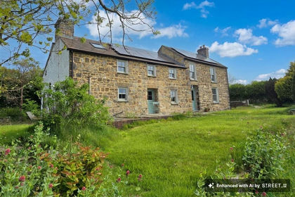
- Price
- Offers in Region of£579,000
- Size
- 3 acres
Penffordd, Clynderwen, SA66, New Moat, Pembrokeshire SA66 Wales
Added on 07/07/2026Farmhouse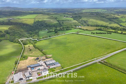
- Price
- £650,000
- Size
- 16 acres
Maenclochog, Clynderwen, SA66, Maenclochog, Pembrokeshire SA66 Wales
Added on 04/07/2026Smallholding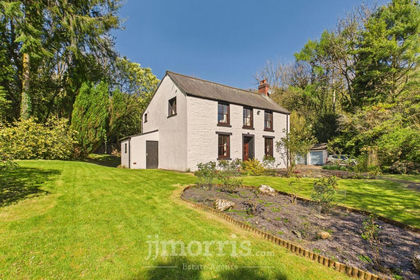
- Price
- Offers in Region of£499,950
- Size
- 10 acres
Llanycefn, Clynderwen, SA66, Maenclochog, Pembrokeshire SA66 Wales
Added on 06/05/2026House with Land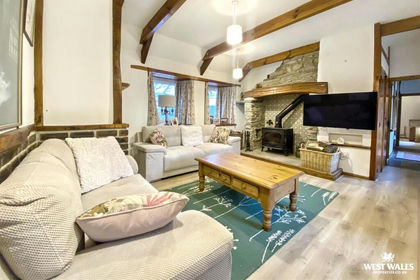
- Price
- Offers in Excess of£525,000
- Size
- 5 acres
Added on 11/02/2026Barn Conversion
- Price
- £650,000
- Size
- 5.47 acres
Brynberian, Near Newport, SA41, Eglwyswrw, Pembrokeshire SA41 Wales
Added on 26/06/2026Smallholding
- Price
- Offers in Region of£675,000
- Size
- 7.98 acres
Yerbeston, Kilgetty, SA68, Jeffreyston, Pembrokeshire SA68 Wales
Added on 09/04/2026Smallholding
- Price
- £585,000
- Size
- 20 acres
Added on 30/04/2026Smallholding
- Price
- Guide Price£635,000
- Size
- 12 acres
Reynalton, Kilgetty, SA68, Kilgetty, Pembrokeshire SA68 Wales
Added on 18/06/2026Farmhouse
- Price
- £585,000
- Size
- 5 acres
Camrose, Haverfordwest, SA62, Haverfordwest, Pembrokeshire SA62 Wales
Added on 13/07/2026Smallholding
- Price
- £575,000
- Size
- 13 acres
Blaenwaun, Whitland, SA34, Llanwinio, Carmarthenshire SA34 Wales
Added on 11/04/2026Smallholding