Worstead, North Walsham, Norfolk
- Land size
- 0.54 acres
- Bedrooms
- 4
- Bathrooms
- 3
Key Features
- Semi-Detached Barn Conversion
- 32ft Open Plan Sitting/Dining Room
- Kitchen/Breakfast Room
- Four Bedrooms (2 en-suite)
- Study/Home Office
- Detached Double Garage
- Semi-Rural Setting
- 0.54 Acres (stms)
- No onward chain
Description
West Barn forms one of a pair of semi-detached barn conversions situated within the Manor Farm Barns development on School Road in the village of Worstead. The property occupies a semi-rural setting within the historic former farmstead associated with the Worstead Estate. The whole enjoys wonderful proportions, gently tucked away behind the part walled and mature boundaries which takes advantage of the incredible views across to the Grade I listed, St Mary's Church.
The building originally formed part of a traditional agricultural complex and was historically used as a grain store serving the wider estate. In 2011, the site was acquired by Worstead Developments, who undertook the conversion and redevelopment of the former agricultural buildings to create two semi-detached residential dwellings. The conversion retained the character and appearance of the original barn structures whilst adapting them for modern residential use.
Constructed in traditional materials with mellow brick elevations under a vast pantile roof, the whole immediately reflects its agricultural heritage and enjoys well-arranged and spacious accommodation on three floors.
The ground floor accommodation is centred around a substantial open-plan sitting/dining room measuring approximately 32 ft in length, which sets the tone and creates an urge to entertain with direct access into the gardens from a number of points. The sitting room is very special with a log burner acting as the central feature and as you move towards the north of the barn a striking mezzanine floor is positioned above you, accessed from the first floor and makes for an excellent study/home office area. The dining room part is substantial and useful for entertaining.
Adjacent is a generously proportioned kitchen/breakfast room featuring fitted cabinetry, integrated appliances, a central island unit with oak worktop and ample space for informal dining. The kitchen benefits from extensive glazing and French doors open onto the main terrace which is a lovely space, slightly elevated and overlooks the established English Lavender that borders the shingled drive beautifully.
Useful ground floor accommodation also includes a study/home office, utility room and cloakroom/WC.
The first floor provides a spacious principal bedroom suite extending to over 23 ft in length, together with a well-appointed en-suite bathroom. A further double bedroom and en-suite bathroom are located on this level. Overlooking the sitting room below is the aforementioned, mezzanine office/study space, and reflects the barn's original open-plan form and vaulted character.
The second floor provides two additional double bedrooms served by a family bathroom. We draw your attention to the floorplan as to how the accommodation is arranged.
Externally, the property is approached over a shared access serving the development and leads on to the access for West Barn which flows onto a shingled parking area with suitable space for a large number of vehicles. The detached double garage of brick and timber clad provides secure parking and storage, and an electric car charger has been installed on the side of the garage.
The gardens and grounds are a major feature of the whole West Barn is set within beautifully maintained gardens and grounds extending to approximately 0.54 acres providing an exceptional setting that complements the character of the barn and enjoys an attractive outlook towards the tower of St Mary's Church.
The gardens have been thoughtfully designed and carefully cultivated by the current owners as they have created a much-loved space of considerable horticultural interest, combining formal planting with wildlife-friendly features. A mature native boundary hedge forms an attractive enclosure and incorporates a diverse range of species including dog rose, hazel, hawthorn and other indigenous planting; an important habitat for birds, pollinators and other wildlife throughout the year.
The grounds are principally laid to lawn and interspersed with a variety of specimen trees, including cherry, crab apple, mountain ash, whitebeam, two lilac bushes, a selection of hollies, five silver birches, two walnut trees and a sweet chestnut.
A particular feature is the delightful rose garden, which contains approximately 28 established David Austin rose bushes, complemented by a further ten rose specimens strategically positioned throughout the wider grounds and provide a succession of colour, fragrance and structure forming an attractive focal point within the garden.
The productive elements of the grounds have been equally well considered and over the course of the last 11 years a dedicated cutting garden has been created incorporating raised beds for flowers and seasonal produce, enclosed by attractive step-over apple and other trees. A new additional bed is planted with raspberries.
A charming pergola, clothed with rambling and climbing roses, provides an attractive seating and entertaining area from which to enjoy the gardens and surrounding setting and the views here back towards the barn and the church are exceptional. Adjacent to the pergola, a small orchard contains a selection of apple, pear and plum trees and a pretty seating area sits on the border of the part walled garden.
Services - Mains water, mains electricity, mains drainage, oil central heating.
Local authority - North Norfolk District Council
Acreage - 0.54 acres (stms)
LOCATION Worstead is a popular village situated approximately 14 miles from Norwich and 4 miles from North Walsham. There is a rail link at Worstead on the Bittern Line which runs from Norwich to Cromer and Sheringham via the Norfolk Broads and stopping at Salhouse, Hoveton and Wroxham, Worstead and North Walsham. Amenities in the village include a primary school, children's nursery, church, weekly post office van and a public house and there is also the annual Worstead Festival which is reputedly Norfolk's largest village festival. This area is ideally situated for access to the Norfolk Broads and some of Norfolk's finest beaches. The surrounding area is predominantly residential and agricultural in character.
DIRECTIONS Leave Norwich on the B1150 North Walsham Road, continuing past Spixworth and through Coltishall village, remaining on the B1150 towards North Walsham. At the Westwick sign, turn right at the signpost to Worstead and follow this road into the village. Turn left by the church into School Road and the access to the development is on the left-hand side.
AGENT´S NOTES: (1) The photographs shown in this brochure have been taken with a camera using a wide angle lens and therefore interested parties are advised to check the room measurements prior to arranging a viewing.
(2) Intending buyers will be asked to produce original Identity Documentation and Proof of Address before solicitors are instructed.
VIEWING Strictly by prior appointment through the selling agents' Norwich Office. Tel: . These particulars were prepared in June 2026. Ref. 068687
Map Location
Property details
- Tenure
- Freehold
- Council Tax Band
- Ask Agent
- Date Posted
- 2026-06-26
Energy Performance Certificate
View the official EPC certificate for detailed energy efficiency information.
View official EPC certificate ↗
Running costs are one side. Planning activity, flood history and ground risks for this location are in the full report.
Utilities & Restrictions
Utilities
- Electricity
- Mains
- Water
- Mains
- Heating
- Oil Heating
- Broadband
- Ask Agent
- Sewerage
- Mains
Rights & Restrictions
- Public Rights of Way
- Ask Agent
- Private Rights of Way
- Ask Agent
- Listed Property
- Ask Agent
- Restrictions
- Ask Agent
Listed status, conservation areas and planning constraints for this location are in the full report.
Property Features
- Accessibility
- Ask Agent
- Parking
- Garage, EV Charger
- Garden
- Garden
Beyond the particulars: planning activity, flood history, heritage and ground risks, checked for this exact spot.
Connectivity
Broadband
Fastest speed available at this postcode
1.8 Gbps
Gigabit full fibre
Suitable for
- 4K streaming on every screen
- Full-time home working
- Online gaming & big downloads
Mobile signal
Outdoor predictions; indoor signal depends on building materials.
Ofcom Connected Nations postcode-level predictions. Speeds and signal are modelled, not measured, and vary between addresses and providers.
Signal is the easy part. Planning activity, flood history and protected designations here are in the full report.
Nearest Schools
Primary
- Worstead Church of England Primary School237 metresNo Ofsted rating
- Ages
- 4 to 11
- Pupils
- 106
- Type
- Voluntary aided school
- Faith
- Church of England
- Swanton Abbott Community Primary School2.4 milesNo Ofsted rating
- Ages
- 4 to 11
- Pupils
- 57
- Type
- Community school
- Tunstead Primary School2.5 milesOfsted: Good *
- Ages
- 4 to 11
- Pupils
- 67
- Type
- Community school
- Millfield Primary School2.7 milesNo Ofsted rating
- Ages
- 4 to 11
- Pupils
- 264
- Type
- Academy converter
- North Walsham Junior School2.7 milesNo Ofsted rating
- Ages
- 7 to 11
- Pupils
- 248
- Type
- Academy converter
Secondary
- North Walsham High School2.5 milesOfsted: Good
- Ages
- 11 to 16
- Pupils
- 641
- Type
- Academy converter
- Stalham High School4.5 milesOfsted: Good
- Ages
- 11 to 16
- Pupils
- 492
- Type
- Academy sponsor led
- Broadland High Ormiston Academy4.6 milesNo Ofsted rating
- Ages
- 11 to 16
- Pupils
- 725
- Type
- Academy converter
- Aylsham High School6.5 milesNo Ofsted rating
- Ages
- 11 to 16
- Pupils
- 1,138
- Type
- Foundation school
- Sprowston Community Academy9.9 milesOfsted report card · May 2026
- Ages
- 11 to 18
- Pupils
- 1,702
- Type
- Academy sponsor led
* Latest graded judgement covers quality of education only; no overall grade was issued under the 2024-25 inspection framework.
Distances are straight-line from the advertised location. Source: the national school registers (DfE, Welsh Government, Scottish Government) and Ofsted.
Schools are just the start: sold prices nearby, planning activity and any flood history are in the full report.
Amenities
Supermarket
GP surgery
Pharmacy
Hospital
Green space
Straight-line distances from the advertised location. Sources: NHS records, Geolytix supermarket locations, OS Open Greenspace and the national trails registers.
The area stacks up? Now check the location itself: planning nearby, protected designations and past flooding.
Getting Around
Nearest station
Nearest bus stop
Typical drive times
Straight-line distances from the advertised location; drive times are typical free-flow times over OpenStreetMap road data, so allow more at peak. Public transport locations from DfT NaPTAN.
Easy to reach matters. So do planning activity, flood history and ground risks: all in the full report.
Flood Risk
From Environment Agency flood map open data, checked around the advertised map pin and allowing for the listed acreage where known. This summary comes from LandSale, the advertising platform, not from the listing agent, and is not part of the agent's particulars. Risk can vary across a single holding, so verify anything critical through your own searches before committing.
Rivers and the sea
Surface water
The detail behind these bandings
The full report pinpoints where this location sits on the flood maps, and runs the deeper checks that usually only surface after an offer.
- Exact flood zones & annual chances (included in the full report)
- Any recorded past flooding (included in the full report)
- Planning activity nearby (included in the full report)
- Heritage & conservation (included in the full report)
- Protected nature designations (included in the full report)
- Ground risks (included in the full report)
- Sold prices nearby (included in the full report)
£14.99 · one-off purchase
By LandSale, the platform. Not provided by the listing agent. Ready in about a minute.
Important notice: Information, maps and tags on this page are drawn from the advertising agent's marketing materials or generated automatically. LandSale has not verified them. Relying on these details is at your own risk, always carry out independent checks before committing to a purchase.
LandSale full disclaimer
Marketing information only - not formal particulars. The details on this website are provided for general guidance and do not constitute an offer or contract. Neither LandSale nor the advertising estate/land agent accepts responsibility for any inaccuracy.
1. Source of information
- Listing content: Core description, asking price, tenure, measurements, photographs and planning history originate from the marketing materials of the advertising estate or land agent. LandSale does not author this content and cannot guarantee its accuracy.
- Automated tags & categorisation: Property type, land-use class, acreage bands and similar labels may be applied by machine-learning models. They are intended as a helpful guide only and may not reflect the property's legal status or permitted use.
- Third-party & enriched data layers: Maps, boundary outlines, planning designations, soil reports, broadband coverage and other environmental or location-based insights are licensed from external suppliers. Such data are supplied “as is", may be incomplete or out of date and are subject to change without notice.
2. Verification required
Prospective purchasers must verify critical matters, including but not limited to planning permission, title boundaries, public rights of way, environmental constraints, acreage, services, access and VAT status, through their own inspections, specialist surveys, legal advisers and the selling agent before relying on the information or entering into any contract.
3. No warranty or liability
LandSale gives no warranty, express or implied, as to the accuracy, completeness or fitness for any particular purpose of the information displayed. LandSale shall not be liable for any loss, damage, cost or expense arising directly or indirectly from any use of or reliance on such information, save where liability may not be excluded by law.
4. Updates & feedback
If you believe any detail on this listing is inaccurate, please let us know. We will investigate and, where appropriate, update the listing or notify the agent.
© LandSale | Version 1.3 - August 2026
Similar properties for sale
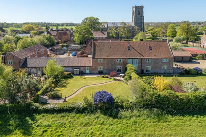
- Price
- Guide Price£750,000
Idyllic Barn Conversion in Worstead, Worstead, Norfolk NR28 England
Added on 21/02/2026Barn Conversion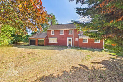
- Price
- Guide Price£775,000
- Size
- 1.57 acres
Meeting Hill Road, North Walsham, Worstead, Norfolk NR28 England
Added on 18/08/2026House with Land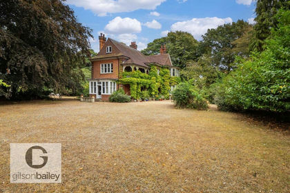
- Price
- £750,000
- Size
- 1 acres
Cromer Road, North Walsham, North Walsham, Norfolk NR28 England
Added on 28/08/2026House with Land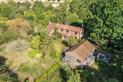
- Price
- Offers in Region of£650,000
- Size
- 2 acres
Added on 02/09/2026House with Land
- Price
- Offers in Excess of£700,000
- Size
- 0.33 acres
Church Barn, Gt. Hautbois Road, Coltishall, Norfolk, Coltishall, Norfolk NR12 England
Added on 02/04/2026Barn Conversion
- Price
- Guide Price£800,000
Added on 01/08/2026Barn Conversion
- Price
- Offers Over£950,000
- Size
- 2 acres
Grange Barn, Grove Road, Ingham, Norfolk, Ingham, Norfolk NR12 England
Added on 29/01/2026Barn Conversion
- Price
- £700,000
- Size
- 3 acres
Added on 10/08/2026House with Land
- Price
- Offers in Excess of£625,000
Added on 19/05/2026Cottage
- Price
- Guide Price£875,000
- Size
- 1 acres
Forest House, Firs Lane, Sutton, Norfolk, Sutton, Norfolk NR12 England
Added on 26/08/2026House with Land