Bury Road, Hengrave, Bury St. Edmunds
- Bedrooms
- 4
- Bathrooms
- 3
Key Features
- **DOWNLOAD our detailed brochure & view the area profile video**
Description
HOME TO HORSEPOWER; RELAXED LIVING AT THIS STUNNING BARN CONVERSION WITH ANNEXE CONVERSION POTENTIAL AND LARGE GARDENS, NESTLED ON THE EDGE OF DESIRABLE VILLAGE CLOSE TO HISTORIC BURY ST. EDMUNDS.
The meticulous high-quality restoration by a well-regarded barn conversion specialist, Dow Brandeston in 2006, makes for a perfect fusion of Grade II-Listed history and modern design nuances. Today, beautifully conceived and updated interiors glisten following a comprehensive programme of refurbishments in recent years, which have transformed this barn into a much loved home.
The one-level living accommodation has two bedroom wings either end of a central open-plan central reception and entertaining space - one has private access with the potential to convert to multi-generational living or AirBnB / rental purposes (refer to floorplan red outline). A carved stone entablature pays homage to Sir T Gage ‘Built 1849’, former owner of neighbouring Hengrave Hall Estate and for whom the range of barns would have once served. Of particular note is the dramatic vaulted reception hall with its eye-catching polygonal midstrey and engineered volumes of timber complemented by a stunning array of exposed beamwork; spectacular open-plan kitchen/dining space with adjacent walk-in pantry / utility room; three large bathrooms and shower rooms. The lofty ceilings throughout (4.1 metres (13.5 feet)), combined with the inter-connecting flow of spaces, with multi-zone underfloor heating, are ideal for entertaining. Newly landscaped low-maintenance gardens complete the picture.
Location - LOCATION:
The property lies on the edge of a semi-rural and much favoured village – only four miles north west of the fine Suffolk cathedral town of Bury St. Edmunds. The University City of Cambridge is easily reached via the A14 east-west major road link, which is accessed via neighbouring Risby village to facilitate commuting ease, and with the M11 providing a fast route to London. Reputable private and state schools, an eclectic range of high street and independent shops, and some the country’s finest restaurants – including the only Michelin star in Suffolk – and leisure facilities can be found within a short drive as are the majestic rambling Lackford Lakes and Cavenham Heath.
Map Location
Property details
- Tenure
- Freehold
- Council Tax Band
- F
- Date Posted
- 2026-06-22
Energy Performance Certificate
Energy Efficiency Rating
Based on UK Energy Performance Certificate standards (EU Directive 2002/91/EC)
Utilities & Restrictions
Utilities
- Electricity
- Mains
- Water
- Mains
- Heating
- Oil Heating
- Broadband
- Ask Agent
- Sewerage
- Septic Tank / Private
Rights & Restrictions
- Public Rights of Way
- Ask Agent
- Private Rights of Way
- Ask Agent
- Listed Property
- Ask Agent
- Restrictions
- Ask Agent
Property Features
- Accessibility
- Ask Agent
- Parking
- Garage
- Garden
- Garden
Connectivity
Broadband
Fastest speed available at this postcode
74 Mbps
Superfast
Suitable for
- HD streaming
- Video calls
- Web & social
Mobile signal
Outdoor predictions; indoor signal depends on building materials.
Ofcom Connected Nations postcode-level predictions. Speeds and signal are modelled, not measured, and vary between addresses and providers.
Nearest Schools
Primary
- Howard Community Academy2.1 milesOfsted: Good *
- Ages
- 3 to 11
- Pupils
- 210
- Type
- Academy sponsor led
- Risby Church of England Voluntary Controlled Primary School2.2 milesOfsted: Good
- Ages
- 4 to 11
- Pupils
- 203
- Type
- Voluntary controlled school
- Faith
- Church of England
- Tollgate Primary School2.4 milesOfsted: Good
- Ages
- 3 to 11
- Pupils
- 437
- Type
- Academy sponsor led
- Sexton's Manor Primary School2.7 milesNo Ofsted rating
- Ages
- 3 to 11
- Pupils
- 165
- Type
- Academy converter
- St Edmundsbury CofE Primary Academy3 milesOfsted: Requires improvement
- Ages
- 5 to 11
- Pupils
- 168
- Type
- Academy sponsor led
- Faith
- Church of England
Secondary
- St Benedict's Catholic School2.4 milesNo Ofsted rating
- Ages
- 11 to 18
- Pupils
- 968
- Type
- Academy converter
- Faith
- Roman Catholic
- Bury St Edmunds County High School2.5 milesOfsted report card · May 2026
- Ages
- 11 to 16
- Pupils
- 657
- Type
- Academy converter
- King Edward VI CEVC School2.9 milesNo Ofsted rating
- Ages
- 11 to 16
- Pupils
- 1,189
- Type
- Voluntary controlled school
- Faith
- Church of England
- Sybil Andrews Academy4.8 milesOfsted: Good
- Ages
- 11 to 16
- Pupils
- 657
- Type
- Academy sponsor led
- Thurston Community College6.3 milesNo Ofsted rating
- Ages
- 11 to 18
- Pupils
- 1,512
- Type
- Community school
* Latest graded judgement covers quality of education only; no overall grade was issued under the 2024-25 inspection framework.
Distances are straight-line from the advertised location. Source: the national school registers (DfE, Welsh Government, Scottish Government) and Ofsted.
Amenities
Supermarket
GP surgery
Pharmacy
Hospital
Straight-line distances from the advertised location. Sources: NHS records, Geolytix supermarket locations, OS Open Greenspace and the national trails registers.
Getting Around
Nearest station
Nearest bus stop
Typical drive times
Straight-line distances from the advertised location; drive times are typical free-flow times over OpenStreetMap road data, so allow more at peak. Public transport locations from DfT NaPTAN.
Flood Risk
From Environment Agency flood map open data, checked around the advertised map pin and allowing for the listed acreage where known. This summary comes from LandSale, the advertising platform, not from the listing agent, and is not part of the agent's particulars. Risk can vary across a single holding, so verify anything critical through your own searches before committing.
Rivers and the sea
Surface water
The detail behind these bandings, including exact zones and annual chances, any recorded past flooding, plus planning, heritage, nature and ground checks, is in the .
Important notice: Information, maps and tags on this page are supplied by the advertising agent or generated automatically. LandSale has not verified them. Relying on these details is at your own risk, always carry out independent checks before committing to a purchase.
LandSale full disclaimer
Marketing information only - not formal particulars. The details on this website are provided for general guidance and do not constitute an offer or contract. Neither LandSale nor the advertising estate/land agent accepts responsibility for any inaccuracy.
1. Source of information
- Agent-supplied content: Core description, asking price, tenure, measurements, photographs and planning history are uploaded by the appointed agent, who remains solely responsible for their accuracy.
- Automated tags & categorisation: Property type, land-use class, acreage bands and similar labels may be applied by machine-learning models. They are intended as a helpful guide only and may not reflect the property's legal status or permitted use.
- Third-party & enriched data layers: Maps, boundary outlines, planning designations, soil reports, broadband coverage and other environmental or location-based insights are licensed from external suppliers. Such data are supplied “as is", may be incomplete or out of date and are subject to change without notice.
2. Verification required
Prospective purchasers must verify critical matters, including but not limited to planning permission, title boundaries, public rights of way, environmental constraints, acreage, services, access and VAT status, through their own inspections, specialist surveys, legal advisers and the selling agent before relying on the information or entering into any contract.
3. No warranty or liability
LandSale gives no warranty, express or implied, as to the accuracy, completeness or fitness for any particular purpose of the information displayed. LandSale shall not be liable for any loss, damage, cost or expense arising directly or indirectly from any use of or reliance on such information, save where liability may not be excluded by law.
4. Updates & feedback
If you believe any detail on this listing is inaccurate, please let us know. We will investigate and, where appropriate, update the listing or notify the agent.
© LandSale | Version 1.2 - January 2026
Listing agent
Whatley Lane, Bury St Edmunds
1 Churchgate Street, Bury St. Edmunds, IP33 1RL
Contact Whatley Lane, Bury St Edmunds
1 Churchgate Street, Bury St. Edmunds, IP33 1RL
View agent profileSimilar properties for sale
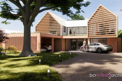
- Price
- £695,000
- Size
- 0.25 acres
Kings Road, Bury St. Edmunds, Bury St Edmunds, Suffolk IP33 England
Added on 08/07/2026Redevelopment Land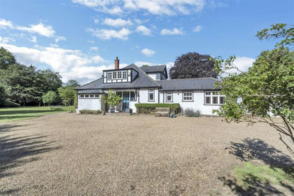
- Price
- Guide Price£845,000
- Size
- 1.05 acres
The Park, Great Barton, Bury St. Edmunds, Great Barton, Suffolk IP31 England
Added on 05/07/2026House with Land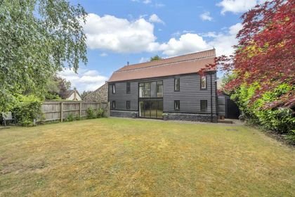
- Price
- Guide Price£740,000
School Road, Thurston, Bury St. Edmunds, Thurston, Suffolk IP31 England
Added on 10/06/2026Barn Conversion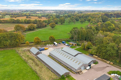
- Price
- Guide Price£700,000
- Size
- 1.6 acres
Added on 16/04/2026Commercial Land
- Price
- £630,000
- Size
- 1 acres
Worlington Road, Mildenhall, Bury St. Edmunds, Suffolk, IP28, Barton Mills, Suffolk IP28 England
Added on 25/07/2026Cottage
- Price
- Offers in Excess of£800,000
- Size
- 12 acres
Field Road, Mildenhall, Mildenhall High, Suffolk IP28 England
Added on 21/07/2026House with Land
- Price
- Guide Price£715,000
- Size
- 1.3 acres
Genesis Green, Wickhambrook, Newmarket, Wickhambrook, Suffolk CB8 England
Added on 17/08/2026House with Land
- Price
- Offers in Excess of£900,000
- Size
- 1.3 acres
Worlington, Bury St. Edmunds, Suffolk, Worlington, Suffolk IP28 England
Added on 04/07/2026House with Land Added on 11/07/2026Building Plot
- Price
- Offers in Excess of£650,000
- Size
- 1.07 acres
West Row, Mildenhall, Suffolk, West Row, Suffolk IP28 England
Added on 29/01/2026House with Land