Bremenvoir Croft, Ardtun, Bunessan, Isle Of Mull, PA67
- Land size
- 19 acres
- Bedrooms
- 6
- Bathrooms
- 4
Key Features
- An idyllic island setting offering a wonderful lifestyle opportunity
- Lovely family home in this popular island location
- Two fully furnished detached letting cottages
- Grounds extending to approximately 19 acres
- Direct coastal frontage
- Open pastureland for sheep grazing
- EPC F27
Description
A beautifully presented croft cottage and two established holiday let cottages, set within approximately 19 acres of prime coastal land, offering direct shore frontage and benefitting from far-reaching coastal views.
Situated in a magnificent coastal setting on the southern shores of the Isle of Mull, Bremenvoir presents a rare opportunity to acquire a beautifully presented croft house accompanied by two popular detached letting cottages.
Set within approximately 19 acres of decrofted land, the property enjoys a direct coastal position at the mouth of Loch Scridain, creating an idyllic backdrop for both permanent residence and holiday accommodation. The main residence is a traditional croft cottage that has been thoughtfully extended to the rear, resulting in a charming and versatile family home arranged over two levels. Mature gardens surround the house, offering vibrant seasonal colour throughout the year and enhancing the tranquillity of the setting.
Entering the main residence through the front elevation, a welcoming vestibule leads into a traditional farmhouse kitchen fitted with white cabinetry and contrasting granite effect worktops. The spacious kitchen comfortably accommodates a six seater dining table, with additional space for freestanding appliances beneath the staircase. Adjacent lies the cosy front-facing lounge, complete with a multi fuel stove, offering an inviting place to relax.
The home provides four bedrooms—one on the ground floor and three on the upper level—ensuring flexibility for family living. The principal bedroom is a bright, airy space with superb views across the grounds toward the coastline, and direct access to the rear garden. The ground floor family bathroom boasts a stylish design with a walk-in shower and contemporary white suite set against feature tiling, while a second bathroom on the upper floor serves the additional living areas.
Within the grounds sit two detached one bedroom letting cottages, each popular with holidaymakers eager to explore this captivating part of the island. Managed privately, the cottages offer private garden areas where guests can relax and enjoy the sweeping open views, along with convenient adjacent parking.
The extensive de-crofted land stretches down to the shoreline, ideal for those keen to discover the rugged coastline or spend time on the water. Much of the land is open pasture, ideal for grazing sheep.
A selection of outbuildings—including a detached garage, storage shed, and stable/stock shed—provide valuable additional space and functionality. A recently installed hen enclosure also sits within the grounds.
Bremenvoir is situated within the community of Ardtun on the Ross of Mull. The nearby villages of Bunessen and Pennyghael boast thriving communities, with amenities including general store, hotel and village hall. The ferry to Iona, a popular tourist destination is just 15 minutes’ drive from the property.
The island bus route provides a regular transport link to the ferry port of Craignure. The Isle of Mull is easily accessible from the mainland ferries from Oban and Lochaline. There is also a small airstrip at Glenforsa suitable for private aircraft and a main line train service operating several times daily between Glasgow and Oban - some connecting directly with the ferries.
Mull boasts an extraordinary and diverse range of scenery, wildlife and leisure activities which brings large numbers of visitors throughout the year. The island also hosts a number of music and arts festivals plus the annual Tour of Mull car rally.
In the sea surrounding Mull there are various trips provided to local puffin and seal colonies and to Iona, as well as the island of Staffa where many tourists visit Fingal’s Cave.
Mains electricity, mains water, private drainage, BT phone and internet connectivity.
Please note, the heating boiler has recently been removed leaving opportunity for the new owner to install to their preferred specification.
Within the grounds sit two detached one bedroom letting cottages, each popular with holidaymakers eager to explore this captivating part of the island. Managed privately, the cottages offer private garden areas where guests can relax and enjoy the sweeping open views, along with convenient adjacent parking.
The extensive de-crofted land stretches down to the shoreline, ideal for those keen to discover the rugged coastline or spend time on the water. Much of the land is open pasture, ideal for grazing sheep.
A selection of outbuildings—including a detached garage, storage shed, and stable/stock shed—provide valuable additional space and functionality. A recently installed hen enclosure also sits within the grounds.
With its picturesque setting, versatile accommodation, and established holiday rental potential, Bremenvoir is expected to attract significant interest, making early viewing highly advisable.
From the ferry terminal in Craignure, take the A849 south, following signs for Bunessen and Fionphort. Continue for approximately 29 miles, continuing through the village of Pennyghael. Upon entering the village of Bunessen, take the right-hand turn, signposted for Ardtun.
Continue along the road for approximately two miles and the entrance track to Bremenvoir will be located on the left-hand side, clearly marked by a sign board on the gate.
What3words ///interview.dries.eliminate
Fixtures and Fittings by separate negotiation.
Map Location
Property details
- Tenure
- Freehold
- Council Tax Band
- E
- Date Posted
- 2026-06-18
Market Value Analysis
Compared with 71 Homes with Land listings in Scotland (10+ acres).
Energy Performance Certificate
Energy Efficiency Rating
Based on UK Energy Performance Certificate standards (EU Directive 2002/91/EC)
Running costs are one side. Planning activity, flood history and ground risks for this location are in the full report.
Utilities & Restrictions
Utilities
- Electricity
- Ask Agent
- Water
- Ask Agent
- Heating
- Ask Agent
- Broadband
- Ask Agent
- Sewerage
- Ask Agent
Rights & Restrictions
- Public Rights of Way
- Ask Agent
- Private Rights of Way
- Ask Agent
- Listed Property
- Ask Agent
- Restrictions
- Ask Agent
Listed status, conservation areas and planning constraints for this location are in the full report.
Property Features
- Accessibility
- Ask Agent
- Parking
- Parking Available
- Garden
- Garden
Beyond the particulars: planning activity, flood history, heritage and ground risks, checked for this exact spot.
Connectivity
Broadband
Fastest speed available at this postcode
1.8 Gbps
Gigabit full fibre · available to 89% of premises
Suitable for
- 4K streaming on every screen
- Full-time home working
- Online gaming & big downloads
Mobile signal
Predicted 4G and 5G signal; indoor signal depends on building materials.
Ofcom Connected Nations postcode-level predictions. Speeds and signal are modelled, not measured, and vary between addresses and providers.
Signal is the easy part. Planning activity, flood history and protected designations here are in the full report.
Nearest Schools
Primary
- Bunessan Primary School0.9 miles
- Pupils
- 12
- Type
- Non-denominational
- Bunessan Primary School Gaelic Unit0.9 miles
- Pupils
- 10
- Type
- Non-denominational
- Iona Primary School6.3 miles
- Pupils
- 11
- Type
- Non-denominational
- Ulva Primary School11 miles
- Pupils
- 9
- Type
- Non-denominational
- Salen Primary School17 miles
- Pupils
- 32
- Type
- Non-denominational
Secondary
- Tobermory High School21 miles
- Pupils
- 151
- Type
- Non-denominational
- Tiree High School30 miles
- Pupils
- 37
- Type
- Non-denominational
- Oban High School30 miles
- Pupils
- 1,009
- Type
- Non-denominational
- Ardnamurchan High School36 miles
- Pupils
- 126
- Type
- Non-denominational
- Lochgilphead High School37 miles
- Pupils
- 408
- Type
- Non-denominational
Distances are straight-line from the advertised location. Source: the national school registers (DfE, Welsh Government, Scottish Government) and Ofsted.
Schools are just the start: planning activity, heritage and any flood history here are in the full report.
Amenities
Supermarket
GP surgery
Pharmacy
Walking trail
Straight-line distances from the advertised location. Sources: NHS records, Geolytix supermarket locations, OS Open Greenspace and the national trails registers.
The area stacks up? Now check the location itself: planning nearby, protected designations and past flooding.
Getting Around
Nearest station
Nearest bus stop
Typical drive times
Straight-line distances from the advertised location; drive times are typical free-flow times over OpenStreetMap road data, so allow more at peak. Public transport locations from DfT NaPTAN.
Easy to reach matters. So do planning activity, flood history and ground risks: all in the full report.
Flood Risk
SEPA open data, checked around the advertised map pin for the listed acreage. Provided by LandSale, not the listing agent, and not part of the agent's particulars. Risk varies across a holding, so verify before committing.
Rivers and the sea
Surface water
Not at the pin: mapped about 20 metres away.
These bandings are the summary. Where this location sits on the flood maps, plus planning activity, heritage and ground risks, is in the full report.
Important notice: Information, maps and tags on this page are drawn from the advertising agent's marketing materials or generated automatically. LandSale has not verified them. Relying on these details is at your own risk, always carry out independent checks before committing to a purchase.
LandSale full disclaimer
Marketing information only - not formal particulars. The details on this website are provided for general guidance and do not constitute an offer or contract. Neither LandSale nor the advertising estate/land agent accepts responsibility for any inaccuracy.
1. Source of information
- Listing content: Core description, asking price, tenure, measurements, photographs and planning history originate from the marketing materials of the advertising estate or land agent. LandSale does not author this content and cannot guarantee its accuracy.
- Automated tags & categorisation: Property type, land-use class, acreage bands and similar labels may be applied by machine-learning models. They are intended as a helpful guide only and may not reflect the property's legal status or permitted use.
- Third-party & enriched data layers: Maps, boundary outlines, planning designations, soil reports, broadband coverage and other environmental or location-based insights are licensed from external suppliers. Such data are supplied “as is", may be incomplete or out of date and are subject to change without notice.
2. Verification required
Prospective purchasers must verify critical matters, including but not limited to planning permission, title boundaries, public rights of way, environmental constraints, acreage, services, access and VAT status, through their own inspections, specialist surveys, legal advisers and the selling agent before relying on the information or entering into any contract.
3. No warranty or liability
LandSale gives no warranty, express or implied, as to the accuracy, completeness or fitness for any particular purpose of the information displayed. LandSale shall not be liable for any loss, damage, cost or expense arising directly or indirectly from any use of or reliance on such information, save where liability may not be excluded by law.
4. Updates & feedback
If you believe any detail on this listing is inaccurate, please let us know. We will investigate and, where appropriate, update the listing or notify the agent.
© LandSale | Version 1.3 - August 2026
Similar properties for sale
- Price
- Offers Over£440,000
- Size
- 3.24 acres
Added on 05/08/2026House with Land
- Price
- £895,000
- Size
- 1.5 acres
Added on 29/01/2026Holiday Let Property
- Price
- Offers Over£695,000
- Size
- 5.98 acres
Added on 29/01/2026House with Land
- Price
- Offers Over£895,000
- Size
- 1.25 acres
Added on 29/01/2026Country Home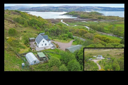
- Price
- Offers Over£445,000
- Size
- 1 acres
Added on 27/05/2026House with Land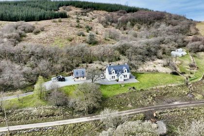
- Price
- Guide Price£525,000
- Size
- 4 acres
Added on 17/04/2026House with Land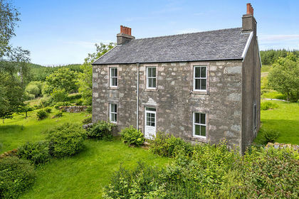
- Price
- Offers Over£950,000
- Size
- 22.5 acres
By Achnabreck, Lochgilphead, Argyll, Bute and South Lochaber, Argyll and Bute PA31 Scotland
Added on 02/07/2026Country Home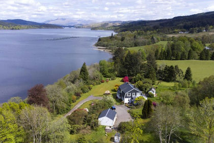
- Price
- Offers Over£575,000
- Size
- 10 acres
Dalmally, Argyll and Bute, Argyll, Bute and South Lochaber, Argyll and Bute PA33 Scotland
Added on 18/06/2026Country Home
- Price
- Guide Price£450,000
- Size
- 1.8 acres
Added on 29/05/2026House with Land
- Price
- Guide Price£795,000
- Size
- 7.7 acres
Added on 03/06/2026Homestead