House Site, 76 Main Street, Tomintoul
- Land size
- 0.15 acres
Key Features
- What3Words Location: ///cigar.overlaid.strays
- Plot Size Circa: 0.15 Acres (621 Sq m)
- Create a Bespoke Residence That Perfectly Suits Your Lifestyle
- Current Planning, Moray Council Ref: 26/00150/APP
- Current Planning, Moray Council: Erect dwellinghouse on Land To The Rear Of No 76 Main Street Tomintoul
- Attractive History of Planning Approval To Erect a Dwellinghouse
- Central Location In Popular Highland Village
- Viewing Highly Recommended
Description
UNDER OFFER - An exciting opportunity to acquire a house site in the sought-after Highland village of Tomintoul, set within the spectacular Cairngorms National Park and along the renowned Snow Roads and North East 250 tourist routes. The plot extends to approximately 0.15 acres (around 621 sqm) and enjoys a peaceful setting within easy reach of the village amenities and surrounding countryside.
The site has a positive planning history, with several historic consents previously granted for the erection of a four-bedroom, one-and-a-half storey dwellinghouse, reflecting the site’s suitability for residential development. While these permissions have now lapsed, they demonstrate a strong precedent for future planning potential.
This plot offers an excellent opportunity to create a bespoke home in a beautiful and accessible Highland location, ideal for those seeking outdoor adventure, natural beauty, and village living within the heart of the Cairngorms National Park.
Tomintoul - Tomintoul is the Eastern Gateway to the Cairngorms National Park and has the reputation of being the highest village in the Highlands at 1165 ft (350m) centred round a picturesque square and situated near the Lecht Ski Resort Centre on the scenic route between Grantown on Spey and Royal Deeside. It is the largest village in the Glenlivet area supporting B&B's, a post office and general stores, art studios, craft, gift and malt whisky shops.
Tomintoul also has its own distillery, "the Tomintoul", which made the Guinness Book of Records for producing "The Largest Bottle of Scotch Whisky in The World" - at 105.3 litres. There are also three more stills, "The Tamnavulin", "The Braeval" and "The Glenlivet" within a few miles.
The area is surrounded by the mountain ranges of the Cromdales, the Ladder Hills and the Cairngorms, facilitating spectacular views, walks and other outdoor pursuits, including wildlife appreciation, salmon and trout fishing on the nearby River Avon, mountain biking on many trails and nearby bike Glenlivet and hill walking a plenty.
The nearby Lecht Ski Centre 2090 provides winter sports and in the summer has quad biking and go-carts.
Transport Links - Located in the heart of the Highlands, Tomintoul offers a number of convenient travel options for local, regional, and international travel.
Road: Tomintoul is well-connected via road with the A939, a major scenic route running through Speyside, providing easy access to both Aberdeen to the east and Inverness to the north.
Air: The nearest airports are Inverness Airport (approximately 43 miles away) and Aberdeen International Airport (approximately 56 miles away), offering both domestic and international flights.
Rail: The nearest railway station is Aviemore (around 27 miles away), which is on the main line from Inverness to London, providing connections to major cities across the UK.
Public Transport: There are regular bus services that run through Glenlivet connecting it to neighbouring towns and villages.
For schooling, Tomintoul falls within the Moray Council area, which provides a comprehensive education system. Primary education is available at Tomintoul Primary School, a small but well-regarded school located right in Tomintoul. For secondary education, pupils typically attend Speyside High School in Aberlour, which is approximately 21 miles away and offers a broad curriculum.
For further education, the University of the Highlands and Islands offers a range of courses and has several campuses throughout the Highlands, with the nearest being in Elgin and Inverness. Other universities in Aberdeen and Dundee are available.
Home Report - There is no requirement for a home report.
Description - The site is approximately 0.15 acres (621 sq m approx). The site forms a largely rectangular shape and is relatively flat bound by wire stock fencing and stone walls. There has been multiple historic planning applications (NOW LAPSED) to erect a 1.5 storey, 4 bedroom detached family home.
Services - It is understood mains water services and mains electricity connection are available adjacent to the site. It is also understood that mains drainage connections are available nearby as communicated by Scottish Water. Purchasers should satisfy themselves on service provision and connection cost
Historical Planning - The site has a positive planning history, with Moray Council, for multiple previous applications approved for the erection of a one-and-a-half storey dwellinghouse. Historic consents were originally granted in 2005 (Ref: 05/02584/OUT) and subsequently renewed or extended in 2006, 2011, 2014, and 2017, demonstrating consistent planning support for residential development on this site.
All previous permissions have now lapsed and are no longer valid. However, given the number of past approvals and renewals, there may be scope for a future application to be viewed favourably.
For the avoidance of doubt, the plot is being sold without current planning permission in place, and any prospective purchaser should satisfy themselves regarding the potential for future planning consent.
Copies of historic drawings and approved plans are available for reference on the Moray Council ePlanning Portal -
17 Oct 2005 - Ref: 05/02584/OUT | Outline Application to build a one and half storey to the rear of | 76 Main Street Tomintoul Ballindalloch Moray AB37 9HA - Permitted
18 Sep 2006 - Ref: 06/02297/FUL | Erect dwellinghouse to rear of | 76 Main Street Tomintoul Ballindalloch Moray AB37 9HA - Permitted
08 Sep 2011 - Ref: 11/01474/APP | Extend planning consent 06/02297/FUL for further 3 years for the erection of house to rear of | 76 Main Street Tomintoul Ballindalloch Moray AB37 9HA - Permitted
13 Oct 2014 - Ref: 14/01965/APP | Extend planning consent ref 11/01474/APP (original consent 06/02297/FUL) to erect a dwellinghouse to rear of | 76 Main Street Tomintoul Ballindalloch Moray AB37 9HA - Permitted
11 Oct 2017 - Ref: 17/01586/APP | Renew planning consent ref 14/01965/APP (original consent 06/02297/FUL) to erect a dwellinghouse to rear of | 76 Main Street Tomintoul Ballindalloch Moray AB37 9HA - Permitted
Entry - By mutual agreement.
Price - UNDER OFFER
Viewings And Offers - Viewing is strictly by arrangement with and all offers to be submitted to:-Masson Cairns
Strathspey House
Grantown on Spey
Moray
PH26 3EQ
Tel:
Fax:
Email:
Copyright Information - All media content produced by Masson Cairns Ltd, including but not limited to images, videos, graphics, and written materials remains the property of Masson Cairns Ltd and is protected by copyright law. No part of this content may be reproduced, distributed, modified, or used in any form without the prior express written permission of Masson Cairns Ltd. Unauthorised use of this material is strictly prohibited and may result in legal action.
Map Location
Property details
- Tenure
- Freehold
- Council Tax Band
- Ask Agent
- Date Posted
- 2026-06-18
Utilities & Restrictions
Utilities
- Electricity
- Ask Agent
- Water
- Ask Agent
- Heating
- Ask Agent
- Broadband
- Ask Agent
- Sewerage
- Ask Agent
Rights & Restrictions
- Public Rights of Way
- Ask Agent
- Private Rights of Way
- Ask Agent
- Listed Property
- Ask Agent
- Restrictions
- Ask Agent
Listed status, conservation areas and planning constraints for this location are in the full report.
Property Features
- Accessibility
- Ask Agent
- Parking
- Ask Agent
- Garden
- Ask Agent
Beyond the particulars: planning activity, flood history, heritage and ground risks, checked for this exact spot.
Connectivity
Broadband
Fastest speed available at this postcode
1.8 Gbps
Gigabit full fibre
Suitable for
- 4K streaming on every screen
- Full-time home working
- Online gaming & big downloads
Mobile signal
Predicted 4G and 5G signal; indoor signal depends on building materials.
Ofcom Connected Nations postcode-level predictions. Speeds and signal are modelled, not measured, and vary between addresses and providers.
Signal is the easy part. Planning activity, flood history and protected designations here are in the full report.
Nearest Schools
Primary
- Tomintoul Primary School210 metres
- Pupils
- 29
- Type
- Non-denominational
- Glenlivet Primary School6.9 miles
- Pupils
- 16
- Type
- Non-denominational
- Grantown Primary School9.9 miles
- Pupils
- 203
- Type
- Non-denominational
- Abernethy Primary School10 miles
- Pupils
- 89
- Type
- Non-denominational
- Strathdon School12 miles
- Pupils
- 18
- Type
- Non-denominational
Secondary
- Grantown Grammar School9.9 miles
- Pupils
- 362
- Type
- Non-denominational
- Speyside High School16 miles
- Pupils
- 395
- Type
- Non-denominational
- Alford Academy25 miles
- Pupils
- 733
- Type
- Non-denominational
- Aboyne Academy25 miles
- Pupils
- 669
- Type
- Non-denominational
- Forres Academy26 miles
- Pupils
- 821
- Type
- Non-denominational
Distances are straight-line from the advertised location. Source: the national school registers (DfE, Welsh Government, Scottish Government) and Ofsted.
Schools are just the start: planning activity, heritage and any flood history here are in the full report.
Amenities
Supermarket
GP surgery
Pharmacy
Green space
Straight-line distances from the advertised location. Sources: NHS records, Geolytix supermarket locations, OS Open Greenspace and the national trails registers.
The area stacks up? Now check the location itself: planning nearby, protected designations and past flooding.
Getting Around
Nearest station
Nearest bus stop
Typical drive times
Straight-line distances from the advertised location; drive times are typical free-flow times over OpenStreetMap road data, so allow more at peak. Public transport locations from DfT NaPTAN.
Easy to reach matters. So do planning activity, flood history and ground risks: all in the full report.
Flood Risk
SEPA open data, checked around the advertised map pin for the listed acreage. Provided by LandSale, not the listing agent, and not part of the agent's particulars. Risk varies across a holding, so verify before committing.
Rivers and the sea
Surface water
These bandings are the summary. Where this location sits on the flood maps, plus planning activity, heritage and ground risks, is in the full report.
Important notice: Information, maps and tags on this page are drawn from the advertising agent's marketing materials or generated automatically. LandSale has not verified them. Relying on these details is at your own risk, always carry out independent checks before committing to a purchase.
LandSale full disclaimer
Marketing information only - not formal particulars. The details on this website are provided for general guidance and do not constitute an offer or contract. Neither LandSale nor the advertising estate/land agent accepts responsibility for any inaccuracy.
1. Source of information
- Listing content: Core description, asking price, tenure, measurements, photographs and planning history originate from the marketing materials of the advertising estate or land agent. LandSale does not author this content and cannot guarantee its accuracy.
- Automated tags & categorisation: Property type, land-use class, acreage bands and similar labels may be applied by machine-learning models. They are intended as a helpful guide only and may not reflect the property's legal status or permitted use.
- Third-party & enriched data layers: Maps, boundary outlines, planning designations, soil reports, broadband coverage and other environmental or location-based insights are licensed from external suppliers. Such data are supplied “as is", may be incomplete or out of date and are subject to change without notice.
2. Verification required
Prospective purchasers must verify critical matters, including but not limited to planning permission, title boundaries, public rights of way, environmental constraints, acreage, services, access and VAT status, through their own inspections, specialist surveys, legal advisers and the selling agent before relying on the information or entering into any contract.
3. No warranty or liability
LandSale gives no warranty, express or implied, as to the accuracy, completeness or fitness for any particular purpose of the information displayed. LandSale shall not be liable for any loss, damage, cost or expense arising directly or indirectly from any use of or reliance on such information, save where liability may not be excluded by law.
4. Updates & feedback
If you believe any detail on this listing is inaccurate, please let us know. We will investigate and, where appropriate, update the listing or notify the agent.
© LandSale | Version 1.3 - August 2026
Listing agent
Masson Cairns, Grantown on Spey
Strathspey House, High Street, Grantown-On-Spey, PH26 3EQ
View agent profileSimilar properties for sale
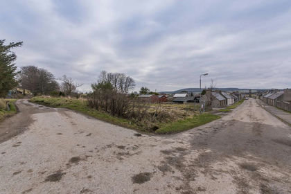
- Price
- Offers Over£49,995
Plot 1, Hill Street, Newmill, Keith, AB55, Aberdeenshire North and Moray East, Moray AB55 Scotland
Added on 29/01/2026Building Plot- Price
- Offers Over£49,995
Plot 2, Hill Street, Newmill, Keith, AB55, Aberdeenshire North and Moray East, Moray AB55 Scotland
Added on 28/01/2026Building Plot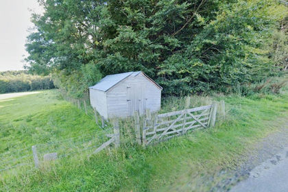
- Price
- Guide Price£8,000
Land at Bogfennan Wood, Forgue, Huntly, AB546DQ, Gordon and Buchan, Aberdeenshire AB54 Scotland
Added on 02/07/2026Small Plot of Land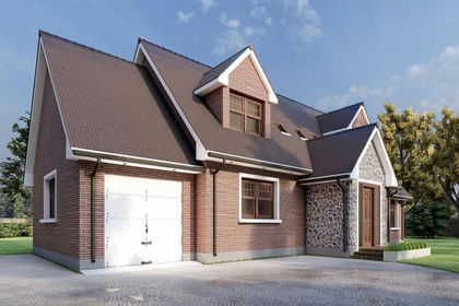
- Price
- Guide Price£35,000
- Size
- 1.2 acres
Added on 02/07/2026Building Plot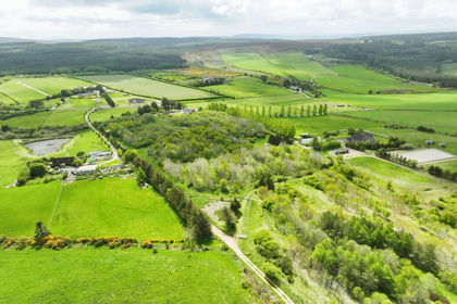
- Price
- Guide Price£25,000
- Size
- 0.4 acres
Added on 02/07/2026Building Plot
- Price
- Offers in Region of£50,000
Wallace Avenue, Buckie, Banffshire, Aberdeenshire North and Moray East, Moray AB56 Scotland
Added on 29/01/2026Building Plot
- Price
- £50,000
- Size
- 0.25 acres
Land At Westhill, Westhill, AB32, West Aberdeenshire and Kincardine, Aberdeenshire AB32 Scotland
Added on 17/07/2026Vacant Land
- Price
- Guide Price£10,000
- Size
- 0.25 acres
Land At Westhill, Westhill, AB32, West Aberdeenshire and Kincardine, Aberdeenshire AB32 Scotland
Added on 27/06/2026Development Land
- Price
- £49,950
Kirkton Bank, 5 Park Place, Kirriemuir, DD8, Angus and Perthshire Glens, Angus DD8 Scotland
Added on 29/01/2026Building Plot
- Price
- From£34,000
- Size
- 0.53 acres
Plots at Kildary, Invergordon, Caithness, Sutherland and Easter Ross, Highland IV18 Scotland
Added on 29/01/2026Development Land