
Boyton, Launceston, PL15
- Land size
- 26.01 acres
Key Features
- Auction 2nd September
- 26.01 acres
- Mainly pasture land
- Including some woodland and conservation areas
- Stream access
Description
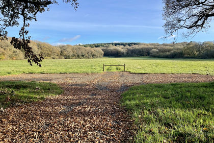
Extending to some 26.01 acres (10.53 hectares) in all, the Land at Dunns Farm comprises a useful run of gently sloping land which runs down to a stream and wooded valley. Benefitting from parish road frontage and access, the majority of the land is down to permanent pasture and has been used for grazing and forage conservation. To the west of the stream is about 5½ acres of conservation land which is a real haven for flora and fauna alike.
The whole is enclosed with fenced natural hedge banks and there are wonderful far reaching countryside views
The lands’ close proximity to the village, may mean there is some long term development potential, but this is subject to gaining the necessary planning consents.
The land is sold without overage/uplift clauses, or any other restrictive covenants.
Services
There are NO services connected, however they may be in the vicinity. We urge prospective buyers to make their own enquiries as to connection and cost of same
Directions
Postcode = PL15 9RE.
What3words = ///volunteered. hunter. Hedgehog.
Contact Us
Please call Kivells Farms & Land Department.
Viewings
Intending purchasers may inspect the property at a time of their choosing bearing a copy of these details. Please ensure that in making your inspection you do so with due care, taking responsibility for your actions. In particular please do not climb gates but open same and leave them shut where found shut and wear suitable footwear.
Phone: or Email: .
Auction Information
Venue & Date | The auction will be held at Lifton Strawberry Fields, Lifton, Devon PL16 0DH on Wednesday 2nd September 2026 at 7pm. Buyers are advised to attend by 6.30pm to register.
Registration | Please note ALL BIDDERS, including Kivells existing clients, will need to register with Kivells on the night of the auction in order to comply with The Money Laundering, Terrorist Financing and Transfer of Funds (Information on the Payer) Regulations 2017 (the "Regulations") – as of 26th June 2017. Bidders will be required to provide one form of government issued photographic identity and a utility bill addressed to them at their home address, dated within 3 months of the date of the auction. Failure to do this, may prejudice your ability to bid on the night.
Buyer's Administration Fee | All successful buyers at Kivells’ Property Auctions should note that on exchange of contracts, a Buyer's Administration Fee of £2,000 plus VAT (Total: £2,400 including VAT) is payable to Kivells on the night of the auction. This fee can be paid by either bank transfer, personal cheque or debit card. Please note if the lot is sold prior to auction, or afterwards, this fee remains payable. There are no discounts for multiple lots purchased and you must consider this when bidding/offering prior. All interested buyers are advised to review the Auction Legal Pack prior to bidding, this can be obtained from Kivells website and is free to download. Any fees that are owed in addition to the buyers administration fee will be included within the legal pack.
Online Bidding | Online bidding registration will be available 10 days before each auction and all bidders must register at least 48 hours prior to the auction. For further information, please visit or contact your local Kivells office.
Auction Payment | At the fall of the gavel the contract is legally binding and a 10% deposit (subject to a minimum fee of £5,000) will be required to be paid by the successful bidder. The deposit has to be paid to Kivells as auctioneers and can only be paid in the form of a cheque or bank transfer. This deposit is also payable for all lots that are sold prior to auction. ALL bidders must only bid if they can make this payment. Cheques must be drawn on a bank or branch of a bank in the United Kingdom, any other cheques may be rejected and it will the responsibility of the purchaser to ensure they have the correct method of payment available at each auction.
Solicitor | Helen Daviess, WBW Solicitors, Launceston.
Auction Pack| An auction pack for this property will be available to download from is usually available about two weeks prior to the auction date.
Completion | Will take place at 28 days from the auction, or earlier by agreement between the parties. On the night of the auction, 10% of the purchase price is due as a deposit being exchange of contracts.
Tenure | Freehold.
Local Authority | Cornwall Council, Truro.
Easements, Wayleaves, Rights of Way | The property is offered for sale, subject to and with the benefit of all matters contained in or referred to in the Property and Charges Register of the registered title together with all public or private rights of way, wayleaves, easements and other rights of way, which cross the property.
Boundaries | Any purchaser shall be deemed to have full knowledge of all boundaries and neither vendor nor the vendor’s agents will be responsible for defining the boundaries or the ownership thereof. Should any dispute arise as to the boundaries or any points on the particulars or plans or the interpretation of them, the question shall be referred to the vendor’s agent whose decision acting as experts shall be final.
Land Plans | The plans included are for identification purposes only and not to scale.
Guide prices | Guide prices given are indications within 10% upwards or downwards of where the reserve price may be set at the time of going to print. Please note they are not an indication of the anticipated sale price or a valuation. The reserve price is the minimum price at which the property can be sold, both the guide price and reserve price may be subject to change up to and including the day of the auction.
Please note that all prices listed, whether prior to or post auction, are subject to contract.
The Auctioneers and sellers accept no responsibility for any loss, cost or damage that a buyer may incur as a result of relying on any guide price. It is the buyer's responsibility to decide how much they should bid for any lot. Please check with us for regular updates as guide prices are subject to change prior to the auction.
The guide price does not include the buyer's fee charged by the auctioneer or VAT which may apply to the sale or other amounts the seller may charge. The seller's Special Conditions of Sale will state whether there are other seller's charges and whether the seller has elected to charge VAT on the sale price.
Disclaimer
Kivells, their clients and any joint agents give notice that they are not authorised to make or give representations or warranties in relation to the property. No responsibility is accepted for any statement within these particulars, which do not form part of any offer or contract. Areas, measurements and boundaries are approximate. Text, photographs, CGI’s and plans are for guidance only. It should not be assumed the property has all necessary planning or building consents, and Kivells have not tested any services or equipment. The property is sold subject to all matters in the Property and Charges Register, including rights of way and easements. Purchasers are deemed to know all boundaries. Nothing herein constitutes financial advice; seek your own. Use of Mortgage Genies SW Ltd. will result in a £250 + VAT referral fee to Kivells. Kivells retains copyright to all particulars and media.
Map Location
Property details
- Tenure
- Freehold
- Council Tax Band
- Ask Agent
- Date Posted
- 2026-06-16
Market Value Analysis
Compared with 13 Bare & Undeveloped Land listings in South West England (25+ acres).
Utilities & Restrictions
Utilities
- Electricity
- Ask Agent
- Water
- Ask Agent
- Heating
- Ask Agent
- Broadband
- Ask Agent
- Sewerage
- Ask Agent
Rights & Restrictions
- Public Rights of Way
- Ask Agent
- Private Rights of Way
- Ask Agent
- Listed Property
- Ask Agent
- Restrictions
- Ask Agent
Listed status, conservation areas and planning constraints for this location are in the full report.
Property Features
- Accessibility
- Ask Agent
- Parking
- Ask Agent
- Garden
- Ask Agent
Beyond the particulars: planning activity, flood history, heritage and ground risks, checked for this exact spot.
Connectivity
Broadband
Fastest speed available at this postcode
80 Mbps
Superfast · available to 17% of premises
Suitable for
- HD streaming
- Video calls
- Web & social
Fixed wireless access may also be an option here.
Mobile signal
Outdoor predictions; indoor signal depends on building materials.
Ofcom Connected Nations postcode-level predictions. Speeds and signal are modelled, not measured, and vary between addresses and providers.
Signal is the easy part. Planning activity, flood history and protected designations here are in the full report.
Nearest Schools
Primary
- Boyton Community Primary School1.1 milesOfsted: Good *
- Ages
- 2 to 11
- Pupils
- 28
- Type
- Academy converter
- Werrington Community Primary School1.7 milesNo Ofsted rating
- Ages
- 2 to 11
- Pupils
- 62
- Type
- Academy converter
- St Giles-on-the-Heath Community School2.3 milesOfsted: Good
- Ages
- 2 to 11
- Pupils
- 100
- Type
- Community school
- St Stephens Community Academy3.2 milesOfsted: Good
- Ages
- 2 to 11
- Pupils
- 199
- Type
- Academy converter
- North Petherwin School3.6 milesNo Ofsted rating
- Ages
- 2 to 11
- Pupils
- 69
- Type
- Academy converter
Secondary
- Launceston College4.5 milesOfsted: Good
- Ages
- 11 to 18
- Pupils
- 1,205
- Type
- Academy converter
- Holsworthy Community College8.3 milesNo Ofsted rating
- Ages
- 11 to 16
- Pupils
- 551
- Type
- Academy converter
- Budehaven Community School12 milesOfsted: Good
- Ages
- 11 to 18
- Pupils
- 1,145
- Type
- Foundation school
- Callington Community College13 milesOfsted: Good
- Ages
- 11 to 18
- Pupils
- 887
- Type
- Academy converter
- Tavistock College14 milesOfsted: Requires improvement
- Ages
- 11 to 18
- Pupils
- 1,200
- Type
- Academy converter
* Latest graded judgement covers quality of education only; no overall grade was issued under the 2024-25 inspection framework.
Distances are straight-line from the advertised location. Source: the national school registers (DfE, Welsh Government, Scottish Government) and Ofsted.
Schools are just the start: sold prices nearby, planning activity and any flood history are in the full report.
Amenities
Supermarket
GP surgery
Pharmacy
Hospital
Straight-line distances from the advertised location. Sources: NHS records, Geolytix supermarket locations, OS Open Greenspace and the national trails registers.
The area stacks up? Now check the location itself: planning nearby, protected designations and past flooding.
Getting Around
Nearest station
Nearest bus stop
Typical drive times
Straight-line distances from the advertised location; drive times are typical free-flow times over OpenStreetMap road data, so allow more at peak. Public transport locations from DfT NaPTAN.
Easy to reach matters. So do planning activity, flood history and ground risks: all in the full report.
Flood Risk
From Environment Agency flood map open data, checked around the advertised map pin and allowing for the listed acreage where known. This summary comes from LandSale, the advertising platform, not from the listing agent, and is not part of the agent's particulars. Risk can vary across a single holding, so verify anything critical through your own searches before committing.
Rivers and the sea
Surface water
Mapped within the area searched, not at the advertised map pin itself.
These bandings are the summary. Where this location sits on the flood maps, plus planning activity, heritage and ground risks, is in the full report.
Important notice: Information, maps and tags on this page are drawn from the advertising agent's marketing materials or generated automatically. LandSale has not verified them. Relying on these details is at your own risk, always carry out independent checks before committing to a purchase.
LandSale full disclaimer
Marketing information only - not formal particulars. The details on this website are provided for general guidance and do not constitute an offer or contract. Neither LandSale nor the advertising estate/land agent accepts responsibility for any inaccuracy.
1. Source of information
- Listing content: Core description, asking price, tenure, measurements, photographs and planning history originate from the marketing materials of the advertising estate or land agent. LandSale does not author this content and cannot guarantee its accuracy.
- Automated tags & categorisation: Property type, land-use class, acreage bands and similar labels may be applied by machine-learning models. They are intended as a helpful guide only and may not reflect the property's legal status or permitted use.
- Third-party & enriched data layers: Maps, boundary outlines, planning designations, soil reports, broadband coverage and other environmental or location-based insights are licensed from external suppliers. Such data are supplied “as is", may be incomplete or out of date and are subject to change without notice.
2. Verification required
Prospective purchasers must verify critical matters, including but not limited to planning permission, title boundaries, public rights of way, environmental constraints, acreage, services, access and VAT status, through their own inspections, specialist surveys, legal advisers and the selling agent before relying on the information or entering into any contract.
3. No warranty or liability
LandSale gives no warranty, express or implied, as to the accuracy, completeness or fitness for any particular purpose of the information displayed. LandSale shall not be liable for any loss, damage, cost or expense arising directly or indirectly from any use of or reliance on such information, save where liability may not be excluded by law.
4. Updates & feedback
If you believe any detail on this listing is inaccurate, please let us know. We will investigate and, where appropriate, update the listing or notify the agent.
© LandSale | Version 1.3 - August 2026
Listing agent
Kivells, Land & Farm Sales
Holsworthy Livestock Market, New Market Road, Holsworthy, EX22 7FA
View agent profileSimilar properties for sale
- Price
- Fixed Price£215,000
- Size
- 14.5 acres
Fellows Meadow & Copse Clawton, Holsworthy, Devon, EX22, Ashwater, Devon EX22 England
Added on 10/09/2026Undeveloped Land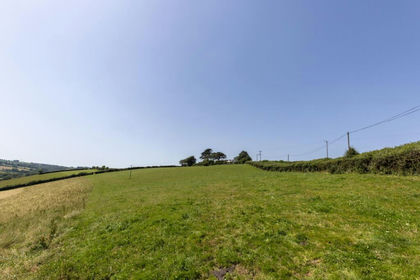
- Price
- Guide Price£150,000
- Size
- 16.04 acres
Milton Damerel, Holsworthy, EX22, Milton Damerel, Devon EX22 England
Added on 07/07/2026Vacant Land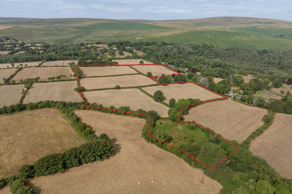
- Price
- Guide Price£175,000
- Size
- 18.31 acres
Throwleigh, Okehampton, EX20, Throwleigh, Devon EX20 England
Added on 24/08/2026Pasture
- Price
- Guide Price£210,000
- Size
- 19.31 acres
Added on 31/07/2026Farmland
- Price
- Guide Price£250,000
- Size
- 29.66 acres
Chilpark, Fremington, Barnstaple, Fremington, Devon EX31 England
Added on 04/09/2026Amenity Land
- Price
- Guide Price£160,000
- Size
- 19.62 acres
Wigford Meadows - 19.62 Acres, Loddiswell, Kingsbidge, Devon, TQ7, Loddiswell, Devon TQ7 England
Added on 20/05/2026Pasture
- Price
- Guide Price£175,000
- Size
- 28.28 acres
Added on 17/03/2026Grazing Land