Combe House - Lot 1, Gawthrop, Sedbergh, Cumbria
- Land size
- 6.59 acres
- Bedrooms
- 3
- Bathrooms
- 2
Key Features
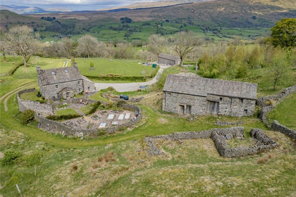
- Quiet, peaceful location, flanked by Combe Scar, in the Yorkshire Dales National Park.
- Traditional stone two/three bed property, generously proportioned and beautifully finished.
- Two further partially converted barns comprising:
- One Bunk Barn [Lot 2]
- One further barn where conversion build has been stated.
- The outside space is amazing, with far reaching views across the Howgills and Yorkshire Dales.
- 7.36 acres [2.98 hectares] acres of land.
- Established raised vegetable beds.
Description
If you are after, peace tranquility and dramatic views in abundance, then this is your destination.
LOT 1 - Recently restored period Dales Farmhouse superbly finished interior with phenomenal character.
Detached barn with planning permission for local occupancy dwelling or holiday accommodation, paddocks and planted woodland about 6.59 acres [2.67 hectares].
LOT 2 - Detached “Bunk Barn”, completely refurbished , needing completion, including a small paddock about 0.77 acres [ 0.31 hectares]
Guide Prices: Lot 1 £850,000 Lot 2: £200,000
Directions
Heading north-west from the cross road in Gawthrop, passing Foulsyke Farm on the right, take the first left along the track towards Bower Bank and Tofts Farm. Just before Tofts Farm, take the track to the left and continue along the track. Combe House is at the end of the access.
What3words - snoozing.kickers.mushroom
Location
Just west of the hamlet of Gawthrop, nestling below Combe Scar, about one and half miles from Dent Village.
Services
Tenure
Freehold. Vacant possession upon completion.
Services
Mains electricity. Spring water via a bore hole. Oil fired central heating. Septic tank.
Council Tax
Band “E”
Energy Performance Certificate
“C”
Wayleaves and Easements
The properties are sold subject to and with the benefit of any existing easements, wayleaves and rights of way. The sale is subject to all the existing rights of way, drainage, light, air support and other easements and quasi-easements and outgoings whether mentioned in these particulars or not.
Sporting Rights
Held by the sellers
Planning
Planning history at the property includes application ref. S/01/150C for the conversion of the Upper Barn to a local occupancy dwelling or holiday accommodation, subject to conditions and a Section 106 agreement. In addition, application ref. S/01/150F granted permission for the conversion of the Lower Barn to a bunk barn, providing basic, group style visitor accommodation ancillary to the main holding rather than a separate self contained dwelling, demonstrating an established and consented scheme for complementary accommodation across the property.
Sale Plan
The sale plan has been prepared by the selling agent for the convenience of the prospective purchasers. It is deemed to be correct, but any error, omission or misstatement shall not affect the sale. Purchasers must satisfy themselves as to accuracy.
Local Authority
Westmorland & Furness Council Tel No; .
Planning Authority
Yorkshire Dales National Park, Tel No:
Viewings
Strictly by appointment only through our South Lakes office in Staveley. Tel No. .
Ground Floor
Living Room
Exposed oak beams, sash windows, woodburning stove set in the most beautiful large fire surround. Window seat, ample room for sofa’s. Stone flagged floor. The front door with porch behind.
Family Room
Kitchen
Really well appointed kitchen, with Aga and tripple aspect double glazed windows, plus skylight and ceiling spotlights. Lovely galley kitchen with ample room for a large farmhouse kitchen table
Laundry
Plumbing for washing machine, storage unit and dual aspect mullion windows, flagged floor
Hall
Off the kitchen has a triple mullion window, useful sink with mixer tap. Shelving and a laundry maid pulley drying rack. The downstairs lavatory is located off this hallway.
Hall
Flagged stairway, with exposed beams, handrail for U shaped staircase. Beautiful mullioned window.
WC
First Floor
Master Bedroom
A lovely light dual aspect with sash windows. Open fireplace and exposed beams
En-Suite
bath and separate shower, mullioned window right by the bath with fantastic views.
Bathroom
Mullioned window lined up beautifully with one end of the bath tub, separate shower, toilet and wash basin.
Bedroom
A beautiful room, with double or twin, sash window, exposed beam and walk in wardrobe
Second Floor
Office
old and new exposed beams in the eaves. 2 rooms, currently used as a gym and a craft room. Skylight to each room plus a sash window to one gable end. These rooms could lend themselves to a variety of uses.
Outside
A beautiful stone shed, useful for all the gardening tools, ample garden, raised vegetable beds and seating areas to capture almost all day sun.
Lot 1
Barn - Grade II Listed with planning for holiday or ancillary use, this barn is of traditional stone and slate. The interior has been prepared ready for internal works.
Room
Storage
Second Floor
Mezzanine level
Map Location
Property details
- Tenure
- Freehold
- Council Tax Band
- E
- Date Posted
- 2026-06-16
Market Value Analysis
Compared with 243 Homes with Land listings in North West England (5+ acres).
Energy Performance Certificate
Energy Efficiency Rating
Based on UK Energy Performance Certificate standards (EU Directive 2002/91/EC)
Utilities & Restrictions
Utilities
- Electricity
- Ask Agent
- Water
- Ask Agent
- Heating
- Ask Agent
- Broadband
- Ask Agent
- Sewerage
- Ask Agent
Rights & Restrictions
- Public Rights of Way
- Ask Agent
- Private Rights of Way
- Ask Agent
- Listed Property
- Ask Agent
- Restrictions
- Ask Agent
Property Features
- Accessibility
- Ask Agent
- Parking
- Ask Agent
- Garden
- Garden
Connectivity
Broadband
Fastest speed available at this postcode
1 Gbps
Gigabit full fibre
Suitable for
- 4K streaming on every screen
- Full-time home working
- Online gaming & big downloads
Mobile signal
Outdoor predictions; indoor signal depends on building materials.
Ofcom Connected Nations postcode-level predictions. Speeds and signal are modelled, not measured, and vary between addresses and providers.
Nearest Schools
Primary
- Dent CofE Voluntary Aided Primary School1.4 milesOfsted: Good
- Ages
- 3 to 11
- Pupils
- 30
- Type
- Voluntary aided school
- Faith
- Church of England
- Sedbergh Primary School3 milesOfsted: Good
- Ages
- 3 to 11
- Pupils
- 168
- Type
- Community school
- Leck St Peter's Church of England Primary School7.2 milesOfsted report card · Jun 2026
- Ages
- 3 to 11
- Pupils
- 38
- Type
- Voluntary aided school
- Faith
- Church of England
- St Mary's CofE Primary School7.2 milesOfsted: Outstanding *
- Ages
- 3 to 11
- Pupils
- 220
- Type
- Voluntary aided school
- Faith
- Church of England
- Old Hutton CofE School7.6 milesOfsted: Good
- Ages
- 3 to 11
- Pupils
- 78
- Type
- Voluntary controlled school
- Faith
- Church of England
Secondary
- Settlebeck School3 milesOfsted: Good *
- Ages
- 11 to 16
- Pupils
- 203
- Type
- Academy converter
- Queen Elizabeth School7.2 milesOfsted: Good
- Ages
- 11 to 18
- Pupils
- 1,155
- Type
- Academy converter
- Queen Elizabeth Studio School7.2 milesOfsted report card · Jun 2026
- Ages
- 14 to 19
- Pupils
- 329
- Type
- Studio schools
- Kirkbie Kendal School10 milesNo Ofsted rating
- Ages
- 11 to 18
- Pupils
- 1,029
- Type
- Academy converter
- The Queen Katherine School11 milesOfsted report card · May 2026
- Ages
- 11 to 19
- Pupils
- 910
- Type
- Academy converter
* Latest graded judgement covers quality of education only; no overall grade was issued under the 2024-25 inspection framework.
Distances are straight-line from the advertised location. Source: the national school registers (DfE, Welsh Government, Scottish Government) and Ofsted.
Amenities
Supermarket
GP surgery
Pharmacy
Hospital
Straight-line distances from the advertised location. Sources: NHS records, Geolytix supermarket locations, OS Open Greenspace and the national trails registers.
Getting Around
Nearest station
Nearest bus stop
Typical drive times
Straight-line distances from the advertised location; drive times are typical free-flow times over OpenStreetMap road data, so allow more at peak. Public transport locations from DfT NaPTAN.
Flood Risk
From Environment Agency flood map open data, checked around the advertised map pin and allowing for the listed acreage where known. This summary comes from LandSale, the advertising platform, not from the listing agent, and is not part of the agent's particulars. Risk can vary across a single holding, so verify anything critical through your own searches before committing.
Rivers and the sea
Surface water
Mapped within the area searched, not at the advertised map pin itself.
The detail behind these bandings, including exact zones and annual chances, any recorded past flooding, plus planning, heritage, nature and ground checks, is in the .
Important notice: Information, maps and tags on this page are supplied by the advertising agent or generated automatically. LandSale has not verified them. Relying on these details is at your own risk, always carry out independent checks before committing to a purchase.
LandSale full disclaimer
Marketing information only - not formal particulars. The details on this website are provided for general guidance and do not constitute an offer or contract. Neither LandSale nor the advertising estate/land agent accepts responsibility for any inaccuracy.
1. Source of information
- Agent-supplied content: Core description, asking price, tenure, measurements, photographs and planning history are uploaded by the appointed agent, who remains solely responsible for their accuracy.
- Automated tags & categorisation: Property type, land-use class, acreage bands and similar labels may be applied by machine-learning models. They are intended as a helpful guide only and may not reflect the property's legal status or permitted use.
- Third-party & enriched data layers: Maps, boundary outlines, planning designations, soil reports, broadband coverage and other environmental or location-based insights are licensed from external suppliers. Such data are supplied “as is", may be incomplete or out of date and are subject to change without notice.
2. Verification required
Prospective purchasers must verify critical matters, including but not limited to planning permission, title boundaries, public rights of way, environmental constraints, acreage, services, access and VAT status, through their own inspections, specialist surveys, legal advisers and the selling agent before relying on the information or entering into any contract.
3. No warranty or liability
LandSale gives no warranty, express or implied, as to the accuracy, completeness or fitness for any particular purpose of the information displayed. LandSale shall not be liable for any loss, damage, cost or expense arising directly or indirectly from any use of or reliance on such information, save where liability may not be excluded by law.
4. Updates & feedback
If you believe any detail on this listing is inaccurate, please let us know. We will investigate and, where appropriate, update the listing or notify the agent.
© LandSale | Version 1.2 - January 2026
Listing agent
H&H Land & Estates, Penrith
1a St. Andrews View Penrith CA11 7YF
Similar properties for sale
- Price
- £1,050,000
- Size
- 7.36 acres
Combe House, Gawthrop, Sedbergh, Cumbria, Dent, Westmorland and Furness LA10 England
Added on 16/06/2026Farmhouse
- Price
- Offers in Region of£925,000
- Size
- 14.59 acres
Dent, Sedbergh, Cumbria, Dent, Westmorland and Furness LA10 England
Added on 28/07/2026Agricultural Land
- Price
- Guide Price£995,000
- Size
- 3.05 acres
High Bendrigg Farm, Kendal, Old Hutton and Holmescales, Westmorland and Furness LA8 England
Added on 09/06/2026Development Land- Price
- Guide Price£995,000
- Size
- 3.05 acres
High Bendrigg Farm, Kendal, Old Hutton and Holmescales, Westmorland and Furness LA8 England
Added on 09/06/2026Development Land
- Price
- £845,000
- Size
- 8 acres
Added on 10/03/2026Country Home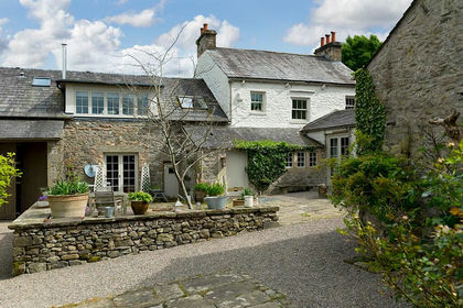
- Price
- Guide Price£845,000
- Size
- 4.99 acres
Pells Yeat Farm, Kirkby Lonsdale, LA6, Kirkby Lonsdale, Westmorland and Furness LA6 England
Added on 10/03/2026Farmhouse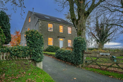
- Price
- £725,000
- Size
- 4 acres
Langber, Ingleton, Carnforth, LA6, Ingleton, North Yorkshire LA6 England
Added on 24/04/2026House with Land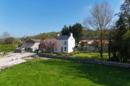
- Price
- £1,000,000
- Size
- 4 acres
Clawthorpe Lodge, Clawthorpe, LA6, Burton-in-Kendal, Westmorland and Furness LA6 England
Added on 14/05/2026Farmhouse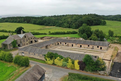
- Price
- Guide Price£1,050,000
- Size
- 3.88 acres
Mill House, Spout Lane, Wennington, LA2, Wennington, Lancashire LA2 England
Added on 29/01/2026Development Land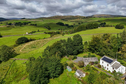
- Price
- £800,000
- Size
- 7 acres
Added on 10/04/2026Farmhouse