High Street, Spalding
- Bedrooms
- 1
- Bathrooms
- 1
Key Features
- Full of quirks and character
- Low maintenance garden area
- Neutral decor throughout
- Large bathroom suite
- No forward chain
- Spacious living space
- Perfect rental and Air Bnb
- Must view to appreciate this property
Description
A standout one bedroom property full of character, featuring quirky details, spacious rooms, and stunning vaulted ceilings. Ideally positioned in central Spalding, just moments from local amenities, this home offers fantastic potential as an Airbnb or investment opportunity.
The layout is surprisingly generous, with plenty of scope to add value or personalise. The oversized bath is a real showstopper, and the property truly needs to be viewed to be fully appreciated.
Entrance Hall/Dining Area - 2.26m x 4.28m (7'4" x 14'0") - Wooden stable door with glazed panel. Wooden double glazed windows to the side and rear. Underfloor heating. Wooden beams. Opening into:
Kitchen - 2.35m x 4.22m (7'8" x 13'10") - Glass brick window to bathroom. Fitted with a range of base and eye level units with work surfaces over. Tiled splashbacks. Sink inset with drainer and mixer tap. Plumbing and space for washing machine. Space for fridge and freezer. Integrated Creda gas hob. Integrated Creda double fan assisted oven. Wooden beams with inset downlighters. Storage cupboard housing boiler with slatted shelving. Underfloor heating. Tiled flooring. New boiler installed with full 5 year warranty.
Open Plan Living - 4.92m x 7.86m (16'1" x 25'9") - 2 wooden double glazed windows to rear. Wooden barn style door. 2 velux windows. Skimmed ceiling with beams. Stone fireplace with wooden mantle and tiled hearth. Under floor heating. Storage cupboards. Staircase leading to bedroom. .
Bathroom - 3.03m x 4.12m (9'11" x 13'6") - Block window to kitchen. Skimmed ceiling with inset downlighters. Fully tiled walls. Tiled floor with underfloor heating. Heated towel rail. Wet Room area with thermostatic shower. Pedestal wash hand basin with mirror over. Shaver point and light. Toilet. Stone bath with tiled insert.
First Floor Landing - 3.56m x 1.76m (11'8" x 5'9") - Smoke alarm. Wooden door leading into:
Bedroom - 4.92m x 4.56m (16'1" x 14'11") - Wooden double glazed window to side. French doors leading to balcony area. Skimmed and beamed sloping ceiling with beams. 2 double radiators. Wooden floor boards.
Balcony - The current balcony area is fibreglass, however could be converted into a usable, enjoyable balcony area. Wrought iron railings either side.
Outside - To the rear of the property is a raised decking area with outside lighting and gravelled area, bricked wall boundaries with fence to the rear. Original stable cobbled flooring leading to the front door. Side intercom gate access.
Property Postcode - For location purposes the postcode of this property is: PE11 1TX
Additional Information - PLEASE NOTE:
All photos are property of Ark Property Centre and can not be used without their explicit permission.
Some rooms as stated in the lower right corner have been staged with Ai to showcase how the rooms can be dressed.
Verified Material Information - Tenure: Freehold
Council tax band: A
Annual charge: No
Property construction: Brick built. Converted Coach House and Stables.
Electricity supply: Ovo Energy
Solar Panels: No
Other electricity sources: No
Water supply: Anglian Water
Sewerage: Mains
Heating: Gas central heating
Heating features: No
Broadband: As stated by Ofcom, Standard, Superfast and Ultrafast is available.
Mobile coverage: As stated by Ofcom, Indoor - EE is Likely over Voice and Data. Three is Limited over Voice and Data. O2 is Limited over Voice and Data. Vodafone is Limited over Voice and Data.
Mobile coverage: As stated by Ofcom, Outdoor - EE is Likely over Voice and Data. Three is Likely over Voice and Data, O2 is Likely over Voice and Data. Vodafone is Likely over Voice and Data.
Parking: On street parking
There is a car park on Holland Road, you can purchase a commuters pass for £260.30 for 12 months for up to 2 cars available from South Holland District Council.
Building safety issues: No
Restrictions: No
Public right of way: Neighbouring property 19a (with prior authorisation) right of access through the garden for any property remedial works. Rarely used.
Flood risk: Surface water - low. Rivers and the sea - medium. Other flood risks - Groundwater - flooding from groundwater is unlikely in this area. Reservoirs - flooding from reservoirs is unlikely in this area.
Coastal erosion risk: No
Planning permission: Please refer to South Holland District Council Planning Portal for any planning applications.
Accessibility and adaptations: No
Coalfield or mining area: No
Energy Performance rating: F32
Viewing Arrangements - Viewing is by appointment with Ark Property Centre only. We suggest you call our office for full information about this property before arranging a viewing.
Access To Property - To find the property, walk across the car park just off high street on the corner of Holland road. You will then find a gate and that then leads to the property.
Offer Procedure - Please note: before an offer is agreed on a property you will be asked to provide I.D and proof of finance, in compliance Money Laundering Regulations 2017 (MLR 2017). The business will perform a Money Laundering Check as part of its Money Laundering Policy.
If a cash offer is made, which is not subject to the sale of a property, proof of funds will be requested or confirmation of available funds from your solicitor.
Ark Property Centre - If you are thinking about selling your property or are not happy with your current agent - we can offer a FREE valuation service with no obligation.
Referral & Fee Disclosure
We can also offer full Financial and Solicitor services.
We have strong relationships with a panel of trusted solicitors and mortgage advisors. Because we refer a high volume of work to them, they’re able to provide our clients with preferential service and competitive rates. If we introduce you to one of these solicitors or mortgage advisors, we may receive a referral fee of between £100 and £250. We only work with firms we trust to deliver high-quality advice and good value. You are free to use any solicitor or mortgage advisor you choose, but we hope you find our recommended panel competitive and helpful.
Disclaimer - These particulars, whilst believed to be accurate are set out as general outline only for guidance and do not constitute any part of an offer or contract. Intending purchasers should not rely on them as statements of representation of fact, but must satisfy themselves by inspection or otherwise as to their accuracy. No person in this firms employment has authority to make or give representation or warranty in respect of the property. These details are subject to change.
Map Location
Property details
- Tenure
- Freehold
- Council Tax Band
- A
- Date Posted
- 2026-06-14
Energy Performance Certificate
Energy Efficiency Rating
Based on UK Energy Performance Certificate standards (EU Directive 2002/91/EC)
Running costs are one side. Planning activity, flood history and ground risks for this location are in the full report.
Utilities & Restrictions
Utilities
- Electricity
- Ask Agent
- Water
- Ask Agent
- Heating
- Ask Agent
- Broadband
- Ask Agent
- Sewerage
- Ask Agent
Rights & Restrictions
- Public Rights of Way
- Ask Agent
- Private Rights of Way
- Ask Agent
- Listed Property
- Ask Agent
- Restrictions
- Ask Agent
Listed status, conservation areas and planning constraints for this location are in the full report.
Property Features
- Accessibility
- Ask Agent
- Parking
- Parking Available
- Garden
- Garden
Beyond the particulars: planning activity, flood history, heritage and ground risks, checked for this exact spot.
Connectivity
Broadband
Fastest speed available at this postcode
80 Mbps
Superfast
Suitable for
- HD streaming
- Video calls
- Web & social
Mobile signal
Outdoor predictions; indoor signal depends on building materials.
Ofcom Connected Nations postcode-level predictions. Speeds and signal are modelled, not measured, and vary between addresses and providers.
Signal is the easy part. Planning activity, flood history and protected designations here are in the full report.
Nearest Schools
Primary
- Spalding Parish Church of England Day School858 metresOfsted: Good
- Ages
- 4 to 11
- Pupils
- 537
- Type
- Academy sponsor led
- Faith
- Church of England
- St Norbert's Catholic Voluntary Academy959 metresOfsted: Good *
- Ages
- 4 to 11
- Pupils
- 204
- Type
- Academy converter
- Faith
- Roman Catholic
- St Paul's Community Primary and Nursery School, Spalding0.7 milesOfsted: Good
- Ages
- 2 to 11
- Pupils
- 209
- Type
- Academy sponsor led
- Spalding Primary Academy0.8 milesOfsted: Good
- Ages
- 2 to 11
- Pupils
- 407
- Type
- Academy converter
- Wygate Park Academy0.9 milesOfsted: Good *
- Ages
- 3 to 11
- Pupils
- 272
- Type
- Academy sponsor led
Secondary
- Spalding High School620 metresOfsted: Outstanding
- Ages
- 11 to 18
- Pupils
- 970
- Type
- Community school
- Gender
- Girls
- Spalding Academy666 metresNo Ofsted rating
- Ages
- 11 to 19
- Pupils
- 1,486
- Type
- Academy converter
- Spalding Grammar School690 metresOfsted: Good
- Ages
- 11 to 18
- Pupils
- 1,023
- Type
- Academy converter
- Gender
- Boys
- University Academy Holbeach7 milesOfsted: Requires improvement *
- Ages
- 11 to 18
- Pupils
- 1,378
- Type
- Academy sponsor led
- Cowley Academy8.4 milesOfsted: Good *
- Ages
- 11 to 16
- Pupils
- 621
- Type
- Academy sponsor led
* Latest graded judgement covers quality of education only; no overall grade was issued under the 2024-25 inspection framework.
Distances are straight-line from the advertised location. Source: the national school registers (DfE, Welsh Government, Scottish Government) and Ofsted.
Schools are just the start: sold prices nearby, planning activity and any flood history are in the full report.
Amenities
Supermarket
GP surgery
Pharmacy
Hospital
Green space
Straight-line distances from the advertised location. Sources: NHS records, Geolytix supermarket locations, OS Open Greenspace and the national trails registers.
The area stacks up? Now check the location itself: planning nearby, protected designations and past flooding.
Getting Around
Nearest station
Nearest bus stop
Typical drive times
Straight-line distances from the advertised location; drive times are typical free-flow times over OpenStreetMap road data, so allow more at peak. Public transport locations from DfT NaPTAN.
Easy to reach matters. So do planning activity, flood history and ground risks: all in the full report.
Flood Risk
From Environment Agency flood map open data, checked around the advertised map pin and allowing for the listed acreage where known. This summary comes from LandSale, the advertising platform, not from the listing agent, and is not part of the agent's particulars. Risk can vary across a single holding, so verify anything critical through your own searches before committing.
Rivers and the sea
Surface water
The detail behind these bandings
The full report pinpoints where this location sits on the flood maps, and runs the deeper checks that usually only surface after an offer.
- Exact flood zones & annual chances (included in the full report)
- Any recorded past flooding (included in the full report)
- Planning activity nearby (included in the full report)
- Heritage & conservation (included in the full report)
- Protected nature designations (included in the full report)
- Ground risks (included in the full report)
- Sold prices nearby (included in the full report)
£14.99 · one-off purchase
By LandSale, the platform. Not provided by the listing agent. Ready in about a minute.
Important notice: Information, maps and tags on this page are drawn from the advertising agent's marketing materials or generated automatically. LandSale has not verified them. Relying on these details is at your own risk, always carry out independent checks before committing to a purchase.
LandSale full disclaimer
Marketing information only - not formal particulars. The details on this website are provided for general guidance and do not constitute an offer or contract. Neither LandSale nor the advertising estate/land agent accepts responsibility for any inaccuracy.
1. Source of information
- Listing content: Core description, asking price, tenure, measurements, photographs and planning history originate from the marketing materials of the advertising estate or land agent. LandSale does not author this content and cannot guarantee its accuracy.
- Automated tags & categorisation: Property type, land-use class, acreage bands and similar labels may be applied by machine-learning models. They are intended as a helpful guide only and may not reflect the property's legal status or permitted use.
- Third-party & enriched data layers: Maps, boundary outlines, planning designations, soil reports, broadband coverage and other environmental or location-based insights are licensed from external suppliers. Such data are supplied “as is", may be incomplete or out of date and are subject to change without notice.
2. Verification required
Prospective purchasers must verify critical matters, including but not limited to planning permission, title boundaries, public rights of way, environmental constraints, acreage, services, access and VAT status, through their own inspections, specialist surveys, legal advisers and the selling agent before relying on the information or entering into any contract.
3. No warranty or liability
LandSale gives no warranty, express or implied, as to the accuracy, completeness or fitness for any particular purpose of the information displayed. LandSale shall not be liable for any loss, damage, cost or expense arising directly or indirectly from any use of or reliance on such information, save where liability may not be excluded by law.
4. Updates & feedback
If you believe any detail on this listing is inaccurate, please let us know. We will investigate and, where appropriate, update the listing or notify the agent.
© LandSale | Version 1.3 - August 2026
Similar properties for sale
 Added on 17/08/2026Development Land
 Added on 29/01/2026Self Build Plot
- Added on 29/01/2026Self Build Plot
- Added on 29/01/2026Self Build Plot
 Added on 29/01/2026Self Build Plot
 Added on 15/06/2026Self Build Plot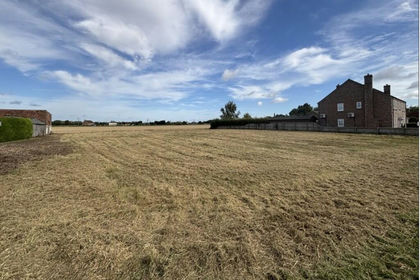
- Price
- Guide Price£149,950
- Size
- 0.23 acres
Building Plots with Full Planning Consent, Surfleet, Lincolnshire PE11 England
Added on 18/06/2026Building Plot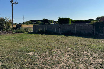 Added on 29/01/2026Building Plot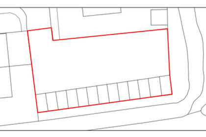
- Price
- Offers Over£135,000
- Size
- 0.14 acres
Spring Gardens, Long Sutton, Long Sutton, Lincolnshire PE12 England
Added on 29/01/2026Development Land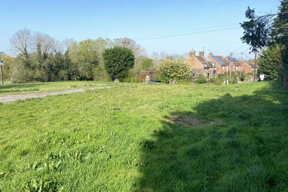
- Price
- Guide Price£175,000
Land adj 'The Ave' Kirkby Underwood Road, Aslackby, Aslackby and Laughton, Lincolnshire NG34 England
Added on 18/04/2026Undeveloped Land