The Shippen, East Allington, Totnes
- Bedrooms
- 3
- Bathrooms
- 3
Key Features
- A rarely available opportunity to acquire a barn with full residential planning permission to convert
- A delightful country setting with far reaching views across the valley beyond
- An opportunity to create an eco-efficient development with solar planning and ground heat source heating
- Set within a collection of 4 potential barn conversions
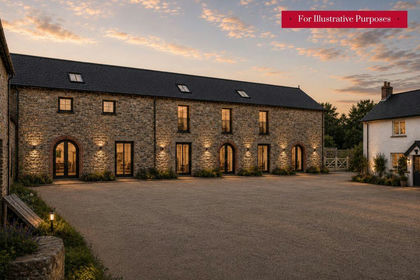
- CGI Image Disclaimer (Please Read Carefully Below)
Description
The Shippen is set within Nutcombe Barns a set potential barn conversions in a loose courtyard formation with one other detached barns and a pair of semi-detached barns. The barns have been granted full residential planning permission to convert into four dwellings with their own private outdoor gardens space along with a communal farmyard courtyard and private parking.
Situation
1.7 miles away is the popular village of East Allington, has a Parish Church and a well-regarded Primary School, part of an academy collection of schools. The Fortescue Arms Pub is popular and well supported. There is an enviable recreational ground, a multi-purpose fenced play area with newly installed equipment, football field, skateboarding ramp, picnic area and a large dog friendly meadow. The surrounding South Hams countryside is delightful, unspoilt and offers excellent opportunities for outdoor pursuits. The nearby market town of Kingsbridge is on the Salcombe Estuary and is approximately 5 miles and offers good shopping facilities, cafes, restaurants, and a renowned secondary school. Totnes is the historic gateway to the South Hams also has a superb range of shops, further educational provision, and a mainline station to London Paddington. The beautiful South Devon coastal resorts are also within very easy reach.
The Property
The shippen. A detached barn taking in wonderful direct views over the valley and beyond. Having a substantial footprint and planning permission has been granted to create a master suite, dressing room, 2 further bedrooms, 3 bathrooms, utility room, a good size kitchen and a sitting/dining room with views. Some partial conversion works have been completed including new roof and internal timbers and flooring. Please see attached plans.
Lot 2 (Available by separate negotiation)
There is a partially stone walled orchard and grass area along with lean-too stabling abutting a neighbouring Class Q Barn, with adjoining lane which leads into a historic lane down into the valley below.
Nutcombe Barns
This property forms part of a larger site comprising of 4 barns, all available under a single guide price of £750,000. Please contact Rendells for further information.
Services
Mains electricity (x 2 supplies). A borehole will be required to be installed to supply the dwellings with water and a shared private drainage system. There is also opportunity to create an eco-efficient development with solar panelling and ground heat source heating.
Agents Note
We are advised the owner of the class Q Barn is willing to take on a 50% share of the new driveway cost with the other 50% costs being the responsibility of the 4 Barns. No formal agreement is in place as yet.
Planning Portal Reference at South Hams District Council
REF: 0903/25/FUL.
CGI Image Disclaimer (Please Note)
IMPORTANT NOTICE: The computer-generated images (CGIs) contained within these particulars are provided for illustrative purposes only and are intended to give an indication of the potential appearance of the approved barn conversion scheme. Whilst every effort has been made to ensure they are representative, the images should not be relied upon as an exact representation of the approved plans, specifications, finishes, landscaping, surroundings or completed development. Interested parties should satisfy themselves by reviewing the approved planning documentation, drawings and associated information, which shall take precedence over any illustrative material. All CGI information is provided in good faith but should not be relied upon as statements of fact.
Local Authority
South Hams District Council, Follaton House, Plymouth Road, Totnes, Devon, TQ9 5NE.
Viewing Arrangements
Strictly by appointment with a member of the Rendells team.
Directions
From Totnes take the A381 for Kingsbridge and continue for approximately 8 miles. Take the second left turning for East Allington after The Mounts. After approximately 1 mile along the lane towards East Allington at Nutcombe Cross turn right and Nutcombe Farm is situated on the left, turn into the private lane and go past the farmhouse and turn right through the gap in the fence and the barns will be on the left.
What3Words: animals.secretly.feasted
Map Location
Property details
- Tenure
- Freehold
- Council Tax Band
- TBC
- Date Posted
- 2026-06-11
Utilities & Restrictions
Utilities
- Electricity
- Ask Agent
- Water
- Ask Agent
- Heating
- Ask Agent
- Broadband
- Ask Agent
- Sewerage
- Ask Agent
Rights & Restrictions
- Public Rights of Way
- Ask Agent
- Private Rights of Way
- Ask Agent
- Listed Property
- Ask Agent
- Restrictions
- Ask Agent
Listed status, conservation areas and planning constraints for this location are in the full report.
Property Features
- Accessibility
- Ask Agent
- Parking
- Parking Available
- Garden
- Garden
Beyond the particulars: planning activity, flood history, heritage and ground risks, checked for this exact spot.
Connectivity
Broadband
Fastest speed available at this postcode
80 Mbps
Superfast · available to 47% of premises
Suitable for
- HD streaming
- Video calls
- Web & social
Mobile signal
Outdoor predictions; indoor signal depends on building materials.
Ofcom Connected Nations postcode-level predictions. Speeds and signal are modelled, not measured, and vary between addresses and providers.
Signal is the easy part. Planning activity, flood history and protected designations here are in the full report.
Nearest Schools
Primary
- East Allington Primary School747 metresOfsted: Good
- Ages
- 2 to 11
- Pupils
- 80
- Type
- Academy converter
- Loddiswell Primary School2.6 milesNo Ofsted rating
- Ages
- 4 to 11
- Pupils
- 118
- Type
- Community school
- Kingsbridge Primary School2.8 milesOfsted: Requires improvement
- Ages
- 4 to 11
- Pupils
- 343
- Type
- Academy converter
- Blackawton Primary School3 milesNo Ofsted rating
- Ages
- 2 to 11
- Pupils
- 140
- Type
- Academy converter
- Charleton Church of England Academy3.7 milesNo Ofsted rating
- Ages
- 2 to 11
- Pupils
- 24
- Type
- Academy converter
- Faith
- Church of England
Secondary
- Kingsbridge Academy3.5 milesOfsted: Good
- Ages
- 11 to 18
- Pupils
- 1,199
- Type
- Academy converter
- Dartmouth Academy6.6 milesOfsted: Good
- Ages
- 3 to 19
- Pupils
- 435
- Type
- Academy sponsor led
- King Edward VI Community College8.2 milesNo Ofsted rating
- Ages
- 11 to 18
- Pupils
- 940
- Type
- Academy converter
- Ivybridge Community College9.2 milesOfsted: Good
- Ages
- 11 to 18
- Pupils
- 2,262
- Type
- Academy converter
- Churston Ferrers Grammar School Academy9.4 milesOfsted: Good
- Ages
- 11 to 18
- Pupils
- 1,062
- Type
- Academy converter
Distances are straight-line from the advertised location. Source: the national school registers (DfE, Welsh Government, Scottish Government) and Ofsted.
Schools are just the start: sold prices nearby, planning activity and any flood history are in the full report.
Amenities
Supermarket
GP surgery
Pharmacy
Hospital
Green space
Straight-line distances from the advertised location. Sources: NHS records, Geolytix supermarket locations, OS Open Greenspace and the national trails registers.
The area stacks up? Now check the location itself: planning nearby, protected designations and past flooding.
Getting Around
Nearest station
Nearest bus stop
Typical drive times
Straight-line distances from the advertised location; drive times are typical free-flow times over OpenStreetMap road data, so allow more at peak. Public transport locations from DfT NaPTAN.
Easy to reach matters. So do planning activity, flood history and ground risks: all in the full report.
Flood Risk
From Environment Agency flood map open data, checked around the advertised map pin and allowing for the listed acreage where known. This summary comes from LandSale, the advertising platform, not from the listing agent, and is not part of the agent's particulars. Risk can vary across a single holding, so verify anything critical through your own searches before committing.
Rivers and the sea
Surface water
These bandings are the summary. Where this location sits on the flood maps, plus planning activity, heritage and ground risks, is in the full report.
Important notice: Information, maps and tags on this page are drawn from the advertising agent's marketing materials or generated automatically. LandSale has not verified them. Relying on these details is at your own risk, always carry out independent checks before committing to a purchase.
LandSale full disclaimer
Marketing information only - not formal particulars. The details on this website are provided for general guidance and do not constitute an offer or contract. Neither LandSale nor the advertising estate/land agent accepts responsibility for any inaccuracy.
1. Source of information
- Listing content: Core description, asking price, tenure, measurements, photographs and planning history originate from the marketing materials of the advertising estate or land agent. LandSale does not author this content and cannot guarantee its accuracy.
- Automated tags & categorisation: Property type, land-use class, acreage bands and similar labels may be applied by machine-learning models. They are intended as a helpful guide only and may not reflect the property's legal status or permitted use.
- Third-party & enriched data layers: Maps, boundary outlines, planning designations, soil reports, broadband coverage and other environmental or location-based insights are licensed from external suppliers. Such data are supplied “as is", may be incomplete or out of date and are subject to change without notice.
2. Verification required
Prospective purchasers must verify critical matters, including but not limited to planning permission, title boundaries, public rights of way, environmental constraints, acreage, services, access and VAT status, through their own inspections, specialist surveys, legal advisers and the selling agent before relying on the information or entering into any contract.
3. No warranty or liability
LandSale gives no warranty, express or implied, as to the accuracy, completeness or fitness for any particular purpose of the information displayed. LandSale shall not be liable for any loss, damage, cost or expense arising directly or indirectly from any use of or reliance on such information, save where liability may not be excluded by law.
4. Updates & feedback
If you believe any detail on this listing is inaccurate, please let us know. We will investigate and, where appropriate, update the listing or notify the agent.
© LandSale | Version 1.3 - August 2026
Listing agent
Rendells, Totnes
57 Fore Street, Totnes, TQ9 5NL
Similar properties for sale
- Price
- Guide Price£250,000
The Linhay & Thresher Barn, East Allington, Totnes, East Allington, Devon TQ9 England
Added on 11/06/2026Barn Conversion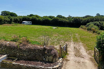
- Price
- Offers in Excess of£300,000
Lister Way, East Allington, TQ9, East Allington, Devon TQ9 England
Added on 18/08/2026Building Plot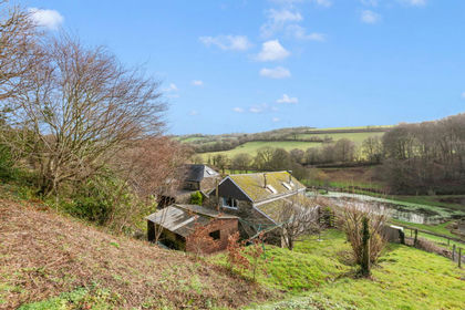
- Price
- Guide Price£275,000
Added on 25/06/2026Cottage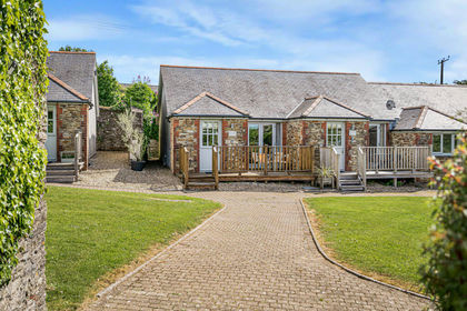
- Price
- Guide Price£208,000
Added on 21/05/2026Barn Conversion
- Price
- Guide Price£275,000
Added on 19/08/2026Barn Conversion
- Price
- Guide Price£250,000
Added on 04/08/2026Barn Conversion
- Price
- £300,000
- Size
- 0.3 acres
Added on 18/08/2026Self Build Plot
- Price
- Guide Price£200,000
Old Milling Barn, Longcombe, Totnes, Berry Pomeroy, Devon TQ9 England
Added on 26/03/2026Barn
- Price
- Offers in Excess of£200,000
Added on 05/06/2026Building Plot
- Price
- £195,000
Added on 22/06/2026Development Land