Gwaun Cae Gurwen, Ammanford, SA18
- Land size
- 1 acres
- Bedrooms
- 5
- Bathrooms
- 1
Key Features
- Smallholding in an rural location
- Approx One Acre With Eight Acres Available Through Separate Negotiation
- EPC Rating: D
- Superb kitchen/family room with log burner.
- Upgraded By Current Owners
- Mountain grazing rights providing extensive additional land for livestock
- Natural spring-fed water supply
- Two substantial barns offering excellent potential (subject to the necessary consents)
- Offering Various Opportunities
- 4/5 Bedroom Home
Description
A fantastic opportunity to acquire a smallholding situated in a rural location within the village of Gwaun Cae Gurwen. The family home has been upgraded by the current owners and offers spacious and versatile accommodation, boasting five bedrooms, a fabulous kitchen/family room complete with a log burner, and a ground floor bathroom. The property further benefits from oil-fired central heating and double glazing throughout. Set within just over one acre of land, with the option to purchase a further eight acres by separate negotiation, the property enjoys an excellent rural setting with mountain grazing rights providing extensive additional land for livestock, together with a natural spring-fed water supply. The property offers outstanding lifestyle and business potential, making it an ideal opportunity for those looking to develop a rural enterprise or multi-generational living arrangement. The two substantial barns provide exciting scope for a variety of potential uses, subject to the necessary planning consents, including conversion to holiday accommodation, workshop or storage facilities, equestrian use, small-scale agricultural ventures, or home-based businesses. The land and grazing rights may also appeal to those interested in keeping livestock, hobby farming, or pursuing self-sufficiency opportunities. With its combination of versatile outbuildings, generous land, and picturesque countryside surroundings, this property presents a rare opportunity to acquire a rural smallholding with significant future potential in a sought-after location.
The village of Gwaun Cae Gurwen offers a range of everyday amenities, with further shopping and leisure facilities available in nearby Ammanford and Pontardawe. Excellent road links to the M4 motorway can be accessed via Junction 49 at Pont Abraham or Junction 45 at Ynysforgan, providing convenient commuting connections throughout South Wales.
Accommodation:
Entrance Hall
Tiled floor, radiator.
Kitchen/Family Room
Double-glazed windows to front, double glazed window to rear, radiator, log burner set in fireplace, kitchen fitted with a range of wall & base units, central island, eye-level electric oven, hob & extractor fan over, sink & draining board unit, storage cupboard, laminate flooring.
Bathroom - 7.26m x 1.65m (23'10" x 5'5")
Double glazed windows to side, two heated towel rails, tiled floor to ceiling, a suite comprising panelled bath, WC, pedestal wash hand basin, plumbing for washing machine, space for tumble dryer, storage cupboards.
Sitting Room/Bedroom Five - 5.21m x 1.88m (17'1" x 6'2")
Double glazed window to rear, radiator.
First Floor Landing
Bedroom One - 5.46m x 3.3m (17'11"/14'7" x 10'10")
Two double glazed windows to rear, radiator.
Bedroom Two - 3.68m x 2.87m (12'1" x 9'5")
Double glazed window to front, radiator.
Bedroom Three - 7.49m x 1.85m (24'7" x 6'1")
Double glazed window to front & rear, radiator.
Bedroom Four - 2.64m x 2.34m (8'8" x 7'8")
Double glazed window to front, radiator.
Externally
Accessed by a private lane, enclosed front garden mainly laid to lawn, parcel of land amounting to just over one acre (tbc) with an option to purchase a further eight acres through separate negotiation, panoramic countryside views, grazing mountain rights, one barn with electricity and plumbing connected offering potential to convert to an annexe (stpp), large barn (37'8" x 35'5") offering potential to convert to a residential dwelling subject to the necessary consents, external oil boiler, oil tank.
Services
We are advised that mains services are connected. Oil fired central heating, cesspit, natural spring-fed water supply.
Tenure
Freehold
Council Tax
Band D
Broadband/Mobile Phone Cooverage
We are advised that super-fast broadband and mobile phone coverage are available in this area.
Disclaimer
Every care has been taken with the preparation of particulars however please note room dimensions and floor plan's should not be relied upon and any appliances or services listed on these details have not been tested.
Map Location
Property details
- Tenure
- Freehold
- Council Tax Band
- D
- Date Posted
- 2026-06-10
Price history
| Date | Change | Price |
|---|---|---|
| 2 Sep 2026 | Reduced 2% (−£10,000) | £489,950 |
| Until 2 Sep 2026 | Asking price | £499,950 |
Market Value Analysis
Compared with 1,207 Homes with Land listings in Wales (1+ acres).
Energy Performance Certificate
Energy Efficiency Rating
Based on UK Energy Performance Certificate standards (EU Directive 2002/91/EC)
Running costs are one side. Planning activity, flood history and ground risks for this location are in the full report.
Utilities & Restrictions
Utilities
- Electricity
- Mains
- Water
- Private Supply
- Heating
- Double Glazing, Oil Heating
- Broadband
- Fibre (FTTC)
- Sewerage
- Septic Tank / Private
Rights & Restrictions
- Public Rights of Way
- Ask Agent
- Private Rights of Way
- Ask Agent
- Listed Property
- Ask Agent
- Restrictions
- Ask Agent
Listed status, conservation areas and planning constraints for this location are in the full report.
Property Features
- Accessibility
- Ask Agent
- Parking
- Driveway, Off-Street Parking
- Garden
- Private Garden
Beyond the particulars: planning activity, flood history, heritage and ground risks, checked for this exact spot.
Connectivity
Broadband
Fastest speed available at this postcode
32 Mbps
Superfast · available to 25% of premises
Suitable for
- HD streaming
- Video calls
- Web & social
Mobile signal
Outdoor predictions; indoor signal depends on building materials.
Ofcom Connected Nations postcode-level predictions. Speeds and signal are modelled, not measured, and vary between addresses and providers.
Signal is the easy part. Planning activity, flood history and protected designations here are in the full report.
Nearest Schools
Primary
- Tairgwaith Primary School932 metres
- Pupils
- 89
- Type
- Nursery, Infants & Juniors
- Language
- English medium school / provision
- YGG Gwaun Cae Gurwen0.9 miles
- Pupils
- 164
- Type
- Nursery, Infants & Juniors
- Language
- Welsh medium school / provision (including transitional)
- Brynaman2.1 miles
- Pupils
- 269
- Type
- Nursery, Infants & Juniors
- Language
- Welsh medium school / provision (including transitional)
- Y Bedol2.2 miles
- Pupils
- 299
- Type
- Nursery, Infants & Juniors
- Language
- Welsh medium school / provision (including transitional)
- YGG Cwmllynfell2.3 miles
- Pupils
- 60
- Type
- Nursery, Infants & Juniors
- Language
- Welsh medium school / provision (including transitional)
Secondary
- Ysgol Gymraeg Ystalyfera Bro Dur3.9 miles
- Pupils
- 1,557
- Type
- Middle (ages 3-19)
- Language
- Welsh medium school / provision (including transitional)
- Ysgol Maesydderwen4.4 miles
- Pupils
- 513
- Type
- Secondary (ages 11-19)
- Language
- English medium school / provision
- Cwmtawe Community School4.7 miles
- Pupils
- 1,047
- Type
- Secondary (ages 11-16)
- Language
- English medium school / provision
- Ysgol Dyffryn Aman5.1 miles
- Pupils
- 1,547
- Type
- Secondary (ages 11-19)
- Language
- Dual language school / provision (Welsh and English) (including transitional)
- Morriston Comprehensive7.5 miles
- Pupils
- 1,055
- Type
- Secondary (ages 11-19)
- Language
- English medium school / provision
Distances are straight-line from the advertised location. Source: the national school registers (DfE, Welsh Government, Scottish Government) and Ofsted.
Schools are just the start: sold prices nearby, planning activity and any flood history are in the full report.
Amenities
Supermarket
GP surgery
Pharmacy
Green space
Straight-line distances from the advertised location. Sources: NHS records, Geolytix supermarket locations, OS Open Greenspace and the national trails registers.
The area stacks up? Now check the location itself: planning nearby, protected designations and past flooding.
Getting Around
Nearest station
Nearest bus stop
Typical drive times
Straight-line distances from the advertised location; drive times are typical free-flow times over OpenStreetMap road data, so allow more at peak. Public transport locations from DfT NaPTAN.
Easy to reach matters. So do planning activity, flood history and ground risks: all in the full report.
Flood Risk
From Natural Resources Wales flood map open data, checked around the advertised map pin and allowing for the listed acreage where known. This summary comes from LandSale, the advertising platform, not from the listing agent, and is not part of the agent's particulars. Risk can vary across a single holding, so verify anything critical through your own searches before committing.
Rivers and the sea
Surface water
These bandings are the summary. Where this location sits on the flood maps, plus planning activity, heritage and ground risks, is in the full report.
Important notice: Information, maps and tags on this page are drawn from the advertising agent's marketing materials or generated automatically. LandSale has not verified them. Relying on these details is at your own risk, always carry out independent checks before committing to a purchase.
LandSale full disclaimer
Marketing information only - not formal particulars. The details on this website are provided for general guidance and do not constitute an offer or contract. Neither LandSale nor the advertising estate/land agent accepts responsibility for any inaccuracy.
1. Source of information
- Listing content: Core description, asking price, tenure, measurements, photographs and planning history originate from the marketing materials of the advertising estate or land agent. LandSale does not author this content and cannot guarantee its accuracy.
- Automated tags & categorisation: Property type, land-use class, acreage bands and similar labels may be applied by machine-learning models. They are intended as a helpful guide only and may not reflect the property's legal status or permitted use.
- Third-party & enriched data layers: Maps, boundary outlines, planning designations, soil reports, broadband coverage and other environmental or location-based insights are licensed from external suppliers. Such data are supplied “as is", may be incomplete or out of date and are subject to change without notice.
2. Verification required
Prospective purchasers must verify critical matters, including but not limited to planning permission, title boundaries, public rights of way, environmental constraints, acreage, services, access and VAT status, through their own inspections, specialist surveys, legal advisers and the selling agent before relying on the information or entering into any contract.
3. No warranty or liability
LandSale gives no warranty, express or implied, as to the accuracy, completeness or fitness for any particular purpose of the information displayed. LandSale shall not be liable for any loss, damage, cost or expense arising directly or indirectly from any use of or reliance on such information, save where liability may not be excluded by law.
4. Updates & feedback
If you believe any detail on this listing is inaccurate, please let us know. We will investigate and, where appropriate, update the listing or notify the agent.
© LandSale | Version 1.3 - August 2026
Listing agent
Calow Evans, Ammanford
38 College Street, Ammanford, SA18 3AF
Similar properties for sale
- Price
- Guide Price£550,000
- Size
- 1.5 acres
Glanaman CARMARTHENSHIRE, Cwmamman, Carmarthenshire SA18 Wales
Added on 15/09/2026House with Land
- Price
- Offers in Region of£400,000
- Size
- 4 acres
Maesquarre Road, Betws, Ammanford, Carmarthenshire, SA18, Betws, Carmarthenshire SA18 Wales
Added on 29/07/2026House with Land
- Price
- Guide Price£599,950
- Size
- 5.4 acres
Ammanford CARMARTHENSHIRE, Llandybie, Carmarthenshire SA18 Wales
Added on 26/03/2026House with Land
- Price
- Offers in Excess of£600,000
- Size
- 2 acres
Added on 01/08/2026House with Land
- Price
- Offers in Region of£399,950
- Size
- 8.96 acres
Bronyglyn, Gwynfe, Llangadog, SA19, Llangadog, Carmarthenshire SA19 Wales
Added on 18/06/2026House with Land
- Price
- £484,950
- Size
- 0.36 acres
Added on 16/06/2026Barn Conversion
- Price
- Guide Price£475,000
- Size
- 1.19 acres
Saron Road, Saron, Ammanford, SA18, Ammanford, Carmarthenshire SA18 Wales
Added on 15/09/2026House with Land
- Price
- Offers in Region of£400,000
- Size
- 1 acres
Llanddeusant, Llangadog, Carmarthenshire, SA19, Llanddeusant, Carmarthenshire SA19 Wales
Added on 16/07/2026Cottage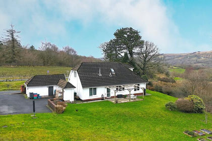
- Price
- £550,000
- Size
- 4.85 acres
Cefn Byrle Road, Coelbren, Powys., Tawe-Uchaf, Powys SA10 Wales
Added on 29/01/2026House with Land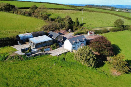
- Price
- Guide Price£525,000
- Size
- 8.5 acres
Carmel, Llanelli, Llanfihangel Aberbythych, Carmarthenshire SA14 Wales
Added on 14/05/2026Farmhouse