Honeywick, Castle Cary, Somerset, BA7
- Land size
- 12 acres
- Bedrooms
- 7
- Bathrooms
- 5
Key Features
- Stunning 18th century grade ll listed country house
- Five bedrooms in the main house
- Four bathrooms
- Sitting room and snug
- Dining room
- Kitchen with Aga
- Large garage with office above
- Two bedroom annexe
- Five bay oak framed carport
- Exceptional gardens and land extending to approximately 12 acres
Description
Located in this charming hamlet between Bruton and Cary is this simply delightful 18th century grade ll listed country house.
Discreetly tucked away yet approached via a long sweeping driveway this former farmhouse is built predominately of Hadspen stone under a tiled roof. The façade of the property is beautifully enhanced with rambling roses curling round the windows and the gardens are full of flower and fauna. Entering through the solid front door into an entrance hall with an open fire and a cloakroom off. Through into the main body of the house and you will find a large sitting room with access to the garden terrace and leading into a most generous dining room with open fireplaces. Off this room there is a cosy snug – again with an open fireplace. The kitchen is situated to the front of the house and has handmade oak wall and base units with granite work tops and tiled floor. There are a two oven Aga and a Siemens oven and hob.
An elegant staircase leads to the first floor which is filled with light. There is a lovely main bedroom with a dressing room (this could be put back to two bedrooms). There are three further double bedrooms – three are ensuite and there is also a family bathroom.
Adjacent to the main house is a former two storey stone cart house which has a double height vaulted ceiling – making this the perfect place to move the kitchen. To the rear there is further room with single height ceilings providing ample storage or utility space. Above this there is an office reached via a wooden staircase.
The detached annexe – The Cider House, which was designed and converted in 2008 – offers very well-appointed ancillary accommodation over two floors with an LPG log look alike fire, and two bedrooms. Next to this is an open oak framed five bay car port which also houses the oil tank.
The gardens at Honeywick House are a particular highlight. Partly designed by Julian and Isabel Bannerman, renowned for their work at Highgrove, Waddesdon and other notable country houses in the area. They have been carefully developed and maintained by the current owners. The valley garden provides year-round interest, with a rich variety of roses, peonies, verbena, box hedging, mature trees, spring bulbs and summer perennials. A thatched tea house and a summer house, perched on the bank, enjoy views back to the house and across the gardens.
The parterre, oak pergola and glasshouses are also worthy of note, along with a series of terraces leading to the croquet lawn and, through ancient gates, to the prolific vegetable and fruit garden with views up the valley.
The gardens and grounds extend to approximately 12 acres, giving the property a high degree of privacy. Honeywick House is ideally located, with Bruton, Castle Cary and The Newt all within a ten-minute drive; Castle Cary also offers a mainline station. Both Bruton and Castle Cary have primary schools and shops, while Bruton is home to King's Bruton and Sexey's School. Hauser & Wirth is on the edge of Bruton. Bruton and Castle Cary have a variety of shops and restaurants - larger supermarkets can be found in Wincanton, Frome and Gillingham.
• Tenure: Freehold
• Council Tax Band: G (Somerset Council)
• Listed Building: Grade ll
• EPC: TBC
• Utilities and Similar: Mains electricity, oil, LPG, mains water, and septic tank
• Main Heating: TBA
• No Onward Chain
Map Location
Property details
- Tenure
- Freehold
- Council Tax Band
- G
- Date Posted
- 2026-06-05
Market Value Analysis
Compared with 221 Homes with Land listings in South West England (10+ acres).
Utilities & Restrictions
Utilities
- Electricity
- Mains
- Water
- Mains
- Heating
- Oil Heating, Open Fire, Wood Burner
- Broadband
- Ask Agent
- Sewerage
- Ask Agent
Rights & Restrictions
- Public Rights of Way
- Ask Agent
- Private Rights of Way
- Ask Agent
- Listed Property
- Yes
- Restrictions
- Ask Agent
Listed status, conservation areas and planning constraints for this location are in the full report.
Property Features
- Accessibility
- No Wheelchair Access
- Parking
- Garage, Covered Parking, Driveway, Private Parking
- Garden
- Front Garden, Patio, Private Garden, Enclosed Garden, Rear Garden, Rear Garden
Beyond the particulars: planning activity, flood history, heritage and ground risks, checked for this exact spot.
Connectivity
Broadband
Fastest speed available at this postcode
52 Mbps
Superfast
Suitable for
- HD streaming
- Video calls
- Web & social
Mobile signal
Outdoor predictions; indoor signal depends on building materials.
Ofcom Connected Nations postcode-level predictions. Speeds and signal are modelled, not measured, and vary between addresses and providers.
Signal is the easy part. Planning activity, flood history and protected designations here are in the full report.
Nearest Schools
Primary
- Castle Cary Community Primary School0.9 milesOfsted: Requires improvement
- Ages
- 4 to 11
- Pupils
- 177
- Type
- Academy sponsor led
- Bruton Primary School2.3 milesNo Ofsted rating
- Ages
- 2 to 11
- Pupils
- 262
- Type
- Foundation school
- Ditcheat Primary School2.9 milesOfsted report card · Jan 2026
- Ages
- 4 to 11
- Pupils
- 89
- Type
- Community school
- North Cadbury Church of England Primary School3.2 milesOfsted: Good
- Ages
- 2 to 11
- Pupils
- 100
- Type
- Academy sponsor led
- Faith
- Church of England
- Lovington Church of England Primary School3.8 milesOfsted: Inadequate
- Ages
- 4 to 11
- Pupils
- 35
- Type
- Academy sponsor led
- Faith
- Church of England
Secondary
- Ansford Academy0.8 milesOfsted report card · Feb 2026
- Ages
- 11 to 16
- Pupils
- 469
- Type
- Academy converter
- Sexey's School1.8 milesOfsted: Good
- Ages
- 11 to 18
- Pupils
- 633
- Type
- Academy converter
- Faith
- Church of England
- King Arthur's School4 milesOfsted: Requires improvement *
- Ages
- 11 to 16
- Pupils
- 450
- Type
- Academy sponsor led
- Whitstone7.1 milesOfsted: Good
- Ages
- 11 to 16
- Pupils
- 545
- Type
- Academy converter
- The Gryphon School9.1 milesNo Ofsted rating
- Ages
- 11 to 18
- Pupils
- 1,569
- Type
- Academy converter
- Faith
- Church of England
* Latest graded judgement covers quality of education only; no overall grade was issued under the 2024-25 inspection framework.
Distances are straight-line from the advertised location. Source: the national school registers (DfE, Welsh Government, Scottish Government) and Ofsted.
Schools are just the start: sold prices nearby, planning activity and any flood history are in the full report.
Amenities
Supermarket
GP surgery
Pharmacy
Hospital
Green space
Straight-line distances from the advertised location. Sources: NHS records, Geolytix supermarket locations, OS Open Greenspace and the national trails registers.
The area stacks up? Now check the location itself: planning nearby, protected designations and past flooding.
Getting Around
Nearest station
Nearest bus stop
Typical drive times
Straight-line distances from the advertised location; drive times are typical free-flow times over OpenStreetMap road data, so allow more at peak. Public transport locations from DfT NaPTAN.
Easy to reach matters. So do planning activity, flood history and ground risks: all in the full report.
Flood Risk
From Environment Agency flood map open data, checked around the advertised map pin and allowing for the listed acreage where known. This summary comes from LandSale, the advertising platform, not from the listing agent, and is not part of the agent's particulars. Risk can vary across a single holding, so verify anything critical through your own searches before committing.
Rivers and the sea
Surface water
Mapped within the area searched, not at the advertised map pin itself.
The detail behind these bandings
The full report pinpoints where this location sits on the flood maps, and runs the deeper checks that usually only surface after an offer.
- Exact flood zones & annual chances (included in the full report)
- Any recorded past flooding (included in the full report)
- Planning activity nearby (included in the full report)
- Heritage & conservation (included in the full report)
- Protected nature designations (included in the full report)
- Ground risks (included in the full report)
- Sold prices nearby (included in the full report)
£14.99 · one-off purchase
By LandSale, the platform. Not provided by the listing agent. Ready in about a minute.
Important notice: Information, maps and tags on this page are drawn from the advertising agent's marketing materials or generated automatically. LandSale has not verified them. Relying on these details is at your own risk, always carry out independent checks before committing to a purchase.
LandSale full disclaimer
Marketing information only - not formal particulars. The details on this website are provided for general guidance and do not constitute an offer or contract. Neither LandSale nor the advertising estate/land agent accepts responsibility for any inaccuracy.
1. Source of information
- Listing content: Core description, asking price, tenure, measurements, photographs and planning history originate from the marketing materials of the advertising estate or land agent. LandSale does not author this content and cannot guarantee its accuracy.
- Automated tags & categorisation: Property type, land-use class, acreage bands and similar labels may be applied by machine-learning models. They are intended as a helpful guide only and may not reflect the property's legal status or permitted use.
- Third-party & enriched data layers: Maps, boundary outlines, planning designations, soil reports, broadband coverage and other environmental or location-based insights are licensed from external suppliers. Such data are supplied “as is", may be incomplete or out of date and are subject to change without notice.
2. Verification required
Prospective purchasers must verify critical matters, including but not limited to planning permission, title boundaries, public rights of way, environmental constraints, acreage, services, access and VAT status, through their own inspections, specialist surveys, legal advisers and the selling agent before relying on the information or entering into any contract.
3. No warranty or liability
LandSale gives no warranty, express or implied, as to the accuracy, completeness or fitness for any particular purpose of the information displayed. LandSale shall not be liable for any loss, damage, cost or expense arising directly or indirectly from any use of or reliance on such information, save where liability may not be excluded by law.
4. Updates & feedback
If you believe any detail on this listing is inaccurate, please let us know. We will investigate and, where appropriate, update the listing or notify the agent.
© LandSale | Version 1.3 - August 2026
Similar properties for sale
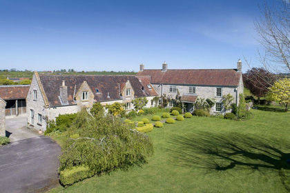
- Price
- Guide Price£2,000,000
- Size
- 17 acres
Superb 5-Bedroom Farmhouse with Land and Outbuildings in Babcary, Babcary, Somerset TA11 England
Added on 20/08/2026House with Land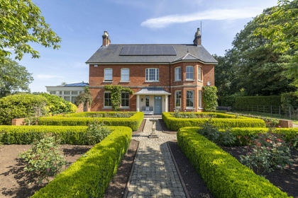
- Price
- Guide Price£1,850,000
- Size
- 6 acres
Added on 28/07/2026House with Land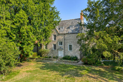
- Price
- Guide Price£2,000,000
- Size
- 25 acres
Manor house with circa 26 acres, a mile from Wells, St Cuthbert Out, Somerset BA5 England
Added on 29/01/2026Country Home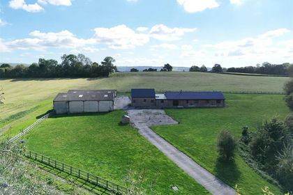
- Price
- Guide Price£1,795,000
- Size
- 42.51 acres
Fifehead Neville, Sturminster Newton, Dorset, Fifehead Neville, Dorset DT10 England
Added on 08/04/2026Country Estate
- Price
- Offers in Excess of£2,000,000
- Size
- 7.68 acres
Harefield Farmhouse, Church Lane, East Orchard, East Orchard, Dorset SP7 England
Added on 12/05/2026Farmhouse
- Price
- Offers in Excess of£2,000,000
- Size
- 7.68 acres
Church Lane, East Orchard, Dorset, SP7, East Orchard, Dorset SP7 England
Added on 12/05/2026Country Home
- Price
- Offers in Excess of£2,250,000
- Size
- 12 acres
Added on 15/05/2026Country Home
- Price
- Guide Price£2,250,000
- Size
- 29.63 acres
Higher Holway Farm, Cattistock, Dorchester, Cattistock, Dorset DT2 England
Added on 21/07/2026House with Land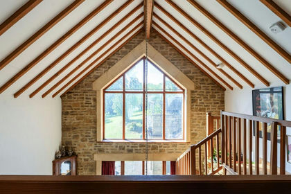
- Price
- Guide Price£1,650,000
- Size
- 8 acres
Added on 25/06/2026House with Land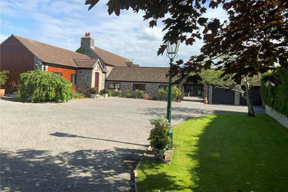
- Price
- £1,595,000
- Size
- 8.3 acres
Added on 02/04/2026Country Home