Arable Land For Sale by Informal Tender
Description
The field is approached over an owned entrance way from High Broadgate lying on the west side of the road and behind frontage residential property. It is rectangular in shape and bordered by dykes in the main. Tydd St Giles lies within easy reach of nearby centres including Wisbech (5 miles), Sutton Bridge (6 miles), Long Sutton (4 miles) and Spalding (13 miles).
LAND CLASSIFICATION:
The land is classified as Grade II on the ´Provisional´ Land Classification Map of England & Wales.
SOIL SERIES:
The soils are principally of the Wallasea 2 series which are described as deep stoneless clayey soils, calcareous in places.
TENURE:
The land is offered for sale freehold.
POSSESSION:
Vacant possession can be available at completion, assuming that the purchaser takes over the growing crop of wheat. If not required, vacant possession will be available when completion takes place after the wheat has been combined.
SERVICES:
There are no services connected to the land. If services are required, interested parties must make their own specific enquiries with the relevant service providers as to availability, practicality of connection and related cost.
ASSESSMENT AND OUTGOINGS:
The land is subject to the payment of annual Drainage Rates to the North Level District Internal Drainage Board. We are advised that the current rates for the 2026/2027 Drainage Rate Liability is £116.43. The Drainage Rates will be apportioned up to the time of completion with the balance to 31.03.27 payable to the Vendor in addition to the purchase price.
WAYLEAVES, RIGHTS OF WAY AND EASEMENTS:
The land is offered for sale subject to, and with the benefit of, all existing rights including rights of way, whether public or private, light, support, drainage, water, electricity, or other rights, easements, quasi-easements and all wayleaves, whether referred to specifically in these particulars or not.
SPORTING AND MINERAL RIGHTS:
As far they are owned, the Sporting and Mineral Rights are included in the sale.
UPLIFT CLAUSE/CLAWBACK PROVISION:
Should Planning Consent be granted for alternative use other than agricultural, horticulture or private equestrian use, then an uplift payment will be due to the Vendor or his Successors in Title for a period of 15 years at the rate of 35% of the uplift in value at the then trigger point which will be defined as the implementation of Planning Consent, the commencements of works on site or the sale of the land with the benefit of such consent, or the development of the land for alternative uses other than those permitted, even though such consent may not necessarily have required Planning Consent or indeed had been proceeded with without consent.
ENVIRONMENTAL SCHEMES:
None of the land is entered into any Environmental Scheme at the present time.
DELINKED PAYMENTS:
The Delinked Payments for the 2026 and 2027 years will be retained by the Vendor.
DRAINS AND DITCHES:
We are advised by the North Level Internal Drainage Board that the drain (Hornfield Drain) which borders the west boundary of the field, is within the control of the IDB. The other boundary dykes are private dykes.
UNDER DRAINAGE:
The Vendor is not aware that the field has ever been under drained.
PLANS, AREAS, AND SCHEDULE:
The plans and areas have been prepared as accurately as reasonably possible and are based on the Ordnance Survey and Rural Land Registry. The plans included in these Particulars are published for convenience and / or identification purposes only and although believed to be correct, the accuracy cannot be guaranteed. The purchaser(s) will be deemed to have satisfied themselves as to the description and extent of the property and the ownership of the boundaries.
HEALTH AND SAFETY:
All those entering on to the land should take great care both for themselves, their property and any part of the farm or crops. It should be remembered that this is a working farm area and neither the Vendor nor his Agents are responsible for any injury or accident that occurs on the farm.
CONTRACTS AND QUOTAS:
There are no contracts nor quotas available with the sale of the land.
TENANTRIGHT/DILAPIDATIONS:
There will be no charge for the current crop of wheat if the purchaser takes this over at completion or if this does not take place until after harvest, the crop will remain with the Vendor. There will be no counterclaim allowed for dilapidations (if any).
FORM OF TENDER:
The Informal Tender Form is attached to these Particulars or is available upon request by contacting the Agricultural Department of R Longstaff & Co LLP, Tel: (Option 4).
Map Location
Property details
- Tenure
- Freehold
- Council Tax Band
- Ask Agent
- Date Posted
- 2026-05-13
Utilities & Restrictions
Utilities
- Electricity
- Ask Agent
- Water
- Ask Agent
- Heating
- Ask Agent
- Broadband
- Ask Agent
- Sewerage
- Ask Agent
Rights & Restrictions
- Public Rights of Way
- Ask Agent
- Private Rights of Way
- Ask Agent
- Listed Property
- Ask Agent
- Restrictions
- Ask Agent
Property Features
- Accessibility
- Ask Agent
- Parking
- Ask Agent
- Garden
- Ask Agent
Important notice: Information, maps and tags on this page are supplied by the advertising agent or generated automatically. LandSale has not verified them. Relying on these details is at your own risk, always carry out independent checks before committing to a purchase.
LandSale full disclaimer
Marketing information only - not formal particulars. The details on this website are provided for general guidance and do not constitute an offer or contract. Neither LandSale nor the advertising estate/land agent accepts responsibility for any inaccuracy.
1. Source of information
- Agent-supplied content: Core description, asking price, tenure, measurements, photographs and planning history are uploaded by the appointed agent, who remains solely responsible for their accuracy.
- Automated tags & categorisation: Property type, land-use class, acreage bands and similar labels may be applied by machine-learning models. They are intended as a helpful guide only and may not reflect the property's legal status or permitted use.
- Third-party & enriched data layers: Maps, boundary outlines, planning designations, soil reports, broadband coverage and other environmental or location-based insights are licensed from external suppliers. Such data are supplied “as is", may be incomplete or out of date and are subject to change without notice.
2. Verification required
Prospective purchasers must verify critical matters, including but not limited to planning permission, title boundaries, public rights of way, environmental constraints, acreage, services, access and VAT status, through their own inspections, specialist surveys, legal advisers and the selling agent before relying on the information or entering into any contract.
3. No warranty or liability
LandSale gives no warranty, express or implied, as to the accuracy, completeness or fitness for any particular purpose of the information displayed. LandSale shall not be liable for any loss, damage, cost or expense arising directly or indirectly from any use of or reliance on such information, save where liability may not be excluded by law.
4. Updates & feedback
If you believe any detail on this listing is inaccurate, please let us know. We will investigate and, where appropriate, update the listing or notify the agent.
© LandSale | Version 1.2 - January 2026
Listing agent
Longstaff Chartered Surveyors, Spalding
5 New Road, Spalding, PE11 1BS
View agent profileSimilar properties for sale

- Price
- Guide Price£195,000
- Size
- 11.64 acres
Land At Broadend Road, Wisbech, Norfolk, Walsoken, Norfolk PE14 7BQ England
Added on 26/02/2026Undeveloped Land
- Price
- £280,000
- Size
- 31.77 acres
Outwell Road, Emneth, Wisbech, Emneth, Norfolk PE14 8BG England
Added on 29/01/2026Agricultural Land
- Price
- Guide Price£1,378,000
- Size
- 164.07 acres
Cow Croft Field Farm, Marshland St. James, Norfolk PE14 8EW England
Added on 17/05/2026Farmland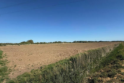
- Price
- Guide Price£70,000
- Size
- 5.08 acres
Land Off Of , Fendyke Road, Outwell, Wisbech, Norfolk, PE14 8PL, Emneth, Norfolk PE14 8EQ England
Added on 06/06/2026Farmland
- Price
- Guide Price£6,300,000
- Size
- 505 acres
Added on 25/04/2026Farm
- Price
- £75,000
- Size
- 0.6 acres
Wisbech Road, Thorney, Peterborough, Thorney, Peterborough PE6 0SE England
Added on 29/01/2026Building Plot
- Price
- £75,000
- Size
- 0.92 acres
Wisbech Road, Thorney, Peterborough, PE6, Thorney, Peterborough PE6 0SE England
Added on 29/01/2026Vacant Land
- Price
- From£14,300,000
- Size
- 1282.79 acres
Added on 29/05/2026Farm
- Price
- Guide Price£240,000
- Size
- 22.31 acres
Added on 24/05/2026Farmland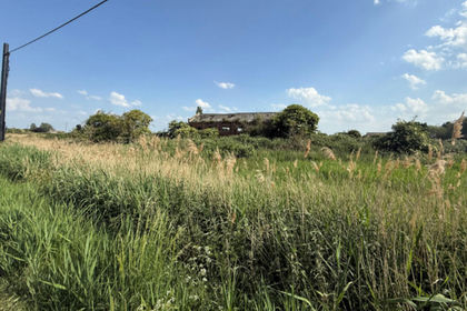
- Price
- Guide Price£50,000
- Size
- 1.25 acres
March Road, Turves, Whittlesey, Cambridgeshire PE7 2FS England
Added on 26/06/2026Derelict property