South Huish, Near Hope Cove
- Bedrooms
- 3
- Bathrooms
- 2
Key Features
- Barn conversion
- South facing
- Pretty gardens
- Glorious rural views
- Garden room
- Separate sitting room
- 3 bedrooms
- 2 bathrooms & cloakroom
- Parking
- Close to the coast
Description
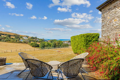
Nestled in a picturesque rural setting, this charming south-facing barn conversion offers a tranquil retreat with glorious views and elegant living spaces. Meticulously designed, this home perfectly blends rustic character with modern comforts, promising a lifestyle of serenity and convenience close to the coast. Attached to its neighbour and having 'upside down' accommodation, the barn has been thoughtfully converted to maximise the convenience of the accommodation and use of the lovely gardens to the rear.
The heart of this home is the garden room, a bright and airy space that invites natural light and offers delightful outlooks onto the pretty gardens. This versatile room is perfect for dining, relaxation, or entertaining guests, providing a seamless connection to the outdoors. Adjacent to this, a separate sitting room offers a cosy and inviting space with a gas fire, ideal for quiet evenings or intimate gatherings. The kitchen/dining room is well designed and incorporates a utility room with sink, space for washing machine and American fridge/freezer, plus storage units. The ground floor also features a convenient cloakroom, adding to the practicality of the layout.
The front door to the property from the parking area leads into the first floor with an attractive hallway and stairs down to the ground floor. On this upper floor you will find three well-proportioned double bedrooms, providing comfortable accommodation. The master bedroom has an en-suite shower room and there is an additional family bathroom.
Externally, the property boasts a very pretty, south facing garden that provides a lovely space for outdoor enjoyment, whether for gardening, relaxation, or alfresco dining. Off-street parking to the front ensures convenience for residents and visitors alike.
LOCATION
Situated in a desirable rural location amongst a small group of other homes including a fine farmhouse and a range of stone barns, this home enjoys the peace and beauty of the countryside while being conveniently close to the coast, offering the best of both worlds. A local footpath leads down towards the sea, which is about 30-40 minutes away by foot, or alternatively the drive is only about 5 minutes. The area provides ample opportunities for exploring natural landscapes, coastal paths, and charming local communities, making it an ideal setting for those who appreciate outdoor pursuits and a relaxed way of life.
This barn conversion truly offers a unique opportunity to acquire a beautifully presented home in an enviable location. Viewing is highly recommended to fully appreciate the charm and lifestyle on offer.
DIRECTIONS
what3words - ///reassured.older.awkward
VIEWING ARRANGEMENTS
Strictly by appointment with Luscombe Maye, Salcombe
MATERIAL INFORMATION
To ensure legal compliance, we require our sellers to complete a Property Information Questionnaire or provide a Material Information Guide along with the title document. If available, please scan the QR code or access the additional online material information. Alternatively, you can contact our team for this information.
Costs & tenure
Tenure: Freehold
Council tax band: F
EPC rating: D
The building
Semi-detached house, standard brick and block construction
3 bedrooms, 2 bathrooms, 2 receptions
Accessibility adaptations: None
Services
Mains electricity
Mains water
Foul drainage: Sewerage treatment plant
Mains surface water drainage
Oil central heating, installed 1st Jan 2024
Heating features: Double glazing
Broadband: ADSL copper wire
Mobile coverage: O2 poor, Vodafone poor, Three poor, EE great
Parking: Private
Risks & restrictions
Not a listed building
Not in a conservation area
No tree preservation order
Historical flooding: yes — October 2021
No specialist issues recorded
All information is provided without warranty. Contains HM Land Registry data © Crown copyright and database right 2021. This data is licensed under the Open Government Licence v3.0.
The information contained is intended to help you decide whether the property is suitable for you. You should verify any answers which are important to you with your property lawyer or surveyor or ask for quotes from the appropriate trade experts: builder, plumber, electrician, damp, and timber expert.
Map Location
Property details
- Tenure
- Freehold
- Council Tax Band
- D
- Date Posted
- 2026-05-12
Energy Performance Certificate
Energy Efficiency Rating
Based on UK Energy Performance Certificate standards (EU Directive 2002/91/EC)
Running costs are one side. Planning activity, flood history and ground risks for this location are in the full report.
Utilities & Restrictions
Utilities
- Electricity
- Mains
- Water
- Mains
- Heating
- Oil Heating
- Broadband
- Standard Copper (ADSL)
- Sewerage
- Septic Tank / Private
Rights & Restrictions
- Public Rights of Way
- Ask Agent
- Private Rights of Way
- Ask Agent
- Listed Property
- Ask Agent
- Restrictions
- Ask Agent
Listed status, conservation areas and planning constraints for this location are in the full report.
Property Features
- Accessibility
- No Wheelchair Access
- Parking
- Off-Street Parking
- Garden
- Private Garden
Beyond the particulars: planning activity, flood history, heritage and ground risks, checked for this exact spot.
Connectivity
Broadband
Fastest speed available at this postcode
16 Mbps
Standard (10-30 Mbps)
Suitable for
- Web & social
- Music streaming
- Standard video calls
Mobile signal
Outdoor predictions; indoor signal depends on building materials.
Ofcom Connected Nations postcode-level predictions. Speeds and signal are modelled, not measured, and vary between addresses and providers.
Signal is the easy part. Planning activity, flood history and protected designations here are in the full report.
Nearest Schools
Primary
- Malborough with South Huish Church of England Primary School1.4 milesNo Ofsted rating
- Ages
- 4 to 11
- Pupils
- 85
- Type
- Voluntary controlled school
- Faith
- Church of England
- Thurlestone All Saints Church of England Academy1.5 milesNo Ofsted rating
- Ages
- 2 to 11
- Pupils
- 149
- Type
- Academy converter
- Faith
- Church of England
- West Alvington Church of England Academy2.3 milesOfsted: Good
- Ages
- 2 to 11
- Pupils
- 34
- Type
- Academy converter
- Faith
- Church of England
- Salcombe Church of England Primary School2.9 milesNo Ofsted rating
- Ages
- 2 to 11
- Pupils
- 80
- Type
- Academy converter
- Faith
- Church of England
- Kingsbridge Primary School3.5 milesOfsted: Requires improvement
- Ages
- 4 to 11
- Pupils
- 343
- Type
- Academy converter
Secondary
- Kingsbridge Academy2.7 milesOfsted: Good
- Ages
- 11 to 18
- Pupils
- 1,199
- Type
- Academy converter
- Ivybridge Community College9.9 milesOfsted: Good
- Ages
- 11 to 18
- Pupils
- 2,262
- Type
- Academy converter
- Dartmouth Academy12 milesOfsted: Good
- Ages
- 3 to 19
- Pupils
- 435
- Type
- Academy sponsor led
- Coombe Dean School13 milesOfsted report card · Mar 2026
- Ages
- 11 to 18
- Pupils
- 1,000
- Type
- Academy converter
- Plympton Academy13 milesOfsted: Requires improvement
- Ages
- 11 to 18
- Pupils
- 984
- Type
- Academy converter
Distances are straight-line from the advertised location. Source: the national school registers (DfE, Welsh Government, Scottish Government) and Ofsted.
Schools are just the start: sold prices nearby, planning activity and any flood history are in the full report.
Amenities
Supermarket
GP surgery
Pharmacy
Hospital
Walking trail
Straight-line distances from the advertised location. Sources: NHS records, Geolytix supermarket locations, OS Open Greenspace and the national trails registers.
The area stacks up? Now check the location itself: planning nearby, protected designations and past flooding.
Getting Around
Nearest station
Nearest bus stop
Typical drive times
Straight-line distances from the advertised location; drive times are typical free-flow times over OpenStreetMap road data, so allow more at peak. Public transport locations from DfT NaPTAN.
Easy to reach matters. So do planning activity, flood history and ground risks: all in the full report.
Flood Risk
From Environment Agency flood map open data, checked around the advertised map pin and allowing for the listed acreage where known. This summary comes from LandSale, the advertising platform, not from the listing agent, and is not part of the agent's particulars. Risk can vary across a single holding, so verify anything critical through your own searches before committing.
Rivers and the sea
Surface water
The detail behind these bandings
The full report pinpoints where this location sits on the flood maps, and runs the deeper checks that usually only surface after an offer.
- Exact flood zones & annual chances (included in the full report)
- Any recorded past flooding (included in the full report)
- Planning activity nearby (included in the full report)
- Heritage & conservation (included in the full report)
- Protected nature designations (included in the full report)
- Ground risks (included in the full report)
- Sold prices nearby (included in the full report)
£14.99 · one-off purchase
By LandSale, the platform. Not provided by the listing agent. Ready in about a minute.
Important notice: Information, maps and tags on this page are drawn from the advertising agent's marketing materials or generated automatically. LandSale has not verified them. Relying on these details is at your own risk, always carry out independent checks before committing to a purchase.
LandSale full disclaimer
Marketing information only - not formal particulars. The details on this website are provided for general guidance and do not constitute an offer or contract. Neither LandSale nor the advertising estate/land agent accepts responsibility for any inaccuracy.
1. Source of information
- Listing content: Core description, asking price, tenure, measurements, photographs and planning history originate from the marketing materials of the advertising estate or land agent. LandSale does not author this content and cannot guarantee its accuracy.
- Automated tags & categorisation: Property type, land-use class, acreage bands and similar labels may be applied by machine-learning models. They are intended as a helpful guide only and may not reflect the property's legal status or permitted use.
- Third-party & enriched data layers: Maps, boundary outlines, planning designations, soil reports, broadband coverage and other environmental or location-based insights are licensed from external suppliers. Such data are supplied “as is", may be incomplete or out of date and are subject to change without notice.
2. Verification required
Prospective purchasers must verify critical matters, including but not limited to planning permission, title boundaries, public rights of way, environmental constraints, acreage, services, access and VAT status, through their own inspections, specialist surveys, legal advisers and the selling agent before relying on the information or entering into any contract.
3. No warranty or liability
LandSale gives no warranty, express or implied, as to the accuracy, completeness or fitness for any particular purpose of the information displayed. LandSale shall not be liable for any loss, damage, cost or expense arising directly or indirectly from any use of or reliance on such information, save where liability may not be excluded by law.
4. Updates & feedback
If you believe any detail on this listing is inaccurate, please let us know. We will investigate and, where appropriate, update the listing or notify the agent.
© LandSale | Version 1.3 - August 2026
Listing agent
Luscombe Maye, Salcombe
2 Island Square, Island Street, Salcombe, TQ8 8DP
Similar properties for sale
- Price
- Guide Price£575,000
Court Barton, South Huish, Kingsbridge, Devon, South Huish, Devon TQ7 England
Added on 26/08/2026Barn Conversion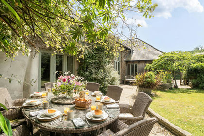
- Price
- Guide Price£750,000
Added on 29/01/2026Barn Conversion
- Price
- Offers Over£765,000
Added on 08/08/2026Barn Conversion
- Price
- Guide Price£575,000
- Size
- 1 acres
Added on 29/01/2026Cottage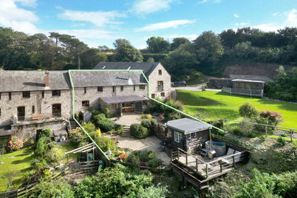
- Price
- Guide Price£550,000
Added on 27/03/2026Barn Conversion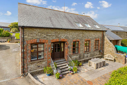
- Price
- Guide Price£795,000
The Coach House, Elston Park, Churchstow, Kingsbridge, Devon, Churchstow, Devon TQ7 England
Added on 27/05/2026Barn Conversion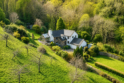
- Price
- Guide Price£799,950
- Size
- 6.5 acres
Added on 22/06/2026House with Land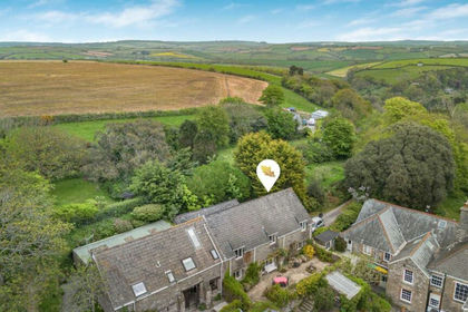
- Price
- Guide Price£625,000
- Size
- 5.5 acres
Added on 13/05/2026Barn Conversion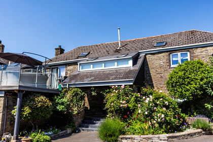
- Price
- Guide Price£650,000
Added on 25/03/2026Barn Conversion
- Price
- Guide Price£700,000
- Size
- 3.5 acres
Added on 25/04/2026Farmhouse