Longnor DERBYSHIRE
- Land size
- 2 acres
Key Features
- Individual Barn Conversion Opportunity with Land
- Huge Potential
- Full Planning Permission Granted
- Rural Yet Accessible Location
- Superb Views
- Private Entrance and Parking
- REF AR8700
- Might Well Suit Equestrian or Smallholding Use
- No Upward Chain
- Lifestyle Property
Description
A TRADITIONAL TWO STOREY BARN WITH PLANNING PERMISSION FOR CONVERSION TO A THREE BEDROOM DWELLING, SET IN APPROX. TWO ACRES AND IDEAL FOR SMALLHOLDING OR EQUESTRIAN USE, IN A STUNNING RURAL SETTING.
Traditional Two-Storey Stone Barn with Planning Consent to Create a Three Bedroom Dwelling
Just Under 2 Acres of Adjoining Paddock Grazing Land
Rare Peak District Development Opportunity in a Stunning Rural Setting
Ideal for Equestrian or Smallholding Use, with Excellent Access to Bridleways and Trails
Further Land May Be Available By Separate Negotiation (to Buy or Rent)
A traditional two storey barn with planning permission for conversion to a three bedroom dwelling, set in approx. two acres and ideal for smallholding or equestrian use, in a stunning rural setting.
An exciting opportunity to acquire a handsome, two-storey stone barn in a lovely countryside position, offered with planning permission to create an exceptional three-bedroom home. With just under two acres of adjoining grazing land and far-reaching views, Fawfield Barn lends itself perfectly to buyers seeking a lifestyle-led project, whether for equestrian interests, a smallholding, or simply space and privacy in one of the Peak District’s most admired settings.
Longnor is a sought-after Peak District village with a strong local community and everyday essentials close at hand, including a village shop, public house, church and primary school. Beyond the village, the surrounding landscape offers a superb network of footpaths, bridleways and cycle routes, ideal for those who want immediate access to the outdoors.
The popular market towns of Bakewell, Buxton and Leek are all within a short drive, providing an excellent range of shops, schools, supermarkets and medical facilities. Road links via the B5053 offer straightforward access towards Macclesfield, Sheffield, Derby and Manchester, while rail connections make London readily accessible.
Map Location
Property details
- Tenure
- Freehold
- Council Tax Band
- Ask Agent
- Date Posted
- 2026-05-11
Market Value Analysis
Compared with 998 Homes with Land listings in West Midlands (1+ acres).
Utilities & Restrictions
Utilities
- Electricity
- Ask Agent
- Water
- Ask Agent
- Heating
- Ask Agent
- Broadband
- Ask Agent
- Sewerage
- Ask Agent
Rights & Restrictions
- Public Rights of Way
- Ask Agent
- Private Rights of Way
- Ask Agent
- Listed Property
- Ask Agent
- Restrictions
- Ask Agent
Listed status, conservation areas and planning constraints for this location are in the full report.
Property Features
- Accessibility
- Ask Agent
- Parking
- Parking Available
- Garden
- Garden
Beyond the particulars: planning activity, flood history, heritage and ground risks, checked for this exact spot.
Connectivity
Broadband
Fastest speed available at this postcode
2 Gbps
Standard (10-30 Mbps)
Suitable for
- 4K streaming on every screen
- Full-time home working
- Online gaming & big downloads
Mobile signal
Outdoor predictions; indoor signal depends on building materials.
Ofcom Connected Nations postcode-level predictions. Speeds and signal are modelled, not measured, and vary between addresses and providers.
Signal is the easy part. Planning activity, flood history and protected designations here are in the full report.
Nearest Schools
Primary
- St Bartholomew's Church of England Primary School1.3 milesOfsted: Requires improvement
- Ages
- 2 to 11
- Pupils
- 20
- Type
- Academy converter
- Faith
- Church of England
- Manifold Church of England Primary School2.5 milesOfsted: Good
- Ages
- 3 to 11
- Pupils
- 38
- Type
- Academy converter
- Faith
- Church of England
- Hollinsclough Church of England Academy2.6 milesOfsted: Good
- Ages
- 3 to 11
- Pupils
- 34
- Type
- Academy converter
- Faith
- Church of England
- Earl Sterndale CofE Primary School2.6 milesNo Ofsted rating
- Ages
- 4 to 11
- Pupils
- 34
- Type
- Voluntary controlled school
- Faith
- Church of England
- Hartington CofE Primary School3.2 milesOfsted: Good
- Ages
- 4 to 11
- Pupils
- 22
- Type
- Voluntary controlled school
- Faith
- Church of England
Secondary
- Buxton Community School6.3 milesNo Ofsted rating
- Ages
- 11 to 18
- Pupils
- 954
- Type
- Academy converter
- Churnet View Middle School6.7 milesNo Ofsted rating
- Ages
- 9 to 13
- Pupils
- 440
- Type
- Academy converter
- Leek High School6.9 milesOfsted: Requires improvement
- Ages
- 13 to 18
- Pupils
- 261
- Type
- Academy converter
- St Thomas More Catholic Voluntary Academy7 milesOfsted: Good *
- Ages
- 11 to 16
- Pupils
- 407
- Type
- Academy converter
- Faith
- Roman Catholic
- St Edward's Church of England Academy8.1 milesOfsted: Good *
- Ages
- 9 to 13
- Pupils
- 662
- Type
- Academy converter
- Faith
- Church of England
* Latest graded judgement covers quality of education only; no overall grade was issued under the 2024-25 inspection framework.
Distances are straight-line from the advertised location. Source: the national school registers (DfE, Welsh Government, Scottish Government) and Ofsted.
Schools are just the start: sold prices nearby, planning activity and any flood history are in the full report.
Amenities
Supermarket
GP surgery
Pharmacy
Hospital
Straight-line distances from the advertised location. Sources: NHS records, Geolytix supermarket locations, OS Open Greenspace and the national trails registers.
The area stacks up? Now check the location itself: planning nearby, protected designations and past flooding.
Getting Around
Nearest station
Nearest bus stop
Typical drive times
Straight-line distances from the advertised location; drive times are typical free-flow times over OpenStreetMap road data, so allow more at peak. Public transport locations from DfT NaPTAN.
Easy to reach matters. So do planning activity, flood history and ground risks: all in the full report.
Flood Risk
From Environment Agency flood map open data, checked around the advertised map pin and allowing for the listed acreage where known. This summary comes from LandSale, the advertising platform, not from the listing agent, and is not part of the agent's particulars. Risk can vary across a single holding, so verify anything critical through your own searches before committing.
Rivers and the sea
Surface water
The detail behind these bandings
The full report pinpoints where this location sits on the flood maps, and runs the deeper checks that usually only surface after an offer.
- Exact flood zones & annual chances (included in the full report)
- Any recorded past flooding (included in the full report)
- Planning activity nearby (included in the full report)
- Heritage & conservation (included in the full report)
- Protected nature designations (included in the full report)
- Ground risks (included in the full report)
- Sold prices nearby (included in the full report)
£14.99 · one-off purchase
By LandSale, the platform. Not provided by the listing agent. Ready in about a minute.
Important notice: Information, maps and tags on this page are drawn from the advertising agent's marketing materials or generated automatically. LandSale has not verified them. Relying on these details is at your own risk, always carry out independent checks before committing to a purchase.
LandSale full disclaimer
Marketing information only - not formal particulars. The details on this website are provided for general guidance and do not constitute an offer or contract. Neither LandSale nor the advertising estate/land agent accepts responsibility for any inaccuracy.
1. Source of information
- Listing content: Core description, asking price, tenure, measurements, photographs and planning history originate from the marketing materials of the advertising estate or land agent. LandSale does not author this content and cannot guarantee its accuracy.
- Automated tags & categorisation: Property type, land-use class, acreage bands and similar labels may be applied by machine-learning models. They are intended as a helpful guide only and may not reflect the property's legal status or permitted use.
- Third-party & enriched data layers: Maps, boundary outlines, planning designations, soil reports, broadband coverage and other environmental or location-based insights are licensed from external suppliers. Such data are supplied “as is", may be incomplete or out of date and are subject to change without notice.
2. Verification required
Prospective purchasers must verify critical matters, including but not limited to planning permission, title boundaries, public rights of way, environmental constraints, acreage, services, access and VAT status, through their own inspections, specialist surveys, legal advisers and the selling agent before relying on the information or entering into any contract.
3. No warranty or liability
LandSale gives no warranty, express or implied, as to the accuracy, completeness or fitness for any particular purpose of the information displayed. LandSale shall not be liable for any loss, damage, cost or expense arising directly or indirectly from any use of or reliance on such information, save where liability may not be excluded by law.
4. Updates & feedback
If you believe any detail on this listing is inaccurate, please let us know. We will investigate and, where appropriate, update the listing or notify the agent.
© LandSale | Version 1.3 - August 2026
Listing agent
Rural Scene, Covering England, Wales and Scotland
Wiltshire SP4 8JJ
Similar properties for sale
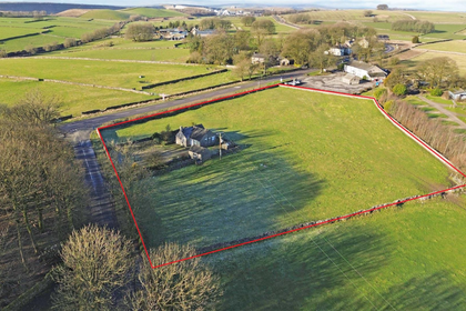
- Price
- Guide Price£325,000
- Size
- 2.08 acres
Woodside, Pomeroy, Buxton, SK17, Hartington Middle Quarter, Derbyshire SK17 England
Added on 21/07/2026Agricultural Land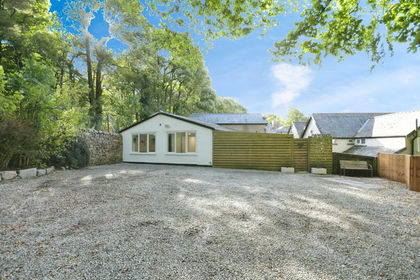
- Price
- Offers Over£390,000
- Size
- 1 acres
Added on 29/01/2026House with Land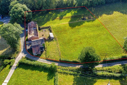
- Price
- Guide Price£350,000
- Size
- 1.37 acres
Dye House, Dye House Lane, Rushton Spencer, Rushton, Staffordshire SK11 England
Added on 26/02/2026Building Plot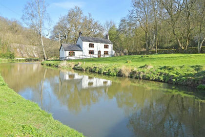
- Price
- Guide Price£425,000
- Size
- 1.81 acres
The White House, Consall Forge, Wetley Rocks, Stoke on Trent, Ipstones, Staffordshire ST9 England
Added on 29/01/2026Cottage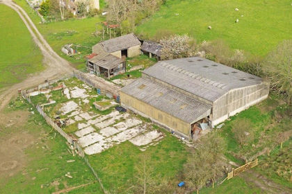
- Price
- Guide Price£285,000
- Size
- 1.22 acres
Meadow Barn, Brentwood Road, Bamford, Bamford, Derbyshire S33 England
Added on 20/05/2026Development Land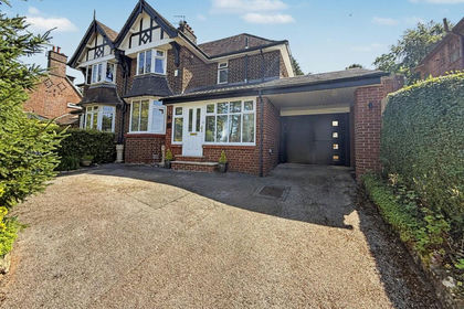
- Price
- £390,000
- Size
- 1.16 acres
Lightwood Road, Stoke-On-Trent, ST3, Stoke-on-Trent South, Stoke-on-Trent ST3 England
Added on 24/06/2026House with Land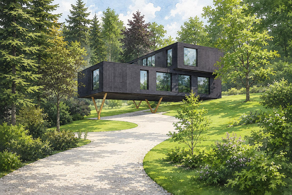
- Price
- Guide Price£450,000
- Size
- 1.25 acres
Building Plot, Windley, Belper, Derbyshire, Windley, Derbyshire DE56 England
Added on 06/06/2026Building Plot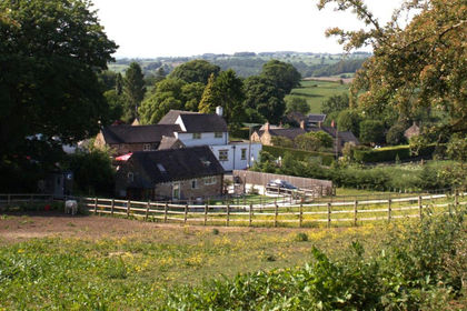
- Price
- £400,000
- Size
- 1.27 acres
Added on 05/08/2026Barn Conversion
- Price
- £295,000
- Size
- 1.13 acres
Hardstoft Road, Pilsley, Chesterfield, Pilsley, Derbyshire S45 England
Added on 21/08/2026House with Land
- Price
- Guide Price£375,000
- Size
- 3.22 acres
Uttoxeter Road, Blithbury, Rugeley, Mavesyn Ridware, Staffordshire WS15 England
Added on 12/06/2026Farmhouse