Halton Quay, St. Dominick, Saltash, Cornwall
- Land size
- 1 acres
- Bedrooms
- 4
- Bathrooms
- 3
Key Features
- Rare opportunity to acquire a special home in a exceptional riverside setting
- Viewing essential to appreciate the lifestyle on offer
- Countryside and waterside living at its best
Description
A truly wonderful opportunity to purchase an attached barn conversion idyllically set in a commanding position above the banks of the River Tamar, within grounds extending to around 1 acre that incorporates the reed bed. Offered for sale for the first time since it was lovingly converted by the current sellers in 1998, the property has no onward chain.
.
Offering a wealth of character and charm throughout, the split level accommodation has two internal staircases making it highly versatile with scope for self-contained living if required for multi-generational or income purposes. Features include a great deal of reclaimed timbers i.e. Elm and Mahogany, a granite fireplace housing a Fisher multi-fuel stove, ceiling beams, granite steps, deep window sills, and wooden latch doors. There are views over the property's grounds towards the river and there is a biomass (wood pellet) central heating system. There is an oversized garage/workshop with Wifi, WC & shower, plus ample parking and the grounds incorporate well stocked formal gardens and sweeping lawns. Steps, currently requiring some attention, lead down to a board walk and the river, perfect for sailing, keen canoeists, kayakers and paddleboarders alike. This property offers a remarkable opportunity for the next owner and viewing is strongly advised.
Accommodation
Double front doors open into the hallway, in turn there is an opening to the sitting room, rear lobby and two granite steps up to the kitchen/diner. Reclaimed Mahogany floor boards and ceiling beams.
Sitting Room
A triple aspect room with windows to the front and side, plus window looking through to the sun room. Views toward the river can be enjoyed from the side window. Floor to ceiling granite fireplace with Fisher log burner, ceiling beams, timber window lintels.
Kitchen/Diner/Utility Room
Bespoke cabinetry including reclaimed Iroko working surfaces and Elm ceiling beams. Room for a table and chairs. Built in double oven and grill, recess for refrigerator, plumbing for a dishwasher, induction hob with extractor hood over, walk-in pantry cupboard with shelving, twin stainless steel sink and drainer with mixer tap. Dual aspect with window to the rear and two windows to the front. Two steps rise with a door opening into the Utility Room.
Utility Room
Doors give external access out to the rear and front elevations. Work surface with Belfast sink, hot water cylinder with water softener unit to one side, built in hoover system unit, tiled flooring, space for upright appliance, plumbing for a washing machine. Stairs rise giving access to Bedroom 2 and a door opens into Bedroom 4/Study.
Bedroom 4/Study & En Suite Wet Room
A versatile dual aspect room, with a long fitted timber desk. Door to understairs cupboard housing the consumer unit, a step rises to a wet room with window to the rear, shower, tiled floor, wash basin.
Bedroom 2
Accessed via stairs rising from the utility room. A spacious light and airy dual aspect room with high level ceiling featuring exposed timber A frame, a range of built in wardrobes/storage and an en suite shower room comprising a mains shower, WC, tiled worksurface with inset wash basin, Mahogany flooring and window overlooking the rear garden.
Rear Hall, Rear Lobby & Sun/Dining Room
From the entrance a hall a door opens into a rear hall, having stairs that rise to the first floor landing, a door to a rear lobby with door giving external access out to the rear garden and step down into an impressive Sun Room being glazed to three aspects, enjoying views over parts of the rear garden and toward the river. The Sun Room houses the Extraflame bio mass heating system (24kw) providing heating and hot water, slate effect flooring.
First Floor Landing & Rooms
Doors off to a bathroom and bedrooms 1 and 3. Bedroom 1 is triple aspect with views toward the river and over the grounds, having a recess for storage. Bedroom 3 has a window to the front and view toward the river, a wash hand basin and partial reclaimed timber wall panelling.
Outside
Idyllically tucked away within a small cluster of properties, there is a parking space to the front elevation and a driveway leads across the side to a parking area for up to three to four cars and from here access can be gained to the rear formal gardens. These gardens are interspersed with a wide range of flowering shrubs and plants, there are river views, a shed and open fronted log store and rear access into the dwelling. A further drive leads down to the garage/workshop and opposite this is a lawned area with open fronted store. From this area, steps lead down to the jetty which takes you directly to the river. We understand that these steps, in part, are currently not passable and require attention. There is a large sweeping lawn providing a perfect vantage point to overlook the river. The garage/workshop is accessed via timber sliding door, there is WIFI, a WC and shower in one corner.
Halton Quay
Halton Quay has long served as a natural landing point on the Tamar. Historically, it was used for loading goods such as lime from nearby kilns, playing a small but vital role in local trade and agriculture. According to local tradition, Irish saints Dominica and Ildract are said to have landed here, adding a spiritual layer to its heritage. One of the most distinctive features is a small chapel perched above the stony beach. Originally an old building, it was converted into a chapel in the 20th century and remains a quiet place of reflection and charm. The quay is located on a picturesque bend of the Tamar, between Pentillie and Cotehele, both notable historic estates and perfect for those seeking a tranquil riverside escape. The setting is especially magical in the early mornings of late autumn, when mist and frost settle over the glassy river, and Pentillie Castle can sometimes be glimpsed through the trees on the opposite bank.
Directions
What3words: ///lives.confusion.pink
Material Information
EPC Rating - D Tenure - Freehold Local Authority - Cornwall Council Council Tax - Band E Services - Mains electricity. Private water and private drainage. The seller advises that for the last 30 years they have paid for the emptying of the septic tank every 2-4 years, while the neighbours have paid for the electricity to pump water up from the borehole. Heating: Bio mass (wood pellet) central heating. Fibre to property. The property is in the Halton conservation area, also mining and radon. Garage/workshop and gravelled parking area for up to three to four more vehicles. One separate parking space to the front. Long driveway for three cars. The property enjoys a right of way over a track in turn giving access to its own driveway. One property has right of way over South Chapel Barn's driveway. We have been advised by the sellers that a mooring could be available. A neighbouring property has right of access over part of the lower garden to access the steps leading down to the jetty.
Covenants
1. Not at any time to park permit to be parked any motor vehicle on the yard hatched yellow and green on the said plan or to use the same for vehicular access to either property except in the case of deliveries of heavy or bulky items. 2. Not to attach to the exterior of the property any radio television or other electronic aerial or device and further not to attach any other item or attachment which is not in keeping with the character of the property or of the area. 3. Not to do or permit to be done anything which may constitute an annoyance or nuisance to the owner of the property 4. Not to use the footpath coloured mauve or the land hatched red other than for the purpose of leisure and to contribute equally to the cost of maintaining the same. 5. To contribute equally to the cost of maintaining or repairing any jetty which is to be constructed in the river or river bank which forms part of or adjoins the Green land.
Map Location
Property details
- Tenure
- Freehold
- Council Tax Band
- E
- Date Posted
- 2026-05-01
Price history
| Date | Change | Price |
|---|---|---|
| 21 Sep 2026 | Reduced 3.4% (−£20,000) | £575,000 |
| Until 21 Sep 2026 | Asking price | £595,000 |
Market Value Analysis
Compared with 1,627 Homes with Land listings in South West England (1+ acres).
Energy Performance Certificate
View the official EPC certificate for detailed energy efficiency information.
View official EPC certificate ↗
Running costs are one side. Planning activity, flood history and ground risks for this location are in the full report.
Utilities & Restrictions
Utilities
- Electricity
- Ask Agent
- Water
- Ask Agent
- Heating
- Ask Agent
- Broadband
- Ask Agent
- Sewerage
- Ask Agent
Rights & Restrictions
- Public Rights of Way
- Ask Agent
- Private Rights of Way
- Ask Agent
- Listed Property
- Ask Agent
- Restrictions
- Ask Agent
Listed status, conservation areas and planning constraints for this location are in the full report.
Property Features
- Accessibility
- Ask Agent
- Parking
- Parking Available
- Garden
- Garden
Beyond the particulars: planning activity, flood history, heritage and ground risks, checked for this exact spot.
Connectivity
Broadband
Fastest speed available at this postcode
1.8 Gbps
Gigabit full fibre
Suitable for
- 4K streaming on every screen
- Full-time home working
- Online gaming & big downloads
Fixed wireless access may also be an option here.
Mobile signal
Predicted 4G and 5G signal; indoor signal depends on building materials.
Ofcom Connected Nations postcode-level predictions. Speeds and signal are modelled, not measured, and vary between addresses and providers.
Signal is the easy part. Planning activity, flood history and protected designations here are in the full report.
Nearest Schools
Primary
- St Dominic CofE Primary School1.4 milesOfsted: Outstanding *
- Ages
- 3 to 11
- Pupils
- 83
- Type
- Academy converter
- Faith
- Church of England
- Bere Alston Primary Academy1.8 milesOfsted: Good
- Ages
- 2 to 11
- Pupils
- 106
- Type
- Academy sponsor led
- St Mellion Church of England Primary School1.8 milesNo Ofsted rating
- Ages
- 3 to 11
- Pupils
- 33
- Type
- Academy converter
- Faith
- Church of England
- Calstock Community Primary School2.1 milesOfsted report card · Jan 2026
- Ages
- 2 to 11
- Pupils
- 60
- Type
- Community school
- Landulph School2.2 milesOfsted: Good
- Ages
- 4 to 11
- Pupils
- 58
- Type
- Academy converter
Secondary
- Callington Community College4.3 milesOfsted: Good
- Ages
- 11 to 18
- Pupils
- 887
- Type
- Academy converter
- Saltash Community School4.8 milesOfsted: Good *
- Ages
- 11 to 18
- Pupils
- 1,139
- Type
- Academy converter
- Marine Academy Plymouth5.1 milesOfsted: Good
- Ages
- 11 to 18
- Pupils
- 989
- Type
- Academy sponsor led
- Sir John Hunt Community Sports College5.3 milesOfsted: Good
- Ages
- 11 to 19
- Pupils
- 760
- Type
- Foundation school
- Notre Dame RC School5.7 milesOfsted report card · Feb 2026
- Ages
- 11 to 18
- Pupils
- 764
- Type
- Academy converter
- Faith
- Roman Catholic
- Gender
- Girls
* Latest graded judgement covers quality of education only; no overall grade was issued under the 2024-25 inspection framework.
Distances are straight-line from the advertised location. Source: the national school registers (DfE, Welsh Government, Scottish Government) and Ofsted.
Schools are just the start: sold prices nearby, planning activity and any flood history are in the full report.
Amenities
Supermarket
GP surgery
Pharmacy
Hospital
Straight-line distances from the advertised location. Sources: NHS records, Geolytix supermarket locations, OS Open Greenspace and the national trails registers.
The area stacks up? Now check the location itself: planning nearby, protected designations and past flooding.
Getting Around
Nearest station
Nearest bus stop
Typical drive times
Straight-line distances from the advertised location; drive times are typical free-flow times over OpenStreetMap road data, so allow more at peak. Public transport locations from DfT NaPTAN.
Easy to reach matters. So do planning activity, flood history and ground risks: all in the full report.
Flood Risk
Environment Agency open data, checked around the advertised map pin for the listed acreage. Long-term risk counts flood defences; the planning map's flood zones do not. Provided by LandSale, not the listing agent, and not part of the agent's particulars. Risk varies across a holding, so verify before committing.
Rivers and the sea
Planning map: Flood Zone 1.
Surface water
Not at the pin: mapped about 30 metres away.
These bandings are the summary. Where this location sits on the flood maps, plus planning activity, heritage and ground risks, is in the full report.
Important notice: Information, maps and tags on this page are drawn from the advertising agent's marketing materials or generated automatically. LandSale has not verified them. Relying on these details is at your own risk, always carry out independent checks before committing to a purchase.
LandSale full disclaimer
Marketing information only - not formal particulars. The details on this website are provided for general guidance and do not constitute an offer or contract. Neither LandSale nor the advertising estate/land agent accepts responsibility for any inaccuracy.
1. Source of information
- Listing content: Core description, asking price, tenure, measurements, photographs and planning history originate from the marketing materials of the advertising estate or land agent. LandSale does not author this content and cannot guarantee its accuracy.
- Automated tags & categorisation: Property type, land-use class, acreage bands and similar labels may be applied by machine-learning models. They are intended as a helpful guide only and may not reflect the property's legal status or permitted use.
- Third-party & enriched data layers: Maps, boundary outlines, planning designations, soil reports, broadband coverage and other environmental or location-based insights are licensed from external suppliers. Such data are supplied “as is", may be incomplete or out of date and are subject to change without notice.
2. Verification required
Prospective purchasers must verify critical matters, including but not limited to planning permission, title boundaries, public rights of way, environmental constraints, acreage, services, access and VAT status, through their own inspections, specialist surveys, legal advisers and the selling agent before relying on the information or entering into any contract.
3. No warranty or liability
LandSale gives no warranty, express or implied, as to the accuracy, completeness or fitness for any particular purpose of the information displayed. LandSale shall not be liable for any loss, damage, cost or expense arising directly or indirectly from any use of or reliance on such information, save where liability may not be excluded by law.
4. Updates & feedback
If you believe any detail on this listing is inaccurate, please let us know. We will investigate and, where appropriate, update the listing or notify the agent.
© LandSale | Version 1.3 - August 2026
Similar properties for sale
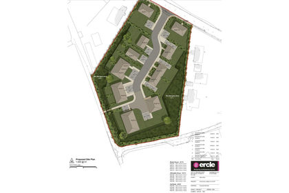
- Price
- Guide Price£510,000
St. Dominick, Saltash, Cornwall, PL12, St. Dominick, Cornwall PL12 England
Added on 08/08/2026Development Land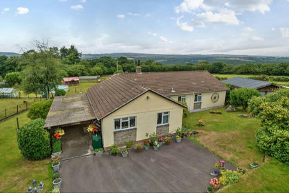
- Price
- £625,000
- Size
- 3.47 acres
Added on 02/07/2026House with Land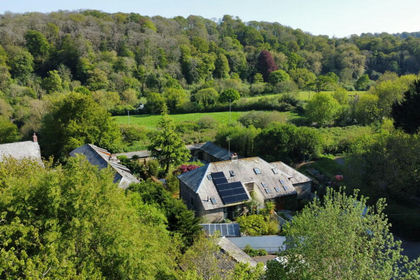
- Price
- Guide Price£475,000
The Barns, Quay Road, Tideford, St. Germans, Cornwall PL12 England
Added on 07/02/2026Barn Conversion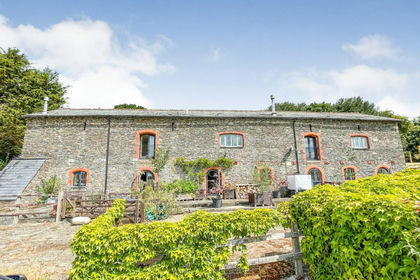
- Price
- Guide Price£700,000
Added on 16/08/2026Barn Conversion Added on 25/09/2026Barn Conversion
- Price
- Offers in Excess of£550,000
- Size
- 2 acres
Added on 29/01/2026Building Plot
- Price
- Guide Price£550,000
- Size
- 0.24 acres
Egypt, Callington, Cornwall, PL17, South Hill, Cornwall PL17 England
Added on 23/05/2026Barn Conversion
- Price
- Offers in Excess of£700,000
- Size
- 1.2 acres
Added on 15/05/2026Barn Conversion
- Price
- £715,000
- Size
- 5.9 acres
Attwood Lane, Pensilva, PL14, St. Cleer, Cornwall PL14 England
Added on 02/10/2026Equestrian property
- Price
- Guide Price£660,000
- Size
- 15.97 acres
Horningtops, Liskeard, Cornwall, PL14, Morval, Cornwall PL14 England
Added on 12/08/2026House with Land