Lot 2 - Tawny Barn, Kingsland, Leominster
- Land size
- 10.45 acres
Description
Lot 2 - Tawny Barn comprises a modern agricultural building and productive pastureland, in all extending to 10.45 acres.
Location - Tawny Barn is located a short distance from the village of Kingsland in North Herefordshire. The property lies approximately 1.5 miles to the north of Kingsland and 4.4 miles north west of the market town of Leominster. The cathedral city of Hereford is situated 17 miles south of Tawny Barn.
Description - Tawny Barn is an attractive smallholding in north Herefordshire extending to approximately 15.53 acres. Tawny Barn is situated to the west of the holding with a private tarmac drive and gated entrance with timber garaging to the rear, the holding is complemented by a modern agricultural building set to the south-east of Tawny Barn providing excellent amenity to the land and may be suitable for a variety of uses (subject to the necessary consents). The land is generally level and benefits from road frontage access onto the adjoining council-maintained road.
Lot 2 - Agricultural Barn & 10.45 Acres Of Land - Extending to approximately 10.45 acres of productive pastureland, the land is conveniently divided into four well-sized adjoining field parcels, all of which are stock-fenced and benefit from drinking troughs for livestock. The land is accessed via several gateways directly off a council-maintained road. The land is Grade 2 & 3 according to the Provisional Agricultural Land Classification.
The land is offered for sale together with a modern seven-bay steel portal-framed agricultural building, which is open-sided, with box-profile sheeting to three elevations. The barn may be suitable for alternative uses (subject to the necessary consents).
Steel Portal Frame Building - 37.89m x 6.36m (124'3" x 20'10") - With stone floor construction and a hardcore stone yard area to the front elevation, the building is enclosed on three sides, with concrete panel walls and box-profile sheeting above, beneath a sheeted roof. One bay is fully enclosed, incorporating concrete panel walls and a steel roller-shutter door to the front.
Planning - No formal planning searches have been undertaken on the land or buildings. Full details of the planning history can be found on the local authority website.
Planning Uplift - The agricultural barn in Lot 2 is sold with an overage clause in favour of the vendor for future alternative development outside of agricultural and equestrian use. The vendors will retain a 35% uplift in value of the building for alternative development on the grant of planning permission for a period of 25 years.
Mode Of Sale - Tawny Barn is being offered for sale as a whole or in two lots by private treaty. Prospective purchasers should carry out there own enquiries with Herefordshire Council and other authorities before making an offer.
Guide Price - Lot 1 - £595,000
Lot 2 - £225,000
As a whole offers in the region of £820,000
Energy Performance Certificate - Tawny Barn has an Energy Efficiency Rating of a D.
Council Tax Band - Tawny Barn is a band D for council tax.
Services - Tawny Barn is connected to mains water, telephone, electricity and foul drainage is to a bio-disc sewage treatment plan. If sold in Lots the respective lots will be sold with their own independent metered water supply. Lot 2 has a mains water supply which connects to a series of tanks.
Broadband - Standard Available. Estimated Broadband speeds: Download - 14 Mbps Uploads: 1 Mbps
Mobile signal/coverage Varying coverage available from the following providers: EE, O2, Three and Vodafone
Access - Each lot will be sold with its own right of access from the council maintained road, via the existing drive to tawny barn and by multiple gateways for Lot 2.
Tenure - Both lots will be sold with Vacant Possession upon completion.
Nitrate Vulnerable Zone / Flood Zone / Designation - None of the land is within Flood Zone 2 or 3.
The property is situated within a Nitrate Vulnerable Zone.
Basic Payment Scheme And Environmental Schemes - We are not aware of the land being entered into any environmental land management schemes.
Wayleaves, Easements & Rights Of Way - The property is sold subject to and with the benefit of all easements, quasi easements, wayleaves and rights of way both declared and not declared in these particulars. There are no public rights of way crossing any of land.
Sporting, Timber & Mineral Rights - All standing timber, mineral rights or any sporting rights, if owned, are included in the sale.
Boundaries & Fencing - The land is enclosed by post and wire fencing and mature hedgerows. If sold in two lots, the purchaser of Lot 2 will erect a stock proof fence along the points shown A, B, C shown on the plan included within these particulars within 1 month of completion. The Purchaser shall be deemed to have full knowledge of the boundaries, and neither the Vendors nor their Agents will be responsible for defining any ownership of boundaries, hedges or fences. They will, however, provide whatever assistance they can to ascertain the ownership of the same.
Local Authority & Public Utilities - Herefordshire County Council, Plough Lane, Hereford HR4 0LE,
Welsh Water, Fortran Road, St. Mellons, Cardiff CF3 0LT,
National Grid Electricity Distribution (West Midlands), Bristol, BS2 0TB
Viewing - Viewing strictly by appointment with the selling agent only.
Charlotte Watson on (Option 3) or c.
Health & Safety - Prospective Purchasers should take all necessary care when making an inspection including wearing suitable clothing. Viewings are taken solely at the risk of those who view and neither the Agents nor the owners of the property take responsibility for any injury however caused.
Agents Note - Any plans used in the preparation of these details may have been reduced in scale and any interested parties should check the Title Plan before proceeding to purchase.
Site Plans - The plans included in the sale particulars are for identification purposes only and may have been reduced in scale to assist with printing. Any interested parties should check the Title Plan before proceeding to purchase.
Important Notice - These particulars are set out as a guide only. They are intended to give a fair description of the property but may not be relied upon as a statement or representation of facts. These particulars are produced in good faith but are inevitably subjective and do not form part of any Contract. No persons within Sunderlands have any authority to make or give any representation or warranty whatsoever in relation to the property.
(a) The property is sold with all faults and defects (if any), whether in good condition or otherwise and neither the Vendors nor Sunderlands 1862 LLP, the Agents for the Vendors, shall be in any way responsible for such faults and defects, or for any statements contained in the particulars of the property prepared by the said Agents.
(b) The purchaser shall be deemed to acknowledge that he has not entered into a contract in reliance on any of the said statements that he has satisfied himself, as to the contents of each of the said statements by inspection or otherwise, and that no warranty or representation has been made by the Vendors or the said Agents in relation to, or in connection with the property.
(c) Any error, omission or misstatement in any of the said statements shall not entitle the purchaser to rescind or to be discharged from this contract, nor give either party any cause for action.
(d) All measurements and distances are approximate. The services have not been tested by the Agents. (The normal enquiry is carried out by the purchaser’s Solicitors and the type of inspection undertaken by a purchaser’s surveyor have not been carried out by the selling agents for the purchase or preparation of these particulars). Interested perspective purchasers are recommended to obtain an independent survey report on this property.
Map Location
Property details
- Tenure
- Freehold
- Council Tax Band
- Ask Agent
- Date Posted
- 2026-05-01
Market Value Analysis
Compared with 95 Farmland & Pasture listings in West Midlands (10+ acres).
Energy Performance Certificate
Energy Efficiency Rating
Based on UK Energy Performance Certificate standards (EU Directive 2002/91/EC)
Running costs are one side. Planning activity, flood history and ground risks for this location are in the full report.
Utilities & Restrictions
Utilities
- Electricity
- Ask Agent
- Water
- Ask Agent
- Heating
- Ask Agent
- Broadband
- Ask Agent
- Sewerage
- Ask Agent
Rights & Restrictions
- Public Rights of Way
- Ask Agent
- Private Rights of Way
- Ask Agent
- Listed Property
- Ask Agent
- Restrictions
- Ask Agent
Listed status, conservation areas and planning constraints for this location are in the full report.
Property Features
- Accessibility
- Ask Agent
- Parking
- Parking Available
- Garden
- Garden
Beyond the particulars: planning activity, flood history, heritage and ground risks, checked for this exact spot.
Connectivity
Broadband
Fastest speed available at this postcode
1.8 Gbps
Gigabit full fibre · available to 71% of premises
Suitable for
- 4K streaming on every screen
- Full-time home working
- Online gaming & big downloads
Mobile signal
Predicted 4G and 5G signal; indoor signal depends on building materials.
Ofcom Connected Nations postcode-level predictions. Speeds and signal are modelled, not measured, and vary between addresses and providers.
Signal is the easy part. Planning activity, flood history and protected designations here are in the full report.
Nearest Schools
Primary
- Kingsland CofE School1.2 milesOfsted: Good
- Ages
- 5 to 11
- Pupils
- 155
- Type
- Voluntary aided school
- Faith
- Church of England
- Luston Primary School2.6 milesNo Ofsted rating
- Ages
- 4 to 11
- Pupils
- 94
- Type
- Community school
- Shobdon Primary School2.8 milesOfsted: Good
- Ages
- 5 to 11
- Pupils
- 74
- Type
- Community school
- Wigmore Primary School3.9 milesNo Ofsted rating
- Ages
- 2 to 11
- Pupils
- 169
- Type
- Academy converter
- Orleton CofE Primary School4.3 milesNo Ofsted rating
- Ages
- 5 to 11
- Pupils
- 175
- Type
- Voluntary controlled school
- Faith
- Church of England
Secondary
- Wigmore School3.9 milesNo Ofsted rating
- Ages
- 11 to 19
- Pupils
- 467
- Type
- Academy converter
- Earl Mortimer College4.5 milesOfsted: Good
- Ages
- 11 to 16
- Pupils
- 502
- Type
- Community school
- Weobley High School7.8 milesNo Ofsted rating
- Ages
- 11 to 16
- Pupils
- 533
- Type
- Community school
- Ludlow Church of England School8.7 milesOfsted: Requires improvement *
- Ages
- 11 to 16
- Pupils
- 626
- Type
- Academy converter
- Faith
- Church of England
- Tenbury High Ormiston Academy9.7 milesOfsted: Good
- Ages
- 11 to 16
- Pupils
- 453
- Type
- Academy sponsor led
* Latest graded judgement covers quality of education only; no overall grade was issued under the 2024-25 inspection framework.
Distances are straight-line from the advertised location. Source: the national school registers (DfE, Welsh Government, Scottish Government) and Ofsted.
Schools are just the start: sold prices nearby, planning activity and any flood history are in the full report.
Amenities
Supermarket
GP surgery
Pharmacy
Hospital
Straight-line distances from the advertised location. Sources: NHS records, Geolytix supermarket locations, OS Open Greenspace and the national trails registers.
The area stacks up? Now check the location itself: planning nearby, protected designations and past flooding.
Getting Around
Nearest station
Nearest bus stop
Typical drive times
Straight-line distances from the advertised location; drive times are typical free-flow times over OpenStreetMap road data, so allow more at peak. Public transport locations from DfT NaPTAN.
Easy to reach matters. So do planning activity, flood history and ground risks: all in the full report.
Flood Risk
Environment Agency open data, checked around the advertised map pin for the listed acreage. Long-term risk counts flood defences; the planning map's flood zones do not. Provided by LandSale, not the listing agent, and not part of the agent's particulars. Risk varies across a holding, so verify before committing.
Rivers and the sea
Planning map: Flood Zone 1.
Surface water
Not at the pin: mapped about 30 metres away.
These bandings are the summary. Where this location sits on the flood maps, plus planning activity, heritage and ground risks, is in the full report.
Important notice: Information, maps and tags on this page are drawn from the advertising agent's marketing materials or generated automatically. LandSale has not verified them. Relying on these details is at your own risk, always carry out independent checks before committing to a purchase.
LandSale full disclaimer
Marketing information only - not formal particulars. The details on this website are provided for general guidance and do not constitute an offer or contract. Neither LandSale nor the advertising estate/land agent accepts responsibility for any inaccuracy.
1. Source of information
- Listing content: Core description, asking price, tenure, measurements, photographs and planning history originate from the marketing materials of the advertising estate or land agent. LandSale does not author this content and cannot guarantee its accuracy.
- Automated tags & categorisation: Property type, land-use class, acreage bands and similar labels may be applied by machine-learning models. They are intended as a helpful guide only and may not reflect the property's legal status or permitted use.
- Third-party & enriched data layers: Maps, boundary outlines, planning designations, soil reports, broadband coverage and other environmental or location-based insights are licensed from external suppliers. Such data are supplied “as is", may be incomplete or out of date and are subject to change without notice.
2. Verification required
Prospective purchasers must verify critical matters, including but not limited to planning permission, title boundaries, public rights of way, environmental constraints, acreage, services, access and VAT status, through their own inspections, specialist surveys, legal advisers and the selling agent before relying on the information or entering into any contract.
3. No warranty or liability
LandSale gives no warranty, express or implied, as to the accuracy, completeness or fitness for any particular purpose of the information displayed. LandSale shall not be liable for any loss, damage, cost or expense arising directly or indirectly from any use of or reliance on such information, save where liability may not be excluded by law.
4. Updates & feedback
If you believe any detail on this listing is inaccurate, please let us know. We will investigate and, where appropriate, update the listing or notify the agent.
© LandSale | Version 1.3 - August 2026
Listing agent
Sunderlands, HerefordOffa House, St. Peters Square, Hereford, HR1 2PQ
View agent profileSimilar properties for sale
- Price
- Guide Price£200,000
- Size
- 22.16 acres
Marston Stannett, Risbury, Humber, Herefordshire, County of HR6 England
Added on 21/05/2026Grazing Land
- Price
- £250,000
- Size
- 25.77 acres
Cold Weston, Craven Arms, Clee St. Margaret, Shropshire SY7 England
Added on 04/09/2026Agricultural Land
- Price
- Offers in Excess of£250,000
- Size
- 26 acres
Added on 29/01/2026Pasture
- Price
- £250,000
- Size
- 14 acres
Hay-On-Wye, Hereford, Cusop, Herefordshire, County of HR3 England
Added on 02/10/2026Agricultural Land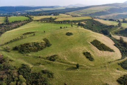
- Price
- Offers in Region of£275,000
- Size
- 41.92 acres
Land at Meadowtown, Shrewsbury, Worthen with Shelve, Shropshire SY5 England
Added on 29/01/2026Grazing Land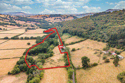
- Price
- Guide Price£200,000
- Size
- 16.3 acres
The Coed Lot 2, Cwmyoy, Abergavenny, Monmouthshire, NP7, Crucorney, Monmouthshire NP7 Wales
Added on 11/09/2026Undeveloped Land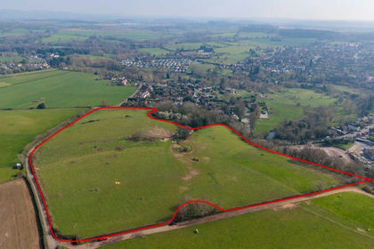
- Price
- Guide Price£225,000
- Size
- 12.55 acres
Added on 18/07/2026Vacant Land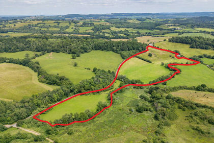
- Price
- Guide Price£245,000
- Size
- 25.88 acres
Land at The Onen, Talycoed, Monmouth, Monmouthshire, NP25, Whitecastle, Monmouthshire NP25 Wales
Added on 04/07/2026Agricultural Land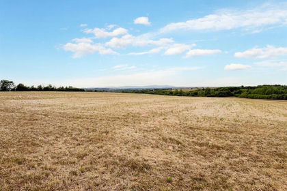
- Price
- Offers in Region of£200,000
- Size
- 15.68 acres
Hill, Throckmorton Road, Pershore, Hill and Moor, Worcestershire WR10 England
Added on 03/08/2026Agricultural Land
- Price
- Guide Price£190,000
- Size
- 16.39 acres
Land known as Bron Fedw, Meifod, SY22, Meifod, Powys SY22 Wales
Added on 22/04/2026Agricultural Land