Historic, buildings, 5 acres., Whatley, Frome, BA11
- Land size
- 5 acres
- Bedrooms
- 4
- Bathrooms
- 1
Key Features
- Historic Grade II* Listed farmhouse with exceptional period character, plus Grade II Listed outbuildings and a remarkable Grade I Listed Tudor gatehouse.
- Set in 5 acres, including formal gardens, former orchard, vegetable garden, and two adjoining paddocks (approx. 3.26 acres combined).
- A rare restoration and development opportunity, offering huge potential to restore reconfigure the main house and develop the outbuildings (subject to consents).
- Approached through the exceptional Tudor Gatehouse with decorative archway and historic timber features.
- Attached large 18th century two storey outbuilding, formerly stable/dairy/wash house, ideal for future incorporation into the main accommodation.
- Beautiful double height stone entrance porch leading into an atmospheric reception hall with original architectural details.
- Four bedrooms and generous ground floor living spaces featuring stone mullion windows, period fireplaces, and original built-in cupboards.
- Impressive, large, early 19th century former threshing barn with potential for alternative uses, alongside more modern agricultural buildings.
- Situated in the peaceful hamlet of Whatley, adjoining the church, just outside Frome, recently voted one of the best towns in England to live and close to Mells and Nunney.
- Excellent access to Bath, Bristol, the Mendip Hills, and key transport routes including M4, M5, A303, plus nearby stations at Frome, Westbury and Warminster.
Description
Steeped in history, an attractive Grade II* Listed farmhouse together with Grade II Listed outbuildings and a Tudor Grade I Listed Gatehouse sit in grounds of over 5 acres.
The house and period buildings are in need of a comprehensive scheme of renovation and there are some more modern buildings and two paddocks totalling just over 3 acres.
The property is approached via the farm buildings and through the Gatehouse. A double height stone entrance porch with parapet over leads to into the entrance hall. From here stairs rise to the first floor and doors lead to the downstairs accommodation. The drawing room enjoys a double aspect with stone mullion windows to the front and rear, a tiled period fireplace and a built in cupboard. The sitting room also enjoys a dual aspect, stone mullion windows, period fireplace and picture rail. The kitchen/breakfast room has a cream Rayburn inset into a wooden mantel and some period built in cupboards. There is a under stairs pantry and utility area, a scullery and secondary staircase leading to the first floor. A covered walkway links the farmhouse to some further outbuildings that would have once been a wash house and store rooms with flagstone floors. From the main staircase there is a half landing leading to bedroom one. A large double room with stone mullion window. Bedroom two has a stone mullion window with built in cupboards either side of the chimney breast. Bedroom three is a walk through room with stone mullion window and built in cupboard. Bedroom four has a stone mullion window overlooking the church. The family bathroom is located on a half landing on the rear staircase. There is an airing cupboard, hot water tank wash hand basin and bath. There is a separate WC.
Outside
Attached to the house with access via a covered walkway a Grade II Listed outbuilding dates to the 18th century and was once thought to provide a stable, dairy and wash house. This building is two storey and could, subject to consent, be incorporated into the living space and retains mullion windows, flagstone floors, oven and plenty a character. The approach to the farmhouse is through a splendid two storey Grade I Listed Gatehouse with decorative Tudor archway. There is a fireplace and decorative timbers, the staircase and first floor are now unsafe and can only safely be viewed from the ground floor.
The gardens are to the front and rear of the house and have a former vegetable garden and orchard.
A large early nineteenth century barn (approx.31m x10m) with lean to stores and hipped vehicular entrances is currently used for storage of hay and straw but has potential, subject to consent, for alternative uses. There are some more recent steel famed agricultural buildings and covered yard areas.
The land
There are two paddocks of 1 and 2.26 acres that adjoin to the side of the house.
Location
Whatley is a small hamlet a couple of miles southwest of Frome. The larger adjoining villages of Mells and Nunney both benefit from a village shop, primary school, pub, village hall, playground and outstanding countryside walks. Frome, a thriving arts and cultural centre, was recently voted the best town in England to live with a vibrant Café culture. The city of Bath and its University are within easy commuting distance as is Bristol. The Mendip Hills provide a variety of leisure pursuits with horse riding, hunting, walking, cycling, diving and dry ski slopes all in the vicinity. Bath and Bristol are all within easy commuting distance. Bristol Airport, the A303(M3), M4 and M5 are all within easy reach.
Agents Notes
1. A public footpath crosses from a gate from the church along the garden wall and through the field gate diagonally across the paddock.
2. The buildings and yards shown hatched purple on the plan are being retained by one of the vendors. These currently have access from the property that is for sale but in future this will cease, and access will be taken from the land to the north.
3. Users of the church have a right to use the area hatched green on the plan for access to the church and for parking provided access to Manor is not obstructed. 5.The small timber field shelter is not included in the sale.
Health & safety. The site is a working farm. Potential purchasers are therefore required to take particular care when inspecting the property, bearing in mind especially the risk of moving machinery, and the presence of livestock, especially in and around the farm buildings. Potential purchasers are requested to wear suitable robust footwear for viewings and are advised to be conscious of potentially uneven and slippery surfaces.
equestrian-property, land-property, farm-property
Map Location
Property details
- Tenure
- Ask Agent
- Council Tax Band
- G
- Date Posted
- 2026-04-02
Market Value Analysis
Compared with 56 Development Land listings in South West England (5+ acres).
Energy Performance Certificate
Energy Efficiency Rating
Based on UK Energy Performance Certificate standards (EU Directive 2002/91/EC)
Running costs are one side. Planning activity, flood history and ground risks for this location are in the full report.
Utilities & Restrictions
Utilities
- Electricity
- Ask Agent
- Water
- Ask Agent
- Heating
- Ask Agent
- Broadband
- Ask Agent
- Sewerage
- Ask Agent
Rights & Restrictions
- Public Rights of Way
- Ask Agent
- Private Rights of Way
- Ask Agent
- Listed Property
- Ask Agent
- Restrictions
- Ask Agent
Listed status, conservation areas and planning constraints for this location are in the full report.
Property Features
- Accessibility
- Ask Agent
- Parking
- Parking Available
- Garden
- Garden
Beyond the particulars: planning activity, flood history, heritage and ground risks, checked for this exact spot.
Connectivity
Broadband
Fastest speed available at this postcode
10 Mbps
Standard (10-30 Mbps)
Suitable for
- Web & social
- Music streaming
- Standard video calls
Mobile signal
Predicted 4G and 5G signal; indoor signal depends on building materials.
Ofcom Connected Nations postcode-level predictions. Speeds and signal are modelled, not measured, and vary between addresses and providers.
Signal is the easy part. Planning activity, flood history and protected designations here are in the full report.
Nearest Schools
Primary
- Mells Church First School1 mileNo Ofsted rating
- Ages
- 5 to 9
- Pupils
- 51
- Type
- Academy converter
- Faith
- Church of England
- Nunney First School1.5 milesNo Ofsted rating
- Ages
- 4 to 9
- Pupils
- 76
- Type
- Academy sponsor led
- Trinity Church of England First School1.9 milesNo Ofsted rating
- Ages
- 5 to 9
- Pupils
- 297
- Type
- Academy converter
- Faith
- Church of England
- Avanti Park School2.5 milesOfsted: Good
- Ages
- 4 to 13
- Pupils
- 503
- Type
- Free schools
- Leigh On Mendip School2.5 milesOfsted: Good
- Ages
- 2 to 11
- Pupils
- 105
- Type
- Academy converter
Secondary
- Oakfield Academy2 milesOfsted: Requires improvement
- Ages
- 9 to 13
- Pupils
- 490
- Type
- Academy converter
- Frome Community College3.3 milesNo Ofsted rating
- Ages
- 13 to 18
- Pupils
- 1,298
- Type
- Academy converter
- Selwood Academy3.4 milesOfsted: Good
- Ages
- 9 to 13
- Pupils
- 658
- Type
- Academy converter
- Faith
- Church of England/Methodist
- Somerset Studio School4.6 milesNo Ofsted rating
- Ages
- 14 to 19
- Pupils
- 152
- Type
- Studio schools
- Writhlington School4.6 milesOfsted: Good
- Ages
- 11 to 18
- Pupils
- 894
- Type
- Academy converter
Distances are straight-line from the advertised location. Source: the national school registers (DfE, Welsh Government, Scottish Government) and Ofsted.
Schools are just the start: sold prices nearby, planning activity and any flood history are in the full report.
Amenities
Supermarket
GP surgery
Pharmacy
Hospital
Green space
Straight-line distances from the advertised location. Sources: NHS records, Geolytix supermarket locations, OS Open Greenspace and the national trails registers.
The area stacks up? Now check the location itself: planning nearby, protected designations and past flooding.
Getting Around
Nearest station
Nearest bus stop
Typical drive times
Straight-line distances from the advertised location; drive times are typical free-flow times over OpenStreetMap road data, so allow more at peak. Public transport locations from DfT NaPTAN.
Easy to reach matters. So do planning activity, flood history and ground risks: all in the full report.
Flood Risk
Environment Agency open data, checked around the advertised map pin for the listed acreage. Long-term risk counts flood defences; the planning map's flood zones do not. Provided by LandSale, not the listing agent, and not part of the agent's particulars. Risk varies across a holding, so verify before committing.
Rivers and the sea
Planning map: Flood Zone 1.
Surface water
These bandings are the summary. Where this location sits on the flood maps, plus planning activity, heritage and ground risks, is in the full report.
Important notice: Information, maps and tags on this page are drawn from the advertising agent's marketing materials or generated automatically. LandSale has not verified them. Relying on these details is at your own risk, always carry out independent checks before committing to a purchase.
LandSale full disclaimer
Marketing information only - not formal particulars. The details on this website are provided for general guidance and do not constitute an offer or contract. Neither LandSale nor the advertising estate/land agent accepts responsibility for any inaccuracy.
1. Source of information
- Listing content: Core description, asking price, tenure, measurements, photographs and planning history originate from the marketing materials of the advertising estate or land agent. LandSale does not author this content and cannot guarantee its accuracy.
- Automated tags & categorisation: Property type, land-use class, acreage bands and similar labels may be applied by machine-learning models. They are intended as a helpful guide only and may not reflect the property's legal status or permitted use.
- Third-party & enriched data layers: Maps, boundary outlines, planning designations, soil reports, broadband coverage and other environmental or location-based insights are licensed from external suppliers. Such data are supplied “as is", may be incomplete or out of date and are subject to change without notice.
2. Verification required
Prospective purchasers must verify critical matters, including but not limited to planning permission, title boundaries, public rights of way, environmental constraints, acreage, services, access and VAT status, through their own inspections, specialist surveys, legal advisers and the selling agent before relying on the information or entering into any contract.
3. No warranty or liability
LandSale gives no warranty, express or implied, as to the accuracy, completeness or fitness for any particular purpose of the information displayed. LandSale shall not be liable for any loss, damage, cost or expense arising directly or indirectly from any use of or reliance on such information, save where liability may not be excluded by law.
4. Updates & feedback
If you believe any detail on this listing is inaccurate, please let us know. We will investigate and, where appropriate, update the listing or notify the agent.
© LandSale | Version 1.3 - August 2026
Similar properties for sale
- Price
- Guide Price£1,000,000
Goatacre, North Lyneham, Wiltshire, SN11, Hilmarton, Wiltshire SN11 England
Added on 29/01/2026Farm
- Price
- Guide Price£675,000
- Size
- 44.1 acres
Llwyn-y-Celyn Farm Lot 3, Shirenewton, Chepstow, NP16, Shirenewton, Monmouthshire NP16 Wales
Added on 29/01/2026Farm
- Price
- Guide Price£1,100,000
- Size
- 97.25 acres
Llwyn-y-Celyn Farm Lot 2, Shirenewton, Chepstow, NP16, Shirenewton, Monmouthshire NP16 Wales
Added on 29/01/2026Dairy Farm
- Price
- Offers in Region of£750,000
- Size
- 67.71 acres
Newchurch, Chepstow, Monmouthshire, NP16, Devauden, Monmouthshire NP16 Wales
Added on 29/01/2026Farm
- Price
- £1,500,000
- Size
- 228 acres
Llanfoist, Abergavenny., Llanfoist Fawr, Monmouthshire NP7 Wales
Added on 11/05/2026Farmland
- Price
- Guide Price£980,000
- Size
- 97.64 acres
Added on 15/10/2026Farmland
- Price
- Guide Price£1,400,000
- Size
- 119.37 acres
Gorse Hill Farm, Clifton-upon-Teme WR6, Tedstone Delamere, Herefordshire, County of WR6 England
Added on 29/01/2026Farm
- Price
- Offers in Excess of£925,000
- Size
- 148.59 acres
Added on 22/06/2026Farmland
- Price
- Guide Price£900,000
- Size
- 2.42 acres
Dial Post - development opportunity, Shipley, West Sussex RH13 England
Added on 07/10/2026Development Land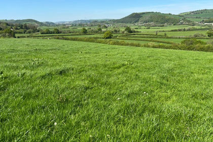
- Price
- Offers in Region of£1,200,000
- Size
- 135 acres
Capel Dewi, Carmarthen, SA32, Llanarthney, Carmarthenshire SA32 Wales
Added on 29/01/2026Farmland