Nyland, Cheddar, Somerset, BS27
- Land size
- 5.25 acres
- Bedrooms
- 6
- Bathrooms
- 1
Key Features
- A commanding, freehold, detached country property
- Exceptional potential to create a commanding, six bedroom, family home, presented over three storeys
- In need of renovation and refurbishment, with some works to the main property already carried out including windows, structural works, roof with solar panels, newly instated floor levels and drainage
- Occupying a privileged rural, Somerset setting, perched on the side of the iconic landmark of Nyland, enjoying tremendous views across open countryside and Mendip Hills beyond
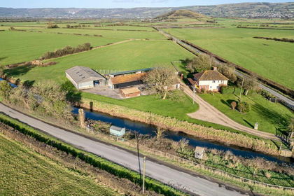
- An extensive range of characterful, stone outbuildings, benefitting from planning permission to develop two further residential properties 17/21/00108
- Surrounding the property are two enclosed parcels of sloping agricultural land, presented over circa 5.25 acres with a separate access along the road frontage next to the entrance driveway
- EPC Rating G1. Council Tax Band E. Freehold Tenure.
Description
Nestled in the sought after rural heart of Somerset, this commanding freehold detached property offers an exceptional opportunity for those seeking a project with tremendous potential. Set on the side of the iconic Nyland Hill, the property enjoys outstanding, far reaching views over the picturesque Mendip Hills and surrounding countryside, providing a tranquil and private retreat in a truly enviable location.
The main residence which spans three storeys, offers the scope to create a substantial six bedroom family home. While requiring renovation and refurbishment throughout, some essential works have already been completed, including the installation of new windows, structural enhancements, roof improvements with solar panels, newly laid floor levels, and updated drainage systems.
Complementing the main house, an extensive range of characterful stone outbuildings offers further potential. These outbuildings benefit from planning permission to develop two additional residential properties 17/21/00108, making them ideal for investment, extension or reimagining to suit various needs.
The surrounding land extends to two enclosed parcels of sloping agricultural land, totalling circa 5.25 acres. These lands are accessible via a separate access point from the road frontage, offering both privacy and convenience.
Located in the picturesque village of Nyland, within close proximity to Cheddar, this property is ideally situated for those seeking a rural lifestyle without compromising on accessibility. Whether for personal use or as an investment opportunity, the scope and appeal of this property are undeniable.
This scenic location offers a blend of tranquility while still being well connected to surrounding areas. It is situated just off the A371, which provides easy access to Cheddar, a town just a few miles away. Cheddar itself is well connected to larger towns such as Wells and Weston super Mare, and the M5 motorway is around a 20 minute drive away, offering convenient routes to Bristol and other South West cities.
In terms of public transport, the closest railway station is in Cheddar, about 2.5 miles from the farm, providing access to rail services linking to Bristol and beyond. For broader travel options, the larger station in Weston super Mare, located around 12 miles away, offers direct rail connections to Bristol, Cardiff and London. Local bus services are available in the area with stops in Nyland, connecting residents to surrounding villages and towns.
Cheddar town itself provides a range of amenities, including shops, supermarkets, independent retailers, cafés, and restaurants. It also offers essential services such as a medical center, dental practices and primary schools. Cheddar is also home to the famous Cheddar Gorge, which draws tourists and provides a scenic backdrop to the area.
For cycling enthusiasts, Decoy Pool Farm benefits from its proximity to several attractive cycling routes. The nearby Cheddar Reservoir is a popular spot for cycling, offering routes around the water. For those seeking more challenging terrain, the Mendip Hills provide a variety of off road trails and mountain biking routes.
Additionally, the National Cycle Network Route 3, connecting Bristol to the southwest, runs close to the area, providing further scenic cycling opportunities.
Outdoor activities abound in the vicinity, with the Mendip Hills Area of Outstanding Natural Beauty (AONB) right on the doorstep. This stunning area offers a wealth of walking, hiking, and outdoor exploration opportunities with its renowned caves, diverse wildlife and panoramic views attracting many nature lovers.
In summary, Decoy Pool Farm in Nyland, Cheddar, offers a perfect balance of rural charm and convenient access to transport, amenities, and recreational activities. The location is well served by road and public transport, with Cheddar providing essential services, while the nearby countryside offers endless outdoor opportunities for cycling, hiking and exploring.
EPC Rating G1. Council Tax Band E. Freehold Tenure.
Driveway and Entrance
As you approach the property from the public highway, there is a gated entrance with stone walling and pillars, leading you into the property with a gravelled driveway providing ample off-street parking.
Main Residence
Ground Floor
Entrance
To the rear of the property, there is a courtyard area laid to concrete leading to a UPVC double glazed door into the property. The ground floor in the main residence benefits from an open plan layout with various UPVC double glazed windows and sash windows, enjoying the wonderful outlook. Please refer to the floor plans for a clearer understanding. A temporary timber staircase has been fitted to access the first floor.
First Floor
On the first floor, most of the internal timber stud work has been carried out and insulation to the outer walls with various UPVC double glazed sash windows. The current layout suggests that you could create four bedrooms and one bathroom on the first floor. The current owners have retained some characterful features including exposed stonewalling and one bedroom benefiting from a fantastic vaulted ceiling with exposed timber beam features. A temporary timber staircase rising from the first floor landing to the second floor landing.
Second Floor
The second floor is currently presented as two further bedrooms, both with en-suite with various UPVC double glazed windows, skylight windows, internal stud timber works have been completed and partly insulated on the roof and outer walls. The main property has been partly renovated, including windows, structural works, roof with solar panels, newly instated floor levels and drainage. Planning permission was approved for the extension of the second floor. The vendor tells us that all building works to the current stage have building regulation approval.
Outbuildings
A fantastic arrangement of characterful and charming stone outbuildings, currently benefitting from granted planning permission to develop into two residential properties, however would suit a variety of alternative uses (subject to planning permission) if desired.
Outbuilding One (next to entrance)
16’0” x 24’1” – 4.88 x 7.34 m & 16’0” x 35’2” – 4.89 x 10.74 m
Outbuilding Two (next to property)
8’5” x 20’3” – 2.58 x 6.18 m
Outbuilding Three (within the courtyard)
42’10” x 12’0” – 13.07 x 3.68 m
Outbuilding Four (positioned on the hillside within the agricultural land)
19’8” x 14’0” – 6.01 x 4.28 m & 19’10” x 9’7” – 6.05 x 2.93 m
Outbuilding Five (to the rear of the courtyard)
16’0” x 19’10” – 4.89 x 6.05 m 14’10” x 12’11” – 4.54 x 3.96 m & 15’0” x 9’11” – 4.58 x 3.03 m
Former Dairy Barns (running adjacent to the road)
14’11” x 14’5” – 4.56 x 4.41 m 15’9” x 17’4” – 4.82 x 5.30 m & 15’1” x 11’1” – 4.61 x 3.38 m 10’9” x 82’6” – 3.29 x 19.06 m & 10’0” x 47’9” – 3.07 x 14.56 m 14’11” x 14’4” – 4.55 x 4.39 m
Courtyard
To the rear of the property are various courtyard areas divided by a mix of stone walling and fencing.
Secondary Access
Secondary access is also provided to the rear of the courtyard, the property is sold with a strip of land running alongside the end of the diary barn, however, please note there is a right of access permitted over the neighbouring entrance. Please refer to ProMap for more details.
Agricultural Land
Surrounding the property are two enclosed parcels of sloping agricultural land presented over circa 5.25 acres. There is a separate access along the road frontage next to the entrance driveway.
Services
Electric
The property is served by one mains electric supply and is metered.
Water
The property is served by two water supplies, both metered.
Gas
There is no gas or heating to the property.
Sewerage
Please note, there is a septic tank within the grounds to the front of the property. This then discharges into the rhyne on the other side of the road. It is our understanding that this is not compliant and buyers must consider this when purchasing.
Solar PV Panels
These have been installed on the roof.
Tenure
Freehold.
Title Number
ST339967.
Planning Permission Reference
17/21/00108
Virtual Tour Link
Map Location
Property details
- Tenure
- Freehold
- Council Tax Band
- G
- Date Posted
- 2026-04-02
Market Value Analysis
Compared with 507 Homes with Land listings in South West England (5+ acres).
Energy Performance Certificate
Energy Efficiency Rating
Based on UK Energy Performance Certificate standards (EU Directive 2002/91/EC)
Running costs are one side. Planning activity, flood history and ground risks for this location are in the full report.
Utilities & Restrictions
Utilities
- Electricity
- Ask Agent
- Water
- Ask Agent
- Heating
- Ask Agent
- Broadband
- Ask Agent
- Sewerage
- Ask Agent
Rights & Restrictions
- Public Rights of Way
- Ask Agent
- Private Rights of Way
- Ask Agent
- Listed Property
- Ask Agent
- Restrictions
- Ask Agent
Listed status, conservation areas and planning constraints for this location are in the full report.
Property Features
- Accessibility
- Ask Agent
- Parking
- Parking Available
- Garden
- Garden
Beyond the particulars: planning activity, flood history, heritage and ground risks, checked for this exact spot.
Connectivity
Broadband
Fastest speed available at this postcode
80 Mbps
Superfast · available to 21% of premises
Suitable for
- HD streaming
- Video calls
- Web & social
Mobile signal
Outdoor predictions; indoor signal depends on building materials.
Ofcom Connected Nations postcode-level predictions. Speeds and signal are modelled, not measured, and vary between addresses and providers.
Signal is the easy part. Planning activity, flood history and protected designations here are in the full report.
Nearest Schools
Primary
- Draycott & Rodney Stoke Church of England First School1 mileNo Ofsted rating
- Ages
- 2 to 9
- Pupils
- 70
- Type
- Academy converter
- Faith
- Church of England
- Cheddar First School1.8 milesOfsted: Good *
- Ages
- 2 to 9
- Pupils
- 358
- Type
- Academy converter
- St Lawrence's CofE Primary School2.7 milesOfsted: Good
- Ages
- 4 to 11
- Pupils
- 55
- Type
- Voluntary controlled school
- Faith
- Church of England
- Wedmore First School Academy2.8 milesOfsted: Requires improvement *
- Ages
- 2 to 9
- Pupils
- 193
- Type
- Academy converter
- Axbridge Church of England First School Academy3 milesOfsted: Good
- Ages
- 2 to 9
- Pupils
- 177
- Type
- Academy converter
- Faith
- Church of England
Secondary
- The Kings of Wessex Academy1.6 milesNo Ofsted rating
- Ages
- 13 to 18
- Pupils
- 1,043
- Type
- Academy converter
- Faith
- Church of England
- Fairlands Middle School1.6 milesOfsted: Good *
- Ages
- 9 to 13
- Pupils
- 405
- Type
- Academy converter
- Hugh Sexey Church of England Middle School3.6 milesOfsted: Good
- Ages
- 9 to 13
- Pupils
- 595
- Type
- Academy converter
- Faith
- Church of England
- The Blue School5.8 milesNo Ofsted rating
- Ages
- 11 to 18
- Pupils
- 1,362
- Type
- Academy converter
- Faith
- Church of England
- Churchill Academy & Sixth Form6.1 milesOfsted: Good *
- Ages
- 11 to 18
- Pupils
- 1,488
- Type
- Academy converter
* Latest graded judgement covers quality of education only; no overall grade was issued under the 2024-25 inspection framework.
Distances are straight-line from the advertised location. Source: the national school registers (DfE, Welsh Government, Scottish Government) and Ofsted.
Schools are just the start: sold prices nearby, planning activity and any flood history are in the full report.
Amenities
Supermarket
GP surgery
Pharmacy
Hospital
Straight-line distances from the advertised location. Sources: NHS records, Geolytix supermarket locations, OS Open Greenspace and the national trails registers.
The area stacks up? Now check the location itself: planning nearby, protected designations and past flooding.
Getting Around
Nearest station
Nearest bus stop
Typical drive times
Straight-line distances from the advertised location; drive times are typical free-flow times over OpenStreetMap road data, so allow more at peak. Public transport locations from DfT NaPTAN.
Easy to reach matters. So do planning activity, flood history and ground risks: all in the full report.
Flood Risk
From Environment Agency flood map open data, checked around the advertised map pin and allowing for the listed acreage where known. This summary comes from LandSale, the advertising platform, not from the listing agent, and is not part of the agent's particulars. Risk can vary across a single holding, so verify anything critical through your own searches before committing.
Rivers and the sea
Mapped within the area searched, not at the advertised map pin itself.
Surface water
Mapped within the area searched, not at the advertised map pin itself.
These bandings are the summary. Where this location sits on the flood maps, plus planning activity, heritage and ground risks, is in the full report.
Important notice: Information, maps and tags on this page are drawn from the advertising agent's marketing materials or generated automatically. LandSale has not verified them. Relying on these details is at your own risk, always carry out independent checks before committing to a purchase.
LandSale full disclaimer
Marketing information only - not formal particulars. The details on this website are provided for general guidance and do not constitute an offer or contract. Neither LandSale nor the advertising estate/land agent accepts responsibility for any inaccuracy.
1. Source of information
- Listing content: Core description, asking price, tenure, measurements, photographs and planning history originate from the marketing materials of the advertising estate or land agent. LandSale does not author this content and cannot guarantee its accuracy.
- Automated tags & categorisation: Property type, land-use class, acreage bands and similar labels may be applied by machine-learning models. They are intended as a helpful guide only and may not reflect the property's legal status or permitted use.
- Third-party & enriched data layers: Maps, boundary outlines, planning designations, soil reports, broadband coverage and other environmental or location-based insights are licensed from external suppliers. Such data are supplied “as is", may be incomplete or out of date and are subject to change without notice.
2. Verification required
Prospective purchasers must verify critical matters, including but not limited to planning permission, title boundaries, public rights of way, environmental constraints, acreage, services, access and VAT status, through their own inspections, specialist surveys, legal advisers and the selling agent before relying on the information or entering into any contract.
3. No warranty or liability
LandSale gives no warranty, express or implied, as to the accuracy, completeness or fitness for any particular purpose of the information displayed. LandSale shall not be liable for any loss, damage, cost or expense arising directly or indirectly from any use of or reliance on such information, save where liability may not be excluded by law.
4. Updates & feedback
If you believe any detail on this listing is inaccurate, please let us know. We will investigate and, where appropriate, update the listing or notify the agent.
© LandSale | Version 1.3 - August 2026
Similar properties for sale
- Price
- Guide Price£1,200,000
- Size
- 4.7 acres
Bartletts Bridge, Cocklake, Wedmore, BS28, Wedmore, Somerset BS28 England
Added on 12/05/2026Farmhouse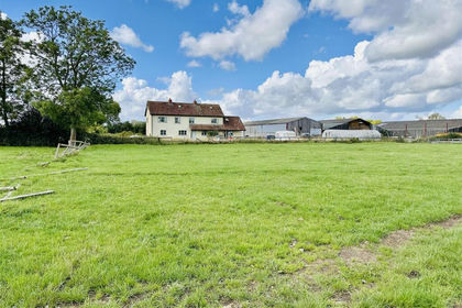
- Price
- £995,000
- Size
- 13 acres
Added on 17/06/2026Farmhouse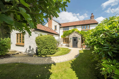
- Price
- Guide Price£1,100,000
- Size
- 5 acres
Cheddar Road, Cocklake, Wedmore, BS28, Wedmore, Somerset BS28 England
Added on 29/01/2026Farmhouse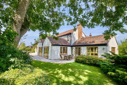
- Price
- Guide Price£1,100,000
- Size
- 5.5 acres
Added on 26/06/2026House with Land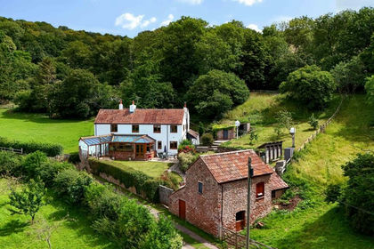
- Price
- Guide Price£1,450,000
- Size
- 10.3 acres
10 acre-glamping-views, Bradley Cross, Nr Cheddar, BS27, Cheddar, Somerset BS27 England
Added on 20/07/2026House with Land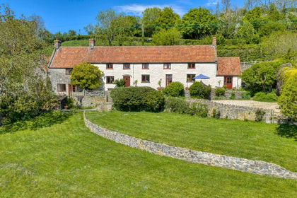
- Price
- Guide Price£1,250,000
- Size
- 6 acres
Added on 30/04/2026Farmhouse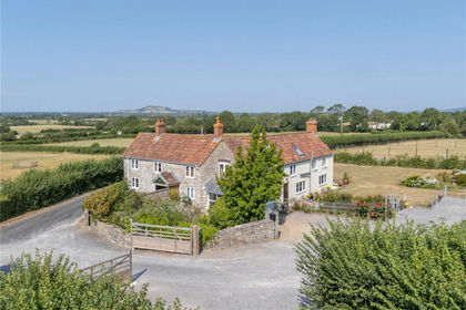
- Price
- £1,200,000
- Size
- 3 acres
Added on 25/07/2026Equestrian property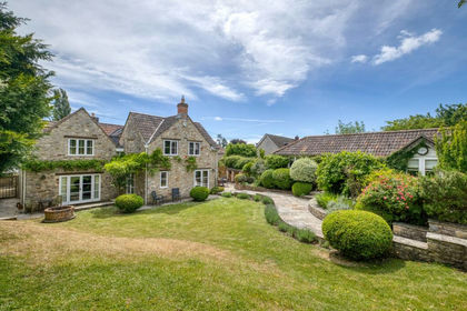
- Price
- Guide Price£1,500,000
- Size
- 2 acres
North Road, Wookey, Nr. Wells with detached annexe, Wookey, Somerset BA5 England
Added on 17/03/2026House with Land
- Price
- Guide Price£1,375,000
- Size
- 2.13 acres
Winscombe, Near Sidcot School, Winscombe and Sandford, North Somerset BS25 England
Added on 19/03/2026House with Land
- Price
- £1,200,000
- Size
- 2.63 acres
Added on 26/08/2026House with Land