Nettlebed House, Nr Low Row, Swaledale
- Land size
- 1 acres
- Bedrooms
- 3
- Bathrooms
- 1
Key Features
- CHARACTER PROPERTY
- 3 DOUBLE BEDROOMS
- ONE ACRE SITE
- PANORAMIC VIEWS OVER SWALEDALE
- QUIET LOCATION
- OIL CENTRAL HEATING
- ESTABLISHED HOLIDAY LET HISTORY
- NO ONWARD CHAIN
Description
A Superb Detached Grade II Listed Cottage of Character enjoying a private one acre site with panoramic views across Swaledale, within the heart of the Yorkshire Dales. Lounge, Kitchen/Dining Room, Pantry, 3 Double Bedrooms, Bathroom/WC, Ample Parking, Garden and Hillside Garth, Two Attached Stores, Oil Fired Central Heating. EER E40. NO ONWARD CHAIN.
Description - A Superb Detached Grade II Listed Cottage of Character enjoying a private one acre site with panoramic views across Swaledale, within the heart of the Yorkshire Dales. Lounge, Kitchen/Dining Room, Pantry, 3 Double Bedrooms, Bathroom/WC, Ample Parking, Garden and Hillside Garth, Two Attached Stores, Oil Fired Central Heating. EER E40. NO ONWARD CHAIN.
Lounge - Beamed ceiling, feature stone surround fireplace with cast iron range, chrome antique style radiator, stone flagged floor. Sash window to front. Entrance door to Front. Doors to Kitchen/Dining Room and Inner Hall.
Kitchen/Dining Room - Beamed ceiling, tiled surrounds, ceramic sink unit with chrome mixer tap, sage green cupboards and drawers, oak work tops, RAYBURN with double electric ovens, twin hot plate and central heating boiler, built in dishwasher, built in fridge, chrome antique style radiator, stone flagged floor. Sash windows to front and rear. Door to Lounge.
Inner Hallway - Stone steps leading upstairs. Window to rear. Doors to Pantry and to Lounge.
Pantry - Feature ceiling beam and stone shelving, fridge/freezer space, loft hatch, stone flagged floor. Window to rear. Door to Inner Hallway.
Landing - Doors to Bedrooms and Bathroom.
Bedroom 1 - Open beamed ceiling, pine boarded floor, radiator. Sash window to front. Glazed external door to side with wooden outer double doors and stone steps down to garden. Door to Landing.
Bedroom 2 - Loft hatch, radiator. Internal high level window to Bathroom. Sash window to front. Door to Landing.
Bedroom 3 - Feature stone surround fireplace with cast iron grate, loft hatch, airing cupboard containing hot water cylinder, radiator. Sash window to front with stone sill. Door to Landing.
Bathroom/Wc - Tiled surrounds, pedestal wash hand basin, roll top bath with electric shower over and curtain and rail, extractor fan, wc, ceramic tiled floor, ceiling halogens, radiator. Internal high level window to Bedroom 2. Door to Landing.
Outside - The total site area is around one acre and is approached by a gravel track from the road between Gunnerside and Crackpot.
Right hand attached store
Beamed ceiling, ceramic sink unit with hot and cold taps, light, double power socket, stone flagged floor, cupboard containing water filter equipment.
Left hand attached store
Light, double doors to rear, door to front.
South Facing Front Garden
Enclosed by dry stone walls comprising lawn, small stone store, further hillside garth with small stream.
Rear Garden
Lawn bordered by post and wire fencing, plastic oil tank.
Services - Mains electricity. Spring fed water. Septic tank drainage. Oil central heating.
Grade Ii Listed - Nettlebed House and byre - II Farmhouse and byre under 1 roof. Probably late C18. Rubble with crude quoins, stone slate roof. 2 storeys, with stair turret and single-storey outshut to rear. House has 2 first floor windows. C20 4-panel door to right. Ground floor windows under large lintels, both containing 4-pane sashes, that to left partly infilled. First floor windows have slab lintels and reveals, with unequally-hung sashes with glazing bars. 2 end and 1 central stacks. Rear: central stair turret contains 2 very small windows, 1 blocked. Interior: large fireplace in centre right, stairs in turret. Byre added on left, not of special interest. In 1795 a building called Nettlebed House, probably this one, was pulled down and rebuilt by Richard Garth (Raistrick). A Raistrick, Buildingsin the Yorkshire Dales.
Directions - The property is on the south side of the Swale valley between the village of Gunnerside and the hamlet of Crackpot.
Having turned off the tarmacadam road (to the south of the road and through a metal gate), the property is reached after a short distance up a gravel track.
The postcode is DL11 6NJ
The What3words location is completed.spine.albums
Distances to Reeth 6 miles, Hawes 12 miles, Leyburn 14 miles, Richmond 17 miles.
General Information - Viewing - By appointment with Norman F. Brown.
Tenure - Freehold. The title register is NYK 207896.
Local Authority - North Yorkshire Council – Tel:
Broadband and Mobile Phone Coverage – please check using this website
Property Reference – 18757237
Particulars Prepared – March 2026.
IMPORTANT NOTICE
These particulars have been produced in good faith to give an overall view of the property. If any points are particularly relevant to your interest, please ask for further information or verification, particularly if you are considering travelling some distance to view the property.
All interested parties should note:
i. The particulars are set out as a general outline only for the guidance of intended purchasers and do not constitute an offer or contract or any part thereof.
ii. All measurements, areas or distances are given only as a guide and should not be relied upon as fact.
iii. The exterior photograph(s) may have been taken from a vantage point other than the front street level. It should not be assumed that any contents/furnishings/furniture etc. are included in the sale nor that the property remains as displayed in the photographs.
iv. Services or any appliances referred to have not been tested and cannot be verified as being in working order. Prospective buyers should obtain their own verification.
FREE MARKET APPRAISAL
We will be pleased to provide an unbiased and professional market appraisal of your property without obligation, if you are thinking of selling.
FREE IMPARTIAL MORTGAGE ADVICE
CALL TODAY TO ARRANGE YOUR APPOINTMENT
Our qualified mortgage and financial advisor will be pleased to advise you on the wide range of mortgages available from all of the mortgage lenders without charge or obligation.
YOUR HOME IS AT RISK IF YOU DO NOT KEEP UP REPAYMENTS ON A MORTGAGE OR OTHER LOAN SECURED ON IT
A life assurance policy may be required. Written quotation available upon request.
Aml Policy - AML Policy (When an offer is accepted):
In accordance with The Money Laundering Regulations 2017, we are required by law to:
•Verify the identity of all buyers
•Check the Politically Exposed Persons and
•Check the Sanctions registers.
•Verify proof of and source of funds for the purchase - What form that takes depends on your position, but we ultimately need you to provide to us (in the office or via email) evidence of the funding you have in place for the purchase price. That may include proof of deposit, an Agreement in Principle from a lender or if you are a cash buyer, a Bank Statement.
The cost of the Identity verification, PEP & Sanctions register checks are £15 for one person and £25 for two people. We will send you a link to the Guild 365 app (which you will need to download) to complete this.
Map Location
Property details
- Tenure
- Freehold
- Council Tax Band
- Ask Agent
- Date Posted
- 2026-03-30
Market Value Analysis
Compared with 669 Homes with Land listings in Yorkshire and The Humber (1+ acres).
Energy Performance Certificate
Energy Efficiency Rating
Based on UK Energy Performance Certificate standards (EU Directive 2002/91/EC)
Running costs are one side. Planning activity, flood history and ground risks for this location are in the full report.
Utilities & Restrictions
Utilities
- Electricity
- Mains
- Water
- Private Supply
- Heating
- Oil Heating
- Broadband
- Ask Agent
- Sewerage
- Septic Tank / Private
Rights & Restrictions
- Public Rights of Way
- Ask Agent
- Private Rights of Way
- Ask Agent
- Listed Property
- Ask Agent
- Restrictions
- Ask Agent
Listed status, conservation areas and planning constraints for this location are in the full report.
Property Features
- Accessibility
- Ask Agent
- Parking
- Parking Available
- Garden
- Garden
Beyond the particulars: planning activity, flood history, heritage and ground risks, checked for this exact spot.
Connectivity
Broadband
Fastest speed available at this postcode
18 Mbps
Standard (10-30 Mbps)
Suitable for
- Web & social
- Music streaming
- Standard video calls
Mobile signal
Predicted 4G and 5G signal; indoor signal depends on building materials.
Ofcom Connected Nations postcode-level predictions. Speeds and signal are modelled, not measured, and vary between addresses and providers.
Signal is the easy part. Planning activity, flood history and protected designations here are in the full report.
Nearest Schools
Primary
- Gunnerside Methodist Primary School0.9 milesNo Ofsted rating
- Ages
- 4 to 11
- Pupils
- 31
- Type
- Voluntary controlled school
- Faith
- Methodist
- Askrigg Voluntary Controlled Primary School3.7 milesOfsted: Good
- Ages
- 4 to 11
- Pupils
- 39
- Type
- Voluntary controlled school
- Bainbridge Church of England Primary and Nursery School4.2 milesOfsted: Good
- Ages
- 3 to 11
- Pupils
- 47
- Type
- Voluntary controlled school
- Faith
- Church of England
- Reeth Community Primary School5.6 milesNo Ofsted rating
- Ages
- 3 to 11
- Pupils
- 63
- Type
- Community school
- Hawes Primary School6.4 milesOfsted: Good
- Ages
- 3 to 11
- Pupils
- 48
- Type
- Academy sponsor led
Secondary
- Wensleydale School11 milesOfsted report card · May 2026
- Ages
- 11 to 16
- Pupils
- 407
- Type
- Community school
- Kirkby Stephen Grammar School13 milesOfsted: Good
- Ages
- 11 to 18
- Pupils
- 377
- Type
- Academy converter
- Teesdale School and Sixth Form14 milesNo Ofsted rating
- Ages
- 11 to 18
- Pupils
- 684
- Type
- Academy sponsor led
- Richmond School & Sixth Form College15 milesOfsted report card · Feb 2026
- Ages
- 11 to 18
- Pupils
- 1,315
- Type
- Academy converter
- Risedale School15 milesOfsted: Requires improvement *
- Ages
- 11 to 16
- Pupils
- 467
- Type
- Community school
* Latest graded judgement covers quality of education only; no overall grade was issued under the 2024-25 inspection framework.
Distances are straight-line from the advertised location. Source: the national school registers (DfE, Welsh Government, Scottish Government) and Ofsted.
Schools are just the start: sold prices nearby, planning activity and any flood history are in the full report.
Amenities
Supermarket
GP surgery
Pharmacy
Hospital
Walking trail
Straight-line distances from the advertised location. Sources: NHS records, Geolytix supermarket locations, OS Open Greenspace and the national trails registers.
The area stacks up? Now check the location itself: planning nearby, protected designations and past flooding.
Getting Around
Nearest station
Nearest bus stop
Typical drive times
Straight-line distances from the advertised location; drive times are typical free-flow times over OpenStreetMap road data, so allow more at peak. Public transport locations from DfT NaPTAN.
Easy to reach matters. So do planning activity, flood history and ground risks: all in the full report.
Flood Risk
Environment Agency open data, checked around the advertised map pin for the listed acreage. Long-term risk counts flood defences; the planning map's flood zones do not. Provided by LandSale, not the listing agent, and not part of the agent's particulars. Risk varies across a holding, so verify before committing.
Rivers and the sea
Planning map: Flood Zone 1.
Surface water
These bandings are the summary. Where this location sits on the flood maps, plus planning activity, heritage and ground risks, is in the full report.
Important notice: Information, maps and tags on this page are drawn from the advertising agent's marketing materials or generated automatically. LandSale has not verified them. Relying on these details is at your own risk, always carry out independent checks before committing to a purchase.
LandSale full disclaimer
Marketing information only - not formal particulars. The details on this website are provided for general guidance and do not constitute an offer or contract. Neither LandSale nor the advertising estate/land agent accepts responsibility for any inaccuracy.
1. Source of information
- Listing content: Core description, asking price, tenure, measurements, photographs and planning history originate from the marketing materials of the advertising estate or land agent. LandSale does not author this content and cannot guarantee its accuracy.
- Automated tags & categorisation: Property type, land-use class, acreage bands and similar labels may be applied by machine-learning models. They are intended as a helpful guide only and may not reflect the property's legal status or permitted use.
- Third-party & enriched data layers: Maps, boundary outlines, planning designations, soil reports, broadband coverage and other environmental or location-based insights are licensed from external suppliers. Such data are supplied “as is", may be incomplete or out of date and are subject to change without notice.
2. Verification required
Prospective purchasers must verify critical matters, including but not limited to planning permission, title boundaries, public rights of way, environmental constraints, acreage, services, access and VAT status, through their own inspections, specialist surveys, legal advisers and the selling agent before relying on the information or entering into any contract.
3. No warranty or liability
LandSale gives no warranty, express or implied, as to the accuracy, completeness or fitness for any particular purpose of the information displayed. LandSale shall not be liable for any loss, damage, cost or expense arising directly or indirectly from any use of or reliance on such information, save where liability may not be excluded by law.
4. Updates & feedback
If you believe any detail on this listing is inaccurate, please let us know. We will investigate and, where appropriate, update the listing or notify the agent.
© LandSale | Version 1.3 - August 2026
Similar properties for sale
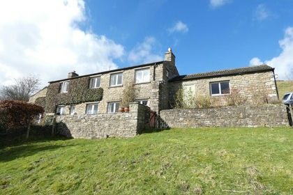
- Price
- £450,000
- Size
- 3.5 acres
East Brocca Bank, Low Row, DL11, Melbecks, North Yorkshire DL11 England
Added on 15/04/2026Residential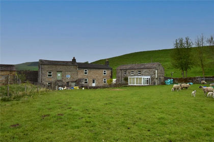
- Price
- Guide Price£595,000
- Size
- 1.43 acres
Bainbridge, Leyburn, North Yorkshire, DL8, Bainbridge, North Yorkshire DL8 England
Added on 20/05/2026House with Land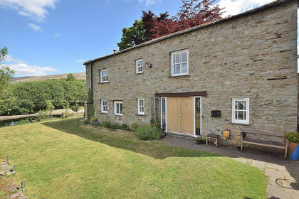
- Price
- Offers in Region of£450,000
Added on 29/01/2026Barn Conversion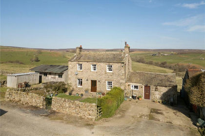
- Price
- £600,000
- Size
- 18.28 acres
Hurst, Richmond, North Yorkshire, DL11, Marrick, North Yorkshire DL11 England
Added on 01/05/2026Farmland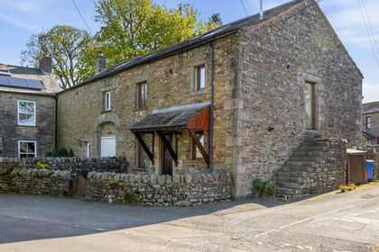
- Price
- Guide Price£375,000
The Old Stables, Outhgill, Mallerstang, Westmorland and Furness CA17 England
Added on 11/05/2026Barn Conversion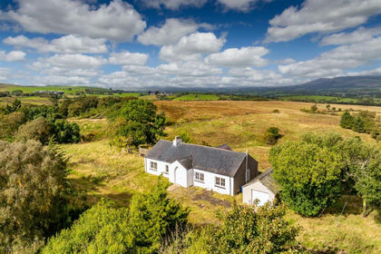
- Price
- Guide Price£375,000
- Size
- 1.75 acres
Belah Cottage, Kaber, Cumbria, Kaber, Westmorland and Furness CA17 England
Added on 30/09/2026Cottage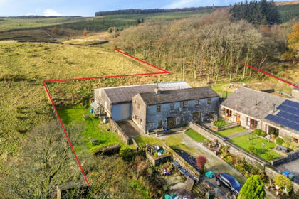
- Price
- £495,000
- Size
- 1.5 acres
Wood Cottage, Buckden, Skipton, BD23, Buckden, North Yorkshire BD23 England
Added on 29/01/2026Barn Conversion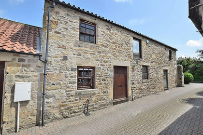
- Price
- Offers in Region of£417,950
West Steadings, Gayles, Gayles, North Yorkshire DL11 England
Added on 29/01/2026Barn Conversion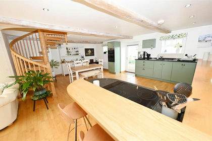 Added on 28/03/2026Barn Conversion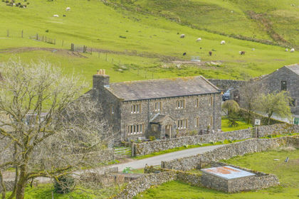
- Price
- Guide Price£625,000
- Size
- 42 acres
Ellershaw Farm, Halton Gill, Skipton, BD23, Halton Gill, North Yorkshire BD23 England
Added on 29/01/2026House with Land