The Langridge, Land Off Bardwell Road, Ixworth, Bury St Edmunds, Suffolk, IP31
- Land size
- 21.02 acres
Key Features
- Outline Planning Permission for up to 160 Dwellings
- 8.51 Hectares (21.02 acres)
- FOR SALE BY INFORMAL TENDER
- OFFERS TO BE RECEIVED BY 10TH APRIL 2026
Description
Outline Planning Permission for up to 160 Dwellings
8.51 Hectares (21.02 acres)
FOR SALE BY INFORMAL TENDER
OFFERS TO BE RECEIVED BY 10TH APRIL 2026
Detailed Description
THE SITE
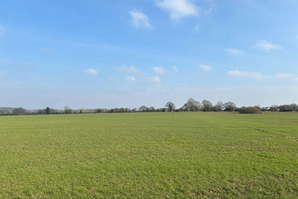
The land extends to approximately 8.51 hectares (21.02 acres) of broadly level, currently cultivated arable land, situated to the south of the A1088 and west of Bardwell Road, on the northern edge of the village of Ixworth. The site is regular in shape and fronts both Bardwell Road and the A1088, which are links roads to the A143 providing access to the cathedral town of Bury St Edmunds.
LOCATION
Ixworth is a sought after semi-rural village offering a range of local amenities including shops, public houses, restaurants, schools and other community facilities, such as the doctor's surgery and pharmacy, all within easy walking distance. It benefits from good transport links providing road access to Bury St Edmunds, Thetford, Diss and Stowmarket.
Railway stations at Thurston, Bury St Edmunds, Diss and Stowmarket provide frequent services to London Liverpool Street, Norwich and Cambridge ensuring strong commuter links to the capital and regional cities. The combination of local facilities and connectivity makes Ixworth an attractive location for residential development.
PLANNING BACKGROUND
The site received outline planning permission on the 24th February 2026 with a S106 Agreement signed and completed. (LPA Ref. DC/25/0370/OUT). This application is for up to 160 dwellings, including market and affordable homes, flats and self-build plots. All matters are reserved except for access, which is approved onto Bardwell Road. The scheme also provides for provision of open space, landscaping, sustainable drainage and associated infrastructure and works.
The scheme recognises the rural setting of the site being situated on the edge of the village. The extensive landscaping and open spaces allows for a high-quality development, whilst delivering all BNG on site. This will help create and deliver a desirable environment for the residents with strong market appeal and house sales pricing.
S106, COMMUNITY INFRASTRUCTURE LEVY (CIL), SELF-BUILD & HOUSING MIX
The S106 Agreement includes contributions totalling £2,249,329.33, together with 40% affordable housing (67% rented and 33% shared ownership), alongside provision of self-build plots. There is no CIL applicable to the scheme.
ACCESS
The site has approved access from Bardwell Road.
RIGHTS OF WAY
There are currently no public rights of way on the subject property. However, as part of the outline planning permission, the provision of a bridleway is required which will link the new access road, within the development site, to the Langridge Track and then through retained land, 'The Front Meadow', linking the site to Thetford Road. Additionally a public footpath is then to be created around 'The Cricket Meadow' linking Thetford Road to the existing bridleway (Ixworth Bridleway 001) situated to the south. Further information and plans can be found in the data room.
OVERAGE
Offers are required to include a provision for overage which is expected to be linked to coverage, GDV, and/or unit numbers, as well as an S.106 contribution or affordable housing reductions. Proposals for overage are invited and should be set out within the tender form.
SERVICES
Electricity, water, drainage, gas and telecoms are available in the vicinity of the site.
Further utility information and costs are included in the data room.
BOUNDARIES
The boundary to north of the property comprises a mature hedge fronting the A1088. The western boundary is a post and two strand barbed wire fence. The southern boundary is formed by the rear boundary fences of the adjacent residential properties. The eastern boundary and around the existing commercial and agricultural buildings has been staked.
RESERVED RIGHTS
The Seller is to retain rights:
(a) to install service media (the precise location and connection points for such service media to be agreed between the parties (acting reasonably) and an estate road with appropriate footpaths through a road corridor of a width of no less than 12 meters which is to run from the Estate Road to be constructed on the Property to the boundary of the Retained Land. Further details can be found in the Data Room.
(b) rights to connect into any Service Media on the Property
(c) rights of way over the estate roads and footpaths constructed on the Property
(d) rights to lay Service Media along the Langridge and the adjoining verge on either side of the Langridge (insofar as the same is within the Property) together with all appurtenant rights to connect into, upgrade, maintain, repair, renew and use such Service Media once laid.
(e) in connection with the delivery of part of the highways works, the Developer shall put a sum equivalent to the agreed estimated cost of the works in a retention fund to be held by the Seller's Solicitor. Further details can be found in the Data Room.
LAND REGISTRY
The property is freehold and forms part of Land Registry Title Number SK315569.
METHOD OF SALE
The property is offered for sale by Informal Tender on the following Terms:
1. All offers must be received by 12 Noon on Friday 10th April 2026.
2. Offers must be sent to nicholas. or delivered to Brown & Co's Bury St Edmunds Office for the attention of Nicholas Staton. Please note, an acknowledgement will be sent in return and if this is not received, please make further contact to ensure receipt.
3. Offers must be submitted in the prescribed form. Copies of the form can be obtained from the data room.
4. No offer will be considered which is calculated only be reference to another offer.
5. The seller does not undertake to accept the highest or indeed any bid.
LOCAL AUTHORITY
The site falls within the jurisdiction of West Suffolk Council.
VAT
It is expected that the property will be elected for VAT. Offers should be submitted on the basis VAT will be payable on the purchase price, unless directed otherwise.
LEGAL COSTS
Each party will be responsible for their own costs.
DATA ROOM
A data room for the proposed development has been compiled. Please contact the selling agent for the details.
HEALTH AND SAFETY
Neither the seller nor the selling agents are responsible for the health and safety of those viewing the property and accordingly do so at their own risk.
WHAT 3 WORDS
///habit.cups.startles.
VIEWING
Viewings are strictly by appointment only through Brown & Co.
SELLING AGENTS
Nicholas Staton & Simon Gilbey
E: nicholas. | simon.
T: |
Map Location
Property details
- Tenure
- Ask Agent
- Council Tax Band
- Ask Agent
- Date Posted
- 2026-02-27
Utilities & Restrictions
Utilities
- Electricity
- Ask Agent
- Water
- Ask Agent
- Heating
- Ask Agent
- Broadband
- Ask Agent
- Sewerage
- Ask Agent
Rights & Restrictions
- Public Rights of Way
- Ask Agent
- Private Rights of Way
- Ask Agent
- Listed Property
- Ask Agent
- Restrictions
- Ask Agent
Listed status, conservation areas and planning constraints for this location are in the full report.
Property Features
- Accessibility
- Ask Agent
- Parking
- Ask Agent
- Garden
- Ask Agent
Beyond the particulars: planning activity, flood history, heritage and ground risks, checked for this exact spot.
Connectivity
Broadband
Fastest speed available at this postcode
1.8 Gbps
Gigabit full fibre · available to 64% of premises
Suitable for
- 4K streaming on every screen
- Full-time home working
- Online gaming & big downloads
Mobile signal
Predicted 4G and 5G signal; indoor signal depends on building materials.
Ofcom Connected Nations postcode-level predictions. Speeds and signal are modelled, not measured, and vary between addresses and providers.
Signal is the easy part. Planning activity, flood history and protected designations here are in the full report.
Nearest Schools
Primary
- Ixworth Church of England Primary School627 metresOfsted: Good
- Ages
- 2 to 11
- Pupils
- 163
- Type
- Academy sponsor led
- Faith
- Church of England
- Bardwell Church of England Primary School2 milesOfsted: Good
- Ages
- 5 to 11
- Pupils
- 54
- Type
- Academy converter
- Faith
- Church of England
- Honington Church of England Primary School2.5 milesNo Ofsted rating
- Ages
- 5 to 11
- Pupils
- 145
- Type
- Academy converter
- Faith
- Church of England
- Stanton Primary School2.9 milesNo Ofsted rating
- Ages
- 3 to 11
- Pupils
- 218
- Type
- Academy converter
- Great Barton Church of England Primary Academy3.3 milesOfsted: Good
- Ages
- 5 to 11
- Pupils
- 188
- Type
- Academy converter
- Faith
- Church of England
Secondary
- Ixworth High School749 metresOfsted: Good *
- Ages
- 11 to 16
- Pupils
- 512
- Type
- Free schools
- Thurston Community College3.4 milesNo Ofsted rating
- Ages
- 11 to 18
- Pupils
- 1,512
- Type
- Community school
- Sybil Andrews Academy5 milesOfsted: Good
- Ages
- 11 to 16
- Pupils
- 657
- Type
- Academy sponsor led
- St Benedict's Catholic School6.2 milesNo Ofsted rating
- Ages
- 11 to 18
- Pupils
- 968
- Type
- Academy converter
- Faith
- Roman Catholic
- Bury St Edmunds County High School6.3 milesOfsted report card · May 2026
- Ages
- 11 to 16
- Pupils
- 657
- Type
- Academy converter
* Latest graded judgement covers quality of education only; no overall grade was issued under the 2024-25 inspection framework.
Distances are straight-line from the advertised location. Source: the national school registers (DfE, Welsh Government, Scottish Government) and Ofsted.
Schools are just the start: sold prices nearby, planning activity and any flood history are in the full report.
Amenities
Supermarket
GP surgery
Pharmacy
Hospital
Green space
Straight-line distances from the advertised location. Sources: NHS records, Geolytix supermarket locations, OS Open Greenspace and the national trails registers.
The area stacks up? Now check the location itself: planning nearby, protected designations and past flooding.
Getting Around
Nearest station
Nearest bus stop
Typical drive times
Straight-line distances from the advertised location; drive times are typical free-flow times over OpenStreetMap road data, so allow more at peak. Public transport locations from DfT NaPTAN.
Easy to reach matters. So do planning activity, flood history and ground risks: all in the full report.
Flood Risk
Environment Agency open data, checked around the advertised map pin for the listed acreage. Long-term risk counts flood defences; the planning map's flood zones do not. Provided by LandSale, not the listing agent, and not part of the agent's particulars. Risk varies across a holding, so verify before committing.
Rivers and the sea
Planning map: Flood Zone 1.
Surface water
Not at the pin: mapped about 60 metres away.
These bandings are the summary. Where this location sits on the flood maps, plus planning activity, heritage and ground risks, is in the full report.
Important notice: Information, maps and tags on this page are drawn from the advertising agent's marketing materials or generated automatically. LandSale has not verified them. Relying on these details is at your own risk, always carry out independent checks before committing to a purchase.
LandSale full disclaimer
Marketing information only - not formal particulars. The details on this website are provided for general guidance and do not constitute an offer or contract. Neither LandSale nor the advertising estate/land agent accepts responsibility for any inaccuracy.
1. Source of information
- Listing content: Core description, asking price, tenure, measurements, photographs and planning history originate from the marketing materials of the advertising estate or land agent. LandSale does not author this content and cannot guarantee its accuracy.
- Automated tags & categorisation: Property type, land-use class, acreage bands and similar labels may be applied by machine-learning models. They are intended as a helpful guide only and may not reflect the property's legal status or permitted use.
- Third-party & enriched data layers: Maps, boundary outlines, planning designations, soil reports, broadband coverage and other environmental or location-based insights are licensed from external suppliers. Such data are supplied “as is", may be incomplete or out of date and are subject to change without notice.
2. Verification required
Prospective purchasers must verify critical matters, including but not limited to planning permission, title boundaries, public rights of way, environmental constraints, acreage, services, access and VAT status, through their own inspections, specialist surveys, legal advisers and the selling agent before relying on the information or entering into any contract.
3. No warranty or liability
LandSale gives no warranty, express or implied, as to the accuracy, completeness or fitness for any particular purpose of the information displayed. LandSale shall not be liable for any loss, damage, cost or expense arising directly or indirectly from any use of or reliance on such information, save where liability may not be excluded by law.
4. Updates & feedback
If you believe any detail on this listing is inaccurate, please let us know. We will investigate and, where appropriate, update the listing or notify the agent.
© LandSale | Version 1.3 - August 2026
Listing agent
BROWN & CO-PROPERTY AND BUSINESS CONSULTANTS LLP, Bury St Edmunds
Contact BROWN & CO-PROPERTY AND BUSINESS CONSULTANTS LLP, Bury St Edmunds
View agent profileSimilar properties for sale
- Price
- From£500,000
- Size
- 55.39 acres
Added on 29/01/2026Farm
- Price
- Guide Price£950,000
- Size
- 99.75 acres
Wyverstone Road, Long Thurlow, Bury St Edmunds, Suffolk, IP31, Badwell Ash, Suffolk IP31 England
Added on 08/03/2026Farmland
- Price
- Fixed Price£350,000
- Size
- 41 acres
Woolpit Wood, Bury St Edmunds, Suffolk, IP30, Woolpit, Suffolk IP30 England
Added on 10/09/2026WoodlandLeasehold
- Price
- Guide Price£325,000
- Size
- 12.63 acres
Added on 29/01/2026Grazing Land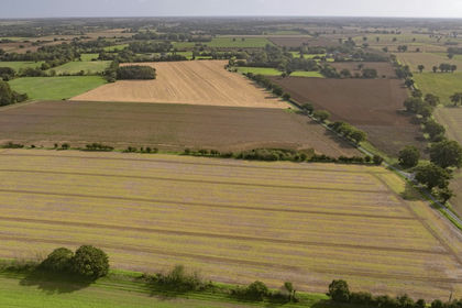
- Price
- Guide Price£1,040,000
- Size
- 159.93 acres
Added on 25/09/2026Farmland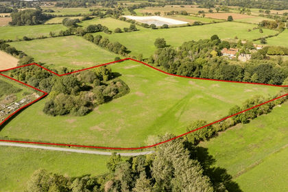
- Price
- Guide Price£1,250,000
- Size
- 170.64 acres
Added on 25/09/2026Agricultural Land- Price
- Guide Price£210,000
- Size
- 10.71 acres
Lot 1, Land at Wilby, Norfolk, Quidenham, Norfolk NR16 England
Added on 25/09/2026Redevelopment Land
- Price
- £750,000
- Size
- 14.1 acres
Monks Eleigh Tye, Ipswich, Suffolk, IP7, Monks Eleigh, Suffolk IP7 England
Added on 18/09/2026Development Land
- Price
- Guide Price£650,000
- Size
- 75.42 acres
Mickfield, Stowmarket, Suffolk, IP14, Mickfield, Suffolk IP14 England
Added on 28/01/2026Farmland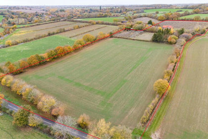
- Price
- Guide Price£950,000
- Size
- 12.6 acres
East Barn & Hedgerows Farm Bungalow, Brent Eleigh, Brent Eleigh, Suffolk CO10 England
Added on 16/09/2026Development Land