Castlebrook, Compton Dundon
Key Features
- A fantastic development opportunity to construct five generously proportioned new homes
- Superb edge of village setting with outstanding countryside views
- Full planning permission for the construction of five dwellings (Planning Reference: 20/02644/REM)
- With the current scheme approved, this consented site has all Phosphate Mitigation solution in place and all preliminary costs absorbed.
Description
Full planning permission has been obtained for the construction of this beautiful courtyard development of impressive family homes. Being perfectly positioned on the southern edge of the village and with consent to construct five spacious, architecturally prominent homes, complete with thoughtful open plan living and entertaining spaces, design led interiors and gorgeous country gardens. All two, four and five-bedroomed homes will enjoy stunning open countryside views and are set back from the road within a private courtyard.
Accommodation
The finished properties will be of comfortable proportions and this plot can be acquired with a pre-tendered build contract if desired. All homes will enjoy a tasteful blend of modern architectural features and building methods with a contemporary finish if desired suited to 21st century living, all whilst complementing their surroundings. Location is key and these generous plots are situated in a prime position on the Southern outskirts of Compton Dundon, mid-way along Castlebrook and with outstanding countryside views.
This is a fully consented site for the construction of five dwellings (Planning Reference: 20/02644/REM)
There is the opportunity to acquire this land independently from our client and appoint a highly regarded construction team whose wealth of experience and great eye for detail will deliver exceptional standards throughout and ensure that the process is a seamless one through to completed build and resale. A full breakdown of process and schedule of costs can be provided by Holland & Odam.
Thoughtfully designed, these beautiful homes will enjoy well-considered layouts, providing impressive living accommodation that is light, generously proportioned throughout and with direct access from their principle rooms onto west-facing gardens.
Attractively constructed of natural blue lias stone elevations sat beneath clay tiled and slate roofs, combined with the pinnacle of energy efficiency with air source heatpumps and underfloor heating if desired.
Well positioned within their plots, each new home will enjoy a private situation set back from the road where an expansive driveway will provide ample parking leading up to the garage on each detached house type. At the rear of the properties, considerable size gardens are west facing in their entirety and can be attractively landscaped to your specification, perfect for keen gardeners and families alike and with the possibility of a full width terrace extending from the rear elevation, ideal for entertaining and accessed from the principle living areas of the homes.
Location
Compton Dundon is the perfect village location for keen walkers, having 62 acres of beautifully managed woodland providing stunning viewpoints, landscapes and wildlife yet still convenient for fantastic schools and local shops. The historic centres of Glastonbury and Wells, and Street, home to popular shopping destination Clarks Village are all on your doorstep and being only a ten minute drive to the A37 connecting you to the coast in less than a hour, this Somerset village is proving desirable. Compton Dundon is a highly regarded active village enjoying a pub, the Castlebrook Inn, a super village hall and Church. The thriving town of Street provides an excellent range of shopping facilities, prestigious Millfield School, as well as Crispin secondary school, Strode Sixth Form College, indoor and open air swimming pools, a theatre and choice of pubs and restaurants. The charming town of Somerton is also nearby, a popular market town with plenty of facilities, superb eating places and an art centre. The neighbouring county of Dorset is similarly attractive and offers a beautiful coastline, with Lyme Regis being with 35 miles. Street (Millfield School) 2 miles, Somerton 3.5 miles, Taunton (County Town) 21 miles, Bristol 35 miles, Bath 32 miles, Castle Cary Railway Station (London Paddington) 13 miles, A303 Podimore Junction 7 miles.
Directions
From the Market Place in Somerton, head left onto Broad Street and follow the road until you get to the mini roundabout where you'll turn right, taking the second exit. At the junction turn left onto B3151 and follow the road through Littleton towards Compton Dundon for approximately 3 miles, the land is located on your left.
Services & Planning Information
Any interested parties should make their own enquiries with relevant authorities. There is mains electricity and water available close to the plot.
Material Information
All available property information can be provided upon request from Holland & Odam. For confirmation of mobile phone and broadband coverage, please visit checker.ofcom.org.uk
Identity Verification
To ensure full compliance with current legal requirements, all buyers are required to verify their identity and risk status in line with anti-money laundering (AML) regulations before we can formally proceed with the sale. This process includes a series of checks covering identity verification, politically exposed person (PEP) screening, and AML risk assessment for each individual named as a purchaser. In addition, for best practice, we are required to obtain proof of funds and where necessary, to carry out checks on the source of funds being used for the purchase. These checks are mandatory and must be completed regardless of whether the purchase is mortgage-funded, cash, or part of a related transaction. A disbursement of £49 per individual (or £75 per director for limited company purchases) is payable to cover all aspects of this compliance process. This fee represents the full cost of conducting the required checks and verifications. You will receive a secure payment link and full instructions directly from our compliance partner, Guild365, who carry out these checks on our behalf.
Map Location
Property details
- Tenure
- Ask Agent
- Council Tax Band
- Ask Agent
- Date Posted
- 2026-01-29
Utilities & Restrictions
Utilities
- Electricity
- Ask Agent
- Water
- Ask Agent
- Heating
- Ask Agent
- Broadband
- Ask Agent
- Sewerage
- Ask Agent
Rights & Restrictions
- Public Rights of Way
- Ask Agent
- Private Rights of Way
- Ask Agent
- Listed Property
- Ask Agent
- Restrictions
- Ask Agent
Listed status, conservation areas and planning constraints for this location are in the full report.
Property Features
- Accessibility
- Ask Agent
- Parking
- Parking Available
- Garden
- Garden
Beyond the particulars: planning activity, flood history, heritage and ground risks, checked for this exact spot.
Connectivity
Broadband
Fastest speed available at this postcode
1.8 Gbps
Gigabit full fibre
Suitable for
- 4K streaming on every screen
- Full-time home working
- Online gaming & big downloads
Mobile signal
Predicted 4G and 5G signal; indoor signal depends on building materials.
Ofcom Connected Nations postcode-level predictions. Speeds and signal are modelled, not measured, and vary between addresses and providers.
Signal is the easy part. Planning activity, flood history and protected designations here are in the full report.
Nearest Schools
Primary
- Brookside Community Primary School1.9 milesNo Ofsted rating
- Ages
- 3 to 11
- Pupils
- 544
- Type
- Academy converter
- Butleigh Church of England Primary School2.1 milesOfsted: Good
- Ages
- 2 to 11
- Pupils
- 98
- Type
- Academy converter
- Faith
- Church of England
- Hindhayes Infant School2.2 milesOfsted: Good *
- Ages
- 5 to 7
- Pupils
- 165
- Type
- Community school
- King Ina Church of England Academy2.3 milesOfsted: Requires improvement
- Ages
- 2 to 11
- Pupils
- 343
- Type
- Academy converter
- Faith
- Church of England
- Elmhurst Junior School2.4 milesOfsted: Good
- Ages
- 7 to 11
- Pupils
- 210
- Type
- Academy converter
Secondary
- Crispin School Academy2.7 milesNo Ofsted rating
- Ages
- 11 to 16
- Pupils
- 978
- Type
- Academy converter
- St Dunstan's School4.3 milesOfsted: Good
- Ages
- 11 to 16
- Pupils
- 529
- Type
- Academy converter
- Huish Episcopi Academy5.3 milesOfsted report card · May 2026
- Ages
- 11 to 18
- Pupils
- 1,192
- Type
- Academy converter
- The Blue School9 milesNo Ofsted rating
- Ages
- 11 to 18
- Pupils
- 1,362
- Type
- Academy converter
- Faith
- Church of England
- Ansford Academy9.4 milesOfsted report card · Feb 2026
- Ages
- 11 to 16
- Pupils
- 469
- Type
- Academy converter
* Latest graded judgement covers quality of education only; no overall grade was issued under the 2024-25 inspection framework.
Distances are straight-line from the advertised location. Source: the national school registers (DfE, Welsh Government, Scottish Government) and Ofsted.
Schools are just the start: sold prices nearby, planning activity and any flood history are in the full report.
Amenities
Supermarket
GP surgery
Pharmacy
Hospital
Green space
Straight-line distances from the advertised location. Sources: NHS records, Geolytix supermarket locations, OS Open Greenspace and the national trails registers.
The area stacks up? Now check the location itself: planning nearby, protected designations and past flooding.
Getting Around
Nearest station
Nearest bus stop
Typical drive times
Straight-line distances from the advertised location; drive times are typical free-flow times over OpenStreetMap road data, so allow more at peak. Public transport locations from DfT NaPTAN.
Easy to reach matters. So do planning activity, flood history and ground risks: all in the full report.
Flood Risk
Environment Agency open data, checked around the advertised map pin for the listed acreage. Long-term risk counts flood defences; the planning map's flood zones do not. Provided by LandSale, not the listing agent, and not part of the agent's particulars. Risk varies across a holding, so verify before committing.
Rivers and the sea
Planning map: Flood Zone 1.
Surface water
Not at the pin: mapped about 20 metres away.
These bandings are the summary. Where this location sits on the flood maps, plus planning activity, heritage and ground risks, is in the full report.
Important notice: Information, maps and tags on this page are drawn from the advertising agent's marketing materials or generated automatically. LandSale has not verified them. Relying on these details is at your own risk, always carry out independent checks before committing to a purchase.
LandSale full disclaimer
Marketing information only - not formal particulars. The details on this website are provided for general guidance and do not constitute an offer or contract. Neither LandSale nor the advertising estate/land agent accepts responsibility for any inaccuracy.
1. Source of information
- Listing content: Core description, asking price, tenure, measurements, photographs and planning history originate from the marketing materials of the advertising estate or land agent. LandSale does not author this content and cannot guarantee its accuracy.
- Automated tags & categorisation: Property type, land-use class, acreage bands and similar labels may be applied by machine-learning models. They are intended as a helpful guide only and may not reflect the property's legal status or permitted use.
- Third-party & enriched data layers: Maps, boundary outlines, planning designations, soil reports, broadband coverage and other environmental or location-based insights are licensed from external suppliers. Such data are supplied “as is", may be incomplete or out of date and are subject to change without notice.
2. Verification required
Prospective purchasers must verify critical matters, including but not limited to planning permission, title boundaries, public rights of way, environmental constraints, acreage, services, access and VAT status, through their own inspections, specialist surveys, legal advisers and the selling agent before relying on the information or entering into any contract.
3. No warranty or liability
LandSale gives no warranty, express or implied, as to the accuracy, completeness or fitness for any particular purpose of the information displayed. LandSale shall not be liable for any loss, damage, cost or expense arising directly or indirectly from any use of or reliance on such information, save where liability may not be excluded by law.
4. Updates & feedback
If you believe any detail on this listing is inaccurate, please let us know. We will investigate and, where appropriate, update the listing or notify the agent.
© LandSale | Version 1.3 - August 2026
Listing agent
holland & odam, Somerton
Holland & Odam Market Place, Somerton, TA11 7NB
Similar properties for sale
- Price
- Guide Price£450,000
- Size
- 0.7 acres
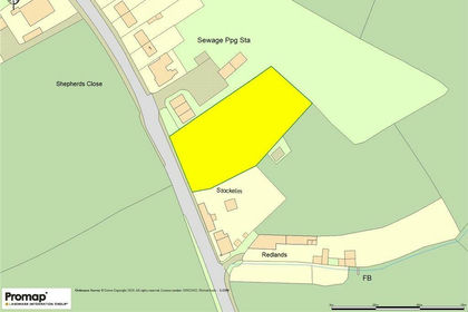
Stockelm, Compton Dundon, Somerton, Compton Dundon, Somerset TA11 England
Added on 29/01/2026Development Land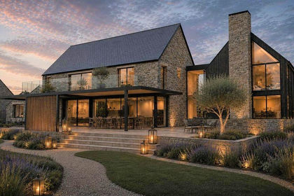
- Price
- Guide Price£500,000
Added on 04/09/2026Building Plot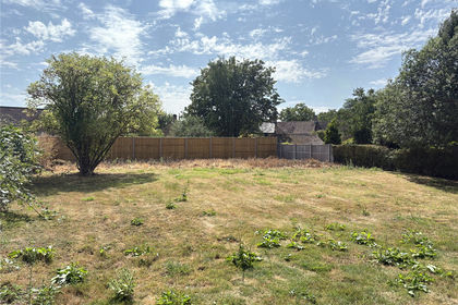
- Price
- Guide Price£380,000
- Size
- 0.97 acres
Land Adjacent Tow 22, Burrough Street, Ash, Martock, TA12, Martock, Somerset TA12 England
Added on 05/08/2026Development Land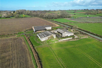
- Price
- Guide Price£575,000
- Size
- 0.86 acres
Development Site At Foldhill Lane, Martock, Somerset, TA12, Tintinhull, Somerset BA22 England
Added on 08/04/2026Development Land
- Price
- Offers Over£420,000
- Size
- 2.8 acres
Development Opportunity at West End Farm, Marston Magna, BA22, Marston Magna, Somerset BA22 England
Added on 10/05/2026Development Land
- Price
- Offers in Excess of£500,000
- Size
- 2.2 acres
Added on 08/10/2026Development Land
- Price
- Offers in Excess of£600,000
- Size
- 3.2 acres
Land At Mason Lane, Montacute, Nr. Yeovil, TA15, Nr. Yeovil, Somerset TA15 England
Added on 01/10/2026Development Land
- Price
- Offers in Region of£600,000
- Size
- 1.21 acres
Land at Combe Street Lane, Yeovil, BA21, Yeovil Without, Somerset BA21 England
Added on 29/01/2026Development Land
- Price
- Guide Price£500,000
- Size
- 1 acres
Added on 28/07/2026Conversion Land
- Price
- Guide Price£550,000
- Size
- 1.26 acres
Lot 1 - Ciderhouse Farm, Sigwells, Nr. Sherborne, DT9, Nr. Sherborne, Somerset DT9 England
Added on 29/01/2026Development Land