Land Opposite, 15 Townhead, Dalmellington, Ayr, Ayrshire, KA6
Key Features
- Building Plot with Previous Planning Permission for Two Residential Units
- Circa 371 sqm
- Ideal Self-Build Opportunity/Development Investment
Description
FOR SALE BY ONLINE AUCTION WEDNESDAY 23RD SEPTEMBER 2026 AT 9.00AM - ***FANTASTIC DEVELOPMENT OPPORTUNITY WITH PREVIOUS PLANNING CONSENT***PIECE OF LAND IN DALMELLINGTON, EAST AYRSHIRE WITH PREVIOUS PLANNING PERMISSION FOR TWO RESIDENTIAL UNITS***DREAM SELF-BUILD HOME OR DEVELOPMENT INVESTMENT***CIRCA 371 SQM***
***An exciting opportunity to acquire a well-located parcel of land in the popular village of Dalmellington, offering excellent potential for residential development.***
This attractive site previously benefited from planning permission for the construction of two residential units, presenting a fantastic prospect for developers, investors, or self-build buyers seeking a ready-considered project (all interested parties should make their own enquiries with the local planning authority regarding renewal or reinstatement).
Situated within an established residential area, the land enjoys a pleasant outlook and convenient access to local amenities, schooling, and transport links, while being surrounded by the beautiful Ayrshire countryside. The nearby Loch Doon and scenic landscapes provide a highly desirable setting for future homes.
Dalmellington offers a welcoming community environment while remaining within easy reach of Ayr and the wider region, making this an appealing location for future homeowners.
A rare opportunity to secure a site with proven development potential in a picturesque and increasingly sought-after area.
***KEY FEATURES***
1. Ideal Location: Situated in the picturesque town of Dalmellington, this land benefits from a tranquil setting while being within close proximity to local amenities, schools, and transportation links.
2. Previous Planning Approval: The land has previously obtained full planning permission for the construction of two residential properties, providing a hassle-free development opportunity for those looking to embark on a new build project.
3. Residential Potential: With the approval of plans, this land would offer the perfect canvas to create two bespoke homes tailored to your preferences. Whether you envision a modern contemporary design or a traditional architectural style, the possibilities are endless.
4. Vibrant Community: Dalmellington offers a warm and welcoming community spirit, making it an ideal place to settle down and enjoy a high quality of life. Local amenities, including shops, restaurants, and leisure facilities, cater to residents' everyday needs.
5. Excellent Investment: The demand for residential properties in Dalmellington is on the rise, making this land an attractive investment opportunity. Whether you choose to build and sell both properties or reside in one and sell the other, the potential for a favourable return on investment is promising.
Link to planning documents:
Don't miss out on this rare chance to acquire a prime land plot with planning permission for two residential builds in the sought-after location of Dalmellington!
***RECENT NEARBY RESIDENTIAL PROPERTY SALES***
- 1, Annbank Road, Mossblown, KA6 5BH - Detached - 3 bedroom - SOLD FEB'26 - £210,000
- West Drumsuie Farm, Drongan, Coylton, KA6 7EF - Semi Detached - SOLD FEB'26 - £182,500
- Wencardo, Carphairn Road, Dalmellington, KA6 7RE - Flat - 3 bedroom - SOLD FEB'26 - £175,000
Dalmellington (Scots: Dawmellinton, Scottish Gaelic: Dail M'Fhaolain) is a market town and civil parish in East Ayrshire, Scotland. The population is 1,284 to 1,500 residents according to recent data.
***TRANSPORT***
*Bus transport (main option)*
Key routes:
52 connects Dalmellington to Ayr Bus Station (main link to wider transport)
352 also runs between Dalmellington and Ayr via nearby villages
356 links Dalmellington with Cumnock and surrounding areas
These routes are mainly operated by Stagecoach West Scotland and serve multiple stops around the village such as Main Street and Bellsbank Road.
Buses run regularly throughout the day, especially toward Ayr, with early morning and daytime departures available.
Other connections:
Additional services (e.g. 14, 42, 347) can be accessed nearby, improving links across South Ayrshire.
A longer-distance coach route (e.g. service 520) connects to places like Castle Douglas.
*Rail transport*
- Nearest train access
The closest rail services are in Ayr, which connects to: Glasgow, Prestwick Airport, Other Scottish cities
*Road transport*
Dalmellington is connected by road to:
Ayr (about 1520 minutes by car)
Cumnock
Rural South Ayrshire areas
***EDUCATION***
The village has two schools within the "Doon Campus": Dalmellington Primary School and Doon Academy.
***THINGS TO DO***
*Nature & outdoor activities*
- Loch Doon: The biggest inland loch in southern Scotland. Great for:
Walking & cycling
Wild swimming (if you're brave!)
Picnics and photography
You can also see Doon Castle ruins on the water
- Carrick Forest Drive: A scenic 6-mile drive through forests and hills
Expect:
Waterfalls
Wildlife
Mountain views
- Galloway Forest Park
A Dark Sky Park amazing for stargazing
Activities:
Hiking
Mountain biking
Wildlife spotting
One of the best places in the UK to see the Milky Way
- Adventure & activities
Adventure sports centre
Offers:
Canoeing & kayaking
Rock climbing
Gorge walking & rafting
*Local history & culture*
- Doon Valley Museum - Small museum showing: Mining history, Local life and textiles, Located in one of the town's oldest buildings
- Dalmellington Motte
A well-preserved medieval earthwork mound
Dates back to around the 11th century
- Dalmellington War Memorial
*Small local experiences*
- Elizabeth James Creations - Gift Shop
*Nearby extras (worth a short drive)*
- More lochs, hills, and trails across the region
- Ideal base for exploring southwest Scotland's countryside
GUIDE PRICE - £22,000
To view legal documents for all properties, and to register for our online auctions please visit our website.
Purchases are subject to a Buyer's Premium. There may also be additional fees on certain properties. Please refer to the Articles of Roup/Special Conditions in the Legal pack to confirm.
Map Location
Property details
- Tenure
- Freehold
- Council Tax Band
- Ask Agent
- Date Posted
- 2026-09-10
Utilities & Restrictions
Utilities
- Electricity
- Ask Agent
- Water
- Ask Agent
- Heating
- Ask Agent
- Broadband
- Ask Agent
- Sewerage
- Ask Agent
Rights & Restrictions
- Public Rights of Way
- Ask Agent
- Private Rights of Way
- Ask Agent
- Listed Property
- Ask Agent
- Restrictions
- Ask Agent
Listed status, conservation areas and planning constraints for this location are in the full report.
Property Features
- Accessibility
- Ask Agent
- Parking
- Ask Agent
- Garden
- Ask Agent
Beyond the particulars: planning activity, flood history, heritage and ground risks, checked for this exact spot.
Connectivity
Broadband
Fastest speed available at this postcode
80 Mbps
Superfast
Suitable for
- HD streaming
- Video calls
- Web & social
Mobile signal
Outdoor predictions; indoor signal depends on building materials.
Ofcom Connected Nations postcode-level predictions. Speeds and signal are modelled, not measured, and vary between addresses and providers.
Signal is the easy part. Planning activity, flood history and protected designations here are in the full report.
Nearest Schools
Primary
- Dalmellington Primary School385 metres
- Pupils
- 81
- Type
- Non-denominational
- Bellsbank Primary School0.7 miles
- Pupils
- 111
- Type
- Non-denominational
- Patna Primary School5 miles
- Pupils
- 111
- Type
- Non-denominational
- St Xavier's Primary School5 miles
- Pupils
- 34
- Type
- Roman Catholic
- Littlemill Primary School6 miles
- Pupils
- 28
- Type
- Non-denominational
Secondary
- Doon Academy385 metres
- Pupils
- 240
- Type
- Non-denominational
- Robert Burns Academy10 miles
- Pupils
- 1,734
- Type
- Non-denominational
- Queen Margaret Academy12 miles
- Pupils
- 681
- Type
- Roman Catholic
- Carrick Academy12 miles
- Pupils
- 391
- Type
- Non-denominational
- Belmont Academy12 miles
- Pupils
- 1,211
- Type
- Non-denominational
Distances are straight-line from the advertised location. Source: the national school registers (DfE, Welsh Government, Scottish Government) and Ofsted.
Schools are just the start: planning activity, heritage and any flood history here are in the full report.
Amenities
Supermarket
GP surgery
Pharmacy
Green space
Walking trail
Straight-line distances from the advertised location. Sources: NHS records, Geolytix supermarket locations, OS Open Greenspace and the national trails registers.
The area stacks up? Now check the location itself: planning nearby, protected designations and past flooding.
Getting Around
Nearest station
Nearest bus stop
Typical drive times
Straight-line distances from the advertised location; drive times are typical free-flow times over OpenStreetMap road data, so allow more at peak. Public transport locations from DfT NaPTAN.
Easy to reach matters. So do planning activity, flood history and ground risks: all in the full report.
Flood Risk
From SEPA flood map open data, checked around the advertised map pin and allowing for the listed acreage where known. This summary comes from LandSale, the advertising platform, not from the listing agent, and is not part of the agent's particulars. Risk can vary across a single holding, so verify anything critical through your own searches before committing.
Rivers and the sea
Surface water
The detail behind these bandings
The full report pinpoints where this location sits on the flood maps, and runs the deeper checks that usually only surface after an offer.
- Exact flood zones & annual chances (included in the full report)
- Any recorded past flooding (included in the full report)
- Planning activity nearby (included in the full report)
- Heritage & conservation (included in the full report)
- Protected nature designations (included in the full report)
- Ground risks (included in the full report)
£14.99 · one-off purchase
By LandSale, the platform. Not provided by the listing agent. Ready in about a minute.
Important notice: Information, maps and tags on this page are drawn from the advertising agent's marketing materials or generated automatically. LandSale has not verified them. Relying on these details is at your own risk, always carry out independent checks before committing to a purchase.
LandSale full disclaimer
Marketing information only - not formal particulars. The details on this website are provided for general guidance and do not constitute an offer or contract. Neither LandSale nor the advertising estate/land agent accepts responsibility for any inaccuracy.
1. Source of information
- Listing content: Core description, asking price, tenure, measurements, photographs and planning history originate from the marketing materials of the advertising estate or land agent. LandSale does not author this content and cannot guarantee its accuracy.
- Automated tags & categorisation: Property type, land-use class, acreage bands and similar labels may be applied by machine-learning models. They are intended as a helpful guide only and may not reflect the property's legal status or permitted use.
- Third-party & enriched data layers: Maps, boundary outlines, planning designations, soil reports, broadband coverage and other environmental or location-based insights are licensed from external suppliers. Such data are supplied “as is", may be incomplete or out of date and are subject to change without notice.
2. Verification required
Prospective purchasers must verify critical matters, including but not limited to planning permission, title boundaries, public rights of way, environmental constraints, acreage, services, access and VAT status, through their own inspections, specialist surveys, legal advisers and the selling agent before relying on the information or entering into any contract.
3. No warranty or liability
LandSale gives no warranty, express or implied, as to the accuracy, completeness or fitness for any particular purpose of the information displayed. LandSale shall not be liable for any loss, damage, cost or expense arising directly or indirectly from any use of or reliance on such information, save where liability may not be excluded by law.
4. Updates & feedback
If you believe any detail on this listing is inaccurate, please let us know. We will investigate and, where appropriate, update the listing or notify the agent.
© LandSale | Version 1.3 - August 2026
Listing agent
Online Property Auction Group, Glasgow
1008 Pollokshaws Road, Shawlands, G41 2HG
Contact Online Property Auction Group, Glasgow
1008 Pollokshaws Road, Shawlands, G41 2HG
View agent profileSimilar properties for sale
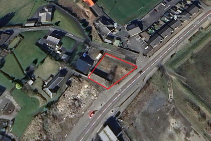
- Price
- Guide Price£27,000
Land at 111, Castle, New Cumnock, KA184AE, Ayr, Carrick and Cumnock, East Ayrshire KA18 Scotland
Added on 03/07/2026Development Land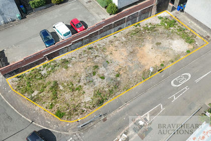
- Price
- Guide Price£22,000
Added on 25/08/2026Development Land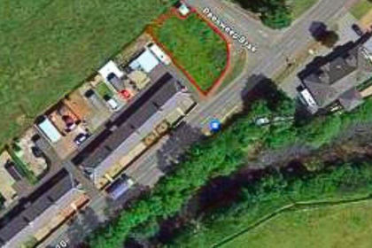
- Price
- Guide Price£22,000
Added on 29/08/2026Building Plot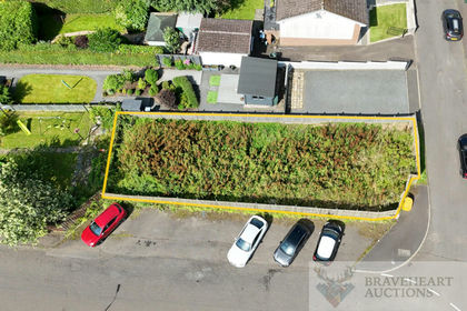
- Price
- Guide Price£22,500
Lochore Terrace, Darvel, East Ayrshire, KA17, Kilmarnock and Loudoun, East Ayrshire KA17 Scotland
Added on 18/07/2026Building Plot Added on 18/07/2026Commercial Land
- Price
- Guide Price£25,000
Added on 21/07/2026Commercial Land
- Price
- Guide Price£24,000
3-11, London Street, Larkhall, ML91AQ, Hamilton and Clyde Valley, South Lanarkshire ML9 Scotland
Added on 31/08/2026Development Land