Stair, Mauchline, East Ayrshire, KA5
- Land size
- 0.98 acres
Description
Excellent opportunity to acquire an attractive development site, comprising two individual plots, each with Planning in Principle for a detached house. Situated on the edge of the picturesque hamlet of Stair. Surrounded by rolling Ayrshire countryside and within easy reach of all main amenities.
Development site on the eastern edge of the picturesque hamlet of Stair with planning in principle for two dwelling houses. Details can be viewed on the East Ayrshire council planning site : 26/0183/PPP. The site extends to approximately 0.98 acres (0.39ha) in total. Each site measures approximately 0.49 acres (0.19ha) with the footprint of the house approximately 245sqm to be situated centrally within the plots. Surrounding each house is an area of good sized garden ground and ample space for parking 4 cars.
Established within a cluster of homes the site offers the prefect balance of peaceful country living and excellent connectivity to all main amenities. The proposed dwelling will be bungalow-style (single storey) and has been designed to remain in keeping with the scale, character, and appearance of the surrounding properties. This will be the final 2 houses to be built within the cluster which will comprise of 15 residential units.
Mineral Rights
To the extent they are included within the vendor’s title.
Local Authority
East Ayrshire Council, Opera House, 8 John Finnie Street, Kilmarnock, KA1 1DD
Date of Entry
By mutual agreement
Servitude Rights
The property is sold subject to and with the benefit of all servitude rights, burdens, reservations and wayleaves, including rights of access and rights of way, whether public or private, light including restriction on external lighting, support, drainage, water and wayleaves for masts, pylons, stays, cable, drains and water, gas and other pipes, whether contained in the Title Deeds or informally constituted and whether referred to in the General Remarks and Stipulations or not.
Plans, Areas and Schedules
These are based on the Ordnance Survey and Title Deeds and are for reference only. They have been carefully checked and computed by the selling agents and the purchaser shall be deemed to have satisfied himself as to the description of the property and any error or mis-statement shall not annul the sale nor entitle either party to compensation in respect thereof.
Viewing Arrangement
Viewing is strictly by appointment with the selling agents. Please contact the Ayr office on to arrange a suitable time.
Important Notice:
Bell Ingram, its clients and any joint agents give notice that 1: They are not authorised to make or give any representations or warranties in relation to the property either here or elsewhere, either on their own behalf or on behalf of their client or otherwise. They assume no responsibility for any statement that may be made in these particulars. These particulars do not form part of any offer or contract and must not be relied upon as statements or representations of fact. 2: Any areas, measurements or distances are approximate. The text, photographs and plans are for guidance only and are not necessarily comprehensive. It should not be assumed that the property has all necessary planning, building regulation or other consents and Bell Ingram have not tested any services, equipment or facilities. Purchasers must satisfy themselves by inspection or otherwise.
Anit-Money Laundering Regulations
Under the 5th Directive of the MoneyLaundering Regulations, effective from 10th January 2020, we are required to carry out anti-money laundering due diligence on both clients and successful purchaser. This check will leave a ‘soft footprint’ on your credit history but will not affect your credit rating.
Situation
Stair forms part of the River Ayr valley and is located around 9 miles from Ayr. It is without doubt an area of outstanding natural beauty surrounded by beautiful Ayrshire countryside. The town of Ayr provides a comprehensive range of amenities including supermarket and retail shopping, transport and recreational facilities. It is 12 miles from Glasgow Prestwick Airport and within easy reach of Glasgow via the A77 / M77.
Primary and Secondary schooling is close by.
Services
Mains Electricity and water are close by.
High-speed fibre-to-the-cabinet (FTTC) broadband is available nearby
Directions
From Ayr take the A70 signposted for Edinburgh/ Cumnock. At the roundabout take the 2nd exit and stay on the A70 and proceed through the village of Coylton and Coalhall. Turn left onto the B730 then take the 1st right and continue past Gemmell’s Garden Centre to the small hamlet. The site is situated on the left-hand side just before leaving the hamlet.
What three words: ///stubbed.tractor.spans
Map Location
Property details
- Tenure
- Freehold
- Council Tax Band
- TBC
- Date Posted
- 2026-09-04
Utilities & Restrictions
Utilities
- Electricity
- Ask Agent
- Water
- Ask Agent
- Heating
- Ask Agent
- Broadband
- Ask Agent
- Sewerage
- Ask Agent
Rights & Restrictions
- Public Rights of Way
- Ask Agent
- Private Rights of Way
- Ask Agent
- Listed Property
- Ask Agent
- Restrictions
- Ask Agent
Listed status, conservation areas and planning constraints for this location are in the full report.
Property Features
- Accessibility
- Ask Agent
- Parking
- Parking Available
- Garden
- Ask Agent
Beyond the particulars: planning activity, flood history, heritage and ground risks, checked for this exact spot.
Connectivity
Broadband
Fastest speed available at this postcode
80 Mbps
Superfast · available to 64% of premises
Suitable for
- HD streaming
- Video calls
- Web & social
Mobile signal
Outdoor predictions; indoor signal depends on building materials.
Ofcom Connected Nations postcode-level predictions. Speeds and signal are modelled, not measured, and vary between addresses and providers.
Signal is the easy part. Planning activity, flood history and protected designations here are in the full report.
Nearest Schools
Primary
- Drongan Primary School2.4 miles
- Pupils
- 259
- Type
- Non-denominational
- Ochiltree Primary School2.7 miles
- Pupils
- 94
- Type
- Non-denominational
- Coylton Primary School3.2 miles
- Pupils
- 251
- Type
- Non-denominational
- Tarbolton Primary School3.9 miles
- Pupils
- 205
- Type
- Non-denominational
- Annbank Primary School3.9 miles
- Pupils
- 265
- Type
- Non-denominational
Secondary
- Robert Burns Academy6.2 miles
- Pupils
- 1,734
- Type
- Non-denominational
- Kyle Academy6.5 miles
- Pupils
- 821
- Type
- Non-denominational
- Queen Margaret Academy6.8 miles
- Pupils
- 681
- Type
- Roman Catholic
- Ayr Academy6.9 miles
- Pupils
- 602
- Type
- Non-denominational
- Prestwick Academy7.2 miles
- Pupils
- 1,186
- Type
- Non-denominational
Distances are straight-line from the advertised location. Source: the national school registers (DfE, Welsh Government, Scottish Government) and Ofsted.
Schools are just the start: planning activity, heritage and any flood history here are in the full report.
Amenities
Supermarket
GP surgery
Pharmacy
Straight-line distances from the advertised location. Sources: NHS records, Geolytix supermarket locations, OS Open Greenspace and the national trails registers.
The area stacks up? Now check the location itself: planning nearby, protected designations and past flooding.
Getting Around
Nearest station
Nearest bus stop
Typical drive times
Straight-line distances from the advertised location; drive times are typical free-flow times over OpenStreetMap road data, so allow more at peak. Public transport locations from DfT NaPTAN.
Easy to reach matters. So do planning activity, flood history and ground risks: all in the full report.
Flood Risk
From SEPA flood map open data, checked around the advertised map pin and allowing for the listed acreage where known. This summary comes from LandSale, the advertising platform, not from the listing agent, and is not part of the agent's particulars. Risk can vary across a single holding, so verify anything critical through your own searches before committing.
Rivers and the sea
Surface water
The detail behind these bandings
The full report pinpoints where this location sits on the flood maps, and runs the deeper checks that usually only surface after an offer.
- Exact flood zones & annual chances (included in the full report)
- Any recorded past flooding (included in the full report)
- Planning activity nearby (included in the full report)
- Heritage & conservation (included in the full report)
- Protected nature designations (included in the full report)
- Ground risks (included in the full report)
£14.99 · one-off purchase
By LandSale, the platform. Not provided by the listing agent. Ready in about a minute.
Important notice: Information, maps and tags on this page are drawn from the advertising agent's marketing materials or generated automatically. LandSale has not verified them. Relying on these details is at your own risk, always carry out independent checks before committing to a purchase.
LandSale full disclaimer
Marketing information only - not formal particulars. The details on this website are provided for general guidance and do not constitute an offer or contract. Neither LandSale nor the advertising estate/land agent accepts responsibility for any inaccuracy.
1. Source of information
- Listing content: Core description, asking price, tenure, measurements, photographs and planning history originate from the marketing materials of the advertising estate or land agent. LandSale does not author this content and cannot guarantee its accuracy.
- Automated tags & categorisation: Property type, land-use class, acreage bands and similar labels may be applied by machine-learning models. They are intended as a helpful guide only and may not reflect the property's legal status or permitted use.
- Third-party & enriched data layers: Maps, boundary outlines, planning designations, soil reports, broadband coverage and other environmental or location-based insights are licensed from external suppliers. Such data are supplied “as is", may be incomplete or out of date and are subject to change without notice.
2. Verification required
Prospective purchasers must verify critical matters, including but not limited to planning permission, title boundaries, public rights of way, environmental constraints, acreage, services, access and VAT status, through their own inspections, specialist surveys, legal advisers and the selling agent before relying on the information or entering into any contract.
3. No warranty or liability
LandSale gives no warranty, express or implied, as to the accuracy, completeness or fitness for any particular purpose of the information displayed. LandSale shall not be liable for any loss, damage, cost or expense arising directly or indirectly from any use of or reliance on such information, save where liability may not be excluded by law.
4. Updates & feedback
If you believe any detail on this listing is inaccurate, please let us know. We will investigate and, where appropriate, update the listing or notify the agent.
© LandSale | Version 1.3 - August 2026
Listing agent
Bell Ingram, Perth
Durn, Isla Road, Perth, PH2 7HF
Similar properties for sale
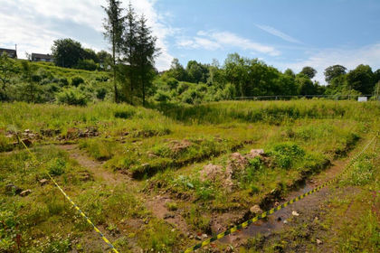
- Price
- Offers Over£60,000
Plot at 64 Newton Street, Catrine, KA5, Kilmarnock and Loudoun, East Ayrshire KA5 Scotland
Added on 09/07/2026Development Land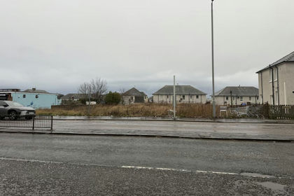
- Price
- Offers in Excess of£90,000
- Size
- 0.26 acres
50, Main Road, Whitletts, Ayr, KA8, Ayr, Carrick and Cumnock, South Ayrshire KA8 Scotland
Added on 29/01/2026Development Land
- Price
- Guide Price£82,000
Added on 29/01/2026Undeveloped Land
- Price
- Offers in Excess of£99,000
Plot @ Adamton Road South Prestwick, Central Ayrshire, South Ayrshire KA9 Scotland
Added on 29/05/2026Self Build Plot
- Price
- Guide Price£55,000
- Size
- 1.06 acres
Added on 25/06/2026Vacant Land
- Price
- £80,000
- Size
- 1.06 acres
Added on 18/07/2026Vacant Land
- Price
- Guide Price£59,000
- Size
- 5 acres
Holmburn Road, Cumnock, Ayr, Carrick and Cumnock, East Ayrshire KA18 Scotland
Added on 29/01/2026Undeveloped Land
- Price
- Guide Price£72,000
Added on 01/05/2026Building Plot- Price
- Guide Price£72,000
Added on 03/07/2026Building Plot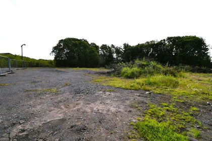
- Price
- Guide Price£120,000
Peesweep Brae, Lugar, KA183LE, Kilmarnock and Loudoun, East Ayrshire KA18 Scotland
Added on 03/07/2026Building Plot