North Perrott, Crewkerne
- Bedrooms
- 3
- Bathrooms
- 2
Key Features
- Three double bedrooms
- Contemporary barn conversion
- Architectural design
- Energy efficient build
- Spacious accommodation
- Enclosed garden
- Timber framed carport
- See video
Description
A new build modern barn conversion set in a high quality development located in a peaceful semi rural setting.
Accommodation - The property is laid out as follows
A path leads up to the entrance door which opens into a spacious hall with all of the beautiful oak wood doors leading off the principle rooms. The cloakroom comes off the hall with WC and basin over. Also a utility cupboard with plumbing for a washing machine and a boiler room off the hall.
The main open plan living space is stunning with bi folding and sliding doors providing open views out to the garden. It is wonderfully light with a vaulted ceiling to give that designer feel. In the kitchen area you will find a contemporary range of base and wall units in anthracite grey topped with a sleek low profile Zenith compact worksurface. Integrated items include a 5 ring induction hob, an eye level double oven and a dishwasher. The kitchen area is separated from the main living area by a stand alone island which has large pan drawers on one side and a breakfast bar on the other. The main living area is very generous and offers a central feature of a stand-alone wood burner to give that extra sense of comfort.
There are 3 bedrooms in total. The main bedroom is located at the far end of the hall. This room has a front aspect and benefits from both a TV and telephone/data point. The en-suite comprises of a shower cubicle, wall hung vanity unit with basin and W.C.
The family bathroom is part tiled and is fitted with a white suite consisting of a 'P' shaped panelled bath with mixer taps and over head shower, vanity unit with basin and W.C.
Outside - A shared sweeping drive leads you down to the development. There is an open framed car port providing numbered allocated parking spaces plus there is also an additional two allocated parking spaces per property. To the rear of the carport are full height double-door storage sheds, one for each property on the site.
To the front of the property is a gravelled area with a porcelain path leading to the parking. The rear garden is laid to lawn.
Local Authority - Somerset Council
Tax Band - D
Property Information - There are no current granted planning applications within the postcode which will effect the property, which we have been made aware of.
There are varying covenants with the property please contact the agent for further information.
Services - Mains water, electricity and drainage are connected.
Air source heat pump with under floor heating throughout.
Superfast broadband is available. All four major networks offer indoor and outdoor mobile service.
Situation - North Perrott is a pretty village with many character houses and cottages and a number of modern properties. Village amenities include church, garden centre, The Manor Arms public house, bus service and private school. The nearest town of Crewkerne is situated approx. 3 miles distant with a larger range of facilities including banks, Post Office, schooling, supermarkets including Waitrose and a leisure complex. There is a main line station (Exeter - Waterloo) and the Jurassic coast is approx. 15 miles distant at West Bay.
Directions - what3words ///commit.belonged.earlobes
Map Location
Property details
- Tenure
- Freehold
- Council Tax Band
- TBC
- Date Posted
- 2026-08-13
Energy Performance Certificate
Energy Efficiency Rating
Based on UK Energy Performance Certificate standards (EU Directive 2002/91/EC)
Utilities & Restrictions
Utilities
- Electricity
- Mains
- Water
- Mains
- Heating
- Air Source Heat Pump
- Broadband
- Full Fibre (FTTP)
- Sewerage
- Mains
Rights & Restrictions
- Public Rights of Way
- Ask Agent
- Private Rights of Way
- Ask Agent
- Listed Property
- Ask Agent
- Restrictions
- Yes
Property Features
- Accessibility
- Ask Agent
- Parking
- Covered Parking, Off-Street Parking
- Garden
- Garden
Connectivity
Broadband
Fastest speed available at this postcode
1 Gbps
Gigabit full fibre · available to 78% of premises
Suitable for
- 4K streaming on every screen
- Full-time home working
- Online gaming & big downloads
Mobile signal
Outdoor predictions; indoor signal depends on building materials.
Ofcom Connected Nations postcode-level predictions. Speeds and signal are modelled, not measured, and vary between addresses and providers.
Nearest Schools
Primary
- Haselbury Plucknett Church of England Primary School656 metresNo Ofsted rating
- Ages
- 4 to 11
- Pupils
- 47
- Type
- Academy converter
- Faith
- Church of England
- St Bartholomew's Church of England Primary School1.9 milesNo Ofsted rating
- Ages
- 5 to 11
- Pupils
- 154
- Type
- Academy converter
- Faith
- Church of England
- West Chinnock Church School2.1 milesOfsted: Inadequate
- Ages
- 5 to 11
- Pupils
- 39
- Type
- Academy sponsor led
- Faith
- Church of England
- Ashlands Church of England Primary School2.1 milesOfsted: Requires improvement
- Ages
- 4 to 11
- Pupils
- 141
- Type
- Academy converter
- Faith
- Church of England
- Maiden Beech Academy2.5 milesOfsted report card · Feb 2026
- Ages
- 4 to 11
- Pupils
- 102
- Type
- Academy converter
Secondary
- Wadham School1.6 milesOfsted: Requires improvement *
- Ages
- 11 to 16
- Pupils
- 763
- Type
- Voluntary controlled school
- Faith
- Church of England
- Stanchester Academy4.6 milesOfsted: Requires improvement *
- Ages
- 11 to 16
- Pupils
- 829
- Type
- Academy converter
- Beaminster School5.2 milesOfsted: Good
- Ages
- 11 to 18
- Pupils
- 673
- Type
- Voluntary controlled school
- Faith
- Christian
- Preston School Academy5.6 milesOfsted: Good
- Ages
- 11 to 16
- Pupils
- 1,003
- Type
- Academy converter
- Westfield Academy6 milesNo Ofsted rating
- Ages
- 11 to 16
- Pupils
- 1,013
- Type
- Academy converter
* Latest graded judgement covers quality of education only; no overall grade was issued under the 2024-25 inspection framework.
Distances are straight-line from the advertised location. Source: the national school registers (DfE, Welsh Government, Scottish Government) and Ofsted.
Amenities
Supermarket
GP surgery
Pharmacy
Hospital
Green space
Straight-line distances from the advertised location. Sources: NHS records, Geolytix supermarket locations, OS Open Greenspace and the national trails registers.
Getting Around
Nearest station
Nearest bus stop
Typical drive times
Straight-line distances from the advertised location; drive times are typical free-flow times over OpenStreetMap road data, so allow more at peak. Public transport locations from DfT NaPTAN.
Flood Risk
From Environment Agency flood map open data, checked around the advertised map pin and allowing for the listed acreage where known. This summary comes from LandSale, the advertising platform, not from the listing agent, and is not part of the agent's particulars. Risk can vary across a single holding, so verify anything critical through your own searches before committing.
Rivers and the sea
Surface water
The detail behind these bandings, including exact zones and annual chances, any recorded past flooding, plus planning, heritage, nature and ground checks, is in the .
Important notice: Information, maps and tags on this page are supplied by the advertising agent or generated automatically. LandSale has not verified them. Relying on these details is at your own risk, always carry out independent checks before committing to a purchase.
LandSale full disclaimer
Marketing information only - not formal particulars. The details on this website are provided for general guidance and do not constitute an offer or contract. Neither LandSale nor the advertising estate/land agent accepts responsibility for any inaccuracy.
1. Source of information
- Agent-supplied content: Core description, asking price, tenure, measurements, photographs and planning history are uploaded by the appointed agent, who remains solely responsible for their accuracy.
- Automated tags & categorisation: Property type, land-use class, acreage bands and similar labels may be applied by machine-learning models. They are intended as a helpful guide only and may not reflect the property's legal status or permitted use.
- Third-party & enriched data layers: Maps, boundary outlines, planning designations, soil reports, broadband coverage and other environmental or location-based insights are licensed from external suppliers. Such data are supplied “as is", may be incomplete or out of date and are subject to change without notice.
2. Verification required
Prospective purchasers must verify critical matters, including but not limited to planning permission, title boundaries, public rights of way, environmental constraints, acreage, services, access and VAT status, through their own inspections, specialist surveys, legal advisers and the selling agent before relying on the information or entering into any contract.
3. No warranty or liability
LandSale gives no warranty, express or implied, as to the accuracy, completeness or fitness for any particular purpose of the information displayed. LandSale shall not be liable for any loss, damage, cost or expense arising directly or indirectly from any use of or reliance on such information, save where liability may not be excluded by law.
4. Updates & feedback
If you believe any detail on this listing is inaccurate, please let us know. We will investigate and, where appropriate, update the listing or notify the agent.
© LandSale | Version 1.2 - January 2026
Listing agent
Symonds & Sampson, Beaminster
36 Hogshill Street, Beaminster, DT8 3AA
Similar properties for sale
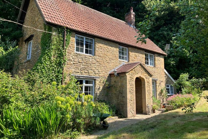
- Price
- Offers in Excess of£550,000
- Size
- 1.84 acres
Added on 29/01/2026Cottage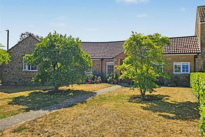
- Price
- Guide Price£400,000
Old Farm Place, Hinton St. George, Somerset, TA17, Hinton St. George, Somerset TA17 England
Added on 12/08/2026Barn Conversion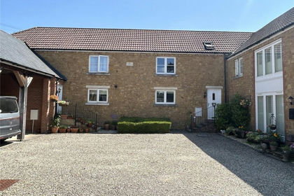
- Price
- Offers in Excess of£380,000
Alvington Fields, Brympton, Yeovil, Somerset, BA22, Brympton, Somerset BA22 England
Added on 04/02/2026Barn Conversion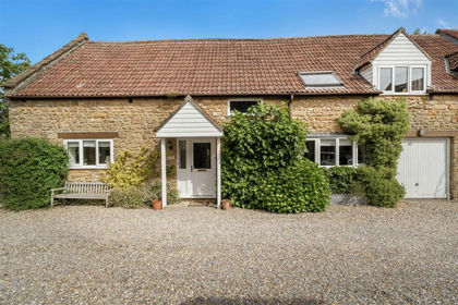
- Price
- Guide Price£429,000
Upton Lane, Seavington, Ilminster, Seavington St Mary, Somerset TA19 England
Added on 03/06/2026Barn Conversion
- Price
- Guide Price£475,000
East Street, Martock, Somerset, Martock, Somerset TA12 England
Added on 24/06/2026Barn Conversion
- Price
- £495,000
- Size
- 1 acres
Queen Street, Tintinhull, Yeovil, Somerset, BA22, Tintinhull, Somerset BA22 England
Added on 05/08/2026House with Land
- Price
- Guide Price£380,000
- Size
- 0.97 acres
Burrough Street, Ash, Martock, Somerset, TA12, Ash, Somerset TA12 England
Added on 05/08/2026Building Plot
- Price
- Fixed Price£450,000
- Size
- 0.15 acres
West Lane, West Lambrook, South Petherton, Somerset, TA13, Kingsbury Episcopi, Somerset TA13 England
Added on 11/06/2026Barn Conversion
- Price
- Guide Price£550,000
- Size
- 1.5 acres
Added on 25/04/2026House with Land Added on 29/01/2026Barn Conversion