Llangovan, Monmouth, NP25
- Land size
- 2.5 acres
- Bedrooms
- 5
- Bathrooms
- 2
Key Features
- 5 bedrooms
- 2.5 acres
- 2 bath/shower rooms
- Lounge with log burner
- Dining room open to kitchen
- Family room
- Utility room
- Outbuildings
- Rural location 7 miles from Monmouth
Description
Unique, spacious and impressive conversion of a former cider mill, ironmongery/smithy and cottage, set within approximately 2.5 acres on the edge of Llangovan village, enjoying stunning countryside views and a rich variety of flora and fauna.
Records date back to pre-1780, when the property was originally a two-up, two-down cottage alongside a separate mill. Over time, the buildings have been thoughtfully combined, with a full rewire and two extensions, creating a bespoke family home full of character and impressive features throughout.
This idyllic rural setting, with far-reaching views bordering an Area of Outstanding Natural Beauty, is situated just 7 miles from Monmouth and 5 miles from Raglan, providing excellent access to the A40, A449, M4 and M50. The area also benefits from a free return school bus service to both Raglan Primary School and Monmouth Comprehensive.
A private driveway, flanked by paddock land to one side and a stream with gardens to the other, leads to a gravel parking area.
A large stable door opens into a spacious entrance hall featuring exposed stone walls, timber lintels and a WC. A tiled floor continues through to the kitchen, while steps rise to an oak latch door leading into the lounge.
Overlooking the rear garden, the spacious lounge features an impressive inglenook fireplace with log burner set on a flagstone hearth, complemented by exposed ceiling beams. A window provides convenient access to an external woodstore.
The dual aspect kitchen is fitted with solid oak units and incorporates a central breakfast bar. A Belfast sink sits beneath a window overlooking the garden, while an externally vented extractor sits above a Belling electric range cooker. Stairs rise from the kitchen to the first floor.
Open plan to the kitchen, the impressive dining room-formerly the mill and smithy-features a slate floor, exposed beams and stone walls, with a fireplace housing a decorative burner that could be reconnected if desired.
Off the dining room is a generous utility room offering extensive storage, a stainless steel sink, space for appliances, a water filtration system, and an oil boiler (approximately 3 years old), with a door leading to the rear garden.
Beyond this is a triple aspect family room with oak flooring, beamed ceiling and sliding doors opening onto the garden. Stairs rise from here to a versatile office/bedroom five.
This triple aspect room enjoys views across the grounds, with part-sloped ceilings and oak flooring, offering flexible use as a home office or additional bedroom.
The main staircase from the kitchen leads to a landing with a front-facing window and exposed timber lintel, providing access to four bedrooms and the family bathroom.
The dual aspect principal bedroom boasts a vaulted ceiling with exposed A-frame beams, painted stone walls, oak flooring, and French doors opening onto a balcony with views across the front paddock and surrounding countryside. The en-suite comprises a shower cubicle with electric shower, pedestal wash basin and WC.
Bedroom two features part-sloped ceilings, exposed stone walls and a built-in cupboard.
Bedroom three also has part-sloped ceilings, exposed stonework and a feature fireplace.
Bedroom four is dual aspect, with a sloped, beamed ceiling and exposed stone wall.
The main bathroom includes a freestanding clawfoot bath, corner shower with power shower, pedestal wash basin and WC. An airing cupboard houses the hot water tank, heated by oil in the winter and electric in the summer.
Externally, the grounds include a separate paddock and mature gardens with a variety of fruit trees. A stream runs through the gardens and, most uniquely, beneath the mill via a historic stone tunnel, once part of the working mill and blacksmiths. The stream attracts a range of wildlife, including deer, and offers practical benefits for pets and smallholding use.
To the front of the property there is a greenhouse and two substantial outbuildings, offering excellent potential for conversion (subject to the necessary consents). The grounds are further enhanced by attractive historic stonework surrounding the stream and garden areas.
Mature hedgerows and fencing form the natural boundaries of this exceptional home.
Services: Mains electric, oil heating, private water and drainage (no water rates payable)
Council tax band G.
Map Location
Property details
- Tenure
- Freehold
- Council Tax Band
- G
- Date Posted
- 2026-06-26
Market Value Analysis
Compared with 1,177 Homes with Land listings in Wales (1+ acres).
Energy Performance Certificate
Energy Efficiency Rating
Based on UK Energy Performance Certificate standards (EU Directive 2002/91/EC)
Utilities & Restrictions
Utilities
- Electricity
- Ask Agent
- Water
- Ask Agent
- Heating
- Ask Agent
- Broadband
- Ask Agent
- Sewerage
- Ask Agent
Rights & Restrictions
- Public Rights of Way
- Ask Agent
- Private Rights of Way
- Ask Agent
- Listed Property
- Ask Agent
- Restrictions
- Ask Agent
Property Features
- Accessibility
- Ask Agent
- Parking
- Parking Available
- Garden
- Garden
Connectivity
Broadband
Fastest speed available at this postcode
1.8 Gbps
Gigabit full fibre · available to 67% of premises
Suitable for
- 4K streaming on every screen
- Full-time home working
- Online gaming & big downloads
Mobile signal
Outdoor predictions; indoor signal depends on building materials.
Ofcom Connected Nations postcode-level predictions. Speeds and signal are modelled, not measured, and vary between addresses and providers.
Nearest Schools
Primary
- Trellech Junior & Infants2.6 miles
- Pupils
- 169
- Type
- Infants & Juniors
- Language
- English medium school / provision
- Raglan Primary2.9 miles
- Pupils
- 165
- Type
- Infants & Juniors
- Language
- English medium school / provision
- Overmonnow Primary School4.4 miles
- Pupils
- 337
- Type
- Nursery, Infants & Juniors
- Language
- English medium school / provision
- Ysgol Gymraeg Trefynwy4.4 miles
- Pupils
- 21
- Type
- Nursery, Infants & Juniors
- Language
- Welsh medium school / provision (including transitional)
- Llandogo Primary4.4 miles
- Pupils
- 64
- Type
- Infants & Juniors
- Language
- English medium school / provision
Secondary
- Monmouth Comprehensive School5.1 miles
- Pupils
- 1,696
- Type
- Secondary (ages 11-19)
- Language
- English medium school / provision
- Chepstow Comprehensive School8.7 miles
- Pupils
- 860
- Type
- Secondary (ages 11-19)
- Language
- English medium school / provision
- Ysgol Gymraeg Gwynllyw11 miles
- Pupils
- 808
- Type
- Middle (ages 3-19)
- Language
- Welsh medium school / provision (including transitional)
- King Henry VIII 31911 miles
- Pupils
- 1,310
- Type
- Middle (ages 3-19)
- Language
- English medium school / provision
- St. Albans R.C. High School12 miles
- Pupils
- 824
- Type
- Secondary (ages 11-16)
- Language
- English medium school / provision
Distances are straight-line from the advertised location. Source: the national school registers (DfE, Welsh Government, Scottish Government) and Ofsted.
Amenities
Supermarket
GP surgery
Pharmacy
Straight-line distances from the advertised location. Sources: NHS records, Geolytix supermarket locations, OS Open Greenspace and the national trails registers.
Getting Around
Nearest station
Nearest bus stop
Typical drive times
Straight-line distances from the advertised location; drive times are typical free-flow times over OpenStreetMap road data, so allow more at peak. Public transport locations from DfT NaPTAN.
Flood Risk
From Natural Resources Wales flood map open data, checked around the advertised map pin and allowing for the listed acreage where known. This summary comes from LandSale, the advertising platform, not from the listing agent, and is not part of the agent's particulars. Risk can vary across a single holding, so verify anything critical through your own searches before committing.
Rivers and the sea
Surface water
The detail behind these bandings, including exact zones and annual chances, any recorded past flooding, plus planning, heritage, nature and ground checks, is in the .
Important notice: Information, maps and tags on this page are supplied by the advertising agent or generated automatically. LandSale has not verified them. Relying on these details is at your own risk, always carry out independent checks before committing to a purchase.
LandSale full disclaimer
Marketing information only - not formal particulars. The details on this website are provided for general guidance and do not constitute an offer or contract. Neither LandSale nor the advertising estate/land agent accepts responsibility for any inaccuracy.
1. Source of information
- Agent-supplied content: Core description, asking price, tenure, measurements, photographs and planning history are uploaded by the appointed agent, who remains solely responsible for their accuracy.
- Automated tags & categorisation: Property type, land-use class, acreage bands and similar labels may be applied by machine-learning models. They are intended as a helpful guide only and may not reflect the property's legal status or permitted use.
- Third-party & enriched data layers: Maps, boundary outlines, planning designations, soil reports, broadband coverage and other environmental or location-based insights are licensed from external suppliers. Such data are supplied “as is", may be incomplete or out of date and are subject to change without notice.
2. Verification required
Prospective purchasers must verify critical matters, including but not limited to planning permission, title boundaries, public rights of way, environmental constraints, acreage, services, access and VAT status, through their own inspections, specialist surveys, legal advisers and the selling agent before relying on the information or entering into any contract.
3. No warranty or liability
LandSale gives no warranty, express or implied, as to the accuracy, completeness or fitness for any particular purpose of the information displayed. LandSale shall not be liable for any loss, damage, cost or expense arising directly or indirectly from any use of or reliance on such information, save where liability may not be excluded by law.
4. Updates & feedback
If you believe any detail on this listing is inaccurate, please let us know. We will investigate and, where appropriate, update the listing or notify the agent.
© LandSale | Version 1.2 - January 2026
Listing agent
M2 Estate Agents, Abergavenny
11 Cross Street, Abergavenny, NP7 5EH
Similar properties for sale
- Price
- £875,000
- Size
- 3 acres
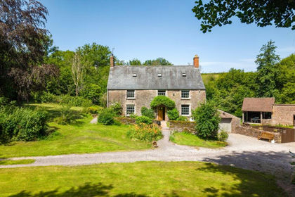
Little Llanthomas, Penyclawdd, NP25, Mitchel Troy, Monmouthshire NP25 Wales
Added on 29/01/2026Cottage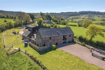
- Price
- Guide Price£975,000
- Size
- 2 acres
Cwmcarvan, Monmouth, Monmouthshire, NP25, Mitchel Troy, Monmouthshire NP25 Wales
Added on 11/05/2026Barn Conversion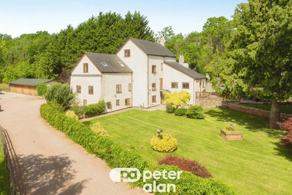
- Price
- £895,000
- Size
- 3.37 acres
Wonastow Mill, Mitchel Troy, Monmouth, Mitchel Troy, Monmouthshire NP25 Wales
Added on 22/06/2026Mill Conversion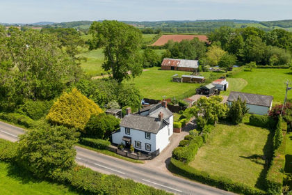
- Price
- £975,000
- Size
- 3 acres
Added on 22/06/2026Cottage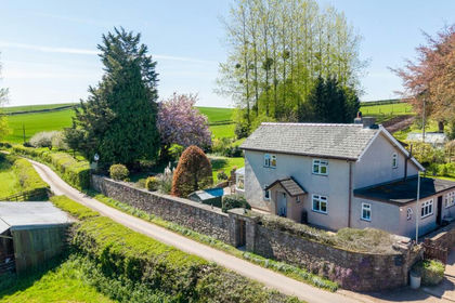
- Price
- £895,000
- Size
- 10 acres
Ty Uchaf Farm, Tregare, Raglan, NP15, Mitchel Troy, Monmouthshire NP15 Wales
Added on 11/05/2026Farmhouse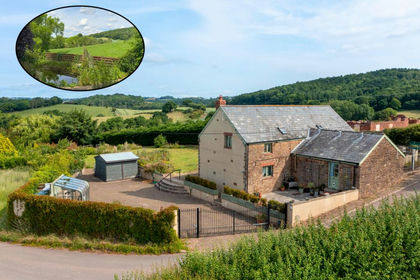
- Price
- £875,000
- Size
- 1 acres
The Hendre, Monmouth, NP25, Whitecastle, Monmouthshire NP25 Wales
Added on 29/01/2026House with Land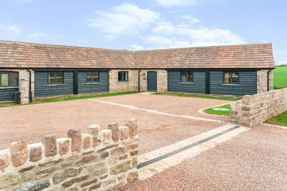
- Price
- £600,000
- Size
- 1.75 acres
The Cayo, Llandenny, Usk, NP15, Raglan, Monmouthshire NP15 Wales
Added on 05/07/2026Barn Conversion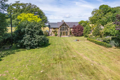
- Price
- Offers Over£1,000,000
- Size
- 2.8 acres
Tregare, Raglan - Three bedroom house + Two bedroom cottage, Mitchel Troy, Monmouthshire NP15 Wales
Added on 29/01/2026House with Land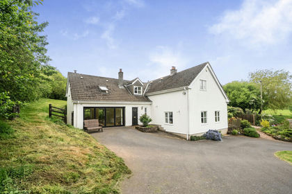
- Price
- £850,000
- Size
- 1.1 acres
Trellech Grange, Llanishen, Chepstow, Monmouthshire, NP16, Trellech United, Monmouthshire NP16 Wales
Added on 16/05/2026House with Land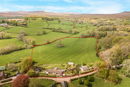
- Price
- Guide Price£895,000
- Size
- 8.5 acres
Penrhos, Raglan, Monmouthshire (with detached annexe), Whitecastle, Monmouthshire NP15 Wales
Added on 03/05/2026House with Land