Stafford Park, Sudbury, Suffolk, CO10
- Land size
- 104.7 acres
Key Features
- Rents Reserved - £442,553 per annum
- Increasing To £487,265 Per Annum
- 102 Acres Offering Additional Income & Development Opportunities
- No Overage / Full Unconditional Disposal
Description
**Rental Income £440,000 pa (rising to £487,000 pa)**
Comprising almost 200,000 sq ft of business space and occupying a site of 104 acres, the property offers reversionary investment and development opportunities. The site was owner-occupied by Bush Boake Allen until 2004 for a range of B1, B2 and B8 uses, with the commercial core of the site operating thereafter as a logistics and trading estate for the past 20+ years.
The industrial buildings comprise mainly warehousing constructed during the 1950s and 1960s, featuring high-bay accommodation (5m / 6m / 7m eaves), and benefiting from mainly clear spans, concrete floors, and generous external areas.
Immediately to the north of the industrial buildings and the River Stour is an area of approx. 20 acres which was formerly a major source of building sand and aggregate used in the development of the site following WWII. This area is registered as a "closed facility" landfill site, the resultant pits having been filled mainly with organic waste from the production of flavours and fragrances by Bush Boake Allen. The vendors have a testing regime in place which, to date, has revealed no issues
To the south of the A1092 is an approximately 30-acre block of agricultural land which will be available subject to residue of a one-year farming arrangement.
LOCATION
Stafford Park is located 2 miles west of Long Melford and approx. 3.5 miles north-east of Sudbury, Suffolk. Access to Stafford Park is from the B1064 at Rodbridge Corner. The site is situated 2 miles along Borley Road and School Lane, and benefits from a secondary northbound access to the A1092 via Cranbrook Lane, an unadopted road.
The A134, which runs from Colchester to Bury St Edmunds via Long Melford, provides access to the A14 dual carriageway and the national motorway network. The drive time to the A14 is approx. 25 minutes.
ACCOMMODATION
[Approximate Gross Internal Floor Areas - Source VOA]
E1: 3,749 sq ft [348.3 sq m] approx.
E2: 669 sq ft [62.19 sq m] approx.
J1: 18.363 sq ft [1,705.93 sq m] approx.
J2: 5,976 sq ft [555.21 sq m] approx.
T2: 4,758 sq ft [442 sq m] approx.
U: 4,526 sq ft [420.5 sq m] approx.
W: 28,288 sq ft [2,628 sq m] approx.
W1: 19,648 sq ft [1,825.4 sq m] approx.
X: 26,947 sq ft [2,503.4 sq m] approx.
X1: 902 sq ft [83.81 sq m] approx.
X2/3: 7,998 sq ft [743.04 sq m] approx.
Z: 27,781 sq ft [2580.95 sq m] approx.
L1 a: 3,600 sq ft [334.5 sq m] approx.
L1 b: 900 sq ft [83.61 sq m] approx.
L1 c: 900 sq ft [83.61 sq m] approx.
L1 d: 1,800 sq ft [167.23 sq m] approx.
L2: 22,801 sq ft [2118.3 sq m] approx.
L3: 12,163 sq ft [1130 sq m] approx.
T2 a: 699 sq ft [65 sq m] approx.
TOTAL: 192,481 sq ft [17,882 sq m] approx.
Excludes tenants mezzanines.
TENANCIES AND INCOME
The main buildings are all occupied. There is a standard lease structure across the site which imposes limited repairing obligations to include reference to a schedule of condition. The leases are mainly contracted outside the Landlord and Tenant Act and provide for full recovery of insurance and service charge costs, although the vendors' approach has historically been not to implement the service charge regime.
The anchor tenant was incorporated in 2009 and has occupied the site for almost 10 years. There is no history of significant rent arrears. A schedule of tenancies and income can be found in our brochure.
TERMS
The property is available for sale freehold, subject to the existing tenancies at £6,000,000 plus VAT. The vendors expectation is that VAT treatment will be by way of a T.O.G.C. process if possible.
PLANNING
The site lies partly within Essex (Braintree District Council) and partly within Suffolk (Babergh and Mid Suffolk District Council).
The existing industrial and warehousing activities are long established and settled.
In 2019, planning proposals were advanced for the development of 100 residential units and 20 apartments on the main industrial site. A revised application was approved by the Suffolk authorities and subsequently recommended for approval by Essex County, but was later refused at committee (April 2019).
A more detailed summary of the above planning process is available upon request.
UTILITIES
There is a mains electricity supply to the site. There are two water supply options; an artesian well benefiting from a new 5-inch steel-lined shaft, pump and control gear (renewed in 2023) to a depth of approx. 200 feet direct into the chalk aquifer. In 2023 a further 70mm metered water supply was connected to the A.W.A. system. This is not been activated.
Foul waste is stored in a central sump and tankered off site.
There is no mains gas connection.
ENERGY PERFORMANCE CERTIFICATE [EPC]
Unit W1 has an EPC rating of C (69), expiring 02 May 2034. EPCs for the remainder of the site have been commissioned and a schedule will be available imminently.
BUSINESS RATES
There are currently 19 Business Rates assessments for the site. These can be viewed on the VOA website using two postcodes; CO10 7HU and CO10 7FN.
VAT
The property is VAT elected. VAT is payable on the rents received and will be payable on the purchase price at the prevailing rate.
ANTI-MONEY LAUNDERING REGULATIONS
Anti-Money Laundering Regulations require Fenn Wright to verify the identity, private residence and source of funds (where applicable) of prospective purchasers and tenants prior to solicitors being instructed. An administration fee is payable, and further details are available upon request.
LEGAL COSTS
Each party will bear their own legal costs.
VIEWINGS STRICTLY BY APPOINTMENT VIA SOLE SELLING AGENTS:
Fenn Wright
T:
E:
Map Location
Property details
- Tenure
- Freehold
- Council Tax Band
- Ask Agent
- Date Posted
- 2026-06-16
Utilities & Restrictions
Utilities
- Electricity
- Ask Agent
- Water
- Ask Agent
- Heating
- Ask Agent
- Broadband
- Ask Agent
- Sewerage
- Ask Agent
Rights & Restrictions
- Public Rights of Way
- Ask Agent
- Private Rights of Way
- Ask Agent
- Listed Property
- Ask Agent
- Restrictions
- Ask Agent
Listed status, conservation areas and planning constraints for this location are in the full report.
Property Features
- Accessibility
- Ask Agent
- Parking
- Parking Available
- Garden
- Ask Agent
Beyond the particulars: planning activity, flood history, heritage and ground risks, checked for this exact spot.
Connectivity
Broadband
Fastest speed available at this postcode
1 Gbps
Gigabit full fibre
Suitable for
- 4K streaming on every screen
- Full-time home working
- Online gaming & big downloads
Mobile signal
Outdoor predictions; indoor signal depends on building materials.
Ofcom Connected Nations postcode-level predictions. Speeds and signal are modelled, not measured, and vary between addresses and providers.
Signal is the easy part. Planning activity, flood history and protected designations here are in the full report.
Nearest Schools
Primary
- Long Melford Church of England Primary School1.1 milesNo Ofsted rating
- Ages
- 3 to 11
- Pupils
- 207
- Type
- Academy sponsor led
- Faith
- Church of England
- Glemsford Primary Academy2.1 milesNo Ofsted rating
- Ages
- 2 to 11
- Pupils
- 243
- Type
- Academy sponsor led
- Woodhall Primary School2.6 milesOfsted: Good
- Ages
- 3 to 11
- Pupils
- 448
- Type
- Academy sponsor led
- Cavendish Church of England Primary School2.8 milesOfsted: Inadequate
- Ages
- 4 to 11
- Pupils
- 52
- Type
- Academy sponsor led
- Faith
- Church of England
- Tudor Church of England Primary School, Sudbury2.8 milesNo Ofsted rating
- Ages
- 4 to 11
- Pupils
- 268
- Type
- Academy sponsor led
- Faith
- Church of England
Secondary
- Ormiston Sudbury Academy2.7 milesOfsted report card · Feb 2026
- Ages
- 11 to 19
- Pupils
- 710
- Type
- Academy sponsor led
- Stour Valley Community School4.4 milesOfsted: Good
- Ages
- 11 to 16
- Pupils
- 569
- Type
- Free schools
- Thomas Gainsborough School4.4 milesOfsted: Good *
- Ages
- 11 to 18
- Pupils
- 1,603
- Type
- Academy converter
- Hedingham School and Sixth Form7.8 milesNo Ofsted rating
- Ages
- 11 to 18
- Pupils
- 1,177
- Type
- Academy converter
- The Ramsey Academy, Halstead9.2 milesOfsted: Good *
- Ages
- 11 to 16
- Pupils
- 702
- Type
- Academy sponsor led
* Latest graded judgement covers quality of education only; no overall grade was issued under the 2024-25 inspection framework.
Distances are straight-line from the advertised location. Source: the national school registers (DfE, Welsh Government, Scottish Government) and Ofsted.
Schools are just the start: sold prices nearby, planning activity and any flood history are in the full report.
Amenities
Supermarket
GP surgery
Pharmacy
Hospital
Green space
Straight-line distances from the advertised location. Sources: NHS records, Geolytix supermarket locations, OS Open Greenspace and the national trails registers.
The area stacks up? Now check the location itself: planning nearby, protected designations and past flooding.
Getting Around
Nearest station
Nearest bus stop
Typical drive times
Straight-line distances from the advertised location; drive times are typical free-flow times over OpenStreetMap road data, so allow more at peak. Public transport locations from DfT NaPTAN.
Easy to reach matters. So do planning activity, flood history and ground risks: all in the full report.
Flood Risk
From Environment Agency flood map open data, checked around the advertised map pin and allowing for the listed acreage where known. This summary comes from LandSale, the advertising platform, not from the listing agent, and is not part of the agent's particulars. Risk can vary across a single holding, so verify anything critical through your own searches before committing.
Rivers and the sea
Mapped within the area searched, not at the advertised map pin itself.
Surface water
Mapped within the area searched, not at the advertised map pin itself.
The detail behind these bandings
The full report pinpoints where this location sits on the flood maps, and runs the deeper checks that usually only surface after an offer.
- Exact flood zones & annual chances (included in the full report)
- Any recorded past flooding (included in the full report)
- Planning activity nearby (included in the full report)
- Heritage & conservation (included in the full report)
- Protected nature designations (included in the full report)
- Ground risks (included in the full report)
- Sold prices nearby (included in the full report)
£14.99 · one-off purchase
By LandSale, the platform. Not provided by the listing agent. Ready in about a minute.
Important notice: Information, maps and tags on this page are drawn from the advertising agent's marketing materials or generated automatically. LandSale has not verified them. Relying on these details is at your own risk, always carry out independent checks before committing to a purchase.
LandSale full disclaimer
Marketing information only - not formal particulars. The details on this website are provided for general guidance and do not constitute an offer or contract. Neither LandSale nor the advertising estate/land agent accepts responsibility for any inaccuracy.
1. Source of information
- Listing content: Core description, asking price, tenure, measurements, photographs and planning history originate from the marketing materials of the advertising estate or land agent. LandSale does not author this content and cannot guarantee its accuracy.
- Automated tags & categorisation: Property type, land-use class, acreage bands and similar labels may be applied by machine-learning models. They are intended as a helpful guide only and may not reflect the property's legal status or permitted use.
- Third-party & enriched data layers: Maps, boundary outlines, planning designations, soil reports, broadband coverage and other environmental or location-based insights are licensed from external suppliers. Such data are supplied “as is", may be incomplete or out of date and are subject to change without notice.
2. Verification required
Prospective purchasers must verify critical matters, including but not limited to planning permission, title boundaries, public rights of way, environmental constraints, acreage, services, access and VAT status, through their own inspections, specialist surveys, legal advisers and the selling agent before relying on the information or entering into any contract.
3. No warranty or liability
LandSale gives no warranty, express or implied, as to the accuracy, completeness or fitness for any particular purpose of the information displayed. LandSale shall not be liable for any loss, damage, cost or expense arising directly or indirectly from any use of or reliance on such information, save where liability may not be excluded by law.
4. Updates & feedback
If you believe any detail on this listing is inaccurate, please let us know. We will investigate and, where appropriate, update the listing or notify the agent.
© LandSale | Version 1.3 - August 2026
Listing agent
Fenn Wright, Colchester Business Park Commercial Sales & Lettings
882 Colchester Business Park The Crescent, Colchester Business Park, Colchester, CO4 9YQ
Contact Fenn Wright, Colchester Business Park Commercial Sales & Lettings
882 Colchester Business Park The Crescent, Colchester Business Park, Colchester, CO4 9YQ
View agent profileSimilar properties for sale
- Price
- Guide Price£5,500,000
- Size
- 2.03 acres
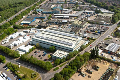
Francis House, Freebournes Road, Witham, Essex, CM8, Witham, Essex CM8 England
Added on 29/01/2026Industrial Land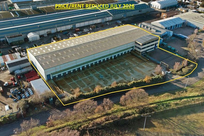
- Price
- £5,750,000
- Size
- 1.05 acres
Unit 1, Quayside Industrial Estate, Maldon, Essex, CM9, Maldon, Essex CM9 England
Added on 17/07/2026Warehouse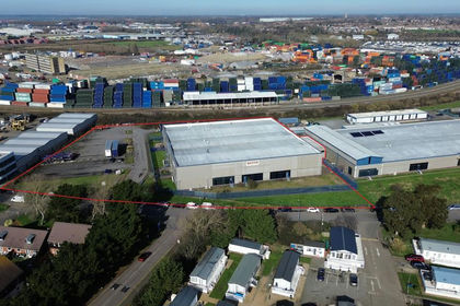
- Price
- Guide Price£4,250,000
- Size
- 1.11 acres
Warehouse Premises, Carr Road, Felixstowe, Suffolk, IP11, Felixstowe, Suffolk IP11 England
Added on 06/03/2026Warehouse
- Price
- Offers in Region of£5,750,000
- Size
- 1.77 acres
Added on 26/06/2026Commercial Land
- Price
- £4,500,000
Building 202, Lancaster Way Business Park, Ely, Cambridgeshire, Ely, Cambridgeshire CB6 England
Added on 10/06/2026Commercial Land
- Price
- POA
- Size
- 0.76 acres
9A Harvey Road, Basildon, Essex, SS13, South Basildon and East Thurrock, Essex SS13 England
Added on 29/01/2026Warehouse
- Price
- Offers in Excess of£7,000,000
- Size
- 3.7 acres
Mylands Farm, Broxhill Road, Havering-atte-bower, Romford, Havering, Romford, Havering RM4 England
Added on 17/07/2026Development Land
- Price
- £6,150,000
- Size
- 2.2 acres
Land On The South Side Of Grange Farm Lane, Chigwell, IG7, Chigwell, Essex IG7 England
Added on 17/07/2026Industrial Land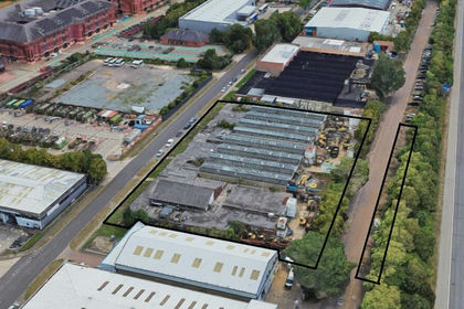
- Price
- £3,750,000
- Size
- 0.92 acres
Added on 20/03/2026Redevelopment Land
- Price
- Guide Price£6,000,000
- Size
- 0.68 acres
Unit 2, Dolphin Park, Dolphin Way, West Thurrock, Essex, RM19, Thurrock, Thurrock RM19 England
Added on 10/05/2026Warehouse