Meadows Farm, Monks Lane, Audlem, Cheshire, CW3
- Land size
- 3 acres
- Bedrooms
- 5
- Bathrooms
- 2
Description
GUIDE PRICE: £800,000 - £850,000
A CHARMING AND CHARACTERFUL DETACHED PERIOD FARMHOUSE IN NEED OF GENERAL MODERNISATION AND REFURBISHMENT WITH A SUBSTANTIAL RANGE OF TRADITIONAL AND MODERN FARM BUILDINGS. ALL SET WITHIN ABOUT THREE ACRES, IN A WONDERFUL RURAL POSITION HALF A MILE FROM AUDLEM VILLAGE CENTRE.
DESCRIPTION
Meadows Farm is a detached period house, constructed of brick under a tiled roof and approached over a sweeping concrete drive to a concrete yard with a turning circle. It offers an exciting opportunity to acquire a fine country house, buildings and land in a wonderful rural position, half a mile from Audlem village. It is believed to have been built on the site of a medieval mill as an Outlier to Combermere Abbey (dating from 1133) and used as a brewhouse. Although the oldest part of the house is believed to be late Medieval, it was substantially remodelled and enlarged in 1891, so in essence is essentially Victorian. Not listed, the house has been in the same family ownership since 1953 and is now offered for sale with no on going chain. It has been a much loved and happy family home.
The house extends to about 2,800 square feet.
The accommodation offers some superb reception rooms, with generous dimensions, bay windows with original shutters, Medieval inglenook, a Minton tiled floor and exposed cruck frames.
The traditional courtyard, range of buildings is aesthetically similar to the house in appearance and would undoubtably convert into ancillary accommodation. However, there are opportunities for other varied uses which could be undertaken to the traditional range and also the block constructed cattle housing, steel frame Dutch Barn and Implement Store. The principle range of brick and tiled buildings extends to about 3,500 square feet. The modern buildings extend to about 7,500 square feet. For avoidance of all doubt to prospective purchasers, any change of use from the present use as agricultural buildings will require planning permission.
LOCATION & AMENITIES
Meadows Farm occupies a wonderful position, half a mile from Audlem village centre. Audlem was mentioned in the Doomsday book as Aldelyme, and Edward 1 granted a market charter in 1295. Audlem is on the Shropshire Union canal, which has a run of 15 locks, designed by Thomas Telford to raise the canal 93 feet from the Cheshire plain to the Shropshire plain. The River Weaver passes West of the village. The sought after, award winning, village of Audlem caters for daily needs with local co-operative store, general store/newsagents, dry cleaners, butchers, flower shop, two restaurants, cafes, three public houses and a medical centre. Nantwich (7 miles) offers a more comprehensive range of services with High Street retailers, banks, restaurants, leisure facilities and supermarkets. Crewe station (11 miles) provides a fast intercity rail network (London Euston 90 minutes, Manchester 40 minutes). The M6 motorway (junction 16) is 11 miles and Manchester Airport 40 miles.
On the Educational front, there is a primary school in Audlem (Ofsted Good) and the house lies in the catchment area for Brine Leas High School/BL6 Sixth Form (Ofsted Good). Private schooling in the area includes Newcastle High School, the Grange at Hartford, the Kings and Queens in Chester and Ellesmere College. There are numerous sports facilities in the area including tennis, bowling, cricket, football, running and cycling clubs in Audlem. There are two 18 hole golf courses in nearby Whitchurch, equestrian interests are vast in the area including British Eventing at Kelsall and Somerford Park and racing enjoyed at Aintree, Chester, Bangor on Dee and Haydock Park.
DIRECTIONS
From Nantwich, proceed along Wellington Road (this becomes Audlem Road), proceed for about 6 miles into Audlem, then left by a small green into Heathfield Road, proceed for 200 yards and then turn left into Monks Lane and Meadows Farm is located on the right hand side.
EPC Rating: F
SUMMARY
Entrance Hall, Sitting Room, Dining Room, Shower Room, Living Room, Garden Room, Kitchen/Breakfast Room, Boot Room, Cellar, Landing, Five Bedrooms, Bathroom, Oil Central Heating, An excellent Range of Traditional and Modern Farm Buildings, Gardens and Land. In all about 3 Acres.
ENTRANCE PORCH
With Victorian tiled floor.
RECEPTION HALL
Minton tiled floor, understairs store & cloaks cupboard, with stairs up to first floor landing.
LIVING ROOM
Working fireplace with tiled inset and timber surround, parquet floor, sash bay window with original shutters, duel aspect 2nd sash window, picture rail.
GARDEN ROOM
Tiled floor, French windows to attractive stone slab patio and garden.
SIDE ENTRANCE PORCH
With brown quarry tiled floor.
INNER HALL
Door from yard entrance porch, cloaks cupboard.
SITTING ROOM
Decorative fireplace (chimney stack removed) with timber surround, sash bay window with original shutters, duel aspect side sash window.
DINING ROOM
Medieval inglenook fireplace, multi-fuel burning stove for back-up domestic hot water and central heating, Victorian quarry tiled floor, Venetian sash window, exposed beams, blocked doorway down to cellar.
SHOWER ROOM
Vanity unit with inset hand basin, tiled shower cubicle with mains shower, separate W/C, exposed beams.
KITCHEN/BREAKFAST ROOM
Stainless steel double bowl sink unit, cupboards under, floor standing cupboards and drawer units, wall cupboard, ceramic tiled floor, plumbing for dishwasher/washing machine.
BOOT ROOM
Oil fired central heating boiler, plumbing for washing machine/dishwasher, front door to yard and rear door to kitchen garden/orchard, access hatch to cellar.
CELLAR
Stone steps up to rear of dining room (doorway blocked off at top of steps).
STAIRS FROM ENTRANCE HALL TO FIRST FLOOR LANDING
BEDROOM NO. 1
Timber floor, wooden double glazed window, direct access to bedroom no. 5/dressing room.
BEDROOM NO. 5/DRESSING ROOM
Two exposed cruck timbers, timber floor, wooden double glazed window.
BEDROOM NO. 2
Duel aspect sash windows.
BEDROOM NO. 3
Sash window.
BEDROOM NO. 4
Duel aspect wooden double glazed windows, exposed wall timbers, timber floor, stairs down to shower room.
BATHROOM
White suite comprising panel bath with mixer shower taps, low flush W/C and hand basin, shaver point, wooden double glazed window.
OUTSIDE
Yard. The traditional, L shaped, brick and tiled range comprised The Old Dairy, Parlour, Shippons, Garages, Work Shops and Isolation Box (some with original stone set flooring) with Hay Loft over part and extends to about 3,500 square feet. Modern buildings include Lean-to Shippon 64'8" x 15'9", Cubicle Shed 97'1" x 14'4", Collecting Yard 49'11" x 30'3", Corrugated Dutch Barn 47'9" x 45'1" and Corrugated Four Bay Implement Store 66'8" x 20'6"
GARDENS AND GROUNDS
The principle gardens enjoy a lovely South Westerly aspect towards Audlem village and Church. They are extensively lawned with borders, holly hedges, conifers, trees including hornbeam, wild cherry and a stunning Magnolia. Kitchen garden with vegetable patch and orchard.
LAND
A small paddock of pasture to the West, adjacent to the entrance drive with two gated access points from the drive and the yard and a water trough. A larger paddock to the East with a double field gate to Monks Lane and double gate access from the drive to all the farm buildings. Also provides vehicle access via a gate into the rear kitchen garden/orchard.
SERVICES
Mains water and electricity. Private drainage.
If the private drainage system requires updating/replacement, it is assumed that prior to offers being made, associated costs have been considered and are the responsibility of the purchaser. Interested parties are advised to make their own investigations, no further information will be provided by the selling agents.
TENURE
Freehold.
COUNCIL TAX
Band G.
VIEWINGS
Viewing by appointment with Baker, Wynne & Wilson.
Map Location
Property details
- Tenure
- Freehold
- Council Tax Band
- G
- Date Posted
- 2026-05-10
Market Value Analysis
Compared with 828 Homes with Land listings in North West England (1+ acres).
Energy Performance Certificate
Energy Efficiency Rating
Based on UK Energy Performance Certificate standards (EU Directive 2002/91/EC)
Running costs are one side. Planning activity, flood history and ground risks for this location are in the full report.
Utilities & Restrictions
Utilities
- Electricity
- Ask Agent
- Water
- Ask Agent
- Heating
- Ask Agent
- Broadband
- Ask Agent
- Sewerage
- Ask Agent
Rights & Restrictions
- Public Rights of Way
- Ask Agent
- Private Rights of Way
- Ask Agent
- Listed Property
- Ask Agent
- Restrictions
- Ask Agent
Listed status, conservation areas and planning constraints for this location are in the full report.
Property Features
- Accessibility
- Ask Agent
- Parking
- Parking Available
- Garden
- Garden
Beyond the particulars: planning activity, flood history, heritage and ground risks, checked for this exact spot.
Connectivity
Broadband
Fastest speed available at this postcode
900 Mbps
Gigabit full fibre · available to 52% of premises
Suitable for
- 4K streaming on every screen
- Full-time home working
- Online gaming & big downloads
Fixed wireless access may also be an option here.
Mobile signal
Outdoor predictions; indoor signal depends on building materials.
Ofcom Connected Nations postcode-level predictions. Speeds and signal are modelled, not measured, and vary between addresses and providers.
Signal is the easy part. Planning activity, flood history and protected designations here are in the full report.
Nearest Schools
Primary
- Audlem St James' CofE Primary School286 metresOfsted: Good
- Ages
- 4 to 11
- Pupils
- 173
- Type
- Academy converter
- Faith
- Church of England
- Adderley CofE Primary School2.5 milesOfsted: Outstanding
- Ages
- 2 to 11
- Pupils
- 46
- Type
- Voluntary controlled school
- Faith
- Church of England
- Sound and District Primary School3.3 milesOfsted: Good
- Ages
- 4 to 11
- Pupils
- 138
- Type
- Community school
- Bridgemere CofE Primary School3.6 milesNo Ofsted rating
- Ages
- 3 to 11
- Pupils
- 94
- Type
- Voluntary aided school
- Faith
- Church of England
- Stapeley Broad Lane CofE Primary School3.9 milesOfsted: Good *
- Ages
- 3 to 11
- Pupils
- 232
- Type
- Academy converter
- Faith
- Church of England
Secondary
- Brine Leas School4.3 milesNo Ofsted rating
- Ages
- 11 to 18
- Pupils
- 1,417
- Type
- Academy converter
- Malbank School and Sixth Form College5.4 milesOfsted: Good
- Ages
- 11 to 18
- Pupils
- 1,289
- Type
- Academy converter
- Shavington Academy5.4 milesNo Ofsted rating
- Ages
- 11 to 16
- Pupils
- 934
- Type
- Academy converter
- The Grove School6.2 milesOfsted: Requires improvement
- Ages
- 11 to 18
- Pupils
- 856
- Type
- Academy converter
- St Thomas More Catholic High School6.7 milesOfsted: Good *
- Ages
- 11 to 16
- Pupils
- 642
- Type
- Academy converter
- Faith
- Roman Catholic
* Latest graded judgement covers quality of education only; no overall grade was issued under the 2024-25 inspection framework.
Distances are straight-line from the advertised location. Source: the national school registers (DfE, Welsh Government, Scottish Government) and Ofsted.
Schools are just the start: sold prices nearby, planning activity and any flood history are in the full report.
Amenities
Supermarket
GP surgery
Pharmacy
Hospital
Green space
Straight-line distances from the advertised location. Sources: NHS records, Geolytix supermarket locations, OS Open Greenspace and the national trails registers.
The area stacks up? Now check the location itself: planning nearby, protected designations and past flooding.
Getting Around
Nearest station
Nearest bus stop
Typical drive times
Straight-line distances from the advertised location; drive times are typical free-flow times over OpenStreetMap road data, so allow more at peak. Public transport locations from DfT NaPTAN.
Easy to reach matters. So do planning activity, flood history and ground risks: all in the full report.
Flood Risk
From Environment Agency flood map open data, checked around the advertised map pin and allowing for the listed acreage where known. This summary comes from LandSale, the advertising platform, not from the listing agent, and is not part of the agent's particulars. Risk can vary across a single holding, so verify anything critical through your own searches before committing.
Rivers and the sea
Surface water
These bandings are the summary. Where this location sits on the flood maps, plus planning activity, heritage and ground risks, is in the full report.
Important notice: Information, maps and tags on this page are drawn from the advertising agent's marketing materials or generated automatically. LandSale has not verified them. Relying on these details is at your own risk, always carry out independent checks before committing to a purchase.
LandSale full disclaimer
Marketing information only - not formal particulars. The details on this website are provided for general guidance and do not constitute an offer or contract. Neither LandSale nor the advertising estate/land agent accepts responsibility for any inaccuracy.
1. Source of information
- Listing content: Core description, asking price, tenure, measurements, photographs and planning history originate from the marketing materials of the advertising estate or land agent. LandSale does not author this content and cannot guarantee its accuracy.
- Automated tags & categorisation: Property type, land-use class, acreage bands and similar labels may be applied by machine-learning models. They are intended as a helpful guide only and may not reflect the property's legal status or permitted use.
- Third-party & enriched data layers: Maps, boundary outlines, planning designations, soil reports, broadband coverage and other environmental or location-based insights are licensed from external suppliers. Such data are supplied “as is", may be incomplete or out of date and are subject to change without notice.
2. Verification required
Prospective purchasers must verify critical matters, including but not limited to planning permission, title boundaries, public rights of way, environmental constraints, acreage, services, access and VAT status, through their own inspections, specialist surveys, legal advisers and the selling agent before relying on the information or entering into any contract.
3. No warranty or liability
LandSale gives no warranty, express or implied, as to the accuracy, completeness or fitness for any particular purpose of the information displayed. LandSale shall not be liable for any loss, damage, cost or expense arising directly or indirectly from any use of or reliance on such information, save where liability may not be excluded by law.
4. Updates & feedback
If you believe any detail on this listing is inaccurate, please let us know. We will investigate and, where appropriate, update the listing or notify the agent.
© LandSale | Version 1.3 - August 2026
Listing agent
Baker Wynne & Wilson, Nantwich
38 Pepper Street, Nantwich, Cheshire, CW5 5AB
View agent profileSimilar properties for sale
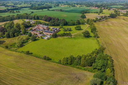
- Price
- Guide Price£800,000
- Size
- 8.6 acres
Added on 02/07/2026House with Land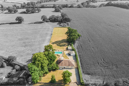
- Price
- £695,000
- Size
- 1.12 acres
Added on 25/07/2026House with Land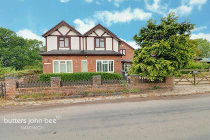
- Price
- Offers Over£800,000
- Size
- 3 acres
Added on 05/08/2026Country Home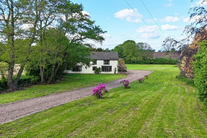
- Price
- Guide Price£750,000
- Size
- 1 acres
Bridgemere Lane, Hunsterson, CW5, Doddington and District, Cheshire East CW5 England
Added on 11/06/2026House with Land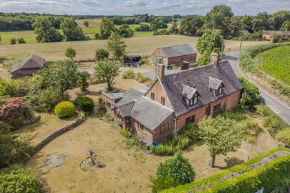
- Price
- Offers Over£650,000
- Size
- 1.7 acres
Crewe Road, Hatherton, Nantwich, Hatherton, Cheshire East CW5 England
Added on 08/08/2026House with Land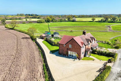
- Price
- Offers Over£750,000
- Size
- 3 acres
Pewit Lane, Hunsterson, CW5, Doddington and District, Cheshire East CW5 England
Added on 22/03/2026House with Land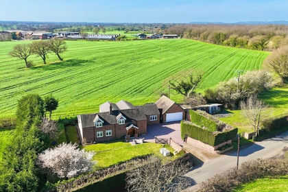
- Price
- £775,000
- Size
- 1 acres
Added on 26/03/2026Residential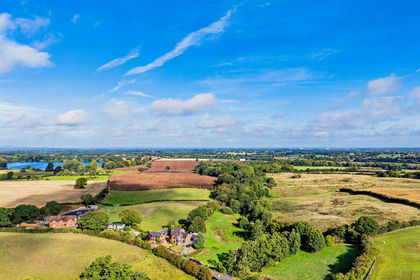
- Price
- Guide Price£925,000
- Size
- 3.6 acres
Smithy House, Bridgemere, Nantwich, Doddington and District, Cheshire East CW5 England
Added on 23/05/2026Country Home
- Price
- Guide Price£850,000
- Size
- 4.2 acres
Stapeley Farm, London Road, Nantwich, CW5, Stapeley and District, Cheshire East CW5 England
Added on 22/06/2026Development Land
- Price
- Guide Price£865,000
- Size
- 3.32 acres
Sunnyside, 19 London Road, Woore, Woore, Shropshire CW3 England
Added on 18/04/2026House with Land