Pen Nab, Main Street, Gillamoor, York, YO62
- Land size
- 1.8 acres
- Bedrooms
- 2
- Bathrooms
- 1
Key Features
- Local Occupancy Clause applies
- 1.8 acre plot
- Sought-after village set within the North York Moors National Park
- Peaceful rural setting with a strong community feel
- Attractive village green at the heart of the village
- Traditional stone properties and picturesque surroundings
- Lifestyle property
- Surrounded by open countryside with far-reaching views
- Excellent walking, cycling, and outdoor pursuits nearby
- Easy access to Kirkbymoorside, Helmsley, and Pickering for amenities
Description
Pen Nab is an attractive and beautifully presented two-bedroom stone-built property, recently renovated to a high standard throughout, and situated in the picturesque village of Gillamoor. With an extensive paddock, of circa 1.68 acres, this property offers a full rural living experience.
Enjoying the peace and tranquillity of a rural setting, the property is ideally positioned within easy reach of the excellent amenities offered by the nearby market towns of Kirkbymoorside, Helmsley and Pickering. It is also conveniently located for the stunning North York Moors and the East Coast, while being approximately 28 miles from York.
The accommodation briefly comprises: entrance hall, a well-appointed fitted kitchen, a spacious living/dining room featuring a cast iron log-burning stove, a bedroom, and a modern shower room to the ground floor. To the first floor is a generously sized double bedroom and a loft room.
Externally, the property benefits from a large attached single garage, driveway parking for one vehicle, and well-maintained walled lawned gardens to three sides, featuring mature trees, shrubs and planted borders, along with a paved patio area to the rear, ideal for outdoor entertaining.
Note: The property is subject to a North York Moors National Park Local Occupancy Clause. Prospective purchasers must be able to demonstrate that they meet at least one of the qualifying criteria, including having lived within the North York Moors National Park boundary for a minimum of three years, having a requirement to care for a relative living within a 30-minute drive of the property who is in need of care and supervision, or needing to work within the neighbouring parishes. It is the responsibility of any interested party to ensure they satisfy these requirements before proceeding.
ENTRANCE HALL
Timber entrance door, front aspect timber framed double glazed window and roman blind, pendant light with glass effect fitting, grey lino flooring, staircase to the first floor, wall mounted coat hooks with shelf over, mirror with shelf under, radiator, power points, smoke alarm.
KITCHEN
Rear aspect timber framed double glazed window and roman blind, a range of timber wall and base mounted units, stainless steel sink with mixer tap over, grey lino flooring, twin pendant light with glass shades, integral "Candy" electric oven and hob with an extractor fan over, and freestanding under-counter "Beko" fridge.
LIVING/DINING ROOM
Dual aspect timber framed double glazed windows with roman blinds, cast iron log burning stove on a flag stone hearth with a timber mantle over, new grey carpet, pendant light and shade, twin double wall lights with wire effect shades, and 2 radiators.
BEDROOM 2/STUDY
Rear aspect timber framed double glazed window, new grey carpet, pendant light and shade, radiator.
SHOWER ROOM
Front aspect part opaque timber framed double glazed window and roman blind, new shower cubicle with electric shower, low flush wc and pedestal wash hand basin with light/shaver point over, grey lino flooring, pendant light, mirror fronted bathroom cabinet, extractor fan, radiator.
STAIRS & LANDING
Timber staircase with new grey carpet, storage cupboard with shelving and a radiator, smoke alarm.
BEDROOM 1
Rear aspect timber framed double glazed velux window with roller blind, new grey carpet, pendant light and shade, radiator.
LOFT ROOM
Rear aspect timber framed twin double glazed velux windows, new grey carpet, pendant light with glass effect fitting, radiator and small eaves storage cupboard.
GARAGE
A tarmac driveway leads to a large single garage with timber doors, a personnel door to the rear garden, rear aspect timber framed window, concrete floor, plumbing for a washing machine, space for dryer, oil fired boiler, wall mounted shelves, outside tap, bin storage. Futhermore, subject to necessary planning consents the space could convert into a large kitchen/diner.
FRONT GARDEN
To the outside there are walled lawned gardens to three sides with mature trees, hedge, shrubs and borders and a paved patio area to the rear. The front of the property has a picturesque view of the village, and the rear of the property has outstanding views over the open countryside beyond.
REAR GARDEN
420 sqm grassed garden, with planning permission for two stepped terraces, three parking bays and new driveway. Overlooking your own paddock with views across to Kirkbymoorside, Barmoors and the delightful Douthwaite Dale.
SERVICES
Mains electricity, water and drainage. Oil fired central heating.
Garden
Gardens surrounding and additional 1.68 acre paddock
Parking - Garage
Parking - Driveway
Currently has capacity for one vehicle, however, has planning approved for 3 spaces.
Disclaimer
Disclaimer
We take care to ensure our property details are accurate and fair, but they are for guidance only and do not form part of any contract. Measurements, floor plans, photographs, and descriptions are provided in good faith as a general guide, and should be checked by any prospective purchaser. We recommend that all buyers satisfy themselves on every aspect of the property before making a commitment to purchase.
Map Location
Property details
- Tenure
- Freehold
- Council Tax Band
- Ask Agent
- Date Posted
- 2026-04-25
Market Value Analysis
Compared with 689 Homes with Land listings in Yorkshire and The Humber (1+ acres).
Utilities & Restrictions
Utilities
- Electricity
- Ask Agent
- Water
- Ask Agent
- Heating
- Oil Heating
- Broadband
- Ask Agent
- Sewerage
- Ask Agent
Rights & Restrictions
- Public Rights of Way
- Ask Agent
- Private Rights of Way
- Ask Agent
- Listed Property
- Ask Agent
- Restrictions
- Yes
Listed status, conservation areas and planning constraints for this location are in the full report.
Property Features
- Accessibility
- Ask Agent
- Parking
- Garage, Driveway
- Garden
- Private Garden
Beyond the particulars: planning activity, flood history, heritage and ground risks, checked for this exact spot.
Connectivity
Broadband
Fastest speed available at this postcode
1.8 Gbps
Gigabit full fibre
Suitable for
- 4K streaming on every screen
- Full-time home working
- Online gaming & big downloads
Fixed wireless access may also be an option here.
Mobile signal
Outdoor predictions; indoor signal depends on building materials.
Ofcom Connected Nations postcode-level predictions. Speeds and signal are modelled, not measured, and vary between addresses and providers.
Signal is the easy part. Planning activity, flood history and protected designations here are in the full report.
Nearest Schools
Primary
- Gillamoor Church of England Voluntary Controlled Primary School134 metresNo Ofsted rating
- Ages
- 4 to 11
- Pupils
- 61
- Type
- Voluntary controlled school
- Faith
- Church of England
- Kirkbymoorside Community Primary School2.4 milesOfsted: Good
- Ages
- 3 to 11
- Pupils
- 181
- Type
- Academy converter
- Nawton Community Primary School3.6 milesOfsted report card · Mar 2026
- Ages
- 3 to 11
- Pupils
- 90
- Type
- Community school
- Rosedale Abbey Community Primary School4.4 milesOfsted: Good
- Ages
- 3 to 11
- Pupils
- 15
- Type
- Community school
- Sinnington Community Primary School4.4 milesNo Ofsted rating
- Ages
- 2 to 11
- Pupils
- 110
- Type
- Academy converter
Secondary
- Ryedale School4 milesOfsted: Outstanding
- Ages
- 11 to 16
- Pupils
- 698
- Type
- Academy converter
- Lady Lumley's Academy7.6 milesOfsted: Good
- Ages
- 11 to 18
- Pupils
- 676
- Type
- Academy sponsor led
- Malton School13 milesOfsted: Good
- Ages
- 11 to 18
- Pupils
- 999
- Type
- Academy converter
- Norton School14 milesOfsted: Good
- Ages
- 11 to 18
- Pupils
- 651
- Type
- Academy converter
- Stokesley School15 milesOfsted: Good
- Ages
- 11 to 18
- Pupils
- 1,079
- Type
- Academy converter
Distances are straight-line from the advertised location. Source: the national school registers (DfE, Welsh Government, Scottish Government) and Ofsted.
Schools are just the start: sold prices nearby, planning activity and any flood history are in the full report.
Amenities
Supermarket
GP surgery
Pharmacy
Hospital
Green space
Straight-line distances from the advertised location. Sources: NHS records, Geolytix supermarket locations, OS Open Greenspace and the national trails registers.
The area stacks up? Now check the location itself: planning nearby, protected designations and past flooding.
Getting Around
Nearest station
Nearest bus stop
Typical drive times
Straight-line distances from the advertised location; drive times are typical free-flow times over OpenStreetMap road data, so allow more at peak. Public transport locations from DfT NaPTAN.
Easy to reach matters. So do planning activity, flood history and ground risks: all in the full report.
Flood Risk
From Environment Agency flood map open data, checked around the advertised map pin and allowing for the listed acreage where known. This summary comes from LandSale, the advertising platform, not from the listing agent, and is not part of the agent's particulars. Risk can vary across a single holding, so verify anything critical through your own searches before committing.
Rivers and the sea
Surface water
The detail behind these bandings
The full report pinpoints where this location sits on the flood maps, and runs the deeper checks that usually only surface after an offer.
- Exact flood zones & annual chances (included in the full report)
- Any recorded past flooding (included in the full report)
- Planning activity nearby (included in the full report)
- Heritage & conservation (included in the full report)
- Protected nature designations (included in the full report)
- Ground risks (included in the full report)
- Sold prices nearby (included in the full report)
£14.99 · one-off purchase
By LandSale, the platform. Not provided by the listing agent. Ready in about a minute.
Important notice: Information, maps and tags on this page are drawn from the advertising agent's marketing materials or generated automatically. LandSale has not verified them. Relying on these details is at your own risk, always carry out independent checks before committing to a purchase.
LandSale full disclaimer
Marketing information only - not formal particulars. The details on this website are provided for general guidance and do not constitute an offer or contract. Neither LandSale nor the advertising estate/land agent accepts responsibility for any inaccuracy.
1. Source of information
- Listing content: Core description, asking price, tenure, measurements, photographs and planning history originate from the marketing materials of the advertising estate or land agent. LandSale does not author this content and cannot guarantee its accuracy.
- Automated tags & categorisation: Property type, land-use class, acreage bands and similar labels may be applied by machine-learning models. They are intended as a helpful guide only and may not reflect the property's legal status or permitted use.
- Third-party & enriched data layers: Maps, boundary outlines, planning designations, soil reports, broadband coverage and other environmental or location-based insights are licensed from external suppliers. Such data are supplied “as is", may be incomplete or out of date and are subject to change without notice.
2. Verification required
Prospective purchasers must verify critical matters, including but not limited to planning permission, title boundaries, public rights of way, environmental constraints, acreage, services, access and VAT status, through their own inspections, specialist surveys, legal advisers and the selling agent before relying on the information or entering into any contract.
3. No warranty or liability
LandSale gives no warranty, express or implied, as to the accuracy, completeness or fitness for any particular purpose of the information displayed. LandSale shall not be liable for any loss, damage, cost or expense arising directly or indirectly from any use of or reliance on such information, save where liability may not be excluded by law.
4. Updates & feedback
If you believe any detail on this listing is inaccurate, please let us know. We will investigate and, where appropriate, update the listing or notify the agent.
© LandSale | Version 1.3 - August 2026
Listing agent
Willowgreen Estate Agents, Ryedale
6-8 Market Street, Malton, YO17 7LY
View agent profileSimilar properties for sale
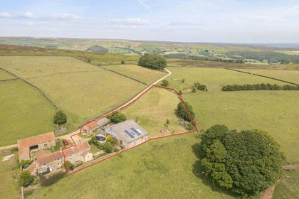
- Price
- Offers in Excess of£465,000
- Size
- 1 acres
Added on 03/07/2026Smallholding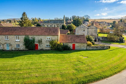
- Price
- Guide Price£475,000
Main Street, Barton-Le-Street, Malton, Barton-le-Street, North Yorkshire YO17 England
Added on 25/03/2026Barn Conversion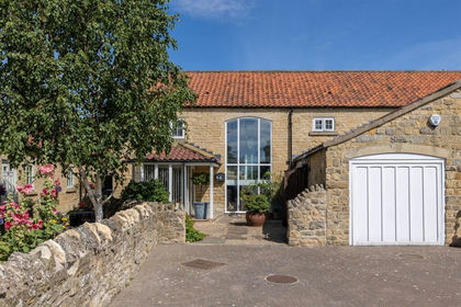
- Price
- Guide Price£500,000
The Granary, Wilton, Pickering, Wilton, North Yorkshire YO18 England
Added on 02/09/2026Barn Conversion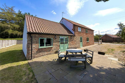
- Price
- £500,000
Added on 04/05/2026Barn Conversion
- Price
- Guide Price£450,000
- Size
- 6.35 acres
Added on 12/08/2026Smallholding
- Price
- Guide Price£375,000
- Size
- 0.33 acres
55 High Street, Snainton, Snainton, North Yorkshire YO13 England
Added on 29/01/2026Redevelopment Land
- Price
- £495,000
Lavender House, Stillington Road Easingwold, York, Easingwold, North Yorkshire YO61 England
Added on 09/08/2026Barn Conversion
- Price
- Guide Price£405,000
The Byre & Annex, Toft House Farm, Main Road, Aislaby, YO21, Aislaby, North Yorkshire YO21 England
Added on 29/01/2026Barn Conversion
- Price
- £335,000
- Size
- 0.34 acres
Sheriff Hutton, York, Sheriff Hutton, North Yorkshire YO32 England
Added on 29/01/2026Barn Conversion
- Price
- £335,000
- Size
- 0.34 acres
Sheriff Hutton, York, Sheriff Hutton, North Yorkshire YO32 England
Added on 29/01/2026Barn Conversion