Ash Mill, South Molton, Devon, EX36
- Land size
- 32.66 acres
Key Features
- Productive agricultural land
- Convenient location with easy access
- Versatile parcels of arable and pasture land
- Agricultural, equestrian, conservation and amenity potential.
- Lot 1 extends to about 32.66 Acres.
- Further 9.02 acres of adjoining land available as Lot 2.
Description
An attractive and useful block of productive arable and pasture land benefiting from good track access and enjoying a convenient and readily accessible rural position. Lot 1 extends to about 32.66 Acres.
The land at Kidland Lane extends in total to about 41.68 Acres and is offered for sale by private treaty either as a whole or in 2 lots, as follows:-
Lot 1: Arable & Pasture land extending to about 32.66 Acres - Guide Price £240,000
Lot 2: Pasture land extending to about 9.02 Acres - Guide Price £75,000
The sale of this land represents an excellent opportunity to acquire a well situated block of versatile agricultural land occupying a convenient and readily accessible rural position between South Molton and Tiverton, lying close to the A361. Divided into a number of manageable enclosures the land is well served by the stone track known as Kidland Lane, leading from the council road which forms the southern boundary. The southerly two fields of Lot 1 are currently utilised for maize cropping, whilst the remainder of the fields comprise productive long term pasture with some rush pastures contained in Lot 2.
The land is mainly level and gently sloping, although there is an area of more moderately to steeply sloping pasture in the two northernmost fields. The land benefits from some natural watering via a spring which feeds into a water trough on Lot 1, with a useful livestock corral also situated on this lot.
Whilst the land may be well suited to arable cropping, fodder production and livestock grazing, its convenient location, superb Exmoor views and aesthetic appeal may also make it suitable for a variety of other agricultural, conservation, equestrian or amenity uses, subject to obtaining any necessary consents.
Extending in total to about 41.68 Acres (16.87 Ha) the land is offered for sale as a whole or in two lots, as shown on the attached identification plan and described within these sale particulars.
Lot 1 - Arable & Pasture land extending to about 32.66 Acres
This comprises an attractive and useful sized block of agricultural land with three gated access points leading directly off Kidland Lane and a grass track running along the north eastern boundary to the northernmost fields. A small stream runs along the western boundary, bordered by trees in some parts. Lot 1 is shown shaded pink on the attached identification plan.
Lot 2 - Pasture land extending to about 9.02 Acres
A smaller block of principally level and gently sloping pasture land divided by Devon hedge banks into three fields. Lot 2 is shown shaded blue on the attached identification plan.
Tenure
The land is of freehold tenure with vacant possession available upon completion of the sale.
Services
The land benefits from some natural watering in Lot 1. The land will be sold without any mains services of any kind and prospective purchaser’s should make their own enquires as to the availability of mains water and any other services.
Basic Payment Scheme
The Basic Payment Scheme has now ended and the land will be sold without any entitlements or de-linked payments.
Agri-Environment Schemes & Designations
We understand that the land is not currently entered into any agri-environment schemes. The land lies within a Nitrate Vulnerable Zone.
Sporting & Mineral Rights
The sporting and mineral rights across the land, insofar as they are owned, will be included in the freehold sale.
Rights of Way, Easements, Etc.
It is understood that the land benefits from a right of way over the initial part of Kidland Lane. The ownership of the remainder of Kidland Lane will be included with Lot 1, with Lot 2 being granted access rights over the same.
An easement exists for a private underground water pipe which crosses the land. The land, as far as required by the Vendors, will be conveyed, subject to all other public or private rights of way, easements, and wayleaves of telegraph and telephone poles, stays and wires, electric pylons, poles and cables, water and gas pipes at present erected on and passing over or under the property and subject to the agreements affecting the same (if any).
Farm Properties Health & Safety Notice
All persons wishing to view the property do so entirely at their own risk. Neither the Vendors or their Agents will be held liable for any damage or injury that may occur when interested parties are visiting the property. Agricultural land is a potentially hazardous environment and for prospective purchasers own personal safety, please be vigilant when viewing, particularly in fields containing horses or stock. All persons viewing the property are asked to observe the country code and close all gates.
The land occupies a convenient rural position lying close to the junction known as Five Crossway, on the road that heads from here towards Knowstone and the Moortown junction of the A361 North Devon link. Despite its rural position the land enjoys easy access to the neighbouring villages and main routes of communication. Surrounding villages provide thriving local communities whilst the larger centre of South Molton affords a good range of everyday services including shops, restaurants, health care, recreational facilities, primary and secondary schooling. The nearby A361 North Devon link road provides quick and easy access to the regional centre of Barnstaple to the north west, with Tiverton and the M5 motorway (Junction 27) to the south east. Mainline intercity rail links are available at Tiverton Parkway, with international airports at Exeter and Bristol.
The land is surrounded by picturesque North Devon countryside providing a wealth of recreational activities including walking, horse riding, cycling, fishing on the rivers Mole, Bray and Taw, hunting, shooting and golf courses at High Bullen, Tiverton and Barnstaple. To the north the Exmoor National Park offers beautiful moorland scenery with many foot and bridle paths and the stunning North Devon coastline, whilst to the west are the popular sandy beaches of Instow, Saunton Sands, Croyde Bay, Putsborough and Woolacombe.
Map Location
Property details
- Tenure
- Freehold
- Council Tax Band
- TBC
- Date Posted
- 2026-04-22
Market Value Analysis
Compared with 78 Farmland & Pasture listings in South West England (25+ acres).
Utilities & Restrictions
Utilities
- Electricity
- Ask Agent
- Water
- Ask Agent
- Heating
- Ask Agent
- Broadband
- Ask Agent
- Sewerage
- Ask Agent
Rights & Restrictions
- Public Rights of Way
- Ask Agent
- Private Rights of Way
- Ask Agent
- Listed Property
- Ask Agent
- Restrictions
- Ask Agent
Listed status, conservation areas and planning constraints for this location are in the full report.
Property Features
- Accessibility
- Ask Agent
- Parking
- Ask Agent
- Garden
- Ask Agent
Beyond the particulars: planning activity, flood history, heritage and ground risks, checked for this exact spot.
Connectivity
Broadband
Fastest speed available at this postcode
1.8 Gbps
Gigabit full fibre · available to 80% of premises
Suitable for
- 4K streaming on every screen
- Full-time home working
- Online gaming & big downloads
Fixed wireless access may also be an option here.
Mobile signal
Outdoor predictions; indoor signal depends on building materials.
Ofcom Connected Nations postcode-level predictions. Speeds and signal are modelled, not measured, and vary between addresses and providers.
Signal is the easy part. Planning activity, flood history and protected designations here are in the full report.
Nearest Schools
Primary
- Bishops Nympton Primary School3.1 milesOfsted: Good *
- Ages
- 2 to 11
- Pupils
- 80
- Type
- Community school
- Rackenford Church of England Primary School3.7 milesNo Ofsted rating
- Ages
- 4 to 11
- Pupils
- 53
- Type
- Voluntary aided school
- Faith
- Church of England
- East Anstey Primary School4.7 milesOfsted: Good
- Ages
- 2 to 11
- Pupils
- 35
- Type
- Community school
- Witheridge Church of England Primary Academy4.9 milesOfsted report card · Jan 2026
- Ages
- 2 to 11
- Pupils
- 135
- Type
- Academy converter
- Faith
- Church of England
- East Worlington Primary School5.5 milesNo Ofsted rating
- Ages
- 0 to 11
- Pupils
- 75
- Type
- Academy converter
Secondary
- South Molton Community College6 milesOfsted: Good *
- Ages
- 11 to 16
- Pupils
- 656
- Type
- Foundation school
- Chulmleigh Community College8.7 milesNo Ofsted rating
- Ages
- 11 to 16
- Pupils
- 735
- Type
- Academy converter
- Tiverton High School11 milesOfsted: Inadequate *
- Ages
- 11 to 16
- Type
- Academy sponsor led
- Queen Elizabeth's13 milesOfsted report card · May 2026
- Ages
- 11 to 18
- Pupils
- 1,096
- Type
- Academy converter
- The Park Community School16 milesOfsted: Good *
- Ages
- 11 to 16
- Pupils
- 1,408
- Type
- Academy converter
* Latest graded judgement covers quality of education only; no overall grade was issued under the 2024-25 inspection framework.
Distances are straight-line from the advertised location. Source: the national school registers (DfE, Welsh Government, Scottish Government) and Ofsted.
Schools are just the start: sold prices nearby, planning activity and any flood history are in the full report.
Amenities
Supermarket
GP surgery
Pharmacy
Hospital
Straight-line distances from the advertised location. Sources: NHS records, Geolytix supermarket locations, OS Open Greenspace and the national trails registers.
The area stacks up? Now check the location itself: planning nearby, protected designations and past flooding.
Getting Around
Nearest station
Nearest bus stop
Typical drive times
Straight-line distances from the advertised location; drive times are typical free-flow times over OpenStreetMap road data, so allow more at peak. Public transport locations from DfT NaPTAN.
Easy to reach matters. So do planning activity, flood history and ground risks: all in the full report.
Flood Risk
From Environment Agency flood map open data, checked around the advertised map pin and allowing for the listed acreage where known. This summary comes from LandSale, the advertising platform, not from the listing agent, and is not part of the agent's particulars. Risk can vary across a single holding, so verify anything critical through your own searches before committing.
Rivers and the sea
Surface water
Mapped within the area searched, not at the advertised map pin itself.
These bandings are the summary. Where this location sits on the flood maps, plus planning activity, heritage and ground risks, is in the full report.
Important notice: Information, maps and tags on this page are drawn from the advertising agent's marketing materials or generated automatically. LandSale has not verified them. Relying on these details is at your own risk, always carry out independent checks before committing to a purchase.
LandSale full disclaimer
Marketing information only - not formal particulars. The details on this website are provided for general guidance and do not constitute an offer or contract. Neither LandSale nor the advertising estate/land agent accepts responsibility for any inaccuracy.
1. Source of information
- Listing content: Core description, asking price, tenure, measurements, photographs and planning history originate from the marketing materials of the advertising estate or land agent. LandSale does not author this content and cannot guarantee its accuracy.
- Automated tags & categorisation: Property type, land-use class, acreage bands and similar labels may be applied by machine-learning models. They are intended as a helpful guide only and may not reflect the property's legal status or permitted use.
- Third-party & enriched data layers: Maps, boundary outlines, planning designations, soil reports, broadband coverage and other environmental or location-based insights are licensed from external suppliers. Such data are supplied “as is", may be incomplete or out of date and are subject to change without notice.
2. Verification required
Prospective purchasers must verify critical matters, including but not limited to planning permission, title boundaries, public rights of way, environmental constraints, acreage, services, access and VAT status, through their own inspections, specialist surveys, legal advisers and the selling agent before relying on the information or entering into any contract.
3. No warranty or liability
LandSale gives no warranty, express or implied, as to the accuracy, completeness or fitness for any particular purpose of the information displayed. LandSale shall not be liable for any loss, damage, cost or expense arising directly or indirectly from any use of or reliance on such information, save where liability may not be excluded by law.
4. Updates & feedback
If you believe any detail on this listing is inaccurate, please let us know. We will investigate and, where appropriate, update the listing or notify the agent.
© LandSale | Version 1.3 - August 2026
Listing agent
Greenslade Taylor Hunt, South Molton
23 Broad Street, South Molton, EX36 3AQ
View agent profileSimilar properties for sale
- Price
- Guide Price£280,000
- Size
- 30.47 acres
Added on 03/07/2026Vacant Land
- Price
- Guide Price£295,000
- Size
- 33.03 acres
Added on 03/07/2026Farm
- Price
- Guide Price£295,000
- Size
- 34.64 acres
Sampford Courtenay, Okehampton, EX20, Sampford Courtenay, Devon EX20 England
Added on 28/04/2026Farmland
- Price
- Guide Price£250,000
- Size
- 29.66 acres
Chilpark, Fremington, Barnstaple, Fremington, Devon EX31 England
Added on 04/09/2026Amenity Land
- Price
- Guide Price£300,000
- Size
- 43.34 acres
Hemyock, Cullompton, Devon, EX15, Hemyock, Devon EX15 England
Added on 11/09/2026Agricultural Land
- Price
- Guide Price£300,000
- Size
- 67.43 acres
Sidmouth Woods Lot 2, Sidmouth, Devon, Sidmouth, Devon EX10 England
Added on 24/07/2026Woodland
- Price
- Guide Price£300,000
- Size
- 40.52 acres
At Moor Road, Sutton Mallet, Bridgwater, Somerset, TA7, Stawell, Somerset TA7 England
Added on 29/01/2026Arable Land
- Price
- Guide Price£195,000
- Size
- 32.82 acres
Long Moor Drove, Huntspill Moor, Bridgwater, Somerset, TA7, Burtle, Somerset TA7 England
Added on 29/01/2026Pasture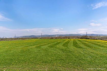
- Price
- Guide Price£270,000
- Size
- 18.59 acres
Lot 5 - 18.59 acres of land, Llanmihangel Farm, Margam, Neath Port Talbot CF33 Wales
Added on 18/03/2026Farmland