Bower Lane, Rugeley
- Bedrooms
- 4
- Bathrooms
- 3
Key Features
- Simply stunning barn conversion (attached)
- Exquisitely appointed
- Truly delightful location
- Magnificent elevated views
- Elegant sitting/dining room with vaulted ceiling
- Splendid dining kitchen
- Two luxuriously appointed en suites
- EPC rating D. Council tax band E.
- Superb family shower room
- Extensive garden areas
Description
The property offers a welcoming introduction into an exceptionally spacious, elegant lounge with both a dining and sitting area, having a vaulted ceiling with exposed beams, inglenook fireplace with a cast log burner, a flagstone floor and deep windows to the front enjoying wonderful views. There is underfloor heating throughout, via a Daikin air source heat pump.
A rear hall area leads to a superb dining kitchen, which again has a vaulted ceiling with exposed timbers incorporating a Velux roof light and is dual aspect with magnificent views. The kitchen is fitted with an attractive range of units with granite work surfaces having a recessed Belfast style sink, plus an integrated induction hob, split-level oven, microwave and dishwasher. The large island has further fitted cupboards and granite worktops, with a wooden dining bar. Please note, the fridge freezer is not included in the sale. There are part panelled walls, wood flooring and feature exposed brickwork to one wall.
There are four bedrooms in total, the front facing bedrooms all enjoying those wonderful views. The principal bedroom has built in wardrobes and a splendid en suite with exquisite tiling, wash basin with integrated cupboard beneath, WC and a shower with both conventional and waterfall heads. The second bedroom has a vaulted ceiling and a beautifully appointed shower room incorporating a shower with both conventional and waterfall heads, wash basin with integrated drawers, splendid tiling, WC and towel radiator.
The luxurious family shower room has striking blue tiling to the wet area with both conventional and waterfall heads, wall hung wash basin with integrated drawers beneath and WC.
Outside, the property enjoys a truly enviable location boasting far reaching views. There is a mature and well stocked garden immediately to the front and side of the property, with a paved entertaining area, in addition to a log cabin, ideal for a gym or home office. There is parking for three or four cars, plus a small paddock area, making an excellent football or cricket pitch for children!
The location is very convenient, being only a few minutes' drive of the A51 which serves the cathedral city of Lichfield and county town of Stafford. There is an intercity railway station at Rugeley Trent Valley. Cannock Chase, An Area of Outstanding Natural Beauty, is a 20 minutes' walk or short drive away. There are M6 junctions at Stafford and the M6 toll road at Lichfield.
To view this property, please contact John German Stafford office.
Agents notes: The front photograph was taken from a neighbouring field.
The property is attached to a neighbouring barn.
The Land Registry document refers to rights, covenants and easements and a copy is available upon request.
There is no mains gas to the property.
There is a neighbouring gas tank located below ground within the paddock belonging to this property.
The physical boundaries on site appear to be correct however we believe the current Land Registry plan does not reflect this correctly. Our clients are currently looking into this matter.
Tenure: Freehold (purchasers are advised to satisfy themselves as to the tenure via their legal representative).
Please note: It is quite common for some properties to have a Ring doorbell and internal recording devices.
Property construction: Traditional. Parking: Drive
Electricity supply: Mains. Water supply: Mains. Sewerage: Mains.
Heating: Daikin air source heat pump with underfloor heating
(Purchasers are advised to satisfy themselves as to their suitability).
Broadband type: See Ofcom link for speed:
Mobile signal/coverage: See Ofcom link
Local Authority/Tax Band: Stafford Borough Council / Tax Band E
Useful Websites:
Our Ref: JGA/20022026
The property information provided by John German Estate Agents Ltd is based on enquiries made of the vendor and from information available in the public domain. If there is any point on which you require further clarification, please contact the office and we will be pleased to check the information for you, particularly if contemplating travelling some distance to view the property. Please note if your enquiry is of a legal or structural nature, we advise you to seek advice from a qualified professional in their relevant field.
We are required by law to comply fully with The Money Laundering Regulations 2017 and as such need to complete AML ID verification and proof / source of funds checks on all buyers and, where relevant, cash donors once an offer is accepted on a property. We use the Checkboard app to complete the necessary checks, this is not a credit check and therefore will have no effect on your credit history. With effect from 1st March 2025 a non-refundable compliance fee of £30.00 inc. VAT per buyer / donor will be required to be paid in advance when an offer is agreed and prior to a sales memorandum being issued.
Map Location
Property details
- Tenure
- Freehold
- Council Tax Band
- E
- Date Posted
- 2026-02-27
Energy Performance Certificate
Energy Efficiency Rating
Based on UK Energy Performance Certificate standards (EU Directive 2002/91/EC)
Running costs are one side. Planning activity, flood history and ground risks for this location are in the full report.
Utilities & Restrictions
Utilities
- Electricity
- Mains
- Water
- Mains
- Heating
- Air Source Heat Pump
- Broadband
- Ask Agent
- Sewerage
- Mains
Rights & Restrictions
- Public Rights of Way
- Ask Agent
- Private Rights of Way
- Ask Agent
- Listed Property
- Ask Agent
- Restrictions
- Ask Agent
Listed status, conservation areas and planning constraints for this location are in the full report.
Property Features
- Accessibility
- Ask Agent
- Parking
- Off-Street Parking
- Garden
- Garden
Beyond the particulars: planning activity, flood history, heritage and ground risks, checked for this exact spot.
Connectivity
Broadband
Fastest speed available at this postcode
5 Gbps
Gigabit full fibre
Suitable for
- 4K streaming on every screen
- Full-time home working
- Online gaming & big downloads
Mobile signal
Outdoor predictions; indoor signal depends on building materials.
Ofcom Connected Nations postcode-level predictions. Speeds and signal are modelled, not measured, and vary between addresses and providers.
Signal is the easy part. Planning activity, flood history and protected designations here are in the full report.
Nearest Schools
Primary
- Etching Hill CofE Primary Academy434 metresNo Ofsted rating
- Ages
- 3 to 11
- Pupils
- 460
- Type
- Academy converter
- Faith
- Church of England
- The John Bamford Primary School661 metresNo Ofsted rating
- Ages
- 2 to 11
- Pupils
- 268
- Type
- Community school
- Forest Hills Primary School689 metresOfsted report card · Jun 2026
- Ages
- 2 to 11
- Pupils
- 79
- Type
- Academy sponsor led
- Chancel Primary School0.9 milesOfsted: Good *
- Ages
- 2 to 11
- Pupils
- 210
- Type
- Community school
- Churchfield CofE Primary Academy1.2 milesOfsted: Good
- Ages
- 2 to 11
- Pupils
- 155
- Type
- Academy converter
- Faith
- Church of England
Secondary
- The Hart School0.8 milesNo Ofsted rating
- Ages
- 11 to 18
- Pupils
- 1,157
- Type
- Academy sponsor led
- Rugeley John Taylor2.1 milesNo Ofsted rating
- Pupils
- 147
- Type
- Free schools
- Staffordshire University Academy4.8 milesOfsted: Good
- Ages
- 11 to 19
- Pupils
- 709
- Type
- Academy sponsor led
- Walton High School4.9 milesNo Ofsted rating
- Ages
- 11 to 18
- Pupils
- 1,262
- Type
- Academy converter
- Kingsmead School4.9 milesOfsted report card · Mar 2026
- Ages
- 11 to 18
- Pupils
- 1,427
- Type
- Academy converter
* Latest graded judgement covers quality of education only; no overall grade was issued under the 2024-25 inspection framework.
Distances are straight-line from the advertised location. Source: the national school registers (DfE, Welsh Government, Scottish Government) and Ofsted.
Schools are just the start: sold prices nearby, planning activity and any flood history are in the full report.
Amenities
Supermarket
GP surgery
Pharmacy
Hospital
Green space
Straight-line distances from the advertised location. Sources: NHS records, Geolytix supermarket locations, OS Open Greenspace and the national trails registers.
The area stacks up? Now check the location itself: planning nearby, protected designations and past flooding.
Getting Around
Nearest station
Nearest bus stop
Typical drive times
Straight-line distances from the advertised location; drive times are typical free-flow times over OpenStreetMap road data, so allow more at peak. Public transport locations from DfT NaPTAN.
Easy to reach matters. So do planning activity, flood history and ground risks: all in the full report.
Flood Risk
From Environment Agency flood map open data, checked around the advertised map pin and allowing for the listed acreage where known. This summary comes from LandSale, the advertising platform, not from the listing agent, and is not part of the agent's particulars. Risk can vary across a single holding, so verify anything critical through your own searches before committing.
Rivers and the sea
Surface water
The detail behind these bandings
The full report pinpoints where this location sits on the flood maps, and runs the deeper checks that usually only surface after an offer.
- Exact flood zones & annual chances (included in the full report)
- Any recorded past flooding (included in the full report)
- Planning activity nearby (included in the full report)
- Heritage & conservation (included in the full report)
- Protected nature designations (included in the full report)
- Ground risks (included in the full report)
- Sold prices nearby (included in the full report)
£14.99 · one-off purchase
By LandSale, the platform. Not provided by the listing agent. Ready in about a minute.
Important notice: Information, maps and tags on this page are drawn from the advertising agent's marketing materials or generated automatically. LandSale has not verified them. Relying on these details is at your own risk, always carry out independent checks before committing to a purchase.
LandSale full disclaimer
Marketing information only - not formal particulars. The details on this website are provided for general guidance and do not constitute an offer or contract. Neither LandSale nor the advertising estate/land agent accepts responsibility for any inaccuracy.
1. Source of information
- Listing content: Core description, asking price, tenure, measurements, photographs and planning history originate from the marketing materials of the advertising estate or land agent. LandSale does not author this content and cannot guarantee its accuracy.
- Automated tags & categorisation: Property type, land-use class, acreage bands and similar labels may be applied by machine-learning models. They are intended as a helpful guide only and may not reflect the property's legal status or permitted use.
- Third-party & enriched data layers: Maps, boundary outlines, planning designations, soil reports, broadband coverage and other environmental or location-based insights are licensed from external suppliers. Such data are supplied “as is", may be incomplete or out of date and are subject to change without notice.
2. Verification required
Prospective purchasers must verify critical matters, including but not limited to planning permission, title boundaries, public rights of way, environmental constraints, acreage, services, access and VAT status, through their own inspections, specialist surveys, legal advisers and the selling agent before relying on the information or entering into any contract.
3. No warranty or liability
LandSale gives no warranty, express or implied, as to the accuracy, completeness or fitness for any particular purpose of the information displayed. LandSale shall not be liable for any loss, damage, cost or expense arising directly or indirectly from any use of or reliance on such information, save where liability may not be excluded by law.
4. Updates & feedback
If you believe any detail on this listing is inaccurate, please let us know. We will investigate and, where appropriate, update the listing or notify the agent.
© LandSale | Version 1.3 - August 2026
Listing agent
John German, Stafford
5 Pool Lane Brocton Stafford ST17 0TR
Similar properties for sale
- Price
- Guide Price£545,000
- Size
- 3.11 acres
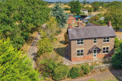
Hadley Gate Farm, Blithbury, Mavesyn Ridware, Staffordshire WS15 England
Added on 03/09/2026House with Land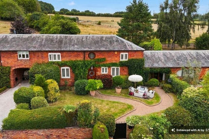 Added on 05/08/2026Barn Conversion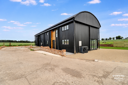
- Price
- Offers Over£595,000
BRAND NEW DUTCH BARN, Tixall Road, Brancote, Stafford, ST18, Tixall, Staffordshire ST18 England
Added on 22/06/2026Barn Conversion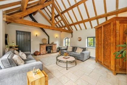
- Price
- £695,000
Lichfield Road, Hamstall Ridware, Rugeley, Hamstall Ridware, Staffordshire WS15 England
Added on 04/07/2026Barn Conversion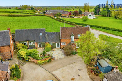 Added on 18/04/2026Barn Conversion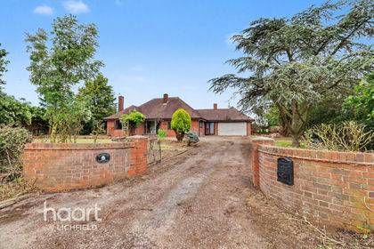
- Price
- Offers in Region of£550,000
- Size
- 2 acres
Bromley Wood, Abbots Bromley, Abbots Bromley, Staffordshire WS15 England
Added on 12/06/2026House with Land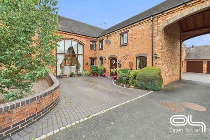
- Price
- Offers Over£625,000
Bednall Road, Acton Trussell, Acton Trussell and Bednall, Staffordshire ST17 England
Added on 04/06/2026Barn Conversion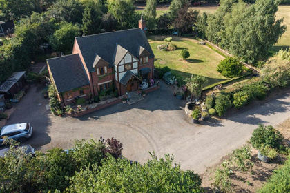
- Price
- Offers in Region of£900,000
- Size
- 2 acres
Pasture Fields, London Road, Weston, Stafford, Weston, Staffordshire ST18 England
Added on 30/07/2026House with Land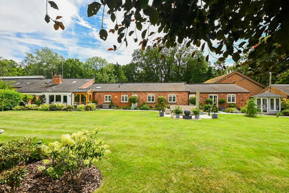
- Price
- Offers in Excess of£750,000
- Size
- 0.2 acres
Lavender Cottage, Hall Estate, Hoar Cross, DE13, Hoar Cross, Staffordshire DE13 England
Added on 08/08/2026Barn Conversion
- Price
- Guide Price£565,000
Dream Weaver, Redbank Farm, Maker Lane, Hoar Cross, DE13, Hoar Cross, Staffordshire DE13 England
Added on 21/05/2026Barn Conversion