Land At 119 Hillcrest Road, Nuneaton, Warwickshire, CV10 9HH
- Land size
- 0.29 acres
Key Features
- Positive pre-application response for four residential dwellings
- Bare Site - building now demolished
- 0.29 of an acre (0.12 of a hectare)
Description
Positive pre-application response for four residential dwellings
Bare Site - building now demolished
0.29 of an acre (0.12 of a hectare)
Location
The Property lies to the north of Hillcrest Road in the Camp Hill ward of Nuneaton. The immediate area is residential, with Camp Hill comprising an area of predominantly semi-detached and terraced housing to the northwest of the town of Nuneaton.
The Property fronts Hillcrest Road to the southwest with housing to the east and west. To the north is the remainder of the land title (to be retained by the Council) and comprising woodland which is contiguous with the Moore Valley public park/open space/hiking area situated to the east.
The Property is around 1.2 miles west of the town centre, 7.5 miles north of Coventry, 9.5 miles southeast of Tamworth, and 16 miles east of Birmingham. The Property is sustainably situated for public transport with local bus stops and Nuneaton train station in the town centre. The B4114 some 700m north provides access to the A5 thereafter north to Tamworth and south to London via the A5 or M1. Junction 3 of the M6 is some 4.5 miles to the south, a direct route to London and Birmingham.
Description
The Property comprises 0.29 of an acre of potential development land on Hillcrest Road in the residential Camp Hill area of Nuneaton. It forms part of Land Registry Title number WK202824, with the land to be disposed of outlined in red on the particulars. The building shown within the red line boundary and on publicly available Satellite imagery has been demolished, and the woodland to the rear of the title is to be excluded. The Property is regular in shape being roughly rectangular comprising scrubland, self-regenerated trees, and tarmacadam and concrete surfacing.
This provides an excellent opportunity for potential residential development, with a positive pre-application response from the local planning authority in principle.
Services
Prior to demolition, the Property benefitted from mains gas and electricity which were disconnected, and mains water which has been capped off. Purchasers are to undertake their own investigations in this regard. No tests have been carried out to verify the information.
Map Location
Property details
- Tenure
- Freehold
- Council Tax Band
- Ask Agent
- Date Posted
- 2026-02-04
Utilities & Restrictions
Utilities
- Electricity
- Ask Agent
- Water
- Ask Agent
- Heating
- Ask Agent
- Broadband
- Ask Agent
- Sewerage
- Ask Agent
Rights & Restrictions
- Public Rights of Way
- Ask Agent
- Private Rights of Way
- Ask Agent
- Listed Property
- Ask Agent
- Restrictions
- Ask Agent
Property Features
- Accessibility
- Ask Agent
- Parking
- Ask Agent
- Garden
- Ask Agent
Important notice: Information, maps and tags on this page are supplied by the advertising agent or generated automatically. LandSale has not verified them. Relying on these details is at your own risk, always carry out independent checks before committing to a purchase.
LandSale full disclaimer
Marketing information only - not formal particulars. The details on this website are provided for general guidance and do not constitute an offer or contract. Neither LandSale nor the advertising estate/land agent accepts responsibility for any inaccuracy.
1. Source of information
- Agent-supplied content: Core description, asking price, tenure, measurements, photographs and planning history are uploaded by the appointed agent, who remains solely responsible for their accuracy.
- Automated tags & categorisation: Property type, land-use class, acreage bands and similar labels may be applied by machine-learning models. They are intended as a helpful guide only and may not reflect the property's legal status or permitted use.
- Third-party & enriched data layers: Maps, boundary outlines, planning designations, soil reports, broadband coverage and other environmental or location-based insights are licensed from external suppliers. Such data are supplied “as is", may be incomplete or out of date and are subject to change without notice.
2. Verification required
Prospective purchasers must verify critical matters, including but not limited to planning permission, title boundaries, public rights of way, environmental constraints, acreage, services, access and VAT status, through their own inspections, specialist surveys, legal advisers and the selling agent before relying on the information or entering into any contract.
3. No warranty or liability
LandSale gives no warranty, express or implied, as to the accuracy, completeness or fitness for any particular purpose of the information displayed. LandSale shall not be liable for any loss, damage, cost or expense arising directly or indirectly from any use of or reliance on such information, save where liability may not be excluded by law.
4. Updates & feedback
If you believe any detail on this listing is inaccurate, please let us know. We will investigate and, where appropriate, update the listing or notify the agent.
© LandSale | Version 1.2 - January 2026
Listing agent
Bruton Knowles, Birmingham
60 Church Street, Birmingham, B3 2DJ
Similar properties for sale
 Added on 29/01/2026Development Land
- Price
- Offers in Excess of£300,000
Jean Street, Baddesley Ensor, CV9, Baddesley Ensor, Warwickshire CV9 2EA England
Added on 29/01/2026Building Plot
- Price
- Guide Price£250,000
Market Street, Polesworth, B78, Polesworth, Warwickshire B78 1HW England
Added on 29/01/2026Development Land
- Price
- Offers in Region of£1,000,000
- Size
- 15 acres
Bumble Bee Lane, Leicestershire, LE10, Sharnford, Leicestershire LE10 3AE England
Added on 25/03/2026Building Plot
- Price
- Offers Over£900,000
- Size
- 2.23 acres
Keats Lane, Earl Shilton, Leicester, Earl Shilton, Leicestershire LE9 7JL England
Added on 11/06/2026Development Land
- Price
- Offers in Region of£350,000
Added on 29/01/2026Building Plot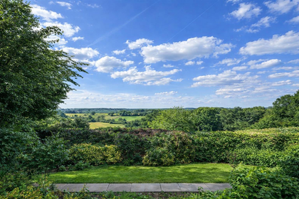
- Price
- Guide Price£220,000
Plot next to 44 Newbold Road, Desford, Leicester, Desford, Leicestershire LE9 9GS England
Added on 15/06/2026Building Plot Added on 02/04/2026Building Plot
- Price
- Guide Price£350,000
- Size
- 0.2 acres
Added on 15/04/2026Self Build Plot
- Price
- Offers Over£275,000
- Size
- 0.25 acres
Cosby Road, Littlethorpe, Narborough, Leicestershire LE19 2HG England
Added on 03/04/2026Building Plot